Karin-Marijke Vis is a student at MatadorU
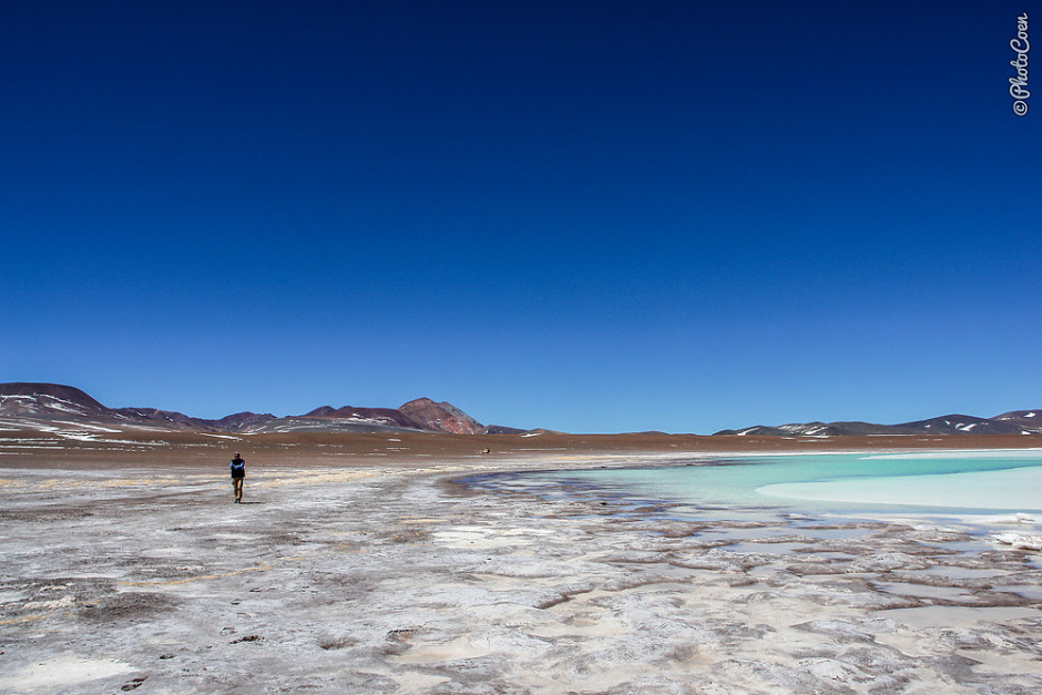
Argentina – Laguna Brava
At an altitude of 4,500 meters, "Brave Pond" in the Andes Mountains literally left me breathless battling a fierce wind and hiking around the blue lake surrounded by salt. Apart from flamingoes this inhospitable land is home to vicuñas, pumas, red foxes, and birds of prey. Photo: Coen Wubbels
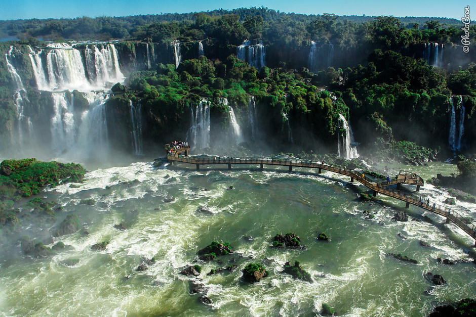
Brazil – Iguaçu National Park
257 tiered waterfalls, spread out over three kilometers plunge into the Paraná River, spanning the border between Argentina and Brazil. The Guaraní Indians gave these waterfalls the name of "Iguaçu", meaning "great water". Iguaçu National Park obtained a UNESCO World Heritage Status in the 1980s. Catwalks run along many of the waterfalls with the best one lying on the Brazilian side. It runs far across the water, drenching you with clouds of spray and rewarding you with a frontal view of Devil's Throat, the fiercest of all waterfalls. Photo: Coen Wubbels
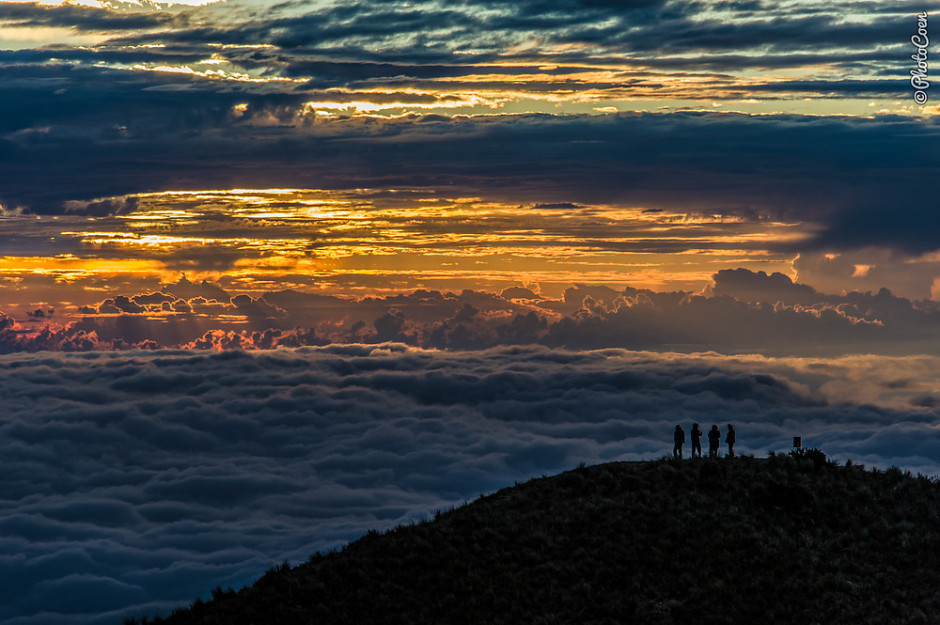
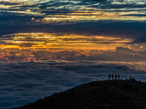
Peru – Tres Cruces
Tres Cruces, meaning Three Crosses, is a viewpoint at 3850 meters in the Andes Mountains from where you have an incredible view of the Amazon Basin, specifically Manu National Park. The place is nicknamed Balcony of the Orient. To us the sunrise and the play of clouds here were among the most mesmerizing sights in South America. Photo: Coen Wubbels
Intermission
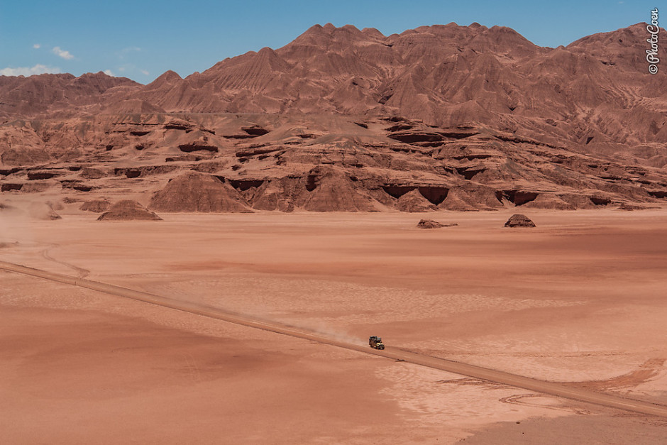
Argentina – Desierto del Diablo
From San Antonio de los Cobres, near Salta, the unpaved road crosses La Puna, the high plains, to Tolar Grande. It meanders between 4,000 and 5,000 meters, traversing a 1.3-kilometer-long salt flat and the Labyrinth Desert, where we almost felt we had left Earth and found ourselves on another planet. That feeling was complete when we crossed Devil's Desert, a world consisting of red sand, dust and mountains, and seemingly devoid of life. Photo: Coen Wubbels
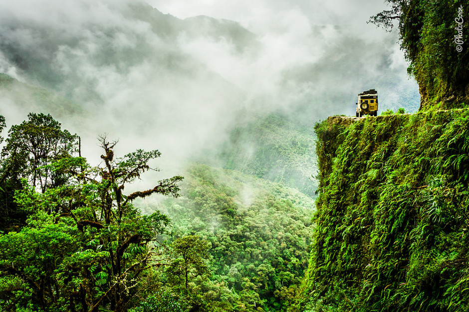
Bolivia – Death Road
Crosses and shrines lining the Yungas Road are still testimony to what indeed was once one of the most dangerous roads in the world. That is until some eight years ago. Since a double-lane highway was built around another mountain range, the so-called Death Road was left to become mostly a tourist attraction with an occasional local using it. Having said that, many consider this one of South America's most rewarding road trips. Visitors cycle down from La Paz (at 4,000 meters) to Coroico (at 1,800 meters). Photo: Coen Wubbels
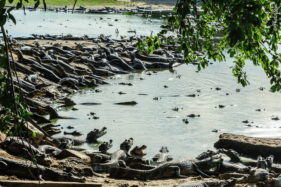
Brazil – Pantanal
The world's largest inland wetland is the best place in South America to see wildlife thanks to its geography of large, open stretches. The best time of the year to visit the Pantanal is July and August, when water levels are low, and animals group together around the few ponds and creeks that are left. There are several roads leading into the Pantanal. Photo: Coen Wubbels
Argentina – Ischigualasto Natural Park
Argentina's Valley of the Moon (Valle de la Luna) consists of eroded rock formations in red and grey tinges and is characterized by little rain, strong winds and high temperatures. If you're into dinosaurs, this is the place to go as it is known for the large number of dinosaur fossils found here. It is a UNESCO World Heritage Site. Photo: Coen Wubbels
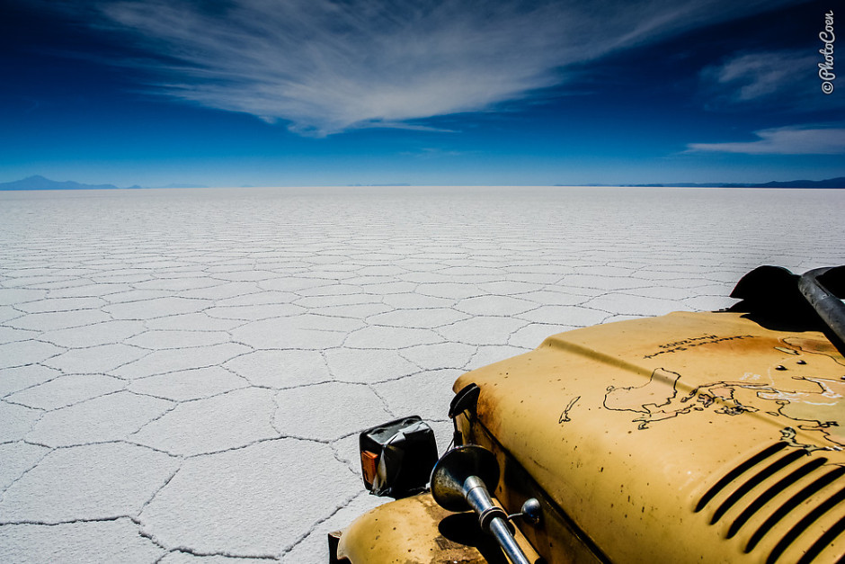
Bolivia – Salar de Uyuni
Driving on the world's largest salt flat is simply surreal. We can set the cruise control at 80 kms/hour, let go of the steering wheel and not get into trouble; the Land Cruiser just cruises straight ahead for some 130 kilometers before reaching the other side. Photo: Coen Wubbels
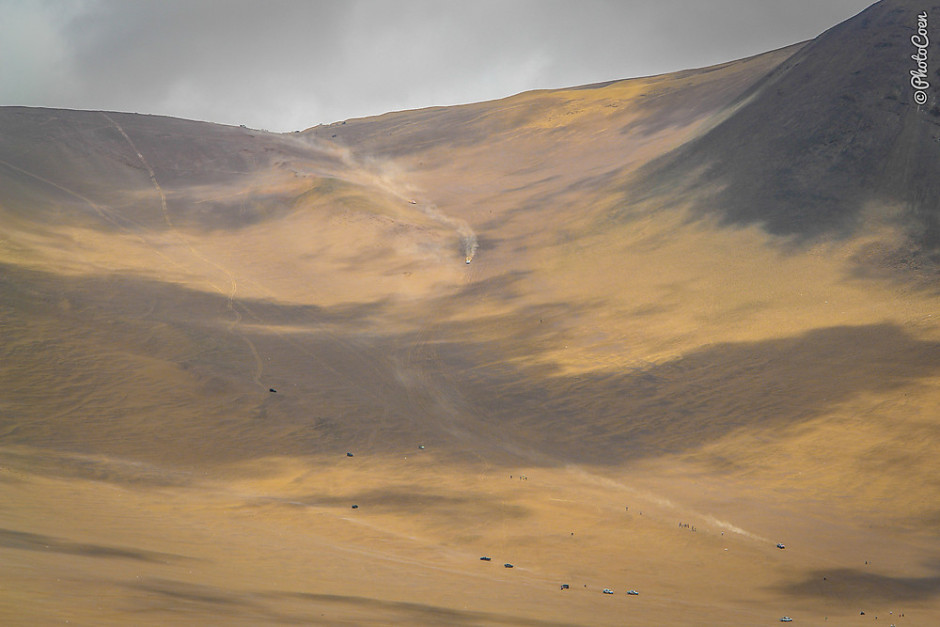
Chile – Atacama Desert
The Caleta Los Verdes, twenty kilometers south of Iquique in Chile, was the last challenge of Top Gear's Special in Bolivia. This incredibly steep descent, running from the Altiplano down to the Pacific Coast, has also been one of the challenges of several Dakar Rallies. Photo: Coen Wubbels
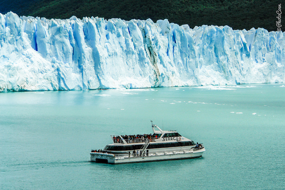
Argentina – Perito Moreno
At 5 kilometers wide, some 70 meters high and running about 30 kilometers in length Perito Moreno is one of the few remaining glaciers in the world that is actually still growing. Throughout the day huge chunks of ice break off, hence the boat can't approach the glacier any closer than it does in this photo. Every few years there is a massive rupture, a sight people especially travel to Perito Moreno for. You don't need to go on a boat trip; you can watch the ice mass from the mainland as well. Photo: Coen Wubbels
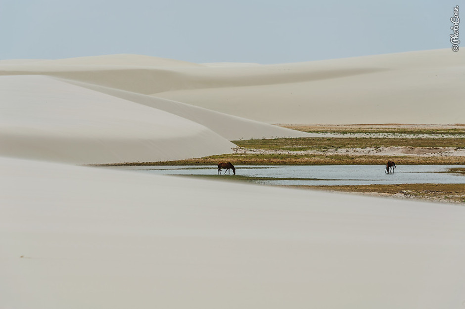
Brazil - Lençóis Maranhenses National Park
White sand dunes that, during parts of the year, are filled with sweet, crystal clear lagunas. Despite the rain there is hardly any vegetation and the few communities living in the middle of these dunes have a rough life, working hard to grow some vegetables and mainly living on fish as the communities are not too far from the Atlantic Ocean. The best time to visit this area is July / August, when the valleys are filled with water. The town of Barreirinhas is lined with travel agencies willing to take you on a tour to the dunes. If you like an off-the-beaten-track approach, stay in Santa Amaro, on the western side of the park. Photo: Coen Wubbels
Intermission
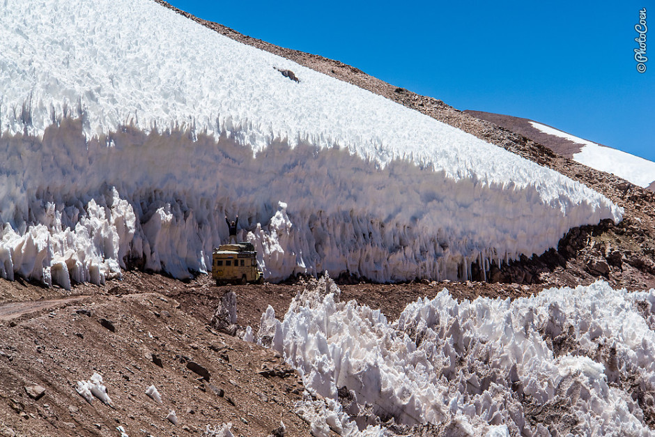
Argentina Agua Negra Pass
The highest border crossing between Chile and Argentina is located at 4,780 meters above sea level. Most of the year the pass is closed due to snow, and generally only open between December and April. Many passes in the Andes have snow, but what makes this road unique are the frozen snow formations you see in the photo, locally called penitentes. Photo: Coen Wubbels
Colombia - Tatacoa
'Weird' would be a correct adjective for this place. You're driving among lush green hilly fields and all of a sudden these red sand formations pop up that are a miniature version of Bryce Canyon. Despite this being one of Colombia's arid zones, you will find beautiful flowers when hiking through this desert, such as flowering cacti. Photo: Coen Wubbels