I feel guilty. We’re cruising effortlessly down West Greenland. Frothy white caps reflect brilliant sunshine under a cobalt sky. I’m in short sleeves, gazing at the snowy peaks and considering four hundred years of struggle and death.
The Sea Adventurer is an expedition vessel and nearing the end of not one, but two traverses of the Northwest Passage.
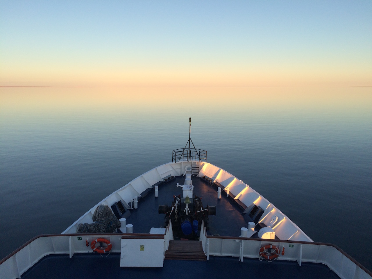
Bow of Sea Adventurer
On board I am a guide and biologist and like my colleagues I make a living out of polar adventure. When I’m not north, I’m south, crossing to Antarctica, switching polar bears for penguins.
For more than 400 years the Northwest Passage has been an obsession; a metaphorical “No” to man’s domination of nature. But times are changing.
North of Canada’s continental coast is a maze of enormous islands and postage stamp islets divided by innumerable straights and sounds. With hazardous reefs, shallow channels, and enormous tides, the swath of undocumented spots on our charts is unsettling. Even today, with radar, GPS, depth sounders and electronic charts, ships run aground and ice is ever-present. And far from being languid channels the water is formidable. On our crossing of Foxe Basin south of Baffin Island we encountered a Beaufort 11 sea with hurricane force winds.
European navigators may have been obsessed with the Passage for its own sake, but economic interests have always been the driver. From Europe to Asia it would only be 13,600km compared to 40,000km via Cape Horn. And today it cuts the Panama Canal trip by nearly half. So everyone is looking north.
Synonymous with the Northwest Passage is John Franklin and his tragic expedition. In 1845 when he, 128 men and their two vessels, the Erebus and the Terror set off from Greenhithe, England, it was front-page news. The already tested vessels Terror and Erebus had been to Antarctica and back. Stout “bomb vessels”, they were built to withstand the recoil of firing cannons and “logically” ice. Reinforced wooden hulls, steel plates, and in addition to hundreds of square metres of sail, steam locomotive engines to help against current and windless days. Theirs were 6 horsepower while today the Sea Adventurer boasts 5200.
Our voyage departs from Kangerlussuac, southwest Greenland. Flying from Ottawa, I gaze in wonder at the low white arc of the receding ice sheet disappear into the horizon. We travel the island’s west coast before crossing to Canada and over the north end of Baffin Island. Roughly following Franklin our vessel travels south, then west, ending in Kugluktuk in the western extreme of Nunavut, Canada’s indigenous self-governed territory.
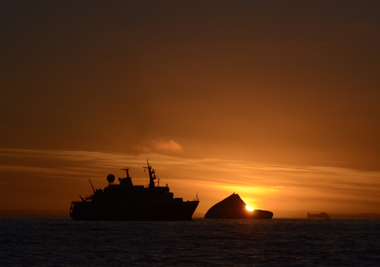
MV Sea Adventurer and ice berg (our vessel, off southern Baffin Island)
A voyage today is much different from Franklin’s time. In addition to the comfort and horsepower, it is warmer. As recently as the 19thth century the earth was going through the “Little Ice Age”. A brief but frigid period in which Franklin’s vessels met ice where we meet open waters. But this doesn’t contest global warming. Today’s record temperatures are unprecedented in history.
On a blistery overcast day we arrive on the island. The Sea Adventurer sets anchor and within minutes we are ferrying yellow parka-clad passengers, ripping across the slate stillness with black Zodiacs.
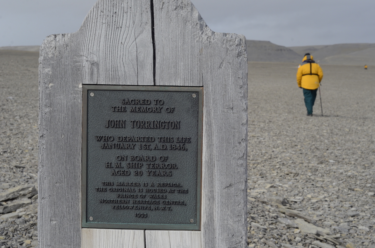
Three wooden tombstones. Three piles of stones on a stony landscape. And in these rocks, fossils of clams and corals diminishing man’s history. Human indentation barely discernable from the muted tones and vastness of the place.
Grave at Beechey Island – Officer John Torrington from Franklin Expedition
On land our historian retells Franklin’s voyage. Beechey Island was their first overwinter site. At that time in polar exploration, voyages took years and it was common practice to find a safe harbour, let the ship freeze in and pass the winter.
While our historian evokes the past, myself and other armed staff form a perimeter standing sentinel, scanning through binoculars, searching the landscape for polar bears. Despite their size and colour, they have the uncanny ability to stay out of sight.
After standing long enough, fingers begin to go numb, the folds of greys and browns playing with sense of distance. Its immensity swallows you up.
When passengers begin to feel discomfort we narrow the perimeter and ferry them back for hot tea and cookies in the warmth of the ship. A winter here — unimaginable.
Despite the difficult conditions, it was a given that Franklin would find the way. They had the confidence of technology, knowhow, leadership, British tradition, and righteousness. But it wasn’t enough. Something went wrong.
After three years with no news, England began to worry, especially his wife Lady Franklin and so it was decided Franklin had to be found
So search parties were dispatched. First, James Clark Ross in 1848 and in the following years many more, by sea — and land.
As clues arrived, returning search parties relayed what they found. Bits of evidence. Breadcrumbs in the emptiness of the Canadian archipelago. Timber, graves, a note.
Conjecture in the 19th century was verified in the 20th. In 1984 anthropologist Owen Beatie was given the go ahead and the three bodies buried in Beechey Island were exhumed.
The images reaching the news made headlines for being remarkably well preserved; faces with contorted expression. But beyond their recessed lips and opaque eyes, their tissues revealed another clue — lead. The perhaps overly-provisioned voyage, had a food supply for three years. But reports say that canning was hastily ordered only weeks before the voyage in an era when lead sealing was a new technology. Lead may have played a role, but researchers point to a combination of factors, malnutrition, scurvy, illness and the stress brought on by the Arctic itself.
Because of ignorance, lack of skill and training or even stubborn to the British way, Franklin’s men never learned to adapt and hunt what the Arctic provided. Had they, raw meat from whales, seals and caribou would have provided them with ample nutrition such as vitamin C.
But 30 corpses found by the Inuit at the time showed even grimmer evidence. With no seal meat or provisions Franklin’s men turned to each other. Bones analyzed by anthropologists recovered from King William Island show incisions. Hands and feet were removed so that compatriots would only be seen as cuts of meat.
Eventually a Captain McClintock found indisputable evidence. In a rocky cairn an official admiral form, and in the margins desperate scribbles.
“25th April 1848. H.M. Ships Terror and Erebus were deserted on the 22nd April…
Sir John Franklin died on the 11th June, 1847…”
After 12 years and 36 expeditions — closure.
Following Beechey Island, we turn south departing from Franklin’s route, past Prince Leopold Island in Lancaster Sound. The currently unprotected waters, awaiting to be declared a National Marine Conservation Area may be one of the richest areas in the Canadian Arctic. Narwhal, beluga, walrus and arctic cod ply these waters. And if noise were evidence, from the 250 metre cliffs surrounding the island is the unrelenting chorus of hundreds of thousands of breeding seabirds, plastering the cliffs, black and white spots of murres, fulmars and kittiwakes lifting like clouds of starlings.
Like Franklin’s voyage we eventually find ourselves where theirs ended, King William Island. The island is unique in Arctic history. Much of the evidence of Franklin’s fate has been found on its shores — and more recently around it.
In 2014 while watching the screen of a sonar detector dragged behind their research vessel, a Parks Canada team saw a ghostly shape sitting still as death — the Erebus. Only 11m down and upright, there it sat where it had crushed and sunk more than 160 years before. And today, roughly two years later, the second half of the puzzle, the Terror, in Terror Bay no less. It just so happens that through our spotty satellite internet, news from the outside world, ironically reporting on where we are, reaches our ship. Years of searching and millions in investment; two shipwrecks off King William Island.
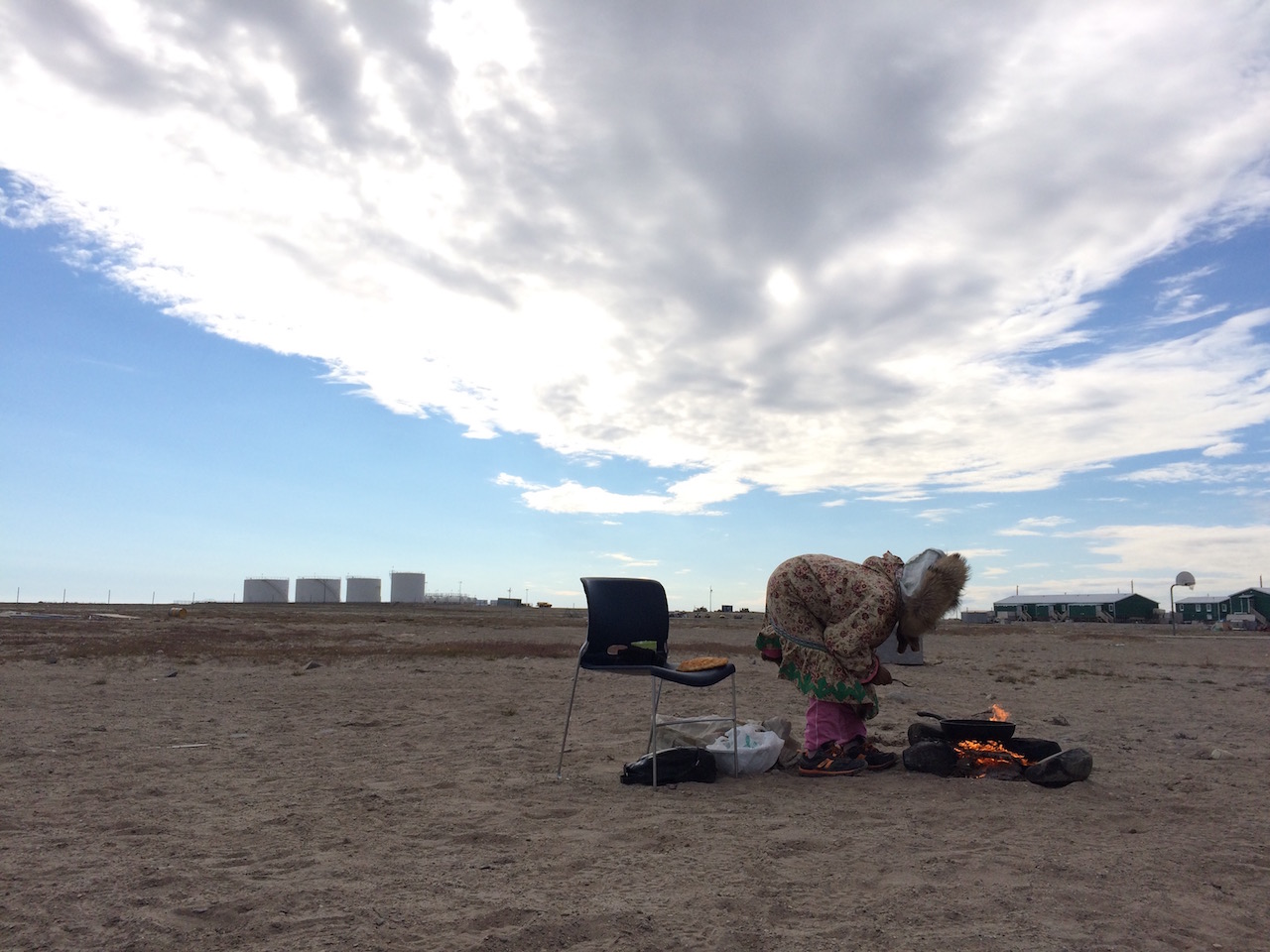
There’s a small hamlet on the south end of King William Island. 1200, mostly Inuit live in a place named not for any Inuit reference or even English, but Norwegian. Like other Canadian Arctic communities it’s a jumble of utilitarian construction; run down houses, a couple churches, a Northern store, a community centre, some government buildings in aluminum siding, an airstrip and a cultural centre. Buildings are elevated above the ground so that their heat doesn’t melt the permafrost below. Rusty snowmobiles wait for winter and ATVs and pick up trucks rumble through the dirt and sand streets. Huskies sit chained. Caribou antlers decorate roofs like antennae and muskox hides are slung casually over railings. Canadian arctic towns are utilitarian and their lack of aesthetic beauty and disarray belies the wonderful people that live in them, strong cultural traditions and their deep connection to the land.
Elder Woman making bannock – Gjoa Haven
With spare time I find myself walking to the cultural centre. Outside two elder women sit in front of a traditional sealskin tent. One is dressed in a hand-sewn parka, a rim of wolverine fur framing her weathered and creased face. Inside the tent burns a kudlik lamp; a stone bowl with an arctic cotton wick; warmth and light in dark arctic winters. I approach them with a “Hi” and crouch down. The elder gestures and speaks in Inuktitut, indecipherable to me. In 1950s the Canadian government enacted forced relocation and settlement of these nomadic people. The first half of this woman’s life was in igloos and sealskin tents.
From a Tupperware they offer traditional food; Narwhal muktuk: raw skin and fat. A delicacy in the north it is also rich in vitamin C. I chew on the grey rubbery skin and consider Franklin’s fate.
Inside the small but impressive cultural centre are graphics about aspects of Inuit life, old and new. There are archaeological displays of traditional tools such as harpoons, amulets and soapstone carvings and even a copy of the Erebus bell. Stories recount Franklin’s fate. But despite his fame, the exhibition is overshadowed by another far less talked about gentleman, Roald Amundsen.
Even in the impartial environment of the museum there is palpable disdain for Franklin, but for Amundsen, admiration. Franklin, like Scott in Antarctica had doomed voyages. Whether bad luck, overconfidence, lack of foresight, both were one upped by a man who today still receives little popular attention.
Unlike many British expeditions, Amundsen’s preparations were marked with forethought, practicality and informality. He trained. He practiced navigating, skiing, and surviving in Scandinavia’s wilderness. He swam in freezing waters to increase his resilience to cold.
And unlike Franklin he wasn’t blinded by pride and so he went to the men who had the greatest knowledge of navigating ice, the sealers. Based on their experience and advice he decided to work with the Arctic rather than against it.
His vessel, the Gjøa, once a herring ketch and then a sealer, was well tested. While Amundsen had her hull strengthened, iron plates attached, and installed a 16 horsepower engine, he chose her for her nimbleness.
When time was closing in the question of finances loomed. He was coming up short and a lender was threatening to seize his ship. So on the night of June 16th, 1903, lines were silently cast, leaving Kristiana (Oslo) in her wake. They sailed west over the North Sea, past Iceland, Greenland, then like Franklin he turned northwest to Baffin Island. Soon he found ice, but with a much smaller ship he was able to navigate the flows.
He stopped at Beechey Island paying respect to his childhood hero then turned south along Peel Straight soon entering waters that Europeans had never sailed before.
At the end of the summer, they found a quiet harbour, and the six-man crew set up a shore camp and prepared for an 18-month overwinter. They named it Gjøahaven, Gjoa’s Harbour.
Soon the Netsilik Inuit discovered them and in a short period the six man camp grew by two hundred more. Unlike Europeans before him, Amundsen respected the Inuit and fascinated by their ability to thrive in the Arctic environment. So in addition to their scientific studies he also set about studying anthropology and arctic survival, learning dog sledding, clothe making and seal hunting.
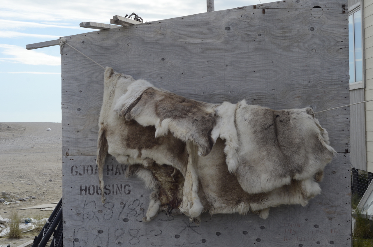
Reindeer pelts, Gjoa Haven
This was one of the marked differences between Amundsen and his boyhood idol. Rather than trying to dominate the indomitable, he chose to work with the Arctic and rather than casting aside the experience of savages and sealers he respected them and embraced their knowledge.
Quickly and efficiently the voyage that began in 1903 reached the end of the Canadian archipelago by 1905.
It is a wonder that Franklin’s name, along with Shackelton and Scott pop up as synonymous with polar exploration and romanticism. But among all these explorers, it was a quiet Norwegian who opted for astuteness and planning that managed to make him the not only the first to navigate the Northwest Passage but also reach both poles.
This September as news exploded over the finding of Franklin’s second ship, the Gjøa, sat modestly in Oslo as it has for over forty years. When exactly the Terror was discovered, who knows, but rumors say that a press release was delayed to coincide with Canada’s 150th birthday. The discovery of both vessels has somehow been tied to ideas of Canada’s sovereignty over the Passage. As summer ice disappears Canada’s government seeks to make its mark.
The Sea Adventurer arrives in Cambridge Bay on the south end of Victoria Island, where Amundsen had sailed past 100 years before. We land and explore the town. I walk into the Northern store. Wandering through an Arctic supermarket is fascinating. Grapes for 18 dollars, toilet paper for 25, the north is expensive. Hunting rifles and fishing rods, a red Canada post box, rows of winter boots, a coffee and doughnut stand, sleds, accordions. Northern stores always have a large sewing section and with winter coming, the season is about to start. Next to a teenage employee fiddling with her cell phone, the speckled grey coat of a wolf hangs listlessly. And on nearby racks are hides of raccoons, wolverines, coyotes and seals fitted with barcodes and price tags. The seals are from Greenland I’m told. Some dyed neon green and others violet; the new generation.
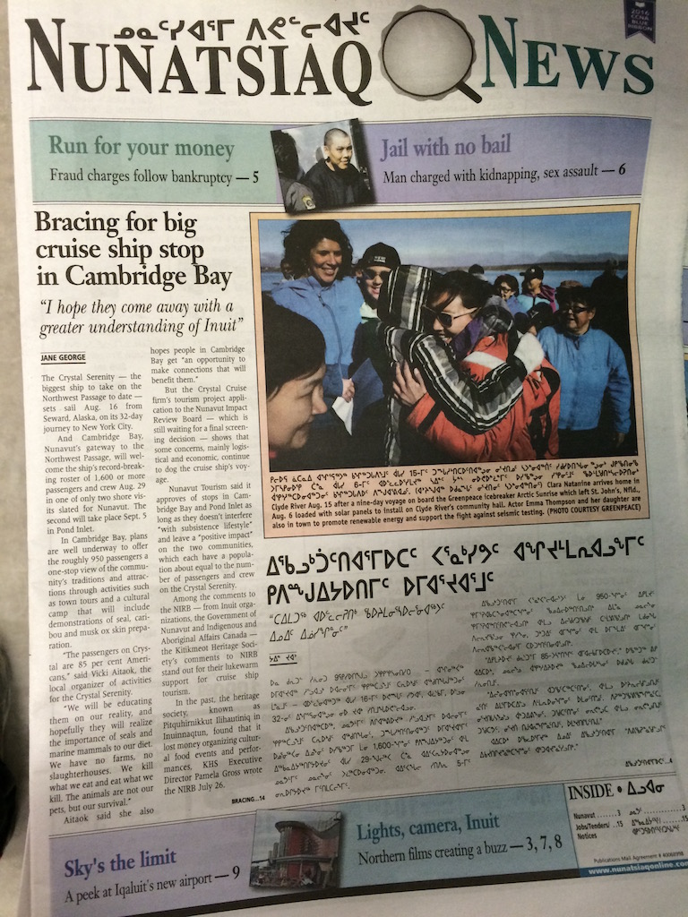
As I leave the supermarket my eyes are caught by a stack of community newspapers: Nunatsiaq News. “Bracing for big cruise ship stop in Cambridge Bay”. And beside the English version, the syllabics of Inuktitut.
Most guides involved in the expedition industry are not impressed by the Crystal Serenity’s size or historical first. From the Pacific to the Atlantic guided by a British icebreaker, her voyage seems a “Trumpism”: ostentatious, and unapologetic. However I was surprised when speaking to residents in Cambridge Bay and other communities.
Newspaper in Cambridge bay covering news on the Crystal Serenity cruise ship
“Oh yes. I think it would be great for the economy up here. It would really help us out”, said one resident.
And from hamlet to hamlet this sentiment was reiterated. But while the cusp of change that the Arctic finds itself, may worry guides and biologists like myself, it is inevitable — the Crystal Serenity is just the beginning. And for communities, where the economy is little to non-existent, tourism development could be an important influx. In northern communities economies are based on government and civil service, local businesses, art production and possibly trophy hunting and mining. Commercial fishing is in its infancy. Influxes are few. But the lack of dollar input is compensated by the land. Subsistence hunting and fishing are intrinsic to Inuit culture.
With the first voyage complete in Kugluktuk, new passengers board and we turn back east. We are scheduled to visit Cambridge Bay again, but the Serenity has trumped us — a 1000 passenger vessel in a town of 1500. Briefly our itineraries overlap and I watch her horizontal form waver on the horizon in an Arctic mirage.
Pond Inlet – The RRS Ernest Shackleton icebreaker in the background – the British research vessel that led the Crystal Serenity cruise ship through the northwest passage.
Part of the beauty of visiting Canada’s northern communities is the intimacy. Sincerity is best word to describe the openheartedness, which receive visitors. Locals will freely tell you their life story, mothers of their babies and hunters will tell you of their prowess. Sculptors will show you their wares. Young children run to our boats on arrival, smiling and giggling and voluntarily guarding them while we’re ashore. Inuit teenagers stand awkwardly in the distance, shy and curious.
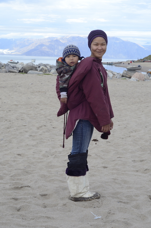
Woman wearing Amauti with child – Pond Inlet, Baffin Island
Many towns suffer from lack of or misguided government input and from plaguing social issues such as substance abuse and suicide. When many communities are officially “dry” how will rapid melting and the rapid arrival of tourism and economic influx affect northern society? And what is the federal government doing to prepare for this? Slowly recovering from upheaval beginning in the 1950s, including religious conversion and residential schools, will the north adapt and thrive or will serious social issues magnify?
Art and skill abound in these northern communities, but how will wildlife fare? Narwhal and Walrus tusks are the other ivory and with more vessel traffic, more tourists wanting something unique might mean more animals killed than needed and for the wrong reasons.
The north is isolated from the rest of Canada. Vancouver and Cambridge bay might as well be in different countries. No roads or power lines connect them. Energy is provided by diesel generators and goods arrive by barge several times per summer or much more costly by plane. The arrival of more traffic may liberate the north from its economic dependence on the south.
An interesting exception is Cape Dorset. World-renowned for its artists, the town lives off an economy of art. I was surprised to hear of collectors arriving from as far away as Russia and South Africa keen to buy up carvings and prints.
The day following our sight of the Serenity we arrive in a bay on Prince of Wales Island. We are up at 5:30 am to do an early morning cruise. Outside 40kmh winds lift small whitecaps and low clouds obscure grey peaks. It doesn’t look promising but reports from previous years say the contrary. A scan from the bridge catches two cream-coloured spots several kilometres away. In a short time zodiacs are lowered and drivers hop in and load passengers. We motor into the bay, deeper and deeper and when we spot our first bear we drop our speed. Entering the inner cove, the wind and waves cut and we watch the white bear amble along the shore in our direction. It’s young, maybe three or four years. Male or female, who knows? Then it stops and lifts its nose toward us. Their sense of smell is astonishing, sniffing out a ringed seal over 30km away.
We halt. As a guide working for a conscientious company, bear and other wildlife welfare is our priority. We want guests to have great viewing, but not at the expense of a stressed animal running away using up valuable energy sources. At this time of year in late August bears are at the height of their annual fasting period. Ice is a bear’s hunting platform, but when it melts in spring, seals and whales are difficult prey. So summer is a prolonged period of fasting and opportunistic feeding on birds eggs and rotting carcasses. In Pond Inlet locals tell me how the spring melt occurred 10 days earlier this year. As melting and freeze up get further and further apart, bears are in even more peril. It is imperative that a pregnant female has enough fat resources for denning, birth and lactation. As trained guides we are sensitive to this.
With the Serenity around the corner I can only imagine the effect of loading innumerable zodiacs into the water and disturbing animals. Not to mention, bear human conflict can only increase with more vessel traffic. On our small vessel of one hundred passengers there are at least 12 trained guides that are specialists in polar travel. As vessels get larger and more numerous the passenger to staff ratio increases and the quality of guide can only decrease.
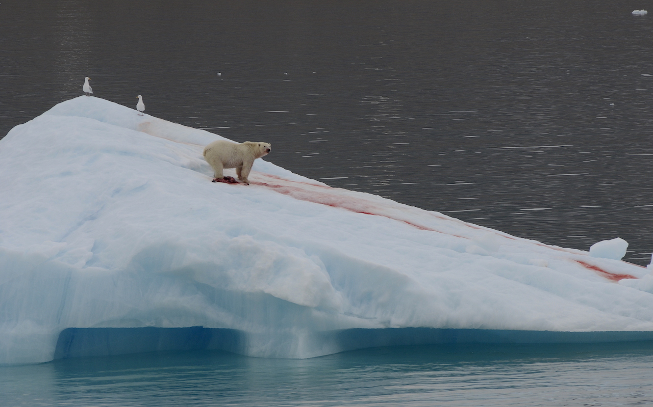
Polar bear eating ringed seal
We are in tight and quiet formation. Then on the eastern shore of the bay a large male appears. Then up the hill another. And another. Soon more bears are spotted including a mother and her cub of the year. And it’s not hard to see why. Several beluga carcasses, purple stained ribs, are scattered on the shoreline. We count 8 bears. Motors are a near putt; cameras click, and in tune with not disturbing the animals passengers emit suppressed gasps and “awwws”. The large male loses interest and lays down for a rest while the mom and cub tear away bloody morsels of the rotten whale.
This second voyage takes a southern route. We land in bay on Prince of Whale’s Island. The polar desert is evident in the stony ground with only lichens and cushion plants suffering the cold, wind and dryness. Close to the landing site we discover a tent ring, a circle of stones, maybe from Inuit predecessors, the Dorset. I recall the seal skin tent on display in Gjoa Haven. The arctic is one enormous archaeological dig.
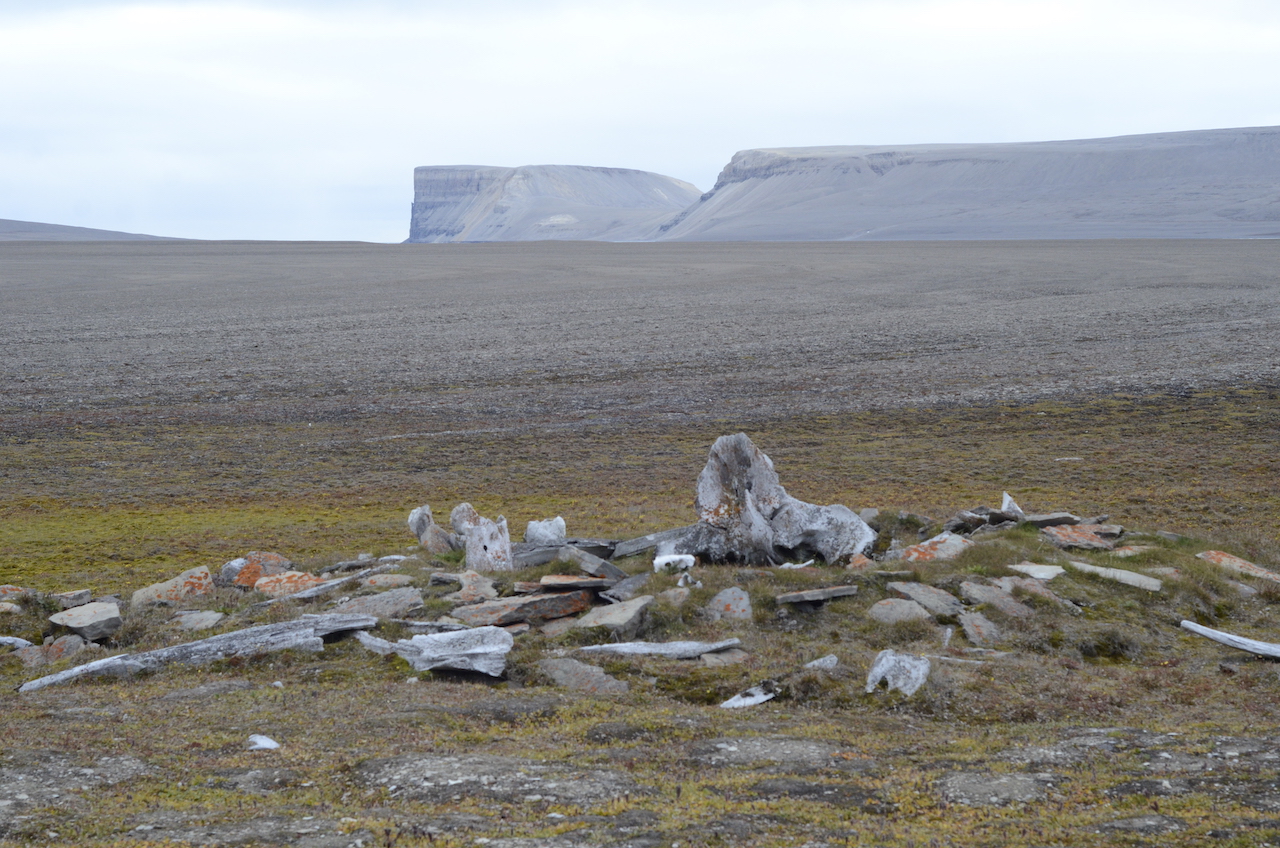
Thule dwelling archaeological site, made of bowhead whale bones
A young snowy owl perches on a lone bolder. Its blotchy brown nearly indiscernible from the landscape. Through my binoculars on the other side of the bay the pastel greys are interrupted by the brown blockiness of muskox. Stalwart, unwavering, relics of the ice age, only their long dress of qiviut, one of the finest wools in the world, waves in the incessant wind. The white of an arctic hare. The grey of an arctic fox.
We transit the torrid waters of Bellot Straight, past Zenith Point, the northern most tip of continental North America. At the eastern end of the channel we land at Fort Ross. Two Hudson Bay posts. The wind is howling 80kmh. Peering through the broken windows, wallpaper wavers and furniture sits in slow disintegration.
On this eastern voyage our vessel turns south and we head to the bottom end of Baffin Island; the other Northwest Passage. We head for Fury and Hecla Straight, notorious for being a pinch point of pack ice. In the previous days the captain and our expedition leader have poured over ice charts from the Canadian Ice Service. But even satellite and images taken from planes can’t keep up with the restless flows.
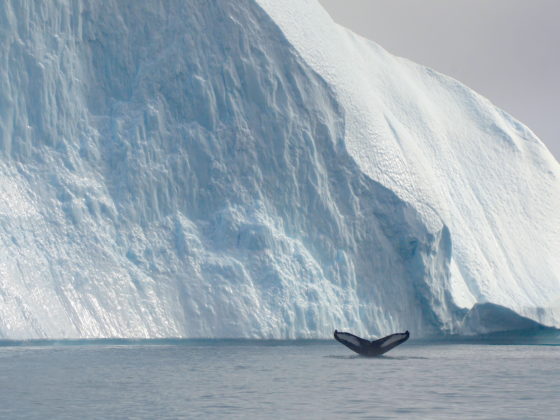
In the distance a line of white and on approach, ice to the horizon. So we follow the edge of the pack and hope for a lead east. Eventually an opening is found and we turn, Fury and Hecla stands ahead and we enter into an open and iceless channel. A bear on a lone flow, then the v-shaped blow of a bowhead whale. Considered to be the longest-lived mammal, at over 200 years, this 100-ton beast may have watched Amundsen or heard the cries of Franklin’s crew.
Further south, the cousin of the bowhead, the right whale is a common victim of ship collision. How will the bowhead fare?
We navigate effortlessly through Fury and Hecla only part of a handful of passenger ships in history. Just for kicks the captain pulls a U-turn and we pass through again — three times in a day, probably a historical first. When we land in Igoolik we are told we are the first passenger ship since 2011 and before that, no one remembers.
From this community onwards, the sea is open. The infamous ice that stopped and sank explorers nearly 200 years earlier is nowhere to be found. When Amundsen sailed from Greenland to Baffin Island it took 18 days. We covered the same distance in two and our entire trip was only 17. Despite the anomaly of the “Little Ice Age”, the Arctic is warming at an unnatural rate. Some scientists argue that the North Pole could have an ice free summer in as early as 20 years*.
But major social and environmental changes are already underway. For the Inuit, tied to the land and sea, climate change means cultural change as the environment in which they evolved and derive identity shifts beneath their feet. And as the barriers that once isolated the Arctic melt away, more visitors on larger and more ships will arrive creating further social and environmental upheaval. How will Lancaster Sound fare with more traffic or even an oil spill?
The transformation of the Arctic is inevitable, but not anticipating and preparing for this risks losing it. For better or worse, the Arctic is changing.
*Ice free is defined has having less than 1million km2 of ice.