BC's Coast Is 100% Worth Protecting. These 13 Stunning Images Remind Us Why.

British Columbia
by Kate Siobhan Mulligan Jun 25, 2015

SUPER NATURAL BRITISH COLUMBIA. Beautiful British Columbia. The Best Place on Earth. We’ve had a whole slew of taglines over the years but they’ve got a connection: The beauty of this place. We’re world famous for our dramatic landscapes, our dense and lush rainforest, and our remarkable wildlife.

On a larger scale, with this being the hottest June on record and one of the driest years in all of BC history, the need to address global warming and what we stand to lose is greater than ever. But making change starts on a more local scale, and the ever growing debate on two proposed pipelines — one from Alberta to Burnaby Mountain just on the edge of Vancouver, courtesy of Kinder-Morgan, and another from Alberta to Kitimat, BC proposed by Enbridge — needs more attention than ever. As many protesters have been chanting: “There is no Planet B.”
The Enbridge Pipeline will cross more than 1000 streams and rivers in Northern BC, many of which are the headwaters for major rivers that cut through the province, before arriving in Kitimat, where massive tankers will load up with oil to take to China or the USA before navigating the famously precarious inlets of the north of our province.

An oil spill in this region — and at any point along the way — would be devastating to locals, to animals, to the ecosystem, and to the First Nations and their land. Despite protests around the province — and despite First Nations tribes turning down “investments” of more than 1 billion dollars to use their land — both pipelines are moving forward disturbingly quickly. Organizations such as Pull Together have been fundraising from both BC residents and local businesses to help financially support the First Nations bands who want to take a stand against Enbridge — specifically the Nadleh Whut’en, Nak’azdli, Heiltsuk, Gitga’at, Haidi, Kitasoo/Xia’xias, and Gitxaala nations.

Here are 13 images of our beautiful BC coast, all of which barely scrape the surface of what we stand to lose, not only to global warming, but to pipelines running across our beautiful province.

1. An orca cuts through the water on a hunt near the Great Bear Rainforest — one of the largest temperate rainforests left on Earth. The area covers the central coastline and goes as far north as the Alaska border.

2. The isolated but phenomenally beautiful Haida Gwaii islands (formerly known as the Queen Charlotte Islands) lie in the Pacific, across the water from Kitimat, BC.

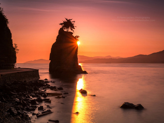
3. Siwash Rock in Stanley Park, Vancouver, at sundown.

4. A young grizzly spies something of interest in a central BC river.

5. A humpback whale passes through the Great Bear Rainforest passage.

6. The view from Horseshoe Bay over the Salish Sea, as the sun sets behind the islands, while a ferry navigates the coastline.

7. A bald eagle in flight near Prince Rupert, BC.

8. A kermode bear. Also knows as a spirit bear, 1 in 10 of these bear cubs have a recessive gene that makes their coat white. They are not polar bears — they are white grizzly bears. They’re a protected species in Central and Northern BC, extremely elusive and rare to see — and they live right along the proposed pipeline.

9. Sea lions take in the last sun of the day along the Central BC coast.

10. A surfer in Tofino, on Vancouver Island, makes his way out of the rainforest and into the waves.

11. A fishing boat heads out to sea from Prince Rupert, BC, with the sky ablaze.

12. Some of the Haida Gwaii island seen from a seaplane.

13. Tidal pools glow in last light on Vancouver Island.

Discover Matador