The Annapurna Circuit has long been the most popular trek in Nepal, but its fame is catching up with it. Teashops strung every few kilometers along the trek sell Coke and candy bars, and each year road development swallows another swath of the original route. Those searching for wilderness and ‘authentic’ village experiences have begun to bypass this ‘Annapurna Highway,’ and trek the Manaslu Circuit instead. Although opened to trekkers since 1991, the Manaslu Conservation Area (MCAP) remains untrampled, with only a small fraction — 1/30th — of the visitors who hike Annapurna each season.
Sama and beyond
All You Need to Know to Trek the Manaslu Circuit in Nepal

lower trek
I was an anthropology undergrad student in Kathmandu working on a month-long independent project when I first discovered Manaslu. The rural village of Sama, located beneath an ancient trade pass to Tibet, was my destination. Accessible only by foot and a seven-day trek from the nearest road, Sama lies along the trail, which crowns Mount Manaslu. My project was to understand how trekkers shape the evolving face of Sama in both positive and negative ways. Guided by my findings, I offer here a detailed and sensitive guide to the Manaslu Circuit.
Usually hiked over a period of two weeks, the Circuit wraps around Mount Manaslu, the world’s eighth highest peak, looming at 26,759 feet. It begins by climbing against the current of the Budhi Gandaki River for nearly three vertical miles. The path sweeps through gorges where glaciers hang and drain the frozen eaves of the planet. It crosses suspension bridges and passes through fields of barley, as it follows an ancient route along which caravans of yaks hauling salt from Tibet have traveled for thousands of years. Climbing higher to the last clusters of homes before the mountain wall of the Himalaya, you step into Tibetan territory. Architecture matches these ethnic lines, and as altitude rises, so do the number of monasteries, maani walls and chortens.
From here, the trail crosses into the legendary land of Ghorka where herder’s huts lay tucked high in the thawing meadows. Close to a dozen peaks over 21,000 feet serrate the horizon as the path rises to Larkya La pass, the highest point of the hike at 17,175 feet.
When to trek

The major trekking seasons are from March to May and September to November. This is due to the monsoon season, a period of relentless rain that drowns the region from June through August. The frigid Himalayan winter also makes visiting this region miserable, if not impossible, during the early months of the year.
For this reason, more than half of the annual 2,000 visitors to Manaslu make their pilgrimage in October. Planning a trip during any other month promises few encounters with other trekkers. I hiked in April and encountered only a handful of folks who made for good company around dung fires on frosty nights, but hardly felt like a crowd.
Permits
Nearly the entire Circuit traverses the Manaslu Conservation Area (MCAP), managed by the National Trust for Nature Conservation (NTNC) — the same agency responsible for Annapurna. MCAP is considered ‘restricted’ by the NTNC, which requires an additional permit and the accompaniment of a registered guide. Be reminded that this additional hassle is what keeps Manaslu from becoming Annapurna, and is well worth the extra fee.
– Trekking companies will arrange permits for you in advance.
– The general permit to enter MCAP costs 2,000 Nepali rupees (approximately $23 USD).
– All permits require passport-sized photos.
– Secure permits well in advance.
– The general permit to enter MCAP costs 2,000 Nepali rupees (approximately $23 USD).
– All permits require passport-sized photos.
– Secure permits well in advance.
Trekking companies will arrange permits for you in advance. If you are traveling alone, most can also connect you with another traveler, since it is illegal to travel in a group of less than two members. I have known people to ‘borrow a passport’ for the permit application and then trek alone, but this risks getting turned around on the trail by an officer and having to scrap your entire trip. Along the trek there will be MCAP officers who check permits for their records. This is rather painless and if the official is not present, your guide may even usher you on to the next village.
The general permit to enter MCAP costs 2,000 Nepali rupees (approximately $23 USD) and is collected by the NTNC in order to support conservation efforts and community development in the region. The Ministry of Culture, Tourism and Civil Aviation also levees fees on all restricted areas: Manaslu is 50 USD per week, with 7 USD for each additional day. If you move at an average pace, a one-week permit should suffice. If you plan to connect with the Annapurna Circuit later in your trek, you will also need to secure the 2,000 Nepali rupee permit for Annapurna Conservation Area in advance.
All permits require passport-sized photos, but pictures can be taken and processed at a booth down the street from the Nepal Tourism Board Office (Bhrikutimandap, Kathmandu: Open 7 days a week: 9am-5pm, except holidays). Be warned that Nepali holidays often emerge sporadically (unmarked on calendars), so make sure you secure your permits well in advance and do not get stuck because the office is closed for an obscure festival of one of Kathmandu’s many ethnic groups.
Route logistics

steps
A ten-hour bus ride leaving Kathmandu at dawn deposits you in Arughat Bazaar (1,893 feet): the end of the road. Be aware that during monsoon season the road is often so rutted that mud swallows the wheels and the bus may not forge on. Even in April, my bus got stuck several times and a team of passengers was recruited to push.
In the itinerary below, hiking times may appear short, but it is important to gain the 15,282 feet of elevation in small increments. Otherwise you risk suffering from acute mountain sickness, potentially fatal at these heights.
From Arughat, it is possible to hire a jeep to transport you to Sothi Khola, which allows you to shave a day off the Circuit, should time be an issue.
Day 1: (or 2 depending on whether you take a jeep to Sothi Khola):
Soti Khola to Maccha Khola (Fish River) [3,281 feet]; 5 hours hiking
Day 2: Machha Khola to Jagat [4,593 feet]; 6 hours hiking
Jagat is the fist official checkpoint on the trek and the largest MCAP station with an English-speaking officer who lives in the village full time.
Day 3: Jagat to Deng [6,102 feet]; 6 hours hiking
Just before Philim, there is another police checkpoint on a riverbed; it is a corrugated metal shed brightly hand-painted in blue and yellow.
Day 4: Deng to Namrung [8,530 feet]; 6 hours hiking
Day 5: Namrung to Lho [10,171 feet]; 4 hours hiking
Day 6: To Samagaon [11,483 feet]; 2 hours hiking
Day 7: Acclimatization day in Sama: See ‘Where to linger’ below for day trip ideas.
Day 8: Samagaon to Samdo [12,467 feet]; 4 hours hiking
Day 9: Acclimimatization day in Samdo:
A fantastic side trip is a full day of hiking to the Tibet border with a local guide. See my recommendation on a guide in ‘Where to linger’ below.
Day 10: Samdo to Larkya Phedi [14,633 feet]; 4 hours hiking
Day 11: Cross the pass and reach Bimtang [12,139 feet]; 8 hours hiking
Note: The highest point of the pass is at 17,175 feet.
Day 12: Bimtang to Tilje [6,890 feet]; 6 hours hiking
Day 13: Tilje to Jagat [4,265 feet]; 6 hours hiking.
Here again, it is also possible to hire jeep transport to Besisahar and cut an extra day from your itinerary.
Day 14: Arrive in Besisahar [2,625 feet]
From Besisahar, buses and microbuses circle regularly between here and Kathmandu.
Connections
Since the Manaslu Circuit ends in Besisahar (the trailhead for the Annapurna Circuit), it is easy to link these treks into one. After crossing Larkya La Pass, the trail descends into the Annapurna’s Manang District where you can continue on the Annapurna Circuit. The paths converge in the village of Dharapani (between Tilje and Jagat on Day 13).

guesthouse
From here, you can ditch your guide, and he can hike back to Besisahar while you continue on to the best of the Annapurna Circuit unaccompanied. This itinerary allows you to bypass the lower section of the Annapurna Circuit, which is mostly consumed by buses and dusty roads, while still hiking the most scenic stretch.
Lodging and food
Each year more guesthouses are built along the Manaslu Circuit. Carrying lighter packs, trekkers can leave their camping gear behind and eat their meals at lodges and restaurants along the way, allowing a greater amount of money to trickle into the local village economies. Rates fluctuate with the season and mood of the guesthouse keeper. The higher the elevation, the more expensive food will cost, as nearly everything must be hauled in on mules.
The cheapest and most filling staple is dal bhaat in the lower villages, but once you climb out of rice country, potatoes and tsampa become the cheapest fare (and what most locals will be eating). Still, nothing in Nepal is very expensive.

dal bhaat
If you plan on purchasing snacks along the trek, don’t plan on being able to get much more than biscuits, cookies, wiwi (raw ramen noodles eaten like crackers) and a candy bar if you are lucky. Occasionally, you may score with a jar of peanut butter. Mountaineers who finish their climb and have leftover rations often sell supplies to shopkeepers.
Water
It is very easy to get hot water along the trek, as every shopkeeper, restaurant owner, and guesthouse manager has a thermos of hot (boiled) water. If you don’t trust this or don’t like drinking luke-warm water while climbing, bring your own water purification system. I hiked with a Steripen, which I only used to double purify water that I doubted had been properly boiled.
Another great backup is buying a bottle of ‘piyush,’ a Nepali chlorine solution developed for residents in Kathmandu to treat their water at home. One bottle, which costs a few bucks at any corner store, can treat countless gallons and is as simple as adding a few drops to a Nalgene.
Gear
Even if your guide has a map, pick one up in Kathmandu. Thamel, the trekking district of the city where most foreigners arrange their hikes and mountain ascents, is full of shops selling maps ranging in content and quality.
– sleeping bag
– map
– trekking poles
– sunscreen
– sunglasses
– map
– trekking poles
– sunscreen
– sunglasses
As mentioned earlier, teahouses make carrying a tent a waste of weight. I do recommend bringing a sleeping bag (down preferred) as nights in even as late as May bring frost. Some villages have limited or no electricity so you will also want to bring flashlights with extra batteries.
Trekking poles are recommended, especially if you plan on doing day hikes up to Manaslu Base Camp or the Tibet Border. Even if you aren’t planning to stray from the Circuit, your knees will thank you coming down from Larkya La Pass! High quality sunscreen is a must. At some point, you will be hiking on snow with very little atmosphere between you and the sun and any exposed skin will fry. Protect your eyes; don’t take sunglasses off until the sun goes down. Pack light; it is possible to hire a porter, which many people do, but this will add to your cost.
How to find the locals
Even if your company cannot secure a local guide from Manaslu, hire someone from Sama or Samdo to take you on a day trip (see ‘Where to linger’). Your best bet is to talk to Bir Bahadur Lama, owner of the quaint Mount Manaslu Hotel, which is the oldest and most prominent guesthouse in Sama. He speaks very good English and can connect you with a local guide. When I was living in Sama in 2011, he was planning to develop a youth program to hire young men in the village to lead trekkers on the day trips listed above.
Bir Bahadur’s contact information:
-
Mount Manaslu Hotel & Lodge
Samagaun 3, Gorkha, G.P.Box: 8974, CPC No: 199, KTM, Nepal
Telephone: +977-993644005, +977-993644006
Cell: +977-9741172857, 9841575009
Tphurbu8163@yahoo.com
http://mountmanasluhotel.com/
In Sama, also try Ngodrup Gyelzen, owner of the Norbu Hotel. Another pioneer in tourism development, he is well connected (and related) to most shop owners and guesthouse managers in town. Ngodrup, who was working on securing his guide certification in 2011, also speaks great English and has a week’s worth of stories (I know this because I spent 7 days hiking to Sama with him) from his youth herding yaks into Tibet and swimming half frozen rivers while clutching a tail! You may contact him or his niece, Pasang Dolma, at pressdress@yahoo.com.
Where to linger
The village of Samagaun sits at the base of Mt. Manaslu — a six-day trek from the nearest road in Nepal, but less than a day’s walk from Tibet. The mountain rears like a gleaming, two-pronged fang behind it; the brown glacial moraines below like the gums of a canine. Even as the community has embraced the growing number of trekkers and mountain climbers visiting their region, the village remains largely consumed with a subsistence lifestyle.

Manaslu Circuit
Families have lived for 1000s of years in elevated stone houses with animal pens underneath their homes. Most households sustain themselves by growing barley and potatoes for three months of the summer and trading with Tibet and lower villages the rest of the year.
Since most itineraries include an acclimatization day in Sama, it is worth exploring the surrounding valleys deeper. In the company of a local guide, visit Pung Gyen Monastery, tucked at the headwaters of a stream with an ancient temple and meditation caves in the rocks above.
Biendra Lake, the pool at the base of one of Manaslu’s many glaciers, is a couple hour excursion or climb to Manaslu Base Camp where mountaineers brace themselves for the summit. If you would rather have a lazier day, wander among the braided grazing paths and help the Tibetan children gather the yaks before dusk.
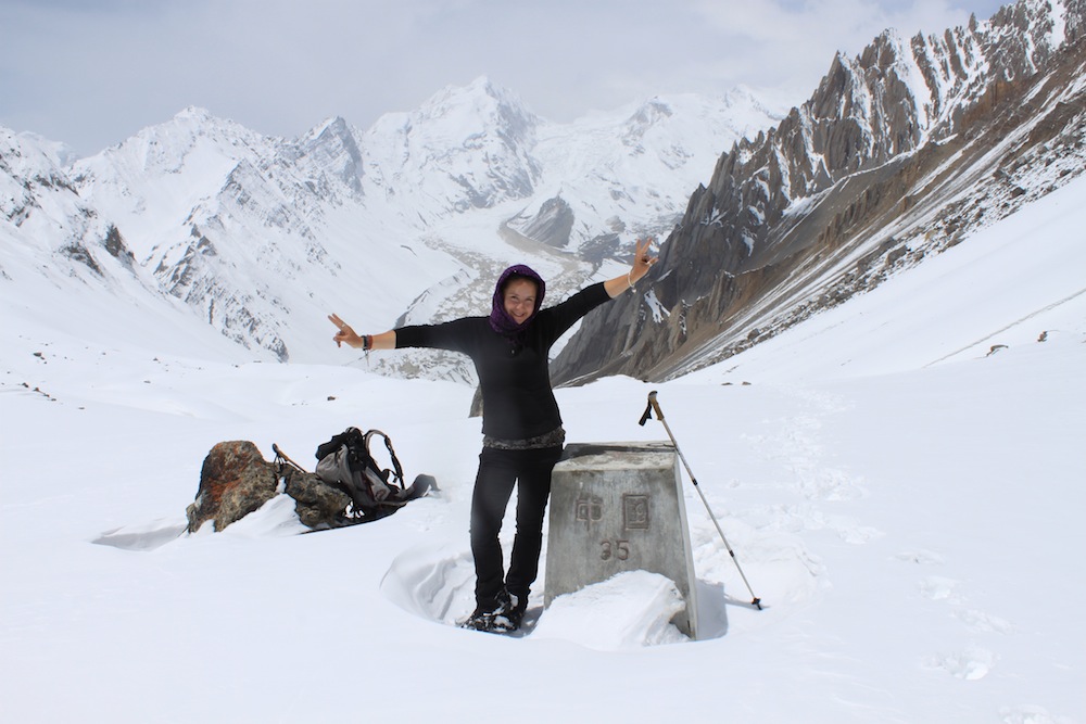
During your acclimatization day in Samdo, climb and stand on the edge of Tibet. There is a stone marker engraved with Tibetan script on the pass, which can be dug out of the snow among heaps of prayer flags. It is easy to become captured here in the ghosts of the mountains and the tangle of flags shedding their blessings to the wind.
The trail to the pass is usually under snow (my guide and I relied on wolf and snow leopard tracks to find the easiest way), so be sure to wear plenty of clothes and pack a thermos of tea, lots of water, and food. Trekking poles are highly recommended. Again, seek out Ngodrup Gylzen of Sama to accompany you or talk to Bir Bahadur about arranging another local expert.
Cultural notes
You are bound to encounter countless maani walls (stone tablets engraved with mantras) and chortens or stupas along the path (rotund religious structures in Buddhism often housing relics and surrounded by prayer wheels). In order to respect the sacredness of these ancient structures and the people who tend them, always walk to the left.
Similarly, if you feel moved to spin prayer wheels or enter a temple also move the wheels (or your body) in a clockwise direction. Before entering a temple, remove your shoes and leave any bags at the door. Do not take pictures. If you make a donation to a monk, or pay a guesthouse owner for that matter, offer the cash cradled in both hands as a sign of respect.
Tips on sustainability
Order what the locals eat. At low elevation, eat rice; when high, eat potatoes. Although some menus offer ‘Western food,’ remember all these ingredients must be hauled in on mules.

The author
Do not order yak burgers, as tempting as they may be. Many villages are suffering from serious vegetation loss and erosion as the number of yaks has escalated with the number of foreigners ordering burgers. Traditionally, Tibetans did not even eat their yaks but rather raised them for dairy. A better idea: try the yogurt or dried yak cheese!
Learn about the region before you go. Read The Snow Leopard by Peter Matthiessen and investigate anthropologist Geoff Childs’ research on communities living in the Nubri valley.
Connect with the Nubri Culture and Youth Promotion Committee in Kathmandu. This organization, established in 2009 by community members, works to promote culture, religion, and tourism in the region through programs hosted along the Manaslu Circuit and at their outreach office in Kathmandu. Check out their events at www.nubri.org.
If you are interested in more tips on leading a sustainable trip to Manaslu or are curious about my findings on how villages along the Circuit have changed you can find a full text copy of my report here. ![]()