Photo: Author

How to Hike Patagonia's Torres Del Paine

Insider Guides Hiking
by Cindy Ross Dec 14, 2012

Patagonia looks like “Alaska on steroids,” my kids remarked.

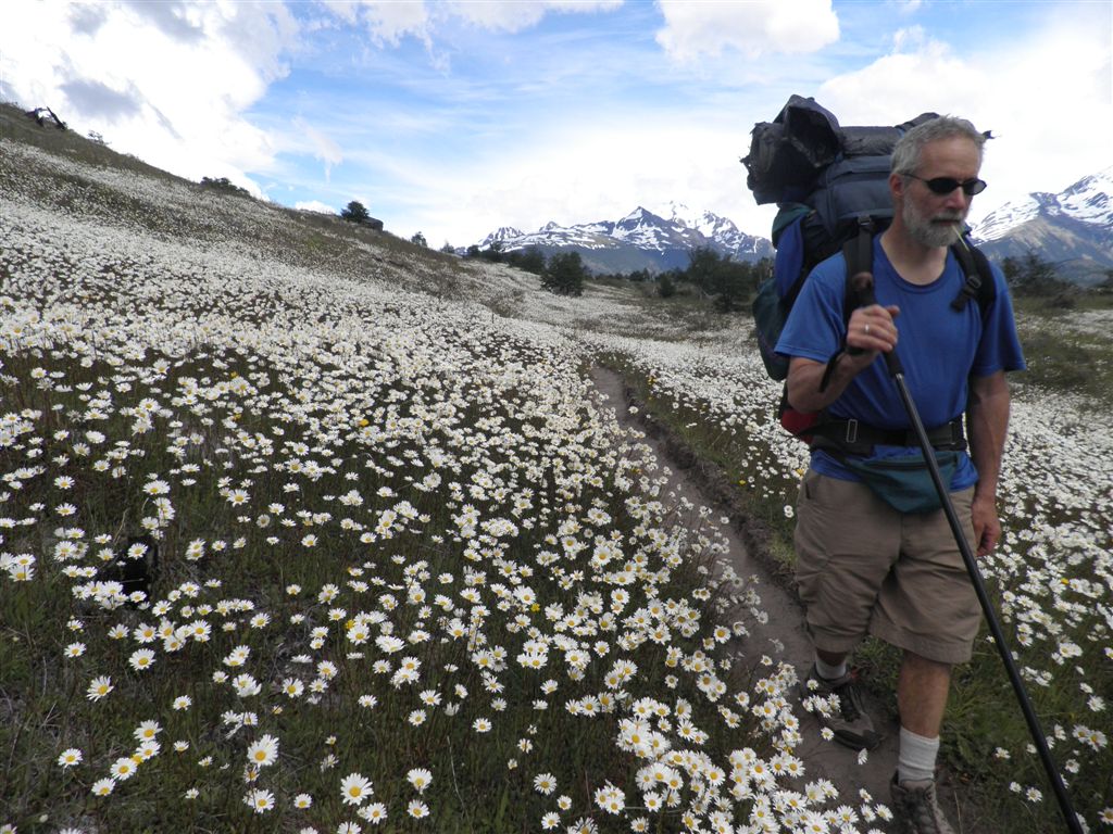
My family came over winter break to backpack the 87-mile Paine Circuit. It circles the Paine massif of 10,000ft (3,200m) peaks and edges a 240-mile-long glacier before climbing to a wind-tunnel pass and looping back around. It’s considered one of the top treks in the world.

Tips:
– Plan early
– Purchase supplies in Puerto Natales (limited goods available inside the park)
– Pack for inclement, cold weather, even in ‘summer’

At the Valle de Frances, we stood atop a ridge surrounded by sheer rock pinnacles — spires of chiseled stone emerging from the clouds, their tops frosted in snow, and trailing robes of glaciers at their feet. Ice chunks bobbed in the ultramarine lakes, calved off from the glaciers, appearing as if a bubble of blue sky was contained inside. The turbulent rivers ran milk white from glacial sediment. There were oceans of flowers — hillsides so thick with daisies that from above it looked like snow covered the ground, and walking through them nearly made us seasick from their bobbing, wind-blown heads. Guanacos grazed on the grasslands. Condors, with their 10ft wing span, glided around the peaks.

Climbing up alongside the enormous shoulder of Grey Glacier, we thought about how the larger Southern Patagonia Icefield is the most extensive outside the world’s polar regions. Grey is one of the icefield’s 19 major glaciers. The field of ice literally fills the valley and chokes the mountain ranges, rearing up like a bowed back of an animal as it swallows entire rock islands. The far side of the glacier is guarded by snowy peaks, extending their own tongues of ice to drool into the river. Above the tree line, you can’t see the glacier’s source, for it spreads for 240 miles.

Planning your route

Planning a trek around the entire perimeter of the national park, or even hiking the shorter “W” route — which hits all the scenic highlights of the southern side — can seem daunting. You don’t need a guide, but it’s good to have some guidance. Start by obtaining a copy of Lonely Planet’s Trekking in the Patagonian Andes. Once you decide on the number of days you want to spend in the park, you can begin to plan your trek.

Besides the main circular loop, which takes a good 7-8 days, there’s a shorter W-shaped trail. The arms of the W are trails that reach up into the throats of the mountains, stopping at viewpoints of turquoise lakes carved into of the cupped palms of the peaks. There are primitive campsites located near these dead ends, which make for good bases for photographing for some of the most spectacular sunrises I’ve ever seen.

A hiker should be in good shape to attempt the entire circuit. We planned 7- to 14-mile days, averaging about 10-11. The day you get dropped off and picked up by the bus, of course, will be abbreviated in mileage.

Our hiking schedule (clockwise)

Day 1 – 3 ½ miles to Camp Chileno (travel day)
Day 2 – 13 miles to Los Cuernos Campground
Day 3 – 11.5 miles to Italinao Camp
Day 4 – 11.5 miles to Refugio Gray
Day 5 – 7 miles to Campo Pass
Day 6 – 13 miles to Dickenson Camp
Day 7 – 11 miles to Seron Camp
Day 8 – 10 miles (travel day)

On arrival: Transportation and accommodation

You’ll probably fly into Punta Arenas, Chile (after a connecting flight through Santiago or Buenos Aires). The region’s bus system is frequent, inexpensive, and nearly luxurious, making it unnecessary to rent a car. Plus, a car would have to sit unattended for many days. From Punta Arenas, hop a bus to Puerto Natales, your kickoff point for the national park. Next, secure a room at the Erratic Rock hostel or their B&B, owned by Portlander Bill Penhallow.

Erratic Rock leads a daily free seminar on how to navigate the park, obtain permits, arrange bus schedules, help design a schedule and a route of travel, rent equipment, and even gives instructions on how to set up a tent if you are a complete greenhorn. You get all this valuable info whether you stay at Erratic Rock or not. But you may as well, for they offer a great breakfast (included in your overnight stay), are very friendly, and will allow you to store your excess traveling gear and luggage until you’ve completed your visit to Torres del Paine.

On the climate: What you need to wear

Patagonia weather is bizarre, even in the summer. One minute it batters you with frigid cold, spitting hail, and driving sleet. Fifteen minutes later, you could be sweating like terrariums, ripping off raingear, and slathering on sunscreen (the ozone hole is directly overhead). Sometimes it rains when the sky is brilliant blue overhead, for the precipitation is carried from miles away on the winds. Clouds race at such speed that it’s worth waiting at any viewpoint, however swallowed in clouds and inclement weather.

You’ll need lightweight, cold-weather clothing, regardless if this is Patagonia’s ‘summer.’ A warm sleeping bag and quality raingear are also essential. Think hypothermic conditions, and leave all cotton clothing at home.

Hiking here is challenging, with the trail often laden with rock and roots. It climbs and descends steeply. River fords are across swinging suspension bridges, or rock hopping where you must wait for the wind to take a breather so you can cross without getting thrown in. Sometimes you have to walk through frigid water that was locked in an ancient glacier an hour ago. A few ravines have 50-foot steel ladders to assist you. Pack sturdy hiking sandals for the fords, and wear boots with ankle support.

Shelter on the trek

We established a system where we’d stash our packs at the campgrounds early, and then climb high into the points of the W on day hikes, returning to the campgrounds by day’s end.

More comfortable than camping are the refugio beds, which come with a hot meal. Accommodations fill up early, so you need to be on top of reservations if you go December through February. Our family came prepared with cooking gear and food, but it’s easy to run out on the circuit. You can purchase hardboiled eggs, homemade bread, cookies, salami, etc. at the refugios to supplement your stash. Some of the campgrounds are free, but they’re not always at the most convenient location or fit into your schedule. Carry a wad of Chilean pesos, but you’ll also need Argentinean cash for the buses to go back and forth across the borders as you travel.

Gauchos resupply the refugios, leading teams of horses laden with lashed crates. The gauchos wear leather-strapped boots and spurs, knickers with sheathed knives stuck in the rear of their pants, and black berets. The horses are not strung together but herded boisterously as they gallop off after their work is finished.

The wind is ferocious up in the pass, but usually it’s at your back if you hike the circuit clockwise. It roared off the glacier and propelled us up and over, inflating our rain gear like we were balloons tethered to the earth by our heavy backpacks. When we yelled with pride at the monument marking the pass, the wind ripped the sound right out of our mouths. In Patagonia nature is boss, and we felt privileged to catch a glimpse.

Touring / sleeping

PUERTO NATALES

  • Erratic Rock Hostel – this place serves as guide service, accommodations, rental center, and the ONLY recycler in Patagonia. Free daily information session, regardless if you stay here.
    Dorm $20US; double $50 for the room. Both prices include breakfast
  • Erratic Rock B&B
    Benjamin Zamora 732 / tel (56-61) 414317
    Rooms with double beds, en suite bathroom, cable tv, and a great breakfast – $75US
  • Tin House Hostel

PUENTA ARENAS

  • Turismo Aonikenk Ltda. – a German-Chilean tour operator specializing in adventure and nature travel in Patagonia and Tierra del Fuego, Chile.
    tel (61) 228 616

NATIONAL PARK & VICINITY

Dining

PUERTO NATALES

  • el Living – “Best vegetarian food in Patagonia”
  • Afrigonia
    323 Eberhard / tel (61) 412 877
National park info

Discover Matador