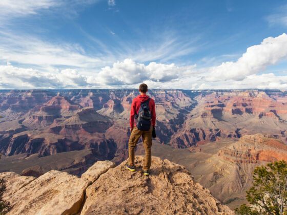
Stop 1. Phoenix
Phoenix is a huge sprawling metropolis in the middle of the Sonoran Desert and the cultural center of the state, with some of the best and most unique museums in the country. The Heard Museum is filled with wonderfully curated intriguing exhibits and accurate information about Arizona’s indigenous people.
There are many hiking trails within the limits of the city. Take the scenic road through South Mountain Park, and explore sections of its trails. Take water, sunscreen, and wear a hat.
Great for: Dining at A Different Pointe of View, visiting museums, hiking, finding local mom ‘n’ pop Mexican restaurants.
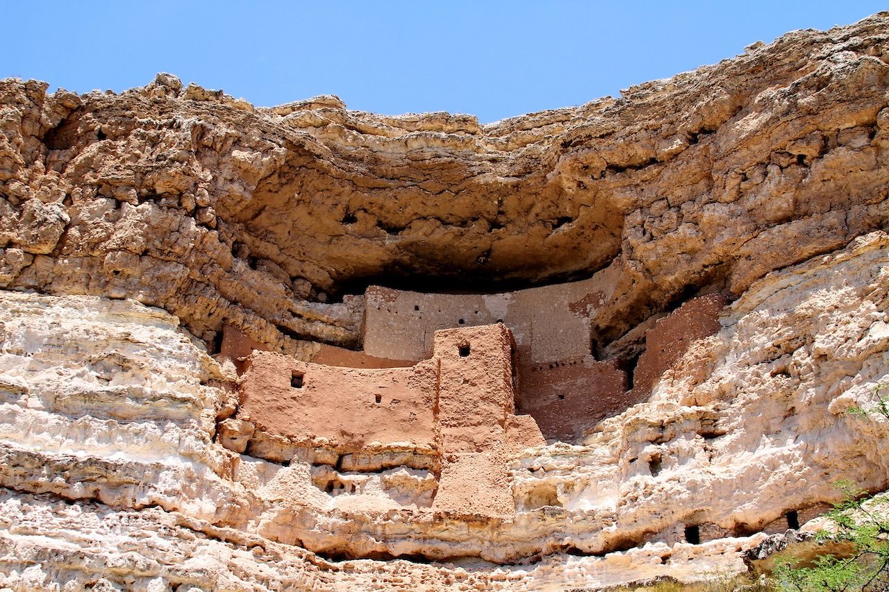
Up next: Drive about an hour out of town on I-17 N and take exit 289, to Montezuma Castle Road.
Learn about the way ancients lived. This multi-home dwelling is built into the rock and looks like part of the cliff. It was the home of early Puebloan people and may have been built by the women of the tribe. For an interesting take on the naming of this site and its early history, check out this Website.
Great for: Self-guided tour, learning about ancient cultures and the desert environment, walking.
Don’t forget: Buy a National Park Pass. On this trip alone you’ll use it enough to be worth it.
Up next: Drive back to I-17 N, take exit 298 to AZ-179, the oldest scenic road into Sedona. Enjoy the scenery. Driving time: About one hour.
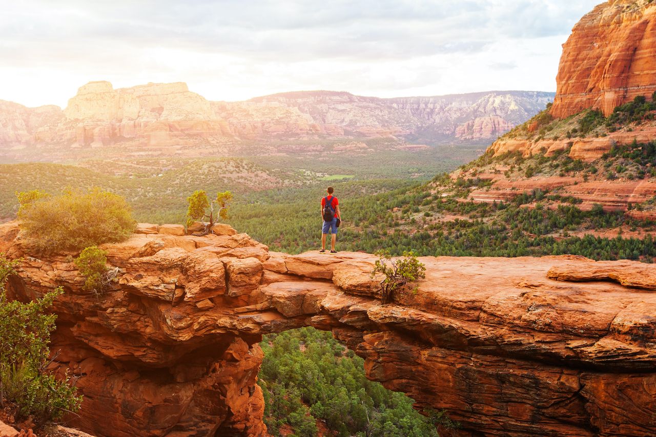
Stop 3. Sedona
The area is worth an overnight stop. Enjoy the beauty of the surrounding red, pink, and orange rocks, great dining, and a stroll through the tourist center of town. Hike the trails around Bell Rock, explore Red Rock State Park, visit the Chapel of the Holy Cross — which was built into the rock, and go for a swim in Slide Rock State Park a short drive up I-89A.
Great for: Hiking, dining, overnight stop.
Don’t forget: When hiking, carry water, wear sunscreen and a hat.
Up next: Take I-89A North to Flagstaff. Driving time: About an hour on a winding scenic road above Oak Creek Canyon. Check to find out summer 2017 closure times. Stop at the scenic view on top of Oak Creek.
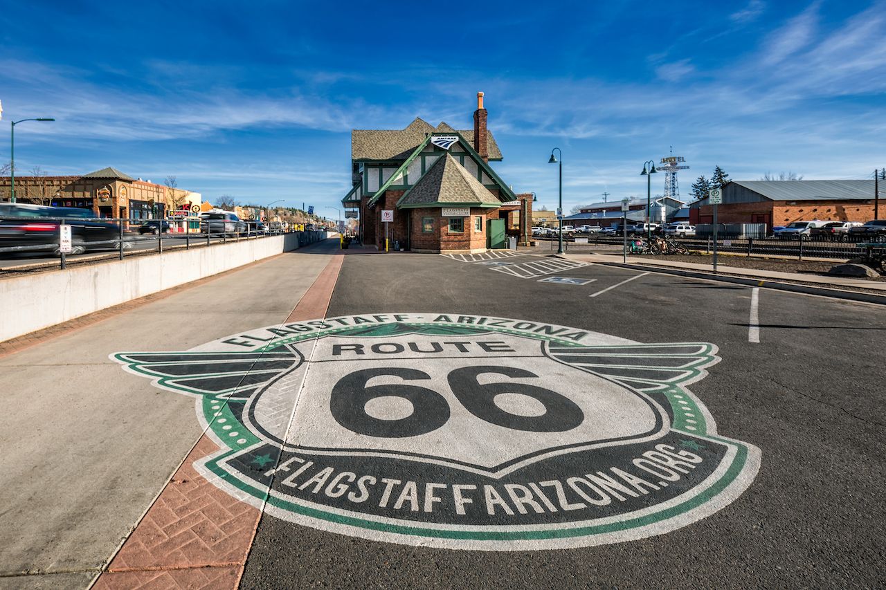
Stop 4. Flagstaff
The soaring ponderosa pines around Flagstaff are a direct contrast to Sedona’s low junipers. You are at the foot of the highest mountain range in Arizona, the San Francisco Peaks. Take the scenic ski-lift ride at Snowbowl, a local ski resort on the mountain. Learn about the importance of these mountains to the Native American people at the Museum of Northern Arizona. Check out Flagstaff’s diverse and abundant locavore dining downtown. Drive up to Mars Hill at night to look through the telescope used to discover Pluto at Lowell Observatory.
Great for: Hiking, dining, observing the night sky, overnight stop.
Don’t forget: Wear warmer clothes in winter or carry a light jacket in summer. You are in the coolest spot in Arizona.
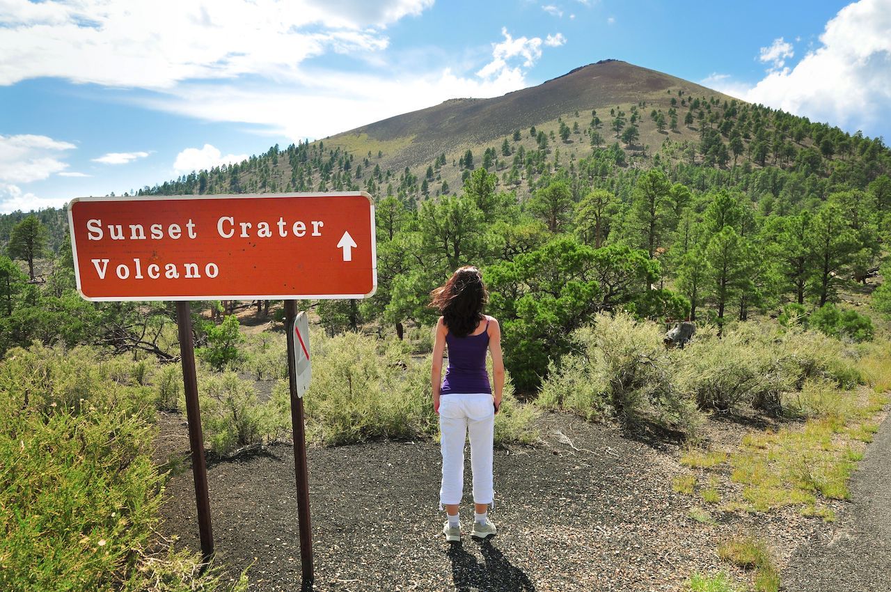
Up next: Take I-89 North to Loop Road to Sunset Crater Volcano National Monument. Driving time: About 30 minutes.
The lava-flow landscape around the youngest volcano of the area might make you feel that you landed on another planet. Stop at the Visitor Center to learn about the geology of the area, then take the self-guided tour at the bottom of Sunset Crater. If you’re feeling fit and want a challenge, hike up to Lenox Crater.
Great for: Hiking, learning about volcanoes, self-guided tour.
Don’t forget: When hiking, be aware of the fragile environment, don’t step on vegetation or pick flowers.
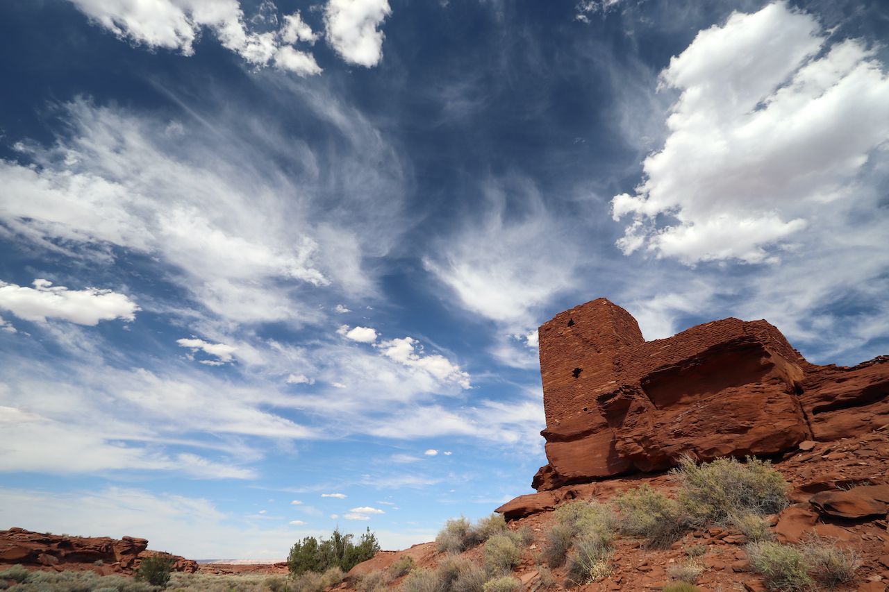
Up next: Continue for about 20 minutes on the Loop Road to Wupatki and the rest of the ruins.
Wupatki is full of the ruins of the villages of the ancient Hisatsinom people (early Hopi), Wupatki being the largest. Walk through the ruins after a stop at the Visitor Center to get a printed guide, then visit Lomaki, Wukoki, and Citadel for a glimpse into the past of the original Arizona people.
Great for: Learning about ancient cultures, visiting ruins, self-guided tours.
Don’t forget: Wear good walking/hiking shoes, hat, and sunscreen.
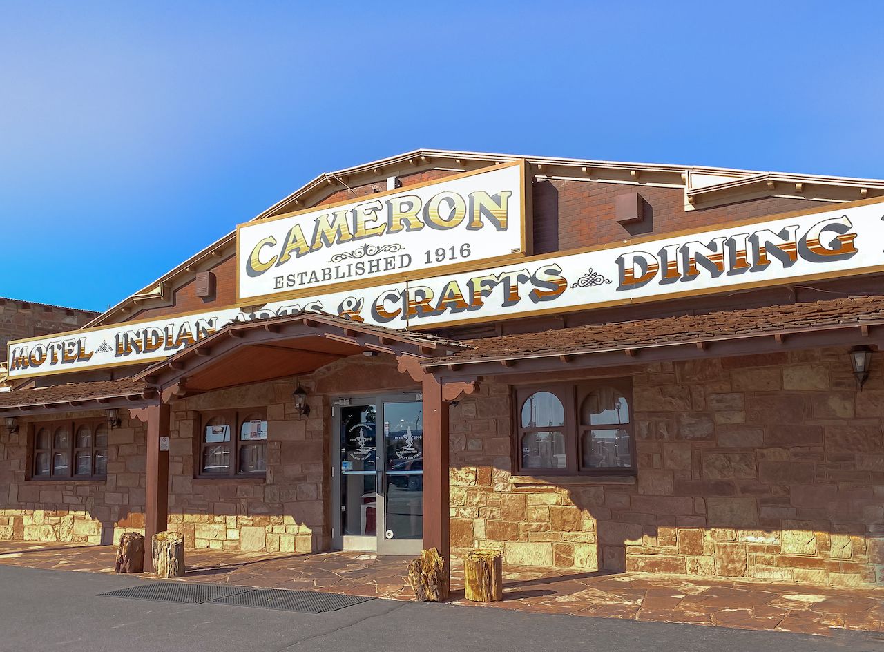
Up next: Continue on Loop Road back to I-89 N to Cameron Trading Post. Driving time: About 40 minutes.
Stop for the night at this historic site, enjoy a great meal of traditional Navajo food, and shop for souvenirs at the store. Enjoy the view of the Colorado River Gorge and the Painted Desert in the distance.
Up next: Go back on I-89 S about 1 mile to the traffic circle, then take the first exit to the scenic Desert View Dr./AZ-64 to the Grand Canyon. Driving time: About 30 minutes.
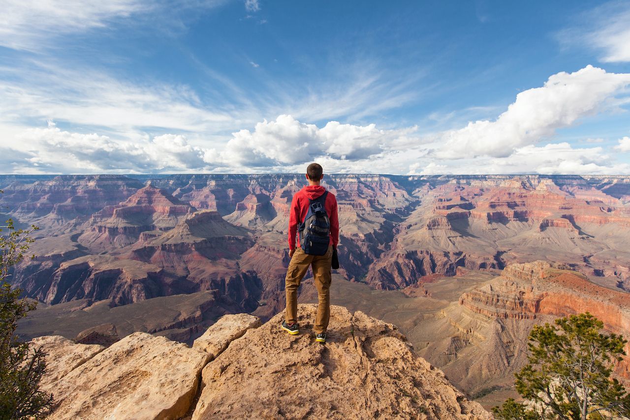
No pictures or videos of this natural wonder prepare you for the real thing. Coming from Cameron, your first stop is Desert View. Take your time to be fully present at the edge of the Canyon and climb up to the top of Watchtower. You can catch a glimpse of the Colorado River in the bottom of the Canyon. While here, stop for a visit at the Tusayan Museum, then continue on Desert View Drive to the Visitor Center. Park your car and take the free shuttle to all the viewpoints. Walk the rim trail and stop often. For a great meal, dine at the historic El Tovar, overlooking the Canyon.
Great for: Hiking, walking on the rim, enjoying the scenery, learning about geology. Consider making reservations ahead at one of the hotels in Grand Canyon Village or in El Tovar.
Don’t forget: When hiking, make sure you have plenty of water, your camera, sunscreen, hat, and please watch your step. (You may want to visit in fall or winter when the crowds are fewer and less dense.)
Up next: Head back on I-64 E, US-89 N and exit to US-160 E. Drive 62 miles on I-160, then turn left on AZ-564 N. Driving time: about 2 hours.
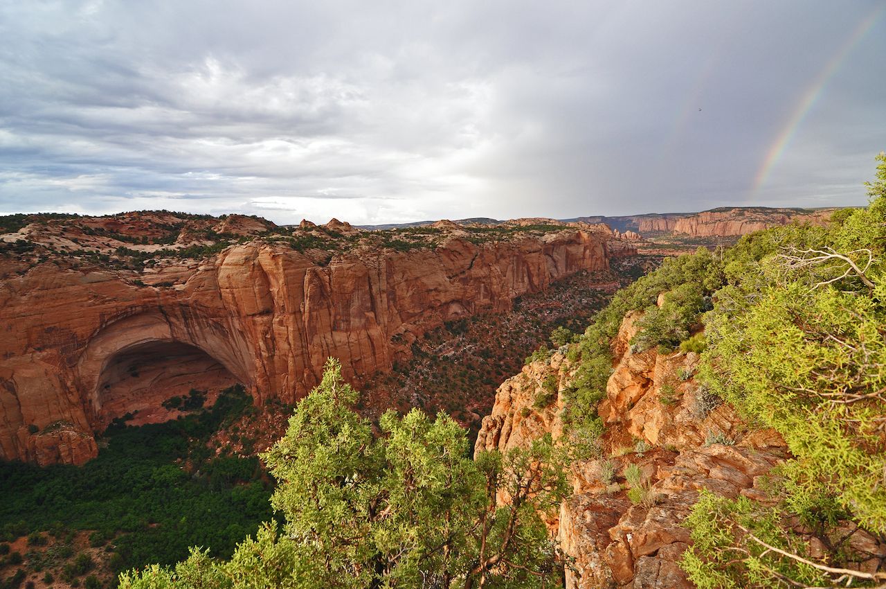
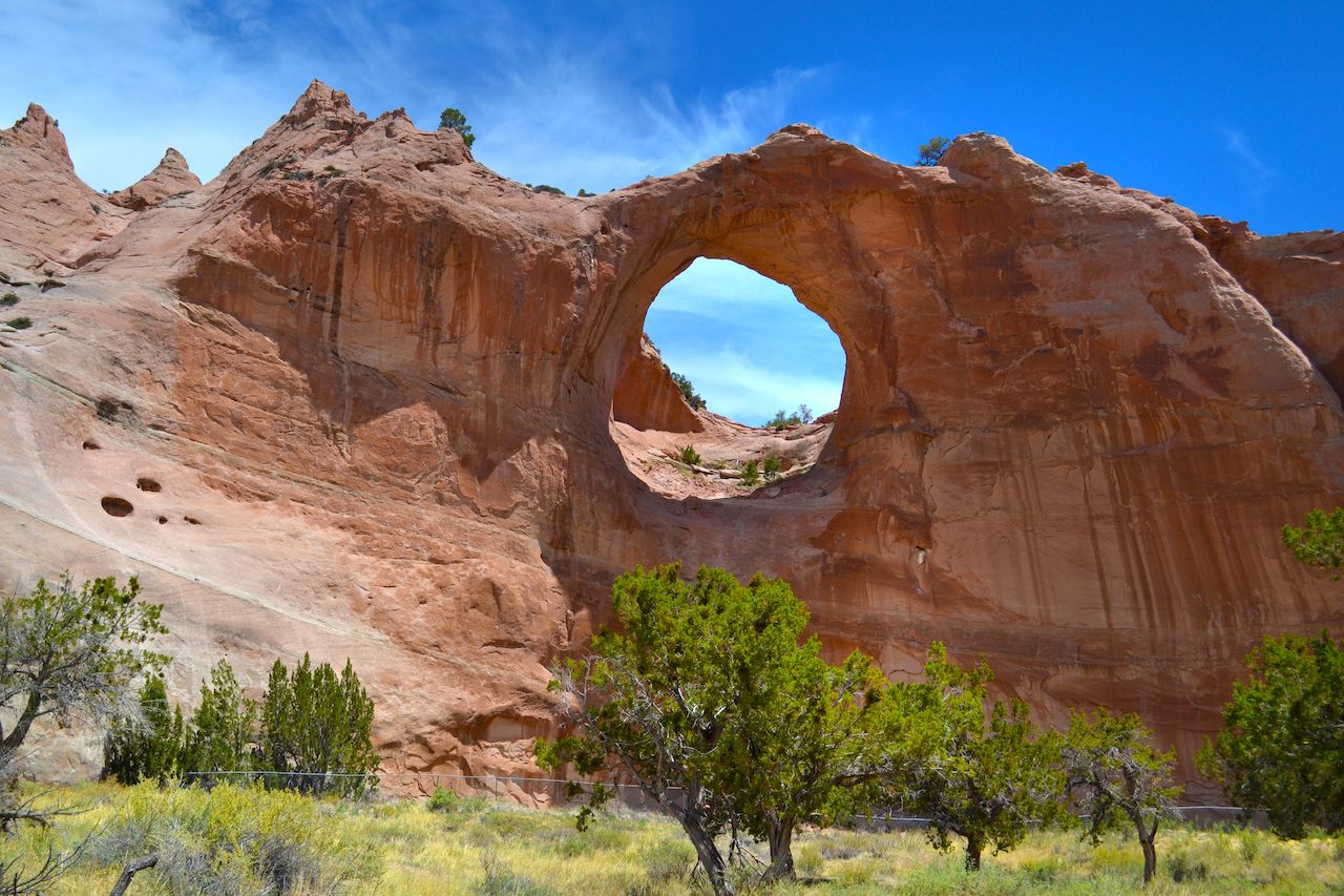
Stop 9. Navajo National Monument
Stop at the Visitor Center, and learn about the ancient people who lived here. Walk on the “Sandal Trail” to the overlook of the ruins. Or take a guided tour for an in-depth experience.
Great for: Hiking, learning about ancient Pueblo people.
Don’t forget: You might be in a different time zone. The Navajo Reservation follows New Mexico, daylight savings time.
Up next: Head back on AZ-564 to US-160 E to Kayenta, then turn left onto US-163 N. Driving time: About one hour.
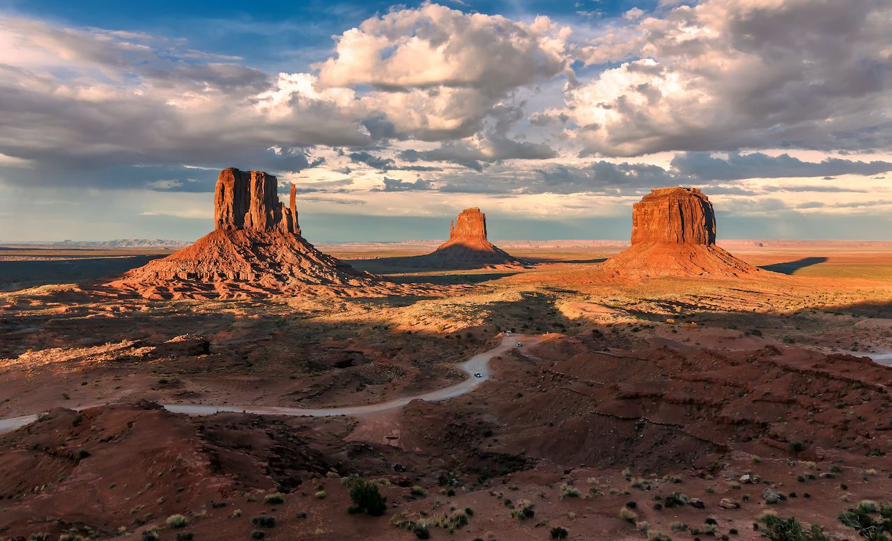
Most of the old western movies were filmed in Monument Valley. This beautiful country belongs to the Navajo Nation, and they live in the middle of it. Stop at the Visitor Center for a view of the Mitten Buttes, and to sign up for a guided tour into the Valley. If you have a four-wheel vehicle, you can drive in yourself. I recommend hiring a local Navajo guide to go with you for the best experience.
Great for: Spending a night at The View Hotel, stopping at the Visitor Center, taking a self-guided ride or a guided jeep tour into the Valley.
Don’t forget: The Navajo people live in Monument Valley. Stay on the designated roads and trails, so you don’t find yourself in someone’s back yard.
Up next: Back on US-163 S to Kayenta, US-160 E to Indian Rte 59 to Indian Rte 64. Driving time: 1 hour 35 minutes.
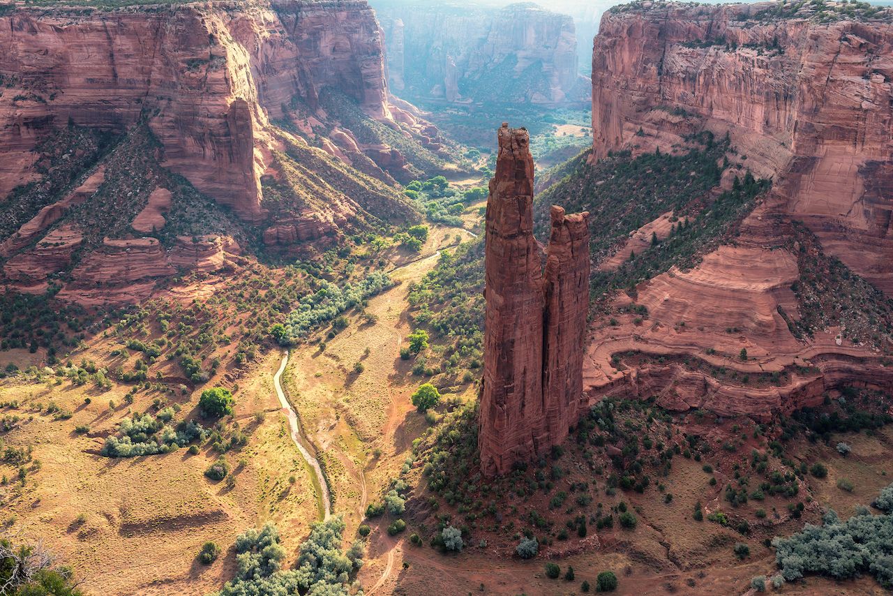
Stop 11. Canyon de Chelly National Monument
Canyon de Chelly lies near the town of Chinle, and has been inhabited continuously for about 5,000 years. Ruins of the ancient Puebloan civilizations are visible on the canyon walls, with the hogans of today’s Navajos on the bottom. Stop at the Visitor Center, hike down to White House Ruins, and stop at the overlooks on the South and North Rim Drive. You can also take a ranger-lead hike or a Navajo guided tour into the canyon.
Great for: Hiking, learning about the Navajo nation and the ancient Hisatsinom people, dining, overnight stay.
Don’t forget: Navajos live inside the canyon, be considerate when meeting locals.
Up next: Drive for about an hour and a half on the Dine-Tah “Among the People” Scenic Road, Navajo Routes 12 and 24 to Window Rock.
Stop 12. Window Rock
Tségháhoodyání, translated as Window Rock, is the capital of the Navajo Nation. Visit the Navajo Nation Park and Veteran’s Memorial to see the rock for which the town is named and to learn about the Navajo Code Talkers who helped us win WWII. Before you leave, check out the Ch’ihootso Indian market and pick up some authentic Navajo art and crafts.
Great for: Walking, dining, shopping.
Up next: Take Indian Rte 12 to I-40 W. Drive on I-40 to exit 311 Park Rd. Driving time: A little over an hour.
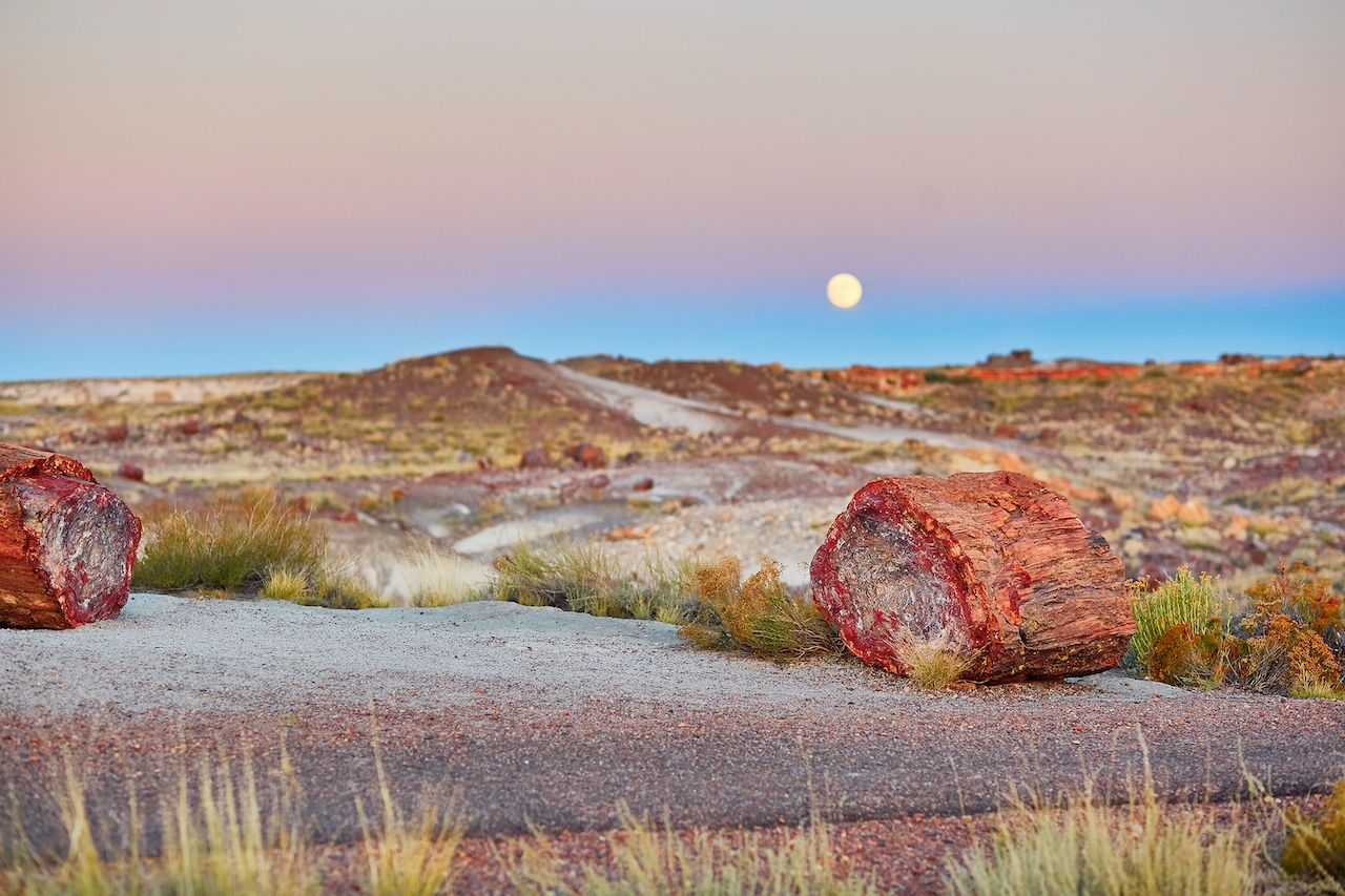
The Monument lies in the middle of the colorful Painted Desert, and is scattered with petrified logs, some of them small, some of them big. Stop at the Painted Desert Visitor Center to learn about the area, and pick up a brochure to learn the trails available. The best way to experience the park is to hike some of the trails. They take you to beautiful views, giant logs, and fossils.
Great for: Hiking, guided tours, geocaching, horseback riding.
Don’t forget: Stay on designated trails.
Up next: US-180 E, 180A S, AZ-61 W and US-60 E to Show Low. Driving time: About one hour.
Stop 14. Show Low
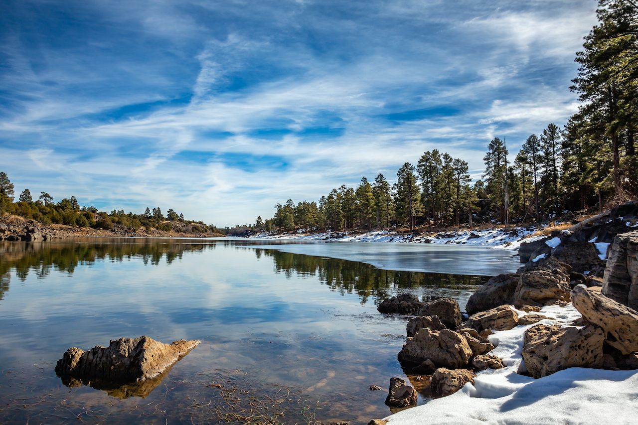
Located on the Mogollon Rim, Show Low is a popular recreation area for Phoenicians. Head over to the Fool Hollow Lake Recreation Area for a refreshing break by the lake in the shadow of big Ponderosa.
Great for: Spending the night, dining, hiking, boating, fishing, picnicking, wildlife viewing.
Up next: Drive for about one hour and a half on I-60 to Globe.
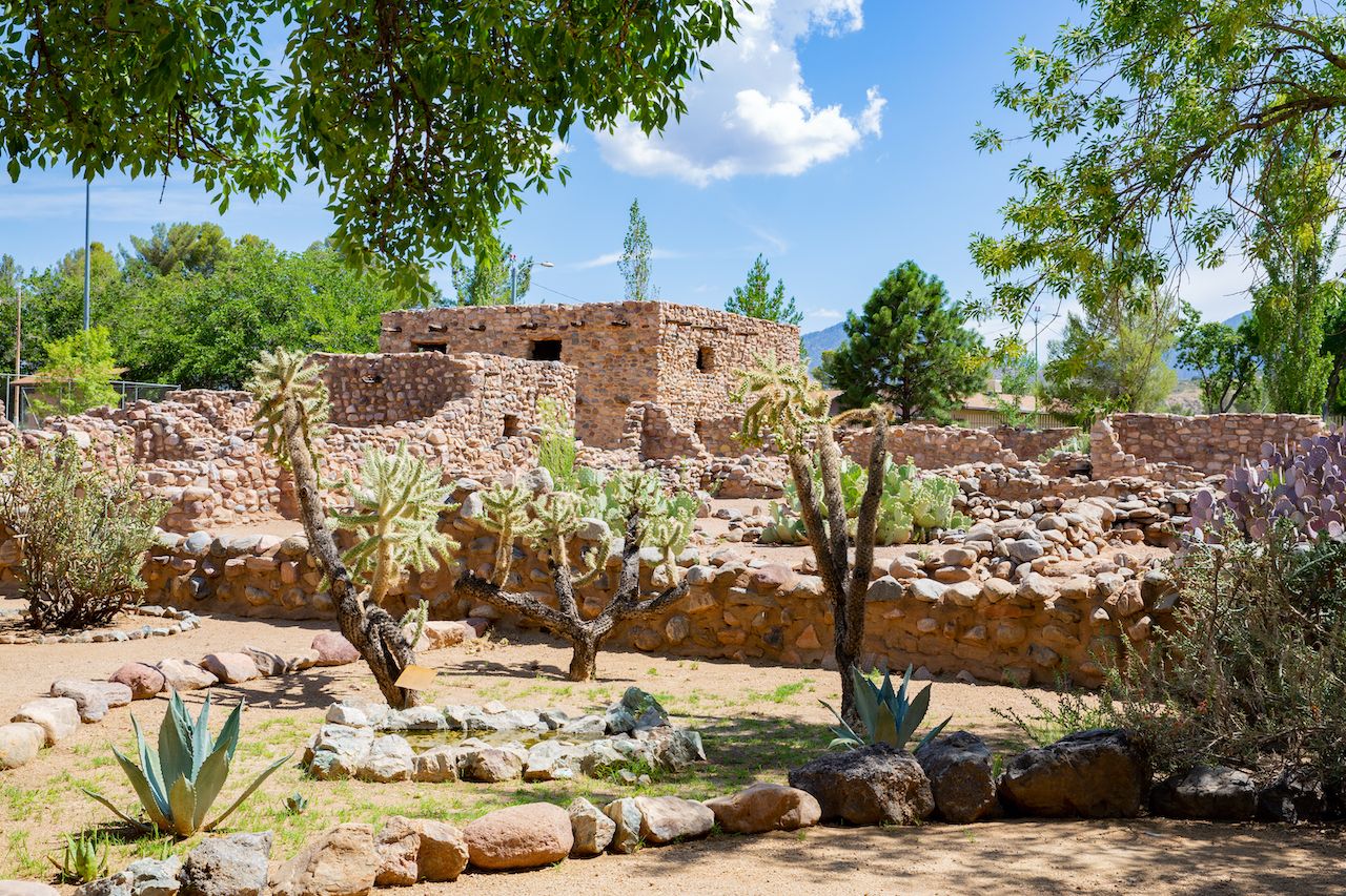
The ruins of an ancient Salado village stand on the outskirts of the town You’ll observe how differently the ancient people here built from those living in the northern parts of the state.
Great for: Walking, museum visit.
Up Next: Follow AZ-77 for about 1 hour 45 minutes to Tucson.
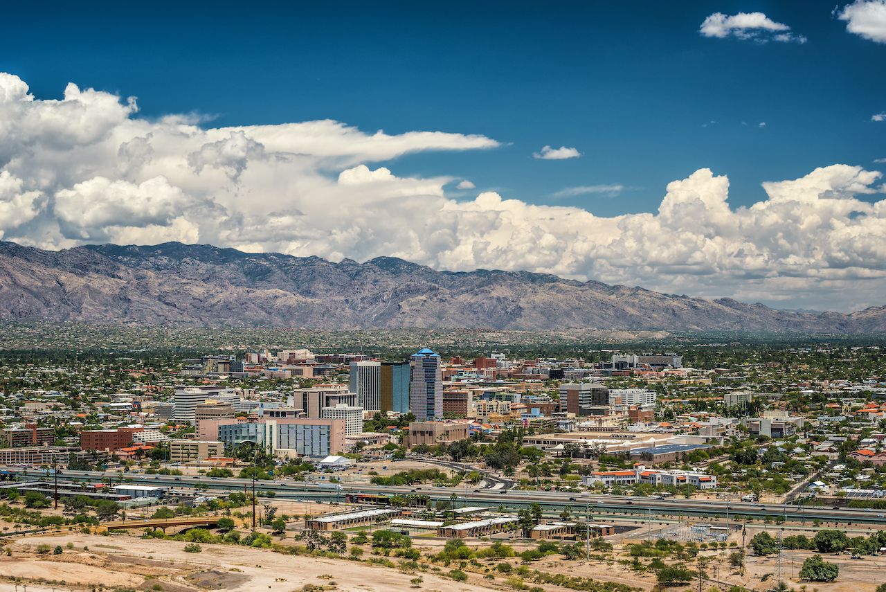
Stop 16. Tucson and vicinity
Before entering the town, stop at the Catalina State Park, home to desert wildlife, saguaros, canyons, streams and foothills. For a great Mexican meal, head over to La Parilla Suiza restaurant, then take the drive up to Mt Lemmon and spend the rest of the day on the mountain.
Great for: Hiking, biking, birdwatching, horseback riding, dining, overnight stay.
Don’t forget: You are back in the Sonoran Desert, make sure to carry plenty of water and wear sunscreen when hiking.
Up next: Follow the signs for Saguaro National Park East. Driving time: About 20 minutes from the center of town.
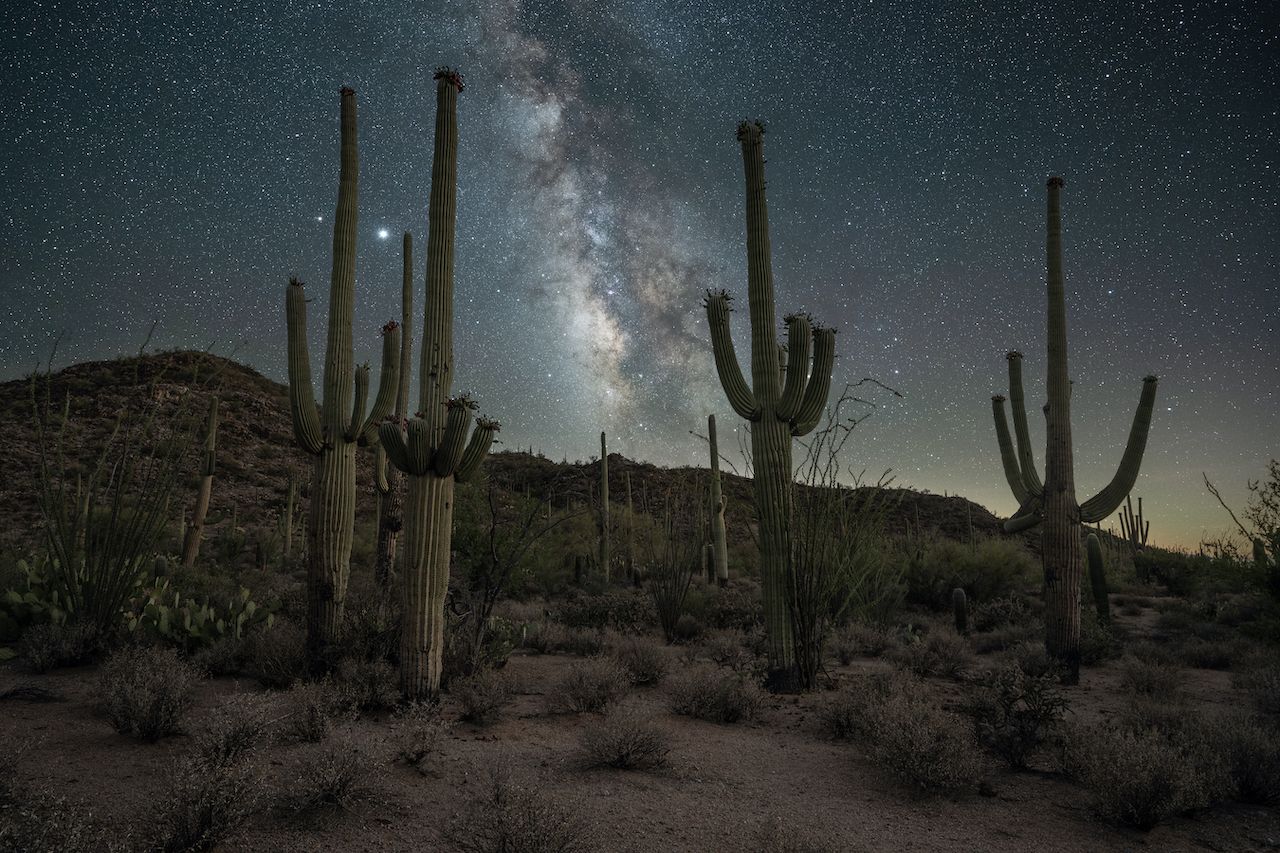
The giant saguaro is the symbol of the American Southwest and the state flower. You’ll find a great concentration of them here, as well as huge and interesting specimens. Stop at the visitor center for facts about saguaro, then drive the Cactus Desert Scenic Loop Drive. Hike some of the trails along the drive and stop to check out the views. You can drive back into town to head over the West side of the Park. The Scenic Bajada Loop Drive within the Park is unpaved — and spectacular.
Great for: Learning about the giant saguaros, the cacti that only grow in the Sonoran Desert, hiking, scenic drives.
Don’t forget: Sunscreen, water, hat.
Up next: I-10 W to Picacho, exit 211 to AZ-87 N to Ruins Rd. Driving time: About 1 hour.
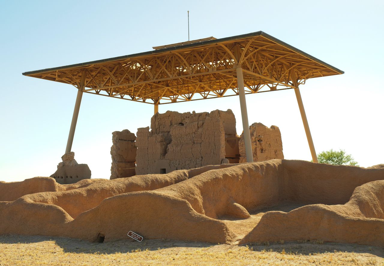
Your last stop before heading back to Phoenix, Casa Grande Ruins is one of the biggest sites built in the area. Stop at the Visitor Center for info on the lives of the ancient Sonoran Desert people; visit the museum and walk around the ruins.
Great for: Walking, learning about ancient people.
Up next: Follow I-10 W back to Phoenix.