Photo: Pata Heredia/Shutterstock

Mountain Biking Peru: 3 Rides in and Around Cuzco

Insider Guides Cycling
by Philip Dixon Oct 2, 2013

When I asked him about the trail below, my mountain bike guide and new riding partner in Cuzco, Juan Carlos, told me, “Hay perros ahí abajo, no les pongas atención y pegales duro si molestan!”(You’ll run into some dogs down there, but just try to ignore them and kick them hard if they follow you!) I told him to go first and I’d follow. When we pedaled on double-track past a small community, the dogs came out in force, barking at our heels. We rode past them and on to a North-Shore-style steep single-track downhill. We cruised past some jumps, over some ruins, and then out to the road.

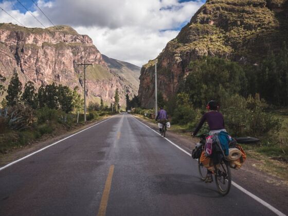
Since 2006 (when the Red Bull Empire Rider urban downhill race visited downtown Cuzco and riders like Kyle Strait attracted record attendance), the mountain biking community has grown exponentially in Cuzco and the Sacred Valley. The three rides below offer an introduction to the opportunities in the area.
1. Yuncaypata, San Sebastian, Cuzco

Location: Near Cuzco
Technical level: Paved road up / advanced downhill trail
Notes: Good acclimatization ride near Cuzco

Known as “Cuzco’s Whistler,” this ride isn’t a part of any tour agency itineraries, but it’s a local favorite. You will undoubtedly run into other riders here, especially on the weekend.

If you’re in good physical condition and feeling strong in the altitude, you can pedal out of central Cuzco to access this ride. Take Avenida Don Bosco west out of town and start to climb. Pedal past some prominent Inca sites: Saqsaywaman, Puka PuKara, and Tambomachay. About 3km past the curve in the road with the Tambomachay ruins, you’ll see a sign indicating Yuncaypata on the right (south) side on the road. The trail begins here.

The first few kilometers pass through the community of Yuncaypata; a few crazy dogs will bark at you. Continue straight, pass a flat section, and as the trail turns downhill you’ll have a few choices, all of which will eventually lead to the same place at the bottom. The last section of trail passes over an Inca wall and then drops into a small river crossing before coming out to the road. From the road, you can ride back (righthand turn uphill), catch a micro-bus, or hitchhike back to town.

2. Pumamarca Ruins, Ollantaytambo

Location: Near Ollantaytambo
Technical level: Rough cobblestone road up / intermediate downhill trail down
Notes: Guide advisable

The trail is best accessed from the town of Ollantaytambo, located between Cuzco and Aguas Calientes (Machu Picchu town) in the Sacred Valley. To get to Ollantaytambo, catch a taxi from Cuzco for ~10 soles (less than $4), or take a bus (the cheapest option), or take the Machu Picchu train (most expensive option).

This ride is offered through several tour companies in Ollantaytambo, so just ask around. Access to the trailhead requires a 30-minute drive (or one-hour ride) up Camino Willoq north of town.

The trail starts near the crumbling grain storage structures of Pumamarca and then drops into the fertile Urubamba Valley and gets narrower as it crosses over Inca agricultural terraces and a few streams. The final section continues down some steep, rocky areas before dead-ending into the cobblestone streets of Ollantaytambo.

3. Mega Avalanche Course, Urubamba Valley

Location: 90-minute drive from Ollyantaytambo
Technical level: Winding paved road up / advanced downhill trail down
Notes: Guide advisable

This is a popular ride offered by several local tour agencies. It’s known to locals simply as “el Mega,” after the Mega Avalanche race that gained an international reputation as a thrilling and beautiful, yet potentially dangerous and technical, ride.

This trail is also accessed from Ollantaytambo. You’ll need to drive 90 minutes up a surprisingly well-maintained section of Peruvian highway. The trail starts at Abra Malaga, near the foot of the Veronica Glacier, at 4,316 meters. It’s almost always cold, windy, and rainy at the top; be sure to bring a warm insulating layer and a rain shell to wear for the first half of the ride.

The top portion is wet — Andean cloud-forest wet, tires sinking into the mossy soil wet — and extremely slippery. Last time I rode it, I fell at least four times in the first 100 meters. But when the single track starts, the technical parts, rocky sharp turns, and floaty jumps will leave you wishing for more.

The trail descends over 3,000 meters and ends in the community of St. Maria along the Urubamba River, about 3km outside of Ollantaytambo.

Practicalities

Should I bring my own bike or rent one?
Bringing your own bike is a hassle and added security risk, but worth it if you’re planning to ride for at least a few days. For one thing, you know your own bike — how it rides and how to fix it — a luxury you won’t have with a rental. Also, sturdy downhill rentals are difficult to find in Cuzco.

However, renting a bike is obviously much more convenient. If you go with a reputable guide agency, they should take care of finding a worthy bike, but always make sure to do a quick test ride and a check of the bike before riding off. Pay attention to mechanical essentials like:

  • Do the brakes feel crisp and effectively stop the bike?
  • Do the gears shift without too much noise?
  • If you stand next to the bike, hold the front brake, and rock the bike forward, do you hear any popping in the headset (indicating that the bolts in the stem need to be tightened)?

If (or most likely when) you answer yes to any of these questions, just give it back to the mechanic for a quick ABC checkup.

Beware: Tour agencies (and I use the term “agency” loosely) get competitive in Cuzco. Especially during the high season when they’re trying to sell as many tours as possible as quickly as possible, they tend to overlook details on the rental bikes.

What can I do to prevent altitude sickness?
Cuzco is at 3,400m (11,200ft) above sea level, so altitude (especially if you’re coming from sea level) is a factor. Before getting on the bike, take a few days to acclimatize to the altitude by doing some short hikes in the area and drinking plenty of water.

Warm liquids like tea aid digestion and help keep you hydrated. Many visitors swear by rehydration salts and coca tea, and although they certainly won’t hurt, I favor a simpler approach.

What should I bring on my first ride?

  • A helmet, riding clothes, and protective gear if riding downhill trails
  • Camelback or comparable hydration pack to carry your essentials for the day
  • Rain poncho — essential in the unpredictable Andean climate
  • Purified water and a snack — bottled water and snacks are readily available at any of the tiendas scattered throughout the valley, but it’s best to fill up with at least two liters of water and toss an energy bar in your pack before the ride
  • Trail-side repair kit with an extra tube, patch kit, mini-pump, and mini-tool
  • Mini first-aid kit
  • Some cash for transportation and any other purchases
  • Cell phone for emergency calls (ask at the tourism center for emergency numbers) — if you bring your cell phone from home, you can swap out the SIM card for a Peruvian card and make and receive calls cheaply
  • Sunscreen and lip protection — the Andean sun is strong and will burn you easily
  • Camera

What about the dogs?
Mountain biking and dogs go hand in hand in Latin America. Stray dogs are common outside the city and town centers. Also, farmers use dogs for protection while grazing or moving livestock in rural areas.

When a dog or pack of dogs approach you, and if you think you can out-pedal them, go for it. If you’re on an uphill section, or if you’re feeling threatened: Stop, get off your bike, keep walking, and keep your bike between you and the dogs as a buffer. Getting aggressive and picking up a rock to throw at them (or just pretending to do so) usually works, but also can make them angrier.

Discover Matador

Save Bookmark

We use cookies for analytics tracking and advertising from our partners.

For more information read our privacy policy.