I set myself a challenge on a recent trip to Vietnam: go as far north as physically possible. This took me to Ha Giang province — pronounced ha zang — which is seriously remote. Viewed on a map, it protrudes into China’s Yunnan province like a nosy neighbor spying over the top of a garden fence. It’s the least visited of Vietnam’s provinces, having been the last to open to tourists. Described in some guidebooks as Vietnam’s final frontier of travel, I knew I had to see just how far I could make it. This is my journey to the rural North of Vietnam. ![]()
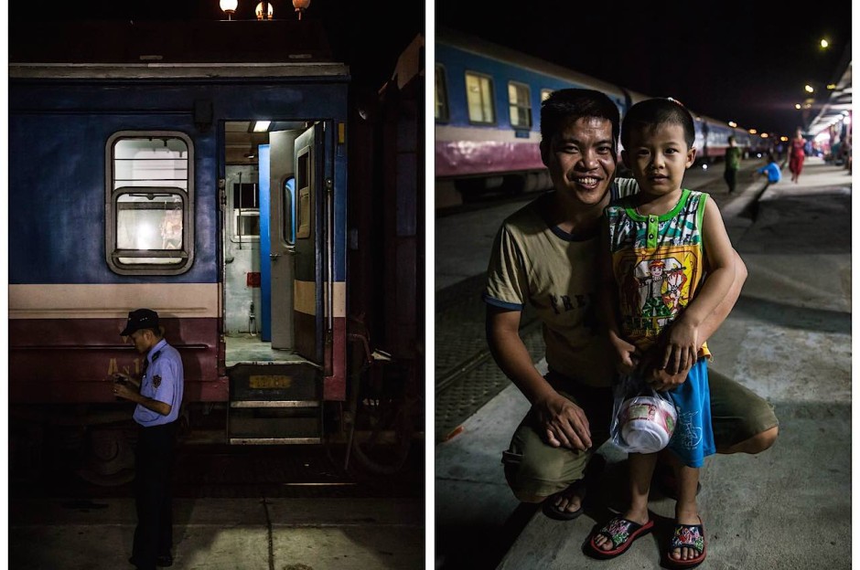
Vietnam Railways guard / Father & Son – Quang Ngai railway station, Central Vietnam
I get to Ha Giang by train, bus, and motorbike. First, I start with the train to Hanoi. I find that taking the train provides an insight into a place's society and culture, and allows the chance to interact with people from different social backgrounds in first, second and third class carriages. Here, a father and son duo Sang, 31, and Duc, 5, were traveling north from Nha Trang where Sang works as a chef, to his hometown Danang.
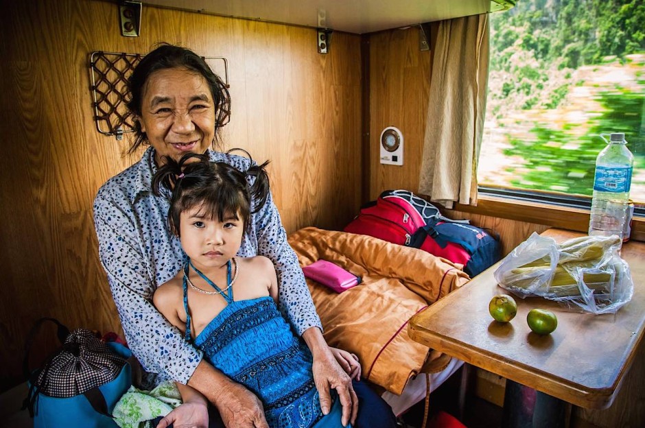
Girl and grandmother – On board the train, Between the cities of Hue and Vinh
To be safe, proud grandmother Anh always pays extra for 'soft-sleeper' (first class) tickets when traveling with her granddaughter Thu. They were on their way to the city of Vinh to reunite Thu with her mother and father. We shared a cabin for thirty-six hours, during which time Anh kept a seemingly endless supply of tiny green citrus fruits coming my way.
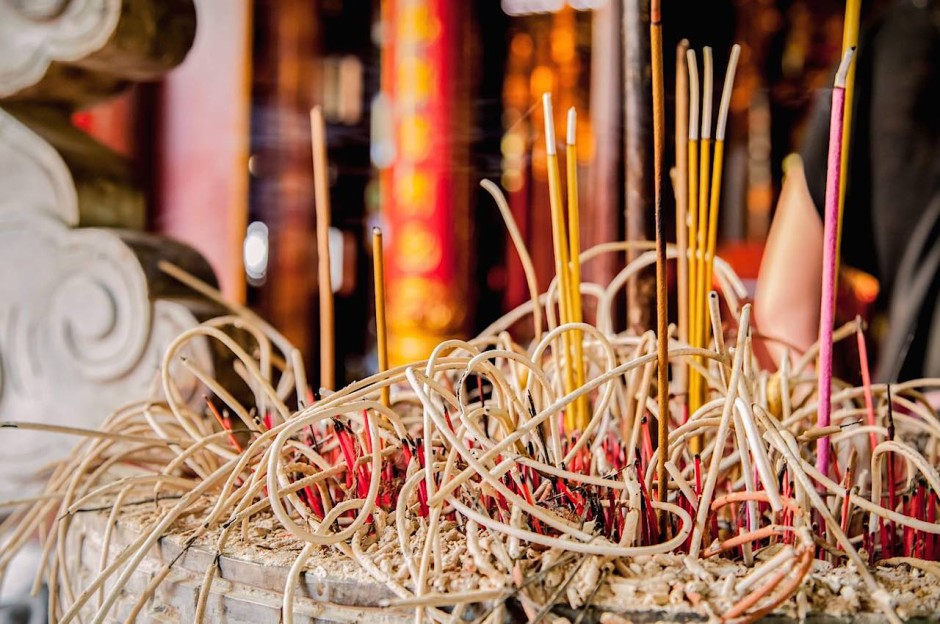
Spirals of incense ash – Bach Ma temple, Hanoi
Stopping in Hanoi to soak up the capital's atmosphere, I found Bach Ma temple, Hanoi's oldest, in the city's old town. It's very much an active place of worship as opposed to a tourist trap. Legend has it that the 11thcentury emperor Ly Thai Tobuilt a temple here in memory of a majestic white horse that led him to this exact spot.
Intermission
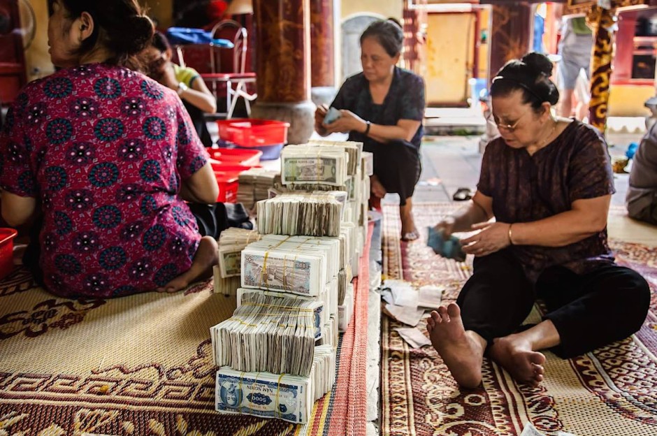
Counting up the week's donations – Bach Ma temple, Hanoi
Women and men sit on the floor of Hanoi's Bach Ma temple, talking noisily, frantically counting enormous piles of Vietnamese Dong and piling them into stacks. It looks like a money laundering scene from a Hong Kong triad movie. It may appear to be a lot of money, but the largest denomination bill in the picture is the 5000 dong note, worth around 22 cents or 14 pence.
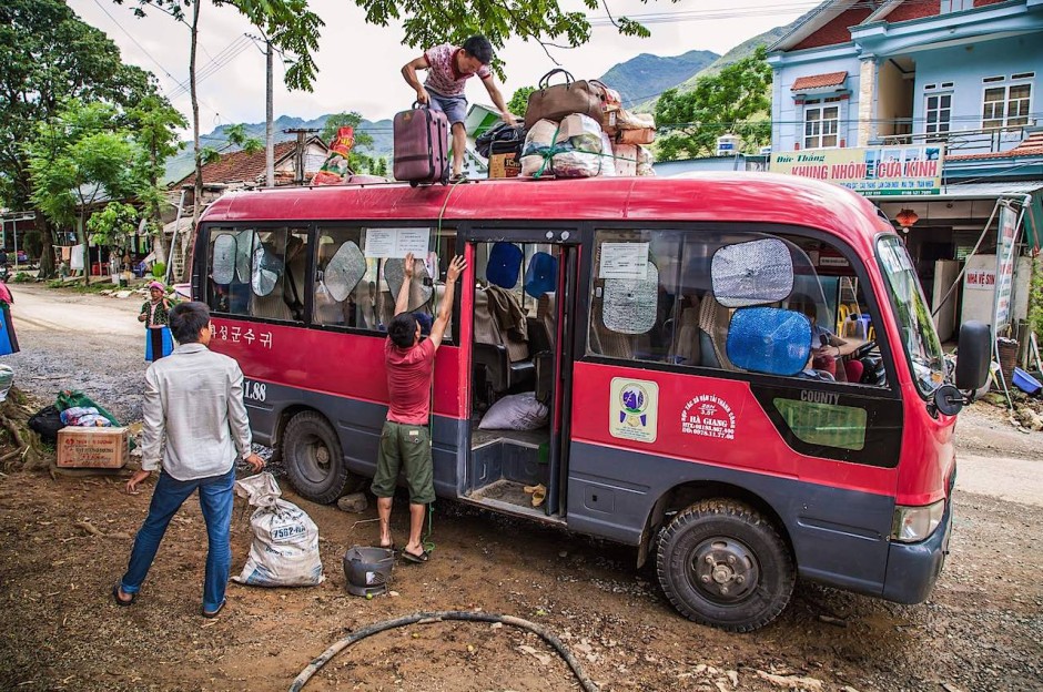
Rest stop en-route to Dong Van – Ha Giang province
The town to aim for in Ha Giang province is Dong Van. First, I take a 7 hour bus from Hanoi's My Dinh bus station to Ha Giang city. From there I will hire a motorcycle or take a minibus to Dong Van. I must be brave; the mountainous roads between Ha Giang city and Dong Van are as beautiful as they are terrifying.
The view north from the Vietnamese 'North Pole' – Lung Cu, Ha Giang province
At the northernmost tip of Vietnamese territory is a giant flagpole, from the base of which you can look into China's Yunnan Province (just past the first hills). Yunnan and Ha Giang share more in common with each other than with their respective countries. They are both populated by scores of distinctly different ethnic minority hill tribes. One such ethnic group is the Hmong. They live in Ha Giang and Yunnan, divided by a militarized border, and subdivided down into smaller communities with names such as Green Hmong, Black Hmong, White Hmong, and – my favorite – the Flower Hmong.
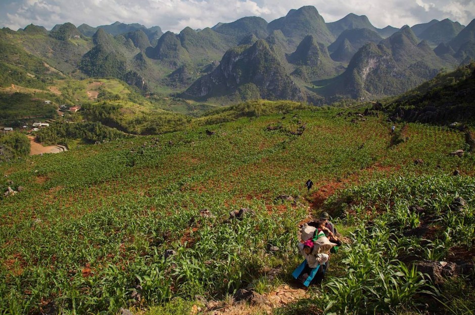
Hill tribe family and scenery – North of Dong Van, Ha Giang province
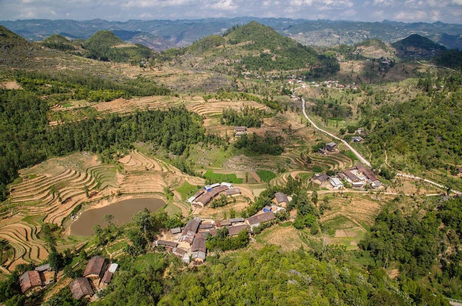
Members of a hill tribe family make their way through a field of crops. Ha Giang is poor in both its economy and infrastructure. The day to day struggles of the people are growing rice and corn for their families, communities and to sell at local markets. It exports delicious peaches, persimmons, and plums.
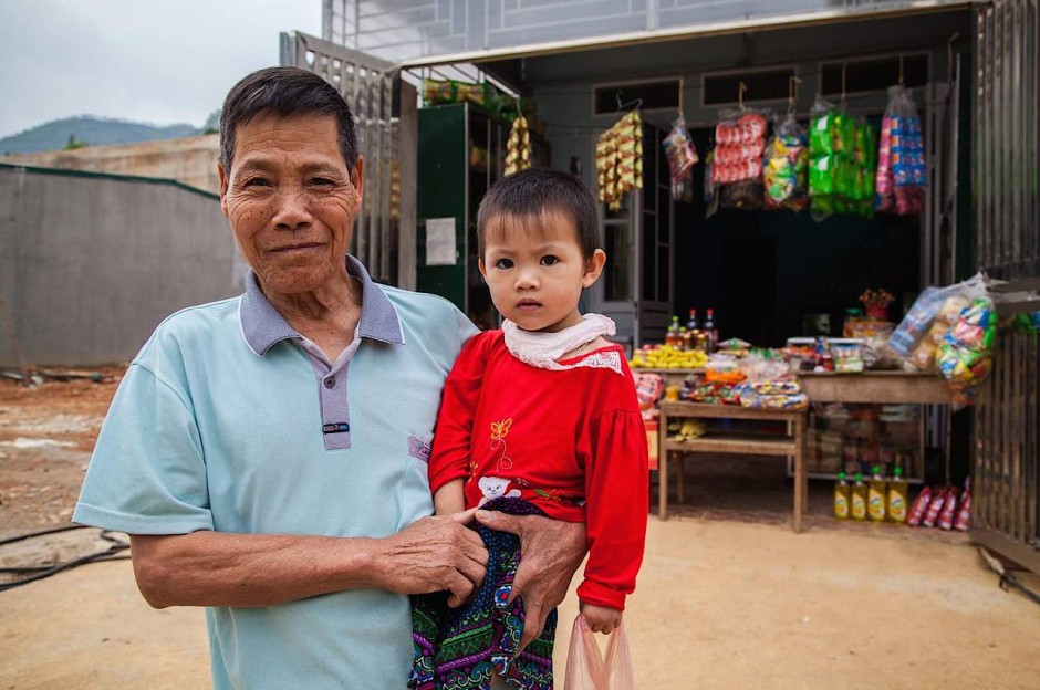
Young child and grandfather at the local store – Dong Van town, Ha Giang province
I've never made so many adults smile and yet so many small children burst into tears (sometimes at the same time) as I did in Ha Giang. Many locals seem to have rarely seen a foreigner. The area is just so new to tourism and so chronically under-visited. Tourism in its fledgling stage began in the late 2000s. China invaded over the border into Ha Giang in 1979, so while the rest of Vietnam was opening to tourism during the nineties, the government still deemed Ha Giang too sensitive and too great of a risk, so kept it closed. As of 2015, things are changing fast.
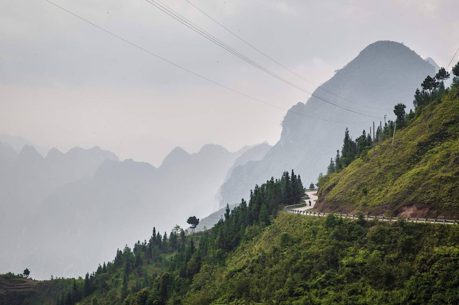
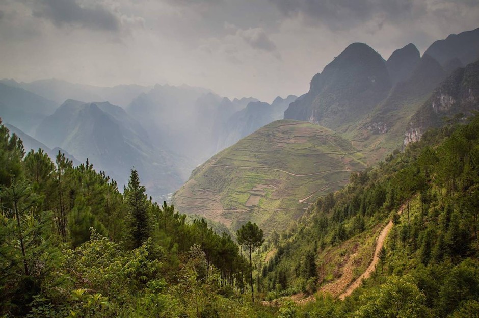
Lone biker on the Ma Pi Leng Pass– Ha Giang province
Cut into the mountainside high above the River Gâm, a 22 km road called the Ma Pi Leng Pass connects Dong Van to the town of Meo Vac. Let that name sink in. Ma Pi Leng. Let it join the mental list of roads you must see in your lifetime. It's amongst the most dramatic places for scenery in the whole of Vietnam. I hiked very slowly, camera in hand, and watched the sun come up here. I watched the fog roll in between the peaks, sometimes revealing these jagged giants, other times masking them all together in subtle layers of grey.
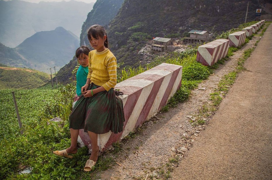
Girls from the Hmong hill tribe take a rest – Ma Pi Leng pass, Ha Giang province
The 22 km hike along the Ma Pi Leng pass is a photographer's dream. A high proportion of people I asked to photograph very happily agreed. The only thing people wanted was to see their picture on my LCD screen, which I was more than happy to share. Earlier in 2015, the process for acquiring a restricted area permit was made easier. Now, just get to Dong Van, register at a guesthouse, pay a nominal permit fee, let the guesthouse staff go to the police, and collect your permit the next day. This might not sound so relaxed, but the same trip a year ago would have required me to register in person at a police station in Ha Giang city and wait for my permit to be processed.
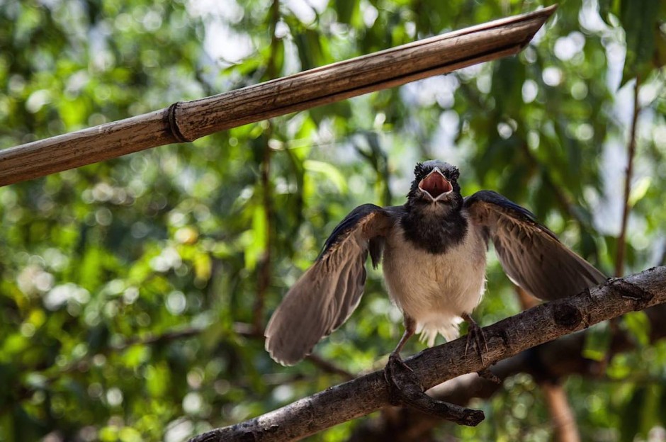
A mother bird protects her nest – Meo Vac, Ha Giang province
There's more to the wildlife in Ha Giang than fearless birds informing you to vacate their personal space. It's here in this tiny, remote corner of Vietnam that over half of the world's highly endangered Tonkin snub-nosed monkeys live, and are increasing in number. On top of the relaxation of restricted area permits, the prime minister of Vietnam announced in August 2015 that the north of Ha Giang province will be become the country's newest protected area; Du Gia National Park.
Intermission
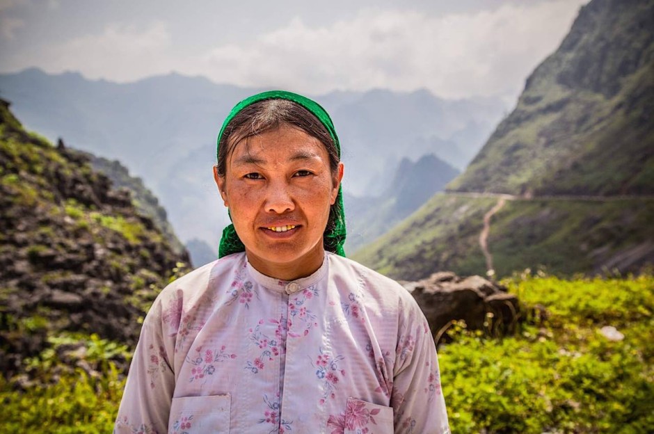
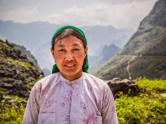
Hill tribe lady with dazzling dental work – Ma Pi Leng pass, Ha Giang province
The beads of sweat on this woman's brow are from working the impossibly steep terraced mountainsides that make up the topography of Ha Giang. Women seem to be responsible for the crops while the men's domain is raising pigs, goats and chickens. For now, life is as it must have been for centuries. Increased tourism is a double-edged sword: does improved infrastructure, new job options and a steadier flow of money into the area outweigh the risk of erosion of local culture, increased prices and pollution? Only time will tell. Sapa, a hill tribe region to the west, used to be like Ha Giang. When visitors began pouring in, this once sleepy town and surrounding mountains went in the direction of commercialism. The culture of the hill tribes was watered down and standardized for tourists. With its new national park, I feel confident that Ha Giang is able to choose a different path.
Early morning on the Ma Pi Leng Pass – Ha Giang province
This region took ahold of me, shook me awake, demanded my senses, all of my attention, and made me simultaneously want to keep it a secret and tell everyone about it. I hope that the establishment of a new national park will protect the environment and culture of the area when tourists begin arriving in much greater numbers. In truth, traveling here jaded me slightly for the journey back through the far more touristed south, throughout which a solitary sentence repeated in my head. It grew louder and louder as the distance increased. Take me back to Ha Giang.