Photo: Lukiyanova Natalia Frenta/Shutterstock

15 Natural Wonders of the Middle East You'll Have to See to Believe

Middle East Hiking Galleries
by Hal Amen Apr 1, 2014
My mental map of the Middle East was gray, sandy, and flat. I was way off…for the most part.
1. Egypt’s White Desert
Chalk training in White desert, Egypt

Photo: Galyna Andrushko/Shutterstock

In Western Egypt, this desert features thousands of chalk formations and is often visited by tourists on camping trips.

2. Jabal Qara Caves, Saudi Arabia

Photo: Afzal Khan Maheen/Shutterstock

The Al Hasa Oasis in the country’s Eastern Province is home to an area of limestone hills, beneath which runs a system of well-visited caves.

3. Socotra Island, Yemen
Blood trees

Photo: Naeblys/Shutterstock

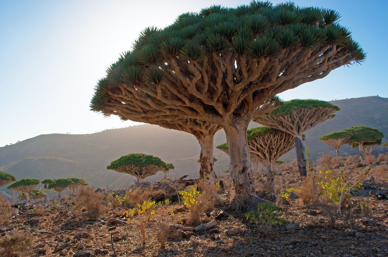
Located in the Arabian Sea, far from any mainland, Socotra has evolved species that aren’t found anywhere else, such as the red-sapped dragon’s blood tree. For information on visiting, read How to travel to Socotra Island.

4. Mt. Ararat, Turkey
Khor Virap church with Ararat Mountain in the background, Armenia

Photo: MehmetO/Shutterstock

The 16,850ft Ararat stands in far eastern Turkey, where it borders Armenia and Iran.

5. Dead Sea, Jordan/Israel/West Bank

Photo: Hrecheniuk Oleksii/Shutterstock

Yup, the rumors are true — it’s easy to float in the Dead Sea.

6. Mt. Sinai, Egypt
Camel riders going up the Sinai Mountain in Egypt

Photo: Zvyagintsev Denis/Shutterstock

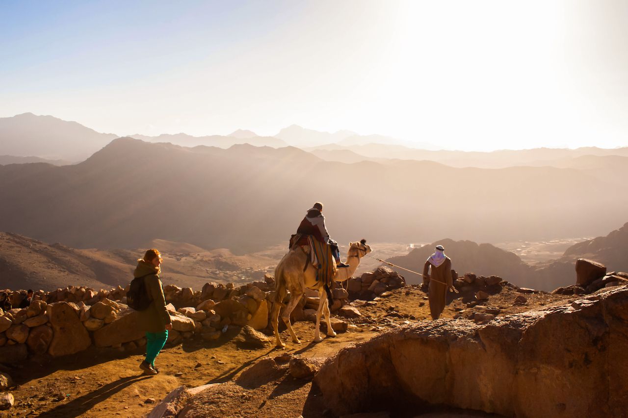
At the bottom of the Sinai Peninsula is a region of granite and volcanic formations that includes the 7,500ft Mt. Sinai, as well as the taller Mt. Saint Catherine (8,625ft). Early tourists included Moses. These days, it’s a super popular spot to catch a sunrise.

7. Rub’ al Khali, Arabian Peninsula

Photo: Katiekk/Shutterstock

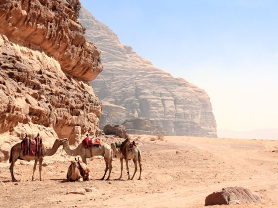
I’ve got a world map from the ’50s, and one of its cooler cartographic artifacts is the “Empty Quarter,” a blank white space with no names, roads, or features listed. One of the largest sand deserts in the world, it’s only recently been explored by scientists. It occupies a large chunk of southern Saudi Arabia and parts of Oman, Yemen, and the UAE.

8. Musandam Fjords, Oman

Photo: Martchan/Shutterstock

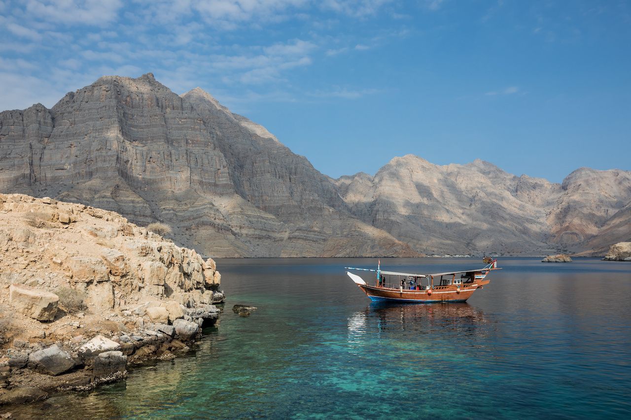
The Musandam Peninsula is the spike that juts up from the boot toe of the Arabian Peninsula, creating the Strait of Hormuz and separating the Persian Gulf from the Gulf of Oman. Its fjords are sometimes compared to Norway’s, though they were formed tectonically rather than by glacial movement.

9. Nile River, Egypt
Small boat and sand dunes on the Nile

Photo: Marcelo Alex/Shutterstock

The longest river in the world runs past several historic sites in Egypt on its way to the Mediterranean.

10. Wadi Rum, Jordan
The Jordan Trail: Hiker's guide to crossing the country in 40 days and 40 nights

Photo: Lukiyanova Natalia Frenta/Shutterstock

South of Petra, near Aqaba, Wadi Rum is a desert valley featuring Nabatean petroglyphs and several sandstone climbing walls/routes.

11. Tortum Waterfall, Turkey

Photo: Elena Odareeva/Shutterstock

The falls is found next to the lake of the same name, around 50 miles north of Erzurum in eastern Turkey.

12. Egypt’s Black Desert

Photo: cornfield/Shutterstock

About 60 miles southeast of the White Desert (see #1 above) is its inverse.

13. Red Canyon, Israel

Photo: barmalini/Shutterstock

This canyon in southern Israel is accessible off Highway 12, just northwest of the city of Eilat.

14. Cappadocia stones and houses

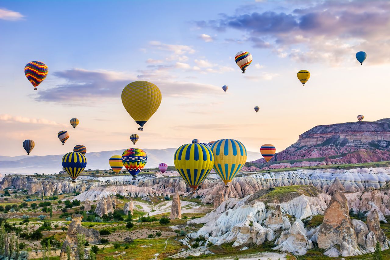
The Cappadocia region of central Turkey is a landscape dominated by fairy chimneys and multi-colored canyons. Starting in Roman times, people carved out many of the chimneys to form living spaces, some of which are now hotels.

15. Western Asir Province, Saudi Arabia

Photo: H1N1/Shutterstock

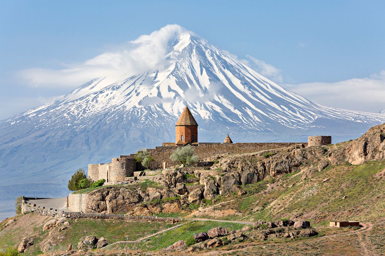
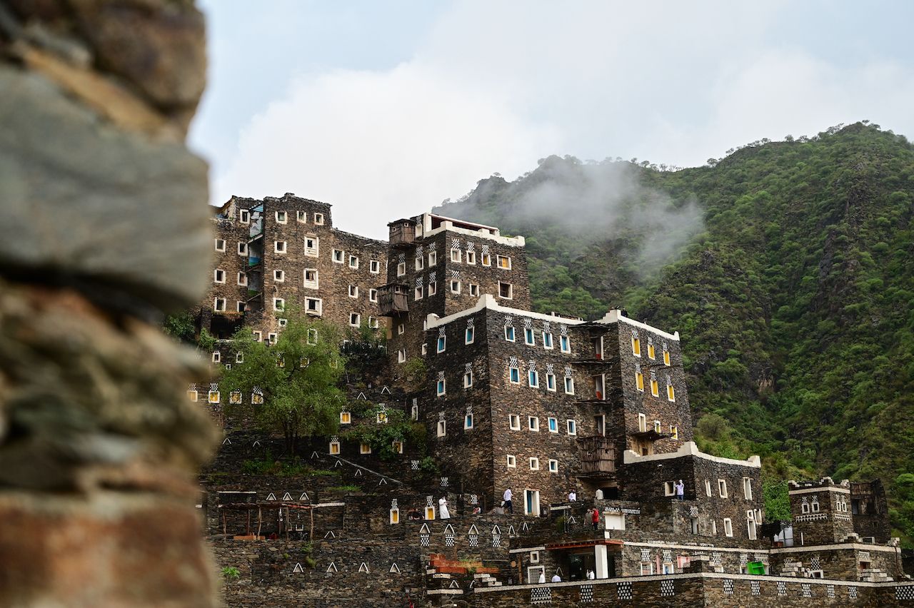
The area around Abha in the southwestern corner of Saudi Arabia is mountainous and fairly fertile. Much of it is protected in Asir National Park, the country’s oldest.

Discover Matador