Photo: Olga Yatsenko/Shutterstock

A Day Hike Into Wilderness From Santiago, Chile

Chile National Parks Hiking
by Eileen Smith Feb 9, 2010
Two bucks’ worth of transport is all it takes to craft a weekend away in Santiago.

TWO DOLLARS is the main unit of currency in Chile. The luka (1,000 pesos) is our smallest bill, and as of January, 2010, a luka is worth just about two bucks. It’s what Chileans consider cheap-but-fair for an event, and pricing one at 1,000 pesos or less is a great way to draw folks in.

A successful new program called Yoga a Luka hosts yoga classes all over the city (and in other regions) for 1,000 pesos, and there’s also the summertime arts program of Santiago a Mil (Santiago for 1,000 pesos).

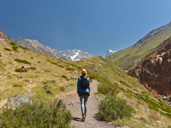
Anyway, one luka is about what it costs to get out of the oven of the Santiago summer and up into the city’s cool backyard — the Andean foothills. With some basic camping gear, a pair of decent walking shoes, and the highest SPF you can find, 1,000 pesos buys a mountain getaway.

Saltos de Apoquindo: Getting There

There’s Parque Mahuida and its access to Cerro San Ramón, the peaks of Provincia or Pochoco, or even Manquehuito and its big brother, the ill-advised-to-climb-alone Manquehue (assaults are an ongoing problem there). But in the dry heat of summer, my friends and I went with the waterfall — Saltos de Apoquindo.

You start out, BIP (like a fast pass) card in hand, at your closest metro and take the red line (línea 1) to the brand-new terminal station, Los Dominicos. This is also home to a craft market whose artisans set up in an old cloister, selling carvings, leather, and Pomaire terra cotta.

Bypass the market and take your free transfer to the 421 bus (or the C02 or C02c), which after another ten to fifteen minutes will drop you at San Carlos de Apoquindo.

From there, sign in with the guards (you need to leave your passport or ID number with them, and they’ll ask you for a phone number as well), and tell them you’re going to the sendero (trail), should they ask.

It’s then about a ten-minute paved walk uphill to the trail head, labeled Reserva Ecológica Contrafuertes Cordillerano, where there’s a basic map of the area (might want to snap a picture here in case you get lost, as the trail is marked but still possible to lose).

The Hike

It’s not just the watefall that attracted me to this trail. Having grown up hiking in New England, I’m not a “straight up the mountain” kind of trekker, as many of the hikes in the central region of Chile tend to demand.

This one meanders, following the folds of the mountain, and has significant downhill portions even on the way “up.” There’s shade, but no water until you get to the falls, which are potable, though you might still want to treat the water before drinking if you’re antsy (we didn’t).

Depending on your pace, expect 3-5 hours to reach the falls. The trail is in pretty good shape, has few areas of loose rocks, and can absolutely be hiked in a pair of running shoes, if that’s what you’ve got.

Warning: the litre tree causes a poison-ivy-like reaction in some unfortunate hikers, so you’ll want to keep clear. Or at least greet the tree (a hearty “Hola Señor Litre” will suffice) as tradition dictates.

Towards the end you’ll need to rockhop across the water’s downward flow, and this will get you close to the bottom of the falls. It looks its best in the morning, with the sun climbing up the notch in the mountain where it pours through.

Staying or Leaving

While camping isn’t technically permitted, there are established fire circles and a few signs that other humans have spent the night. Packing out all your trash and proper disposal of waste are a must, as there are no facilities.

You can follow the trail back the way you came, or ask a passing huaso (Chile’s version of the Argentine gaucho) for directions. We met one up top, who lip-pointed us down towards another path, across the flat site people use as a campsite.

This trail had views falling to the right, along the Precordillera, of numerous other waterfalls, and a little stand of trees where we cooked and ate lunch before continuing out.

Several hours later (again, 3-5 is a good range), we came out past terraced plantings and finally to a different trail head, this time at an area called Aguas de San Ramón.

Here you can slip through the gate, walk five long blocks downhill to the Plaza La Reina, catch the D08 bus to the metro at Bilbao on the blue line, and do the whole thing in reverse. Sneers at your dusty backpack and air of self-satisfaction should be expected.

That’s my best $2 travel tip. What’s yours?

Community Connection

For another Santiago sidetrip, check out our guide to Cajón del Maipo.

Other hiking tips: Where to Hike After You’ve Finished the Appalachian Trail and the travel video Notes on Hiking up Mount Rainier.

Discover Matador