Among many embarrassing travel mistakes I’ve made over the years was the time I booked a hotel in Kansas City that wasn’t actually in Kansas City, despites the hotel claiming to be “near the Fountain District,” but in a far-south suburb that required a 40-minute Uber ride to reach (my wife still reminds me of this mishap seven years later). That mistake never would have happened had I used a handy tool called Close.city. The tool is an interactive website that allows users to find the most walkable areas to stay in cities around the world.
Screenshot from Close.city
Stay in Walkable Neighborhoods When You Travel With This Handy Interactive Map
How Close.city works
Screenshot from Close.city
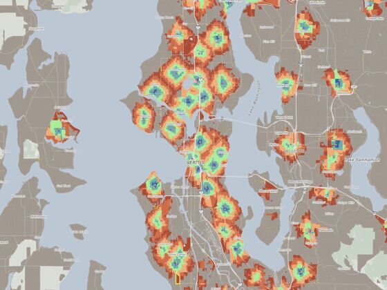
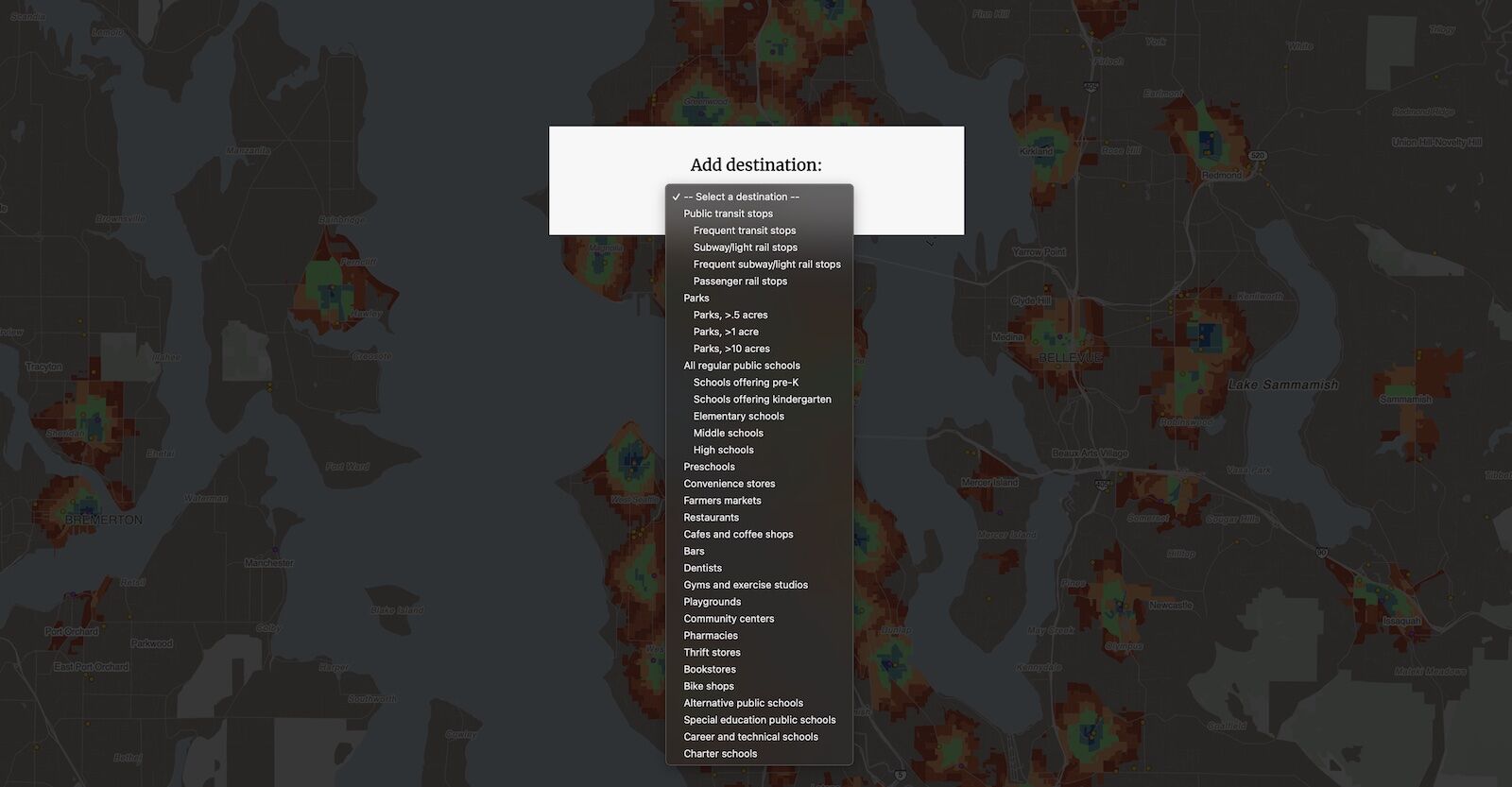
Let’s say you’re planning a trip to Seattle (because that’s the default city that loads when you land at close.city. The lower-left corner of the map allows you to note your priorities from an extensive drop down menu. For the case of this example, you need a hotel that’s walkable to restaurants and bars, and that is accessible via public transit from SeaTac airport. You’re also a bibliophile with a penchant for hunting down bookstores when you travel, and you’re willing to hop on a bike to find one. Set those priorities, and then zoom in.
Screenshot from Close.city
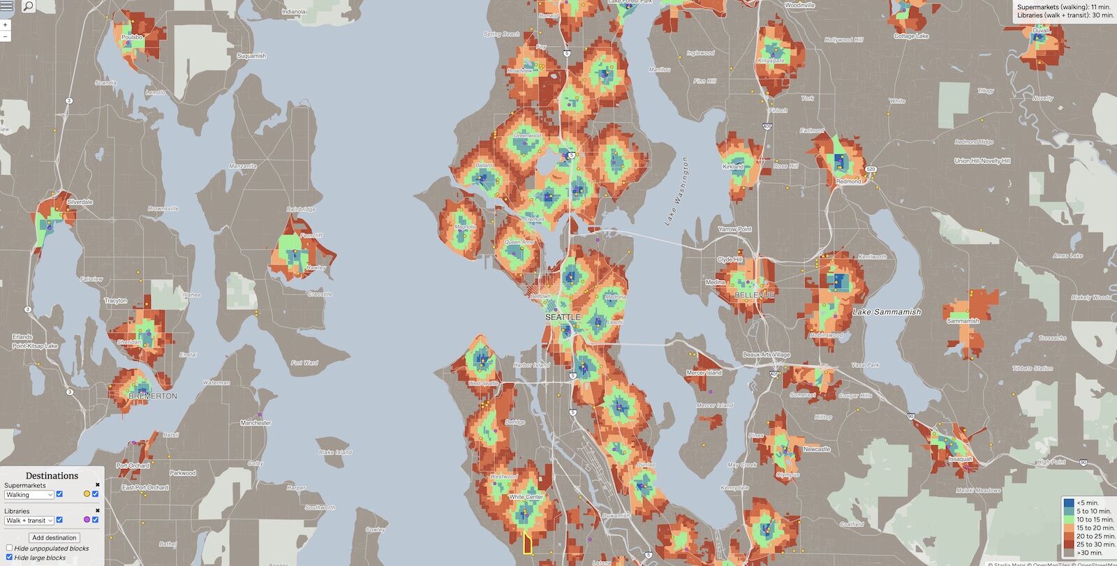
Areas shaded in dark blue meet your criteria spot-on. Lighter blue and green shades are doable, though you may have to hoof it a bit more to get to certain places. Red shades mean you’d better keep the Uber app handy. In Seattle, the downtown Central Business District is a great spot, as is the neighborhood just north of Lumen Field, where the Seattle Mariners play and home to more than half a dozen bookstores. You could also stay in Lower Queen Anne, with the added perk that you’d be able to walk to the Space Needle.
What’s cool about Close.city is that with each search I’ve tried, at least one surprise find sticks out – a neighborhood I’d never have thought was so convenient for travelers or residents but that turns out to be quite walkable. In our Seattle example, that’s the Yesler Terrace and Judkins Park area, each a light blue shade with green on the fringes. The area is served by transit, has plenty of coffeeshops and bars, and is home a local veggie market.
Things to note about Close.city
Screenshot from Close.city
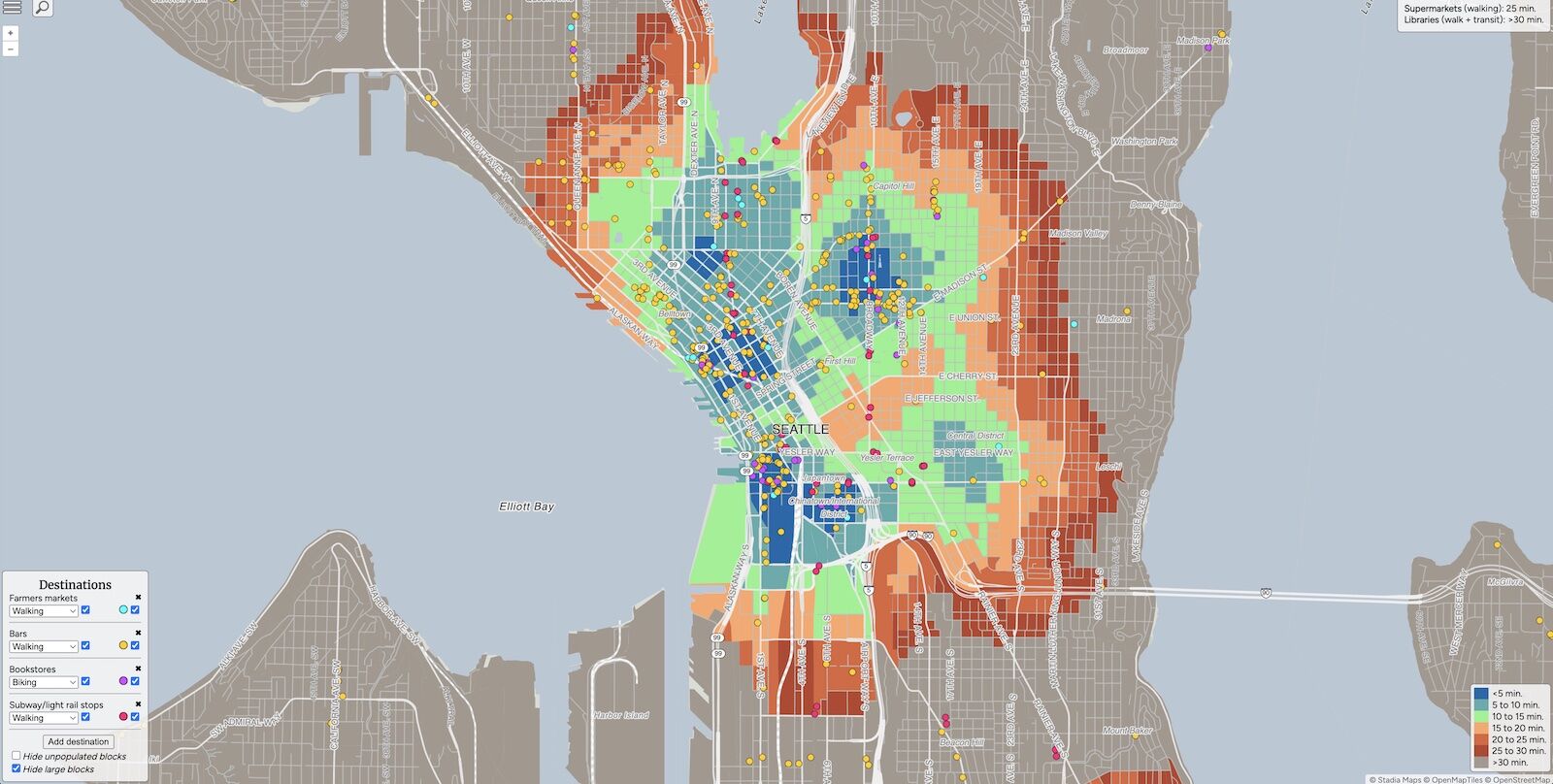
Close City makes it easy to find what you’re looking for in neighborhoods all over the world, without having to hop an Uber or drive there. However, it’s important to be thorough in your research if you plan to visit a specific business. In Seattle’s Yesler Terrace neigbhorhood, for example, the site marked the location of Nam Phuong Bookstore, a fine find but one that’s helpful specifically for those seeking Vietnamese-language media and books.
The shading indicates walking (or biking, if checked) distance from the locations you select. Deep blue signifies less than a five minute walk, while deep red means 25 to 30 minutes and gray (no shading) means you’re looking at a 30+ minute walk to your preferred amenities. Also, note that the site allows you to indicated which type of public transit you prefer. If you’re ok taking a subway or light rail but don’t want to get on a bus that slowly snakes its way through the city, you’ll need to select subway/light rail.
Once you play around with the tool a bit, you’ll gain a sense for the areas of cities that tend to be more walkable than others. Before you know it, you’ll be able to ditch the rental car for good. ![]()