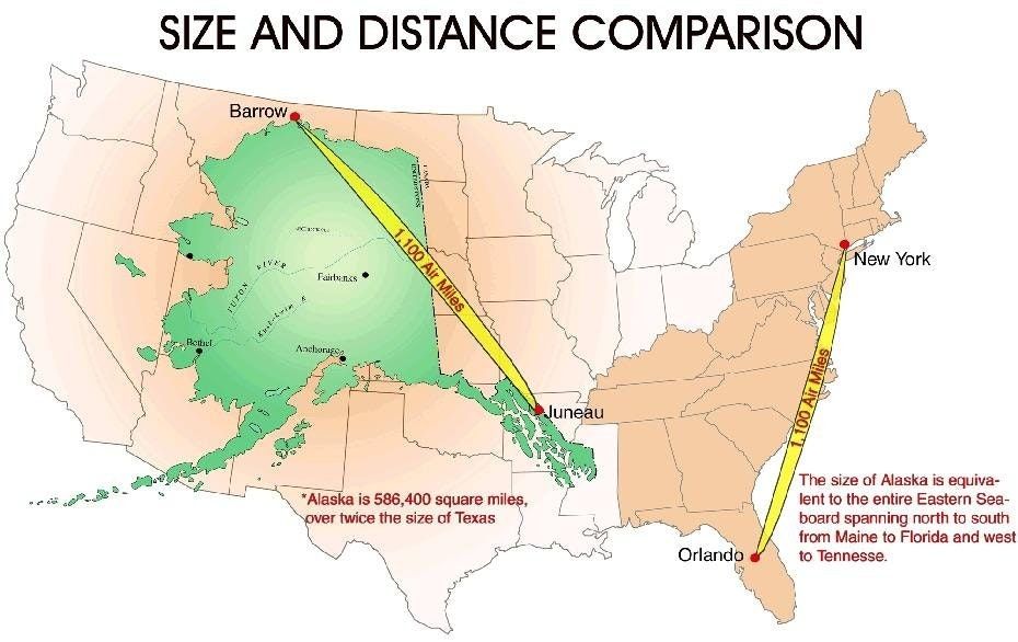
SORRY, TEXAS. You may be the biggest state in the contiguous US, but if we take the whole union into account, you’re well behind Alaska. So behind in fact that if Alaska was divided into two states, you’d still be the third largest US state.
It’s hard to comprehend just how big Alaska is by looking at numbers (663,268 square miles) or the flawed Mercator projection of the world, so Reddit user TGJ01 created the map below for us to get a more realistic idea of the real size of Alaska.

