Say you’re going to Palm Springs and people picture you day-drinking poolside or playing round after round of golf with your grandparents. In either scene, a big, bright sun undoubtedly hangs overhead in a cloudless sky, like summer in a still frame. Only, in Palm Springs, that perfect summer sun actually comes out during winter, when the temperature drops from oppressively hot to pleasantly warm and rarely dips below 60 degrees.
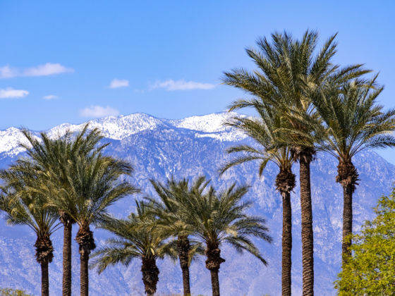
Photo: Sundry Photography/Shutterstock
The Steep, Staggering Hikes You Need to Do in Palm Springs This Winter
Though hiking may not be the first activity that springs to mind when you think of the Sonoran Desert, December through February is the ideal time for cold-phobic trail fanatics to lace up their boots and hit the Southern California wilderness. These are the best winter hikes around Palm Springs to put you in touch with your outdoorsy side while (mostly) avoiding the snow.
Traveling to Palm Springs? Check out Matador’s accommodations guides to the area:
Riding the tramway to one of Southern California’s tallest peaks
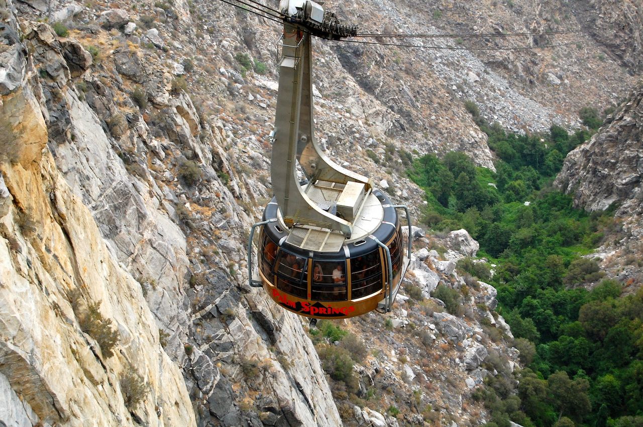
Photo: Cameron Cross/Shutterstock
Standing guard over the Sonoran Desert at nearly 11,000 feet, Mount San Jacinto is without question the peak to bag while in Palm Springs. According to some, including famed naturalist John Muir, it ranks among the finest hikes in California or anywhere in the world.
In Muir’s day, summiting San Jacinto Peak meant plodding up the mountain from the desert floor. Today’s visitors can kick off their excursions on the world’s largest rotating tramway, which connects Valley Station just outside of Palm Springs to Mountain Station in Mount San Jacinto State Park, a stop on the Pacific Crest Trail. It’s a 10-minute ride packed with views of granite peaks, sub-alpine forests, and cities scattered across the sands. Though relatively quick, the tramway cuts out over a mile of steep, rocky incline.
Don’t expect a cakewalk up to the summit once you’re at the top, however. There’s still six strenuous miles to go on foot from Long Valley, a short walk from Mountain Station where you’ll find the park’s trailheads. Self-register for a permit at the ranger station before following Long Valley Creek to Round Valley, where there are campsites should you prefer backpacking to day hiking, then on to Wellman Divide, and up to the summit of San Jacinto Peak.
While winter is prime hiking season in Palm Springs, it’s worth noting that, on average, Mount San Jacinto State Park is about 30 degrees cooler than the flats, and it can get snowy up at the top. Waterproof hiking boots are recommended, as are warm layers and accessories like gloves and a beanie. Pro tip: Stop at Peaks Restaurant once you’re back at Mountain Station to warm up, refuel, and toast to your successful climb.
Cactus to Clouds — the long route to San Jacinto Peak
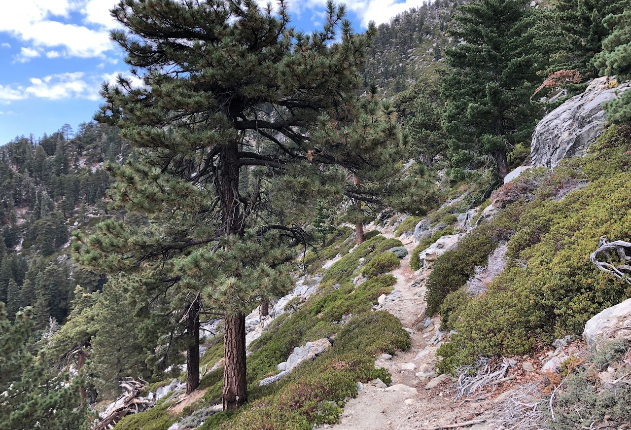
Photo: AJ9/Shutterstock
Memorable as the tram ride is, some hikers may want the bragging rights to climbing Mount San Jacinto from base to peak. For them, there’s the grueling, yet rewarding, Cactus to Clouds hike, which starts in downtown Palm Springs and largely follows the Skyline Trail to the summit. This isn’t a route to be tackled by just any hiker, particularly during winter when it may get icy. Experienced trekkers should come prepared with the appropriate winter-hiking gear.
To set off on the Cactus to Clouds ascent, find the trailhead near the Palm Springs Art Museum. From there, the hike can be broken up into roughly a dozen different sections ranging in distance from less than a mile to more than 15. (In total, the Cactus to Clouds Skyline Trail spans just under 25 miles.) On the descent from San Jacinto Peak, we recommend taking the tramway back down to the desert floor from Mount Valley. Even without hiking all the way back to Palm Springs, budget for about 15 hours of total hiking time.
Not up for all that but keen on a tram-free summit experience? The shortest route kicks off from the Marion Mountain Trail near Idyllwild-Pine Cove. Easier than Cactus to Clouds, it’s still a tricky 13-mile trip that’s only appropriate for advanced hikers. You’ll even break a fierce sweat on the six-mile uphill, which is only occasionally broken up by switchbacks or flat paths.
Exploring Mount San Jacinto State Park
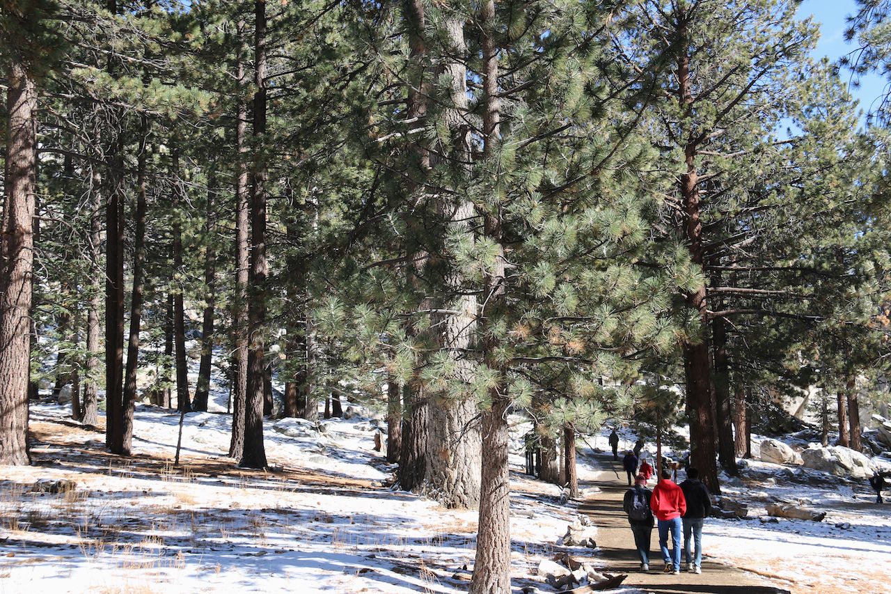
Photo: Supannee_Hickman/Shutterstock
Not all hikers are peak-baggers. Mount San Jacinto State Park has more than 50 miles of trails suited to everyone from amblers to experienced trekkers. For something gentle, follow the 1.5-mile Desert View Trail loop, which is dotted with scenic lookouts where you’ll get eyefuls of Coachella Valley and miles beyond.
For a bit more of a challenge, consider the six-mile, out-and-back Suicide Rock Trail. Beginning near Idyllwild-Pine Cove, about an hour from Palm Springs circumnavigating the park, it’s steeper than the Desert View Trail but still moderate enough for most with sturdy shoes and a can-do attitude.
To step it up another notch without committing to the whole peak, do just the Round Valley to Wellman Divide leg of the San Jacinto Peak hike. Alltrails has good information on the park’s various trails, and visitors can now download the OuterSpatial app to help plan and navigate their ideal hikes.
Other winter hikes in and around Palm Springs
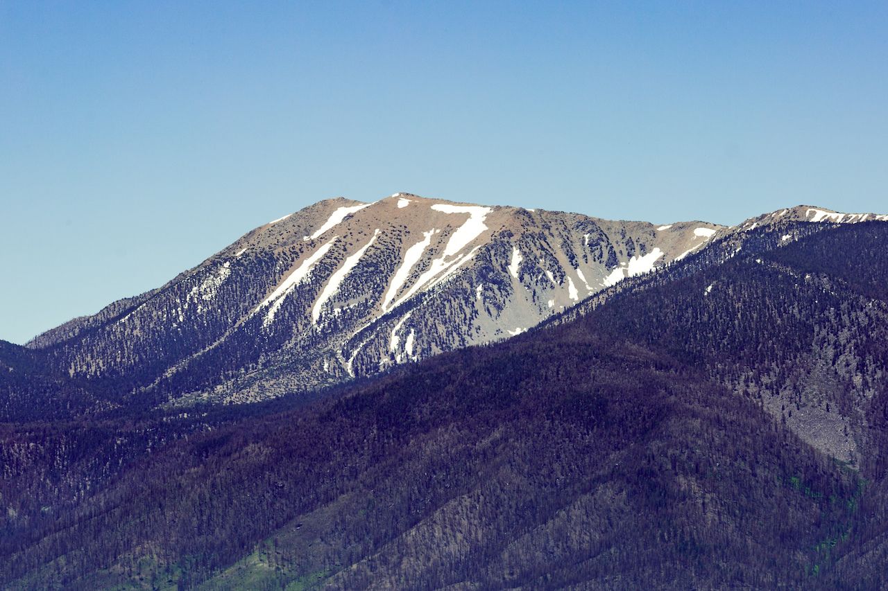
Photo: David Calhoun/Shutterstock
There’s a good chance you’ll catch the hiking bug after dipping a toe into the Sonoran Desert outdoors scene. Luckily, there’s no shortage of wilderness in the surrounding area. Palm Springs is within driving distance of Joshua Tree National Park, Coachella Valley Preserve, Indian Canyons, Whitewater Canyon, the San Bernardino Mountains, and more, all of which offer excellent hiking. These are a few of our favorites:
Palm Canyon Trail to the Stone Pools: It only takes a few hours to hike this six-mile out-and-back in Indian Canyons, the traditional territory of the Agua Caliente Band of Cahuilla Indians, but you should probably budget extra time to admire the water features. As this trail is located on the Agua Caliente reservation just south of Palm Springs, there’s a $9 fee to hike.
Vivian Creek Trail up San Gorgonio: Good luck summiting Mount San Jacinto and Mount San Gorgonio, the tallest peak in Southern California, during the same visit. The Vivian Creek Trail is the quickest, steepest way up to the top, totaling around eight miles and 10 hours to complete. Some hike Mount Baldy in preparation for Mount San Gorgonio while others treat San Gorgonio like a training ground for Mount Whitney about five hours northeast.
Ryan Mountain Trail in Joshua Tree National Park: Some say that standing atop Ryan Mountain yields the most impressive panoramas in all of Joshua Tree. The hike to the summit is relatively manageable, around three miles there and back, and the view offers yet another perspective on Mount San Jacinto. It’s not to be confused with the Ryan Ranch Trail hike, a sweet but simple jaunt through the park to the ruins of an old homestead. ![]()