Water is a precious resource and a fundamental part of life. The movement of water over time has created some of the most naturally beautiful spaces and environments in the world. HighTide Technologies put together this infographic with the top natural wonders shaped by water and how climate change is impacting them. We’ve selected 12 of these locations that are currently being affected by the changes in our environment.
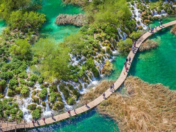
Photo: Maurizio de Mattei/Shutterstock
11 Natural World Wonders That Are Being Destroyed by Climate Change
HA LONG BAY — VIETNAM
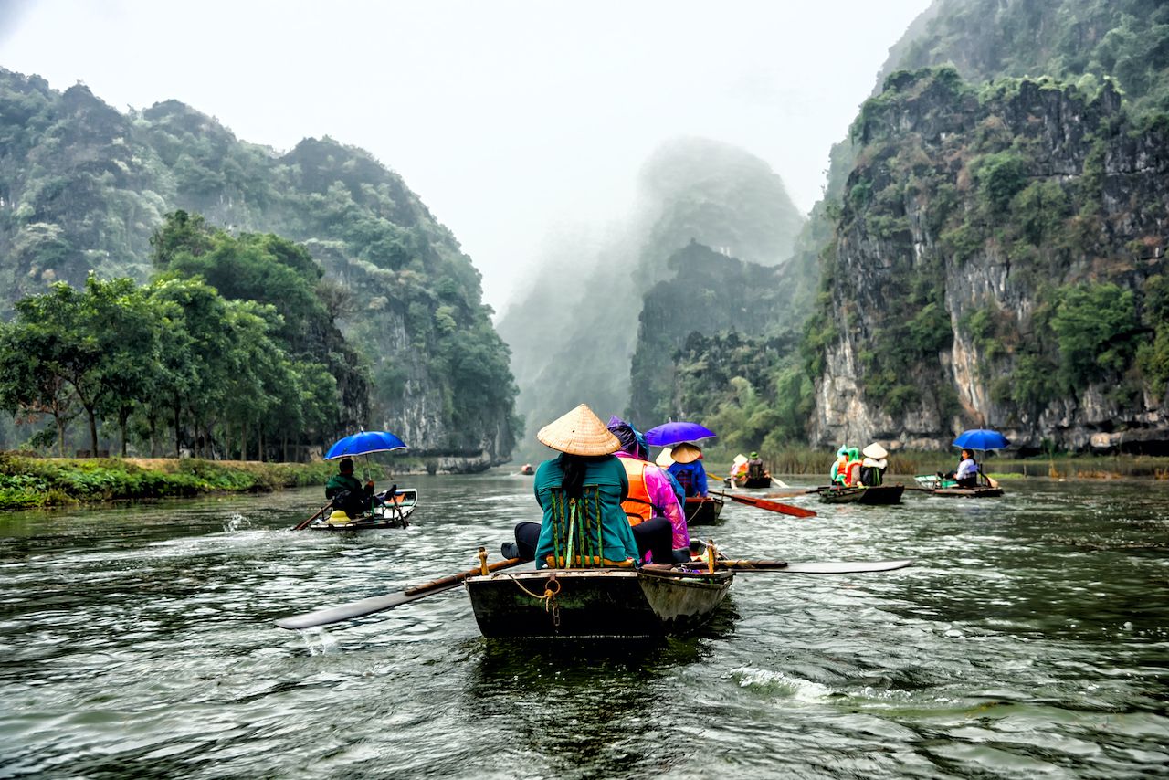
Photo: Shutterstock/Pongwan Sukpoka
Ha Long Bay, made of more than 1,600 inlets and islands, is known for pillars, caves, and arches that were formed over 500 million years. The karst formations occur when ocean waves dissolve the limestone. The area is a designated UNESCO World Heritage site.
Climate impact
Increased flooding in the region has caused a coal-fired power plant to run-off steam into the bay. Extreme weather is also accelerating erosion.
THE GREAT BLUE HOLE — BELIZE
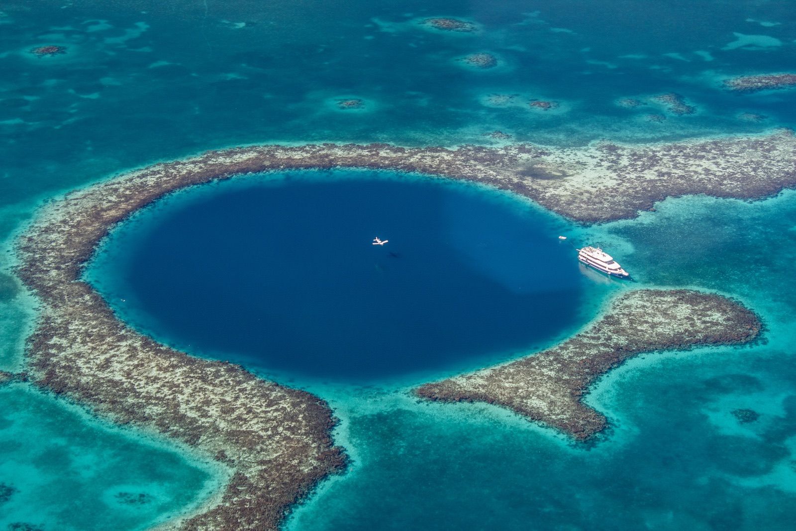
The Great Blue Hole is a large underwater sinkhole. Originally a limestone cave, it collapsed when sea levels rose over 150,000 years ago. In 1971, Jacques Cousteau declared it one of the top 10 diving spots in the world. It’s said the water become clears the deeper you dive.
Climate impact
Increases in ocean acidification caused by the uptake of carbon dioxide in the atmosphere are damaging local marine life and the coral reefs.
THE STONE FOREST — CHINA
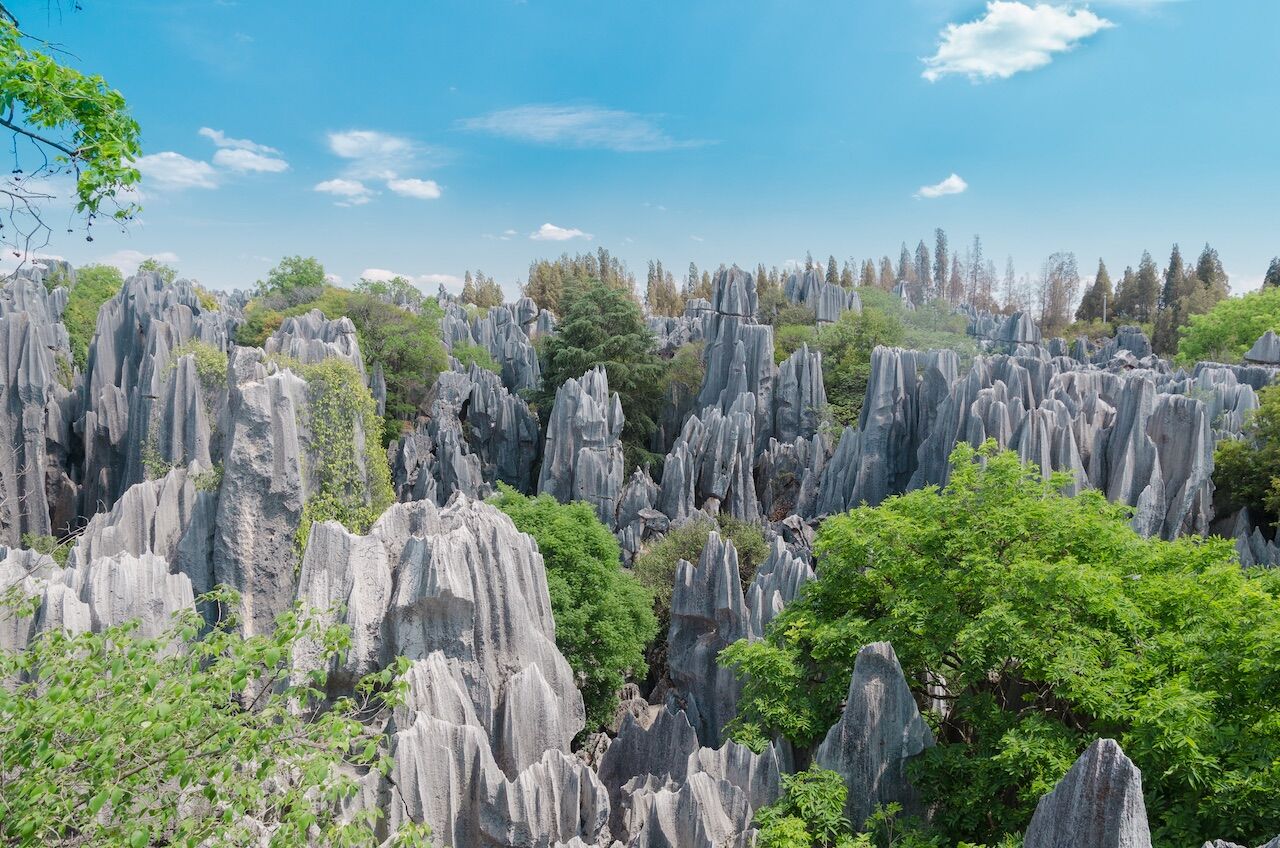
Photo: Nipathorn/Shutterstock
75 miles from Kunming, the Stone Forest, or Shilin, comprises multiple groupings of “stalagmite”-style limestone formations. The famous rocks that make up the forest are said among local peoples to resemble people, lions, birds, and trees. The area was formed 270 million years ago through a series of earthquakes and later by water and wind erosion.
Climate impact
The increase of carbon dioxide in the atmosphere will increase acid rain, accelerating the deterioration of the karst formations.
BRYCE CANYON — UTAH
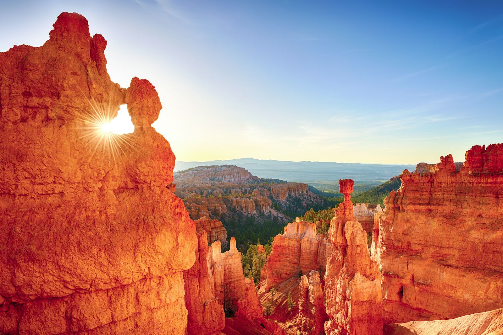
Photo: Shutterstock/Filip Fuxa
Bryce Canyon is filled with spires, pillars, and hoodoos. The landscape is made of limestone, sandstone, and mudstone. It was shaped by ice and water 40 to 60 million years ago. The area surrounding the canyon became a national monument in 1923 and a national park in 1928.
Climate impact
As Utah gets warmer and drier and the local rainfall is affected, the chance of flash flooding will increase hugely.
TWELVE APOSTLES — AUSTRALIA
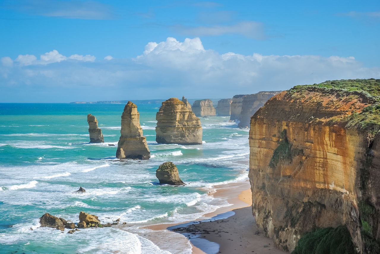
Photo: Kamala Sakornmaneesup/Shutterstock
The Twelve Apostles are rock stacks that have separated from nearby limestone cliffs, to stand tall where the ocean meets the shore on southeast Australia. The stack began eroding away and separating from caves in the cliffs approximating 10 to 20 million years ago. The wind and water continue to erode 0.75 inches per year.
Climate impact
An increased frequency of extreme weather events and higher levels of carbonic acid in the water threaten to accelerate the erosion.
PLITVICE LAKES — CROATIA
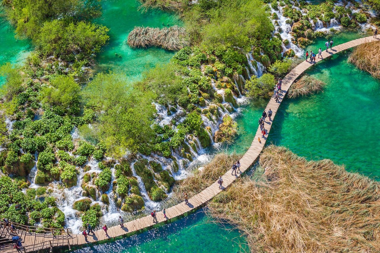
Photo: Maurizio de Mattei/Shutterstock
Plitvice Lakes is a series of 16 lakes, connected waterfalls, and caves. The lakes were formed as recently as 6,000 to 7,000 years ago from erosion of limestone in the area. The water in the lakes is famous for its variety of changing colors.
Climate impact
The lakes are most susceptible to pollution from visitors, local biodiversity is also being impacted by climate change and various endemic species are under threat of extinction.
IGUAZU FALLS — BRAZIL/ARGENTINA
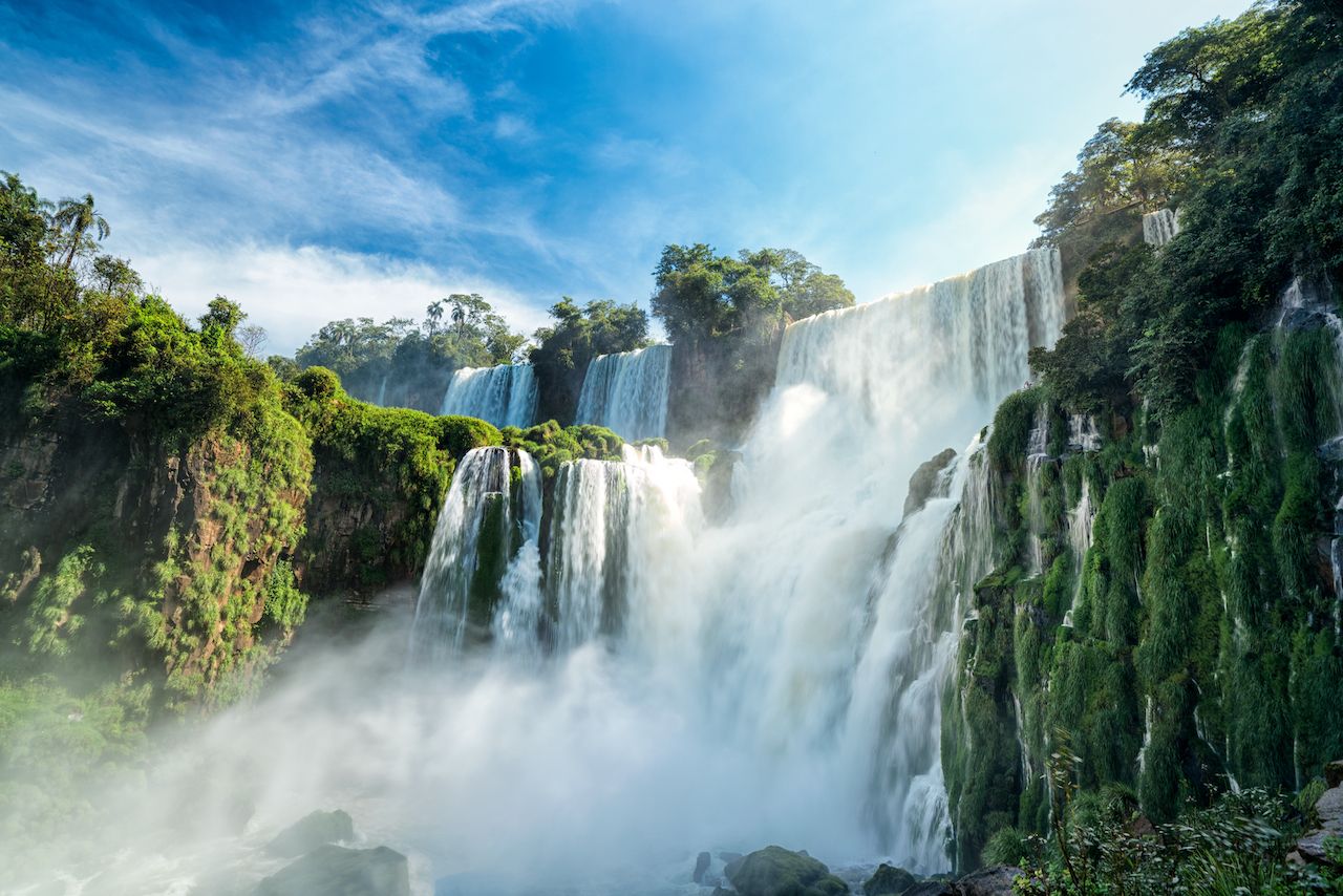
Photo: sharptoyou/Shutterstock
Iguazu Falls is a system of 275 waterfalls that occur along the Iguazu River. The falls formed as a result of volcanic activity that occurred more than 100 million years ago. They are taller than Niagara Falls and twice as wide — in fact, there’s a spot where a person could stand and be surrounded by 260 degrees of waterfalls.
Climate impact
Increased instances of drought in the area will diminish the water flow of the falls.
ANTELOPE CANYON — ARIZONA

Photo: canadastock/Shutterstock
Antelope Canyon is a slot canyon (it’s deeper than it is wide) formed from sandstone from flash flooding over 190 million years ago. The canyon is an enormously popular tourist destination and widely publicized for its interaction with sunlight.
Climate impact
Increased instances of flash flooding will make visiting the canyon unsafe for visitors and locals.
LEGZIRA BEACH — MOROCCO
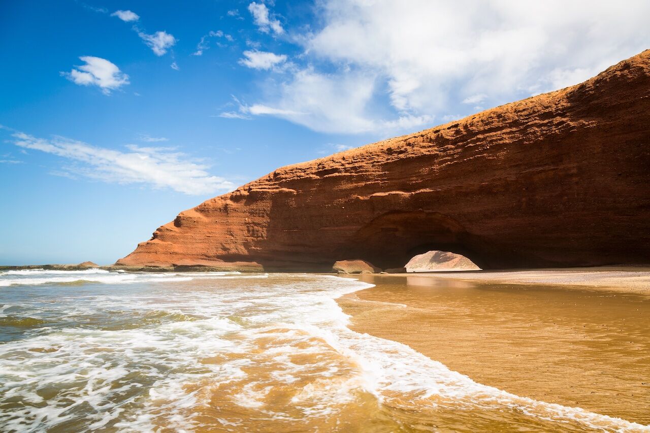
Photo: KajzrPhotography/Shutterstock
Legizira Beach was once home to two rock archways, each extending from the beach into the water of the North Atlantic. In late 2016, the smaller of the two arches collapsed. The beach itself is famous for itsc sunsets, and the remaining arch, which is accessible on foot during low tide.
Climate impact
One of the two arches has already collapsed due to erosion. Increased dryness and rising sea levels could accelerate further collapse.
CLIFFS OF MOHER — IRELAND
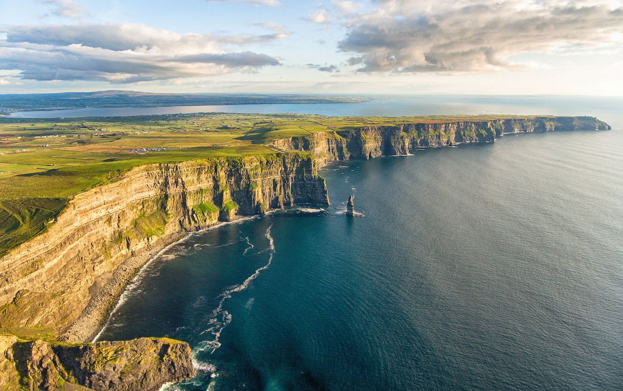
Photo: shutterupeire/Shutterstock
The Cliffs of Moher, estimated to be 319 million years old, are the second most popular tourist destination in Ireland, after Trinity College in Dublin. The cliffs rise sharply — several hundred feet above sea level — and are a breeding ground and safe haven for more than 30,000 seabirds.
Climate impact
Increased levels of carbonic acid in the water, along with flooding, will accelerate erosion of the formation.
VERMILION CLIFFS — ARIZONA
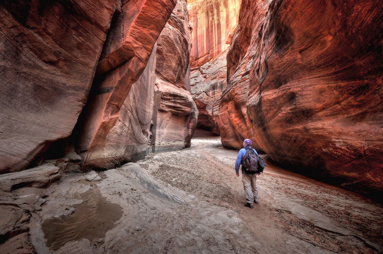
Photo: Sierralara/Shutterstock
The Vermillion Cliffs represent one layer in a sedimentary rock formation called the Grand Staircase, located in Arizona and Utah. Known for a red hue, the cliffs are made of quartz and were shaped by water and the wind over 190 million years.
Climate impact
The cliffs have relatively low vulnerability to climate change, but as Arizona gets warmer and drier, local wildlife and plant life will be at increased risk.
YANGTZE RIVER — CHINA
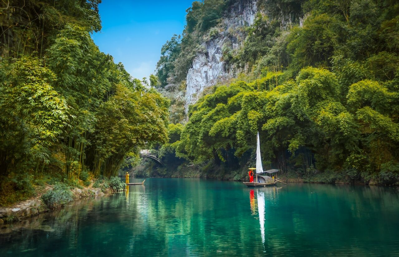
Photo: Hugo Mauricio Lopez V /Shutterstock
The Yangtze is the longest river in China, and third longest in the world. It originated in the Tanggula Mountains and is considered the dividing line between Northern and Southern China. The Yangtze is the busiest inland of China’s biggest cities, and home to the Three Gorges Dam, the world’s largest hydropower project.
Climate impact
Many of the lakes that feed the river are shrinking due to climate change. Also, the water has become extremely polluted. ![]()