Chamonix, France, is best known as a hardcore ski destination and Europe’s mountaineering capital. But, in summer, the trekking and hiking routes that take you about the stunning Chamonix valley are equally spectacular. Chamonix is not just home to some of the most beautiful peaks in the Alps, but also to several major glaciers — including the largest one in France, Mer de Glace. And you don’t need to pack crampons and ice axes to experience them. These five hikes to glaciers will bring your right to the crevasses of major glaciers or allow you to see them from a panoramic perspective of the high mountains.
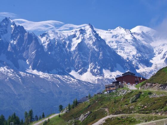
Photo: Anna Shevchenko
These 5 Hikes to Chamonix’s Glaciers Are Some of the Best Walks in the World
Mer de Glace glacier via Grand Balcon Nord Hike
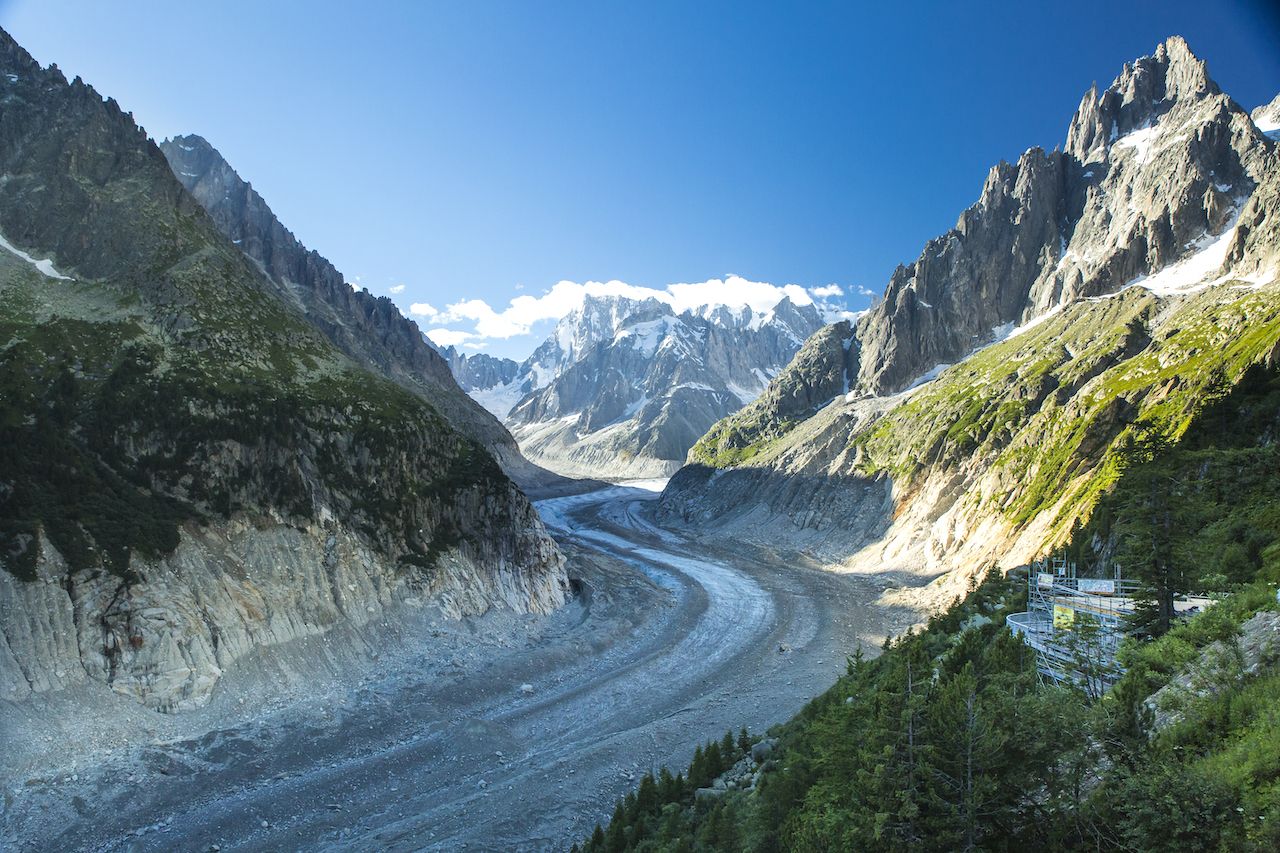
Photo: Geartooth Productions/Shutterstock
At nearly 25 thousand feet long and over 600 feet deep, Mer de Glace is the largest glacier in France. The name of the glacier translates to English as “Sea of Ice” and explains what this massive glacier appeared like to the early explorers of Chamonix — crevasses of ice glistened in the valley like frozen waves. Although it has declined significantly over the last century, Mer de Glace is still an incredible glacier to experience up close.
You will combine your visit to Mer de Glace with a walk on Grand Balcon Nord — a trekking path that runs along the Chamonix valley at the height of over 7,000 feet. The day logistics are as follows: Take the Aiguille du Midi cable car to the half-way station called Plan de l’Aiguille du Midi, hike for two hours and 15 minutes to Mer de Glace, explore the glacier, and take the Montenvers train back to Chamonix. The cable car and the train ride will ensure that you don’t have to do the tricky ascent from and descent to the valley on foot.
Start your day with a meal at the Refuge du Plan de L’Aiguille just outside of the cable car station. The 150-year old Alpine hut has retained its original rustic feel. The hut runs an overnight refuge for trekkers and mountaineers and has a great selection of food with the best fruit tarts in the valley. After the snack, enjoy a hike along Grand Balcon Nord trail with spectacular views of Mont Blanc, the Aiguille du Midi station, the Chamonix valley below, and Mer de Glace from the lookout at Signal Point. Bring your binoculars or a zoom photo lens to spot the mountaineers atop the glacier below.
Once you ascend towards Mer de Glace, you can take another free gondola and walk a set of stairs to the large grottos carved inside the ice. There are marks on the cliffside along the stairs that will show how much the glacier has receded from previous years. After exploring Mer de Glace, take the historical Montenvers train back down to Chamonix.
2. Panoramic glacier view from le Brévent
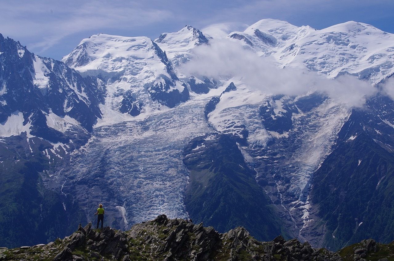
Photo: Anna Shevchenko
Just over 8,000 feet high, le Brévent is the peak located right across from Mont Blanc. It offers the highest panoramic views of the Mont Blanc massif, which is the collection of peaks around Mont Blanc. You will also have views of des Bossons and de Taconnaz glaciers. To get to the viewpoint, take the gondola from Chamonix to Plan Praz station and then the cable car to le Brévent. Plan Praz is the favourite spot for the paragliders in the Chamonix valley.
From le Brévent station follow the signs on the path to Lac du Brévent. The trail will take you down the switchbacks below the station to the ridge across from Mont Blanc. Stay here a while to enjoy the view of the glaciers towering above the valley right across from you and watch the paragliders soar silently through the air. Bring your binoculars or zoom lens and you can spot mountaineers atop of Mont Blanc.
End your day with a beer and a snack at either Brévent or Plan Praz stations before you head back down to Chamonix.
3. Glacier des Bossons
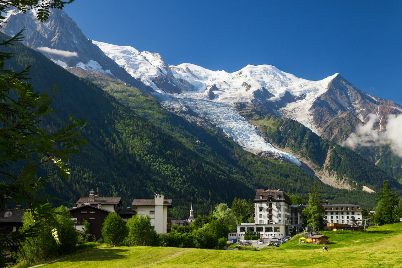
Photo: Julia Kuznetsova/Shutterstock
Les Bossons glacier extends from Mont Blanc towards the valley and is visible from almost anywhere in the town of Chamonix. You can experience Les Bossons glacier on a quick visit to the Chalet du Glacier.
Walk over or take a bus to Les Bossons village located 2.5 miles west of Chamonix. The stream below the glacier, Torrent des Bossons, is a great place to view the glacier from the ground level. From there, take a 40-minute walk uphill or ride the Bossons chairlift to the chalet. Chalet du Glacier has an outdoor terrace that overlooks the glacier and the valley. You can enjoy a tasty meal and learn more about the history of les Bossons glacier and the plane crash that occurred in the area in 1966 in an informative display offered by the chalet owners.
Experienced hikers should consider climbing another 3,000 feet up the trail to Chalet des Pyramides/Le Jonction. The highly exposed alpine trail will take you to the junction where glaciers des Bossons and de Taconaz merge. The open Alpine views of the glacier field below Mont Blanc and the neighboring peaks are worth the extra effort.
4. Lac Blanc and Lacs des Chéserys
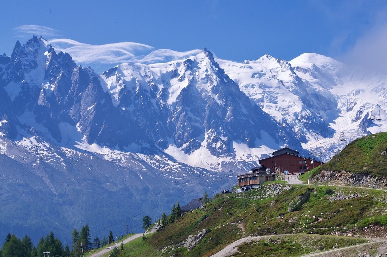
Photo: Anna Shevchenko
A hike to Lac Blanc and Lacs des Chéserys is one of the most famous walks in Chamonix. Lac Blanc is a high alpine lake with a milky blue hue — the milkiness being caused by mineral runoff from the glaciers — and is often surrounded by snow even in the summer. Lacs des Chéserys are neighboring lakes known for their clear mirror-like surface with some of the best views of the Mont Blanc massif, the Bossons, Mer de Glace, and the Argentiére glaciers.
Start your day in the village of Les Praz, less than two miles outside of Chamonix. From Les Praz, take a cable car to the Flégère station. From there walk the following loop: Hike for three hours to Lac Blanc, enjoy the lake, have a snack at the Refuge Chalet du Lac Blanc, and then ascend to Lacs des Chéserys. After that, you can walk back to the Flégère station along the Grand Balcon Sud path.
Allocate at least five hours for the entire walk. The Balcon portion of the hike will take you past a number of waterfalls and streams through an alpine meadow. Expect to meet ibexes, with their distinctive long and curved horns, and always give them plenty of room to pass you on the narrow trail. Blooming azaleas will turn the meadow into a sea of pink in late June and early July.
5. Argentière Glacier
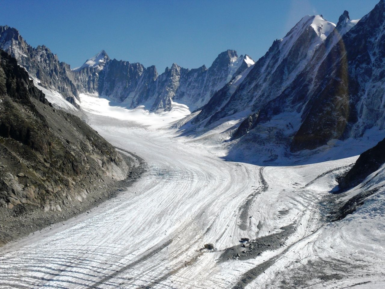
Photo: LACROIX CHRISTINE/Shutterstock
The Argentière glacier is another large glacier in the Mont Blanc massif. It extends towards the village of Argentière, located 20 minutes away by bus from the center of Chamonix. You will start your journey by taking the Grands Montets cable car from Argentière to the middle station Lognan at 6,470 feet. Follow the signs to Refuge Chalet de Lognan; they will lead you to a dirt path along the ridge. You will see the refuge in about 15 minutes perched on the side of the cliff to the left.
Stay on your track to the Point de Vue, a viewpoint over the Argentière glacier at 7670 feet. The trail will reach a cliffside along the path of the glacier. You will soon turn the corner and see the mass of the Argentière glacier ahead of you protruding above the track and dropping deep down below it. The crevasses and seracs, or points and ridges of ice, will glow sapphire in the sun and you will hear the sound of the waterfall rushing between them.
The dirt path will end at the wall of the cliff and you will find smaller footpaths along the side of the mountain that can get you even closer to the glacier. Proceed only if you’re a skilled hiker and are well-equipped with hiking boots and good balance. Find a spot in the grass and enjoy the head-spinning panorama before you.
After experiencing the glacier up close, walk back to Lognan station and take the cable car to the higher Grands Montets station at 10,810 feet. The station has a café and multiple terraces with panoramic views of the Argentière glacier, the Aiguille du Midi, Mont Blanc, and other adjacent peaks, as well as the mountains across the valley. Watch mountaineers get on ice right outside of the station and paragliders float off the snowy ledges below you.
Important tips for planning your trip
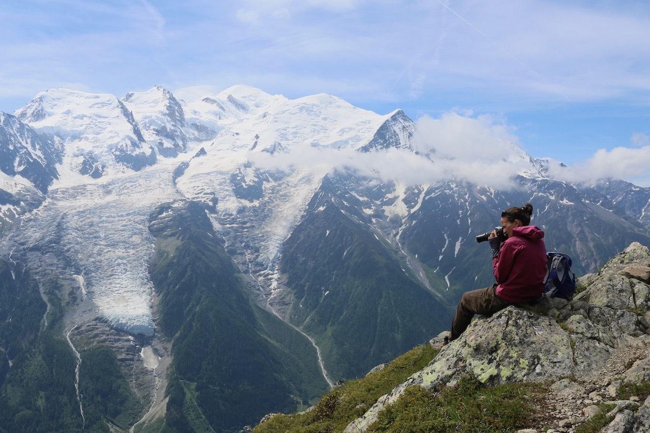
Photo: Anna Shevchenko
The hiking season in Chamonix runs from May to September. All of the routes are well developed with excellent directional signage. Most signs give directions in time rather than distance or elevation gain, so consider the length of each trip ahead and according to your own abilities.
Check the cable car and lift schedule ahead of your hike. If you miss the last trip down, you will be stuck having to descend over 6,500 feet on foot. Plan to be at the station on time for the quick ride to the valley; but, just in case, always save enough energy and food for a hike down on your own.
We recommend that buy the Vallée de Chamonix Summer Mountain Hiking Map at the Chamonix Tourism Office and pick up a free brochure with up-to-date schedules for all of the cable cars, gondolas, and ski lifts. Ask your accommodation provider for the Carte d’Hôte Guest Card for free access to the buses in the valley.
The Chamonix hiking map suggested above grades all of the hikes to glaciers listed here as “easy.” Please don’t be fooled by this evaluation. Do not get on the trails in Chamonix without good hiking boots and poles. The hikes will feature varied terrain with gravel, sleek granite steps, stream crossings, and often snow. Dress for sunny conditions that can quickly change to rain and hail. The ability to have a meal at the chalets is a nice perk, but be prepared for unexpected closures and always bring enough food and water to last through the day. ![]()