Photo: Benny Marty/Shutterstock

The Absolute Best Hiking Trails Near Sydney, Australia

Australia National Parks Hiking
by Gabrielle Boucher May 19, 2021

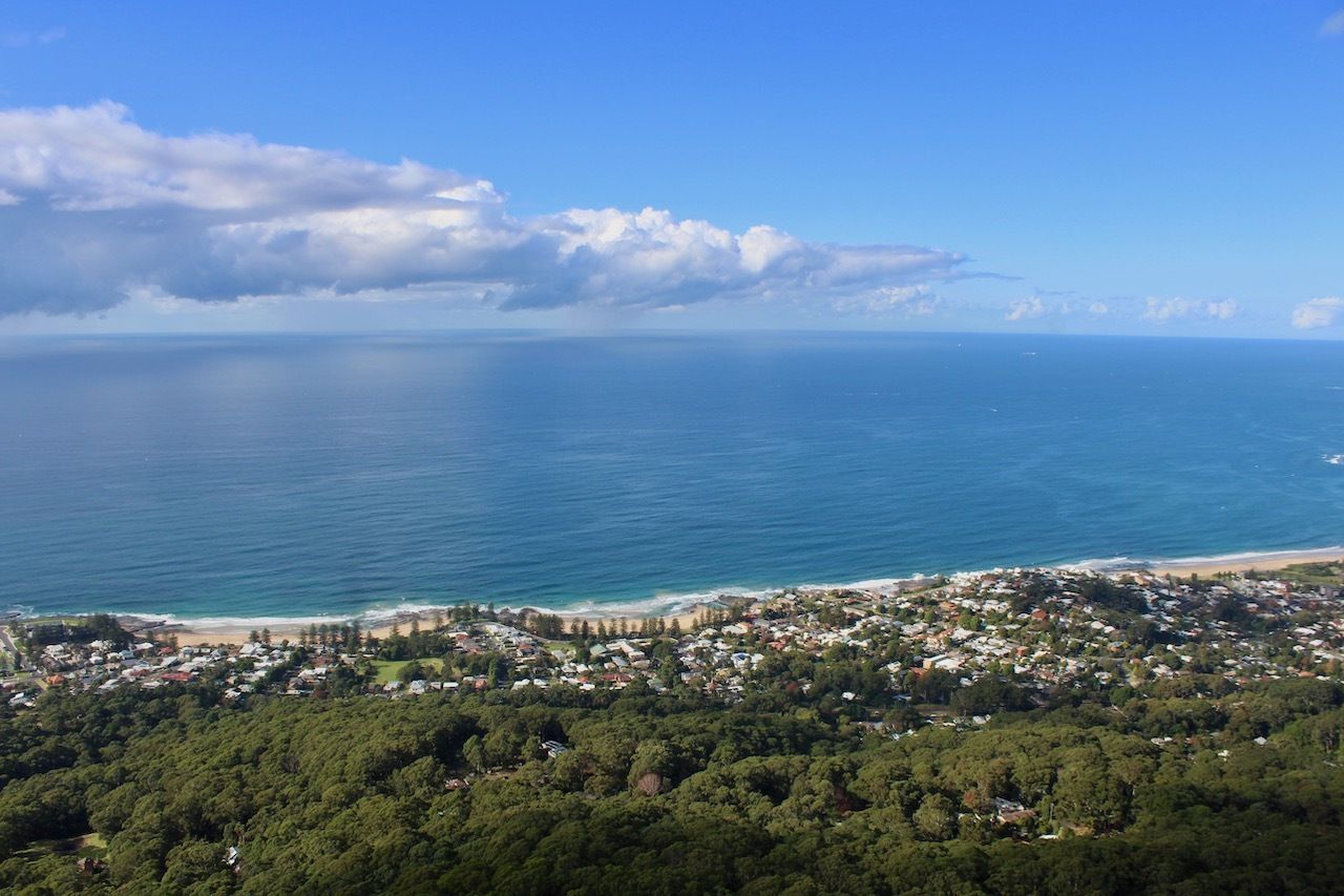
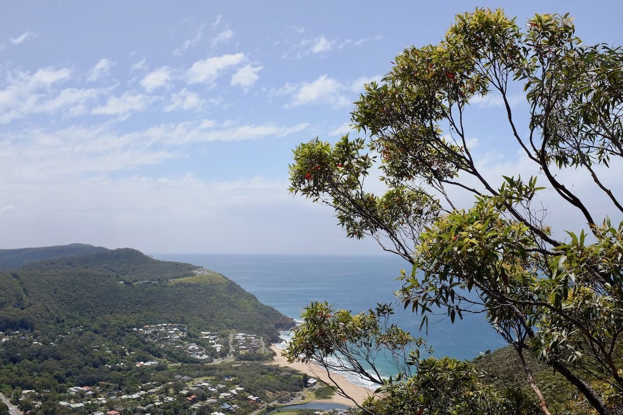
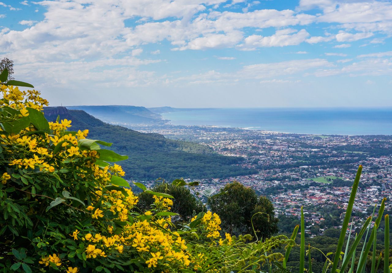
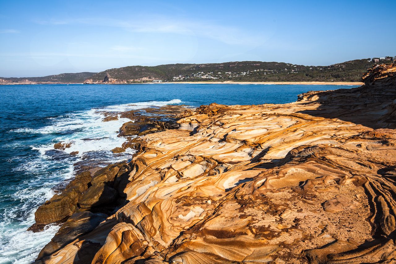
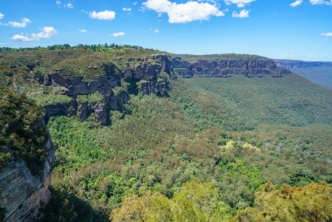
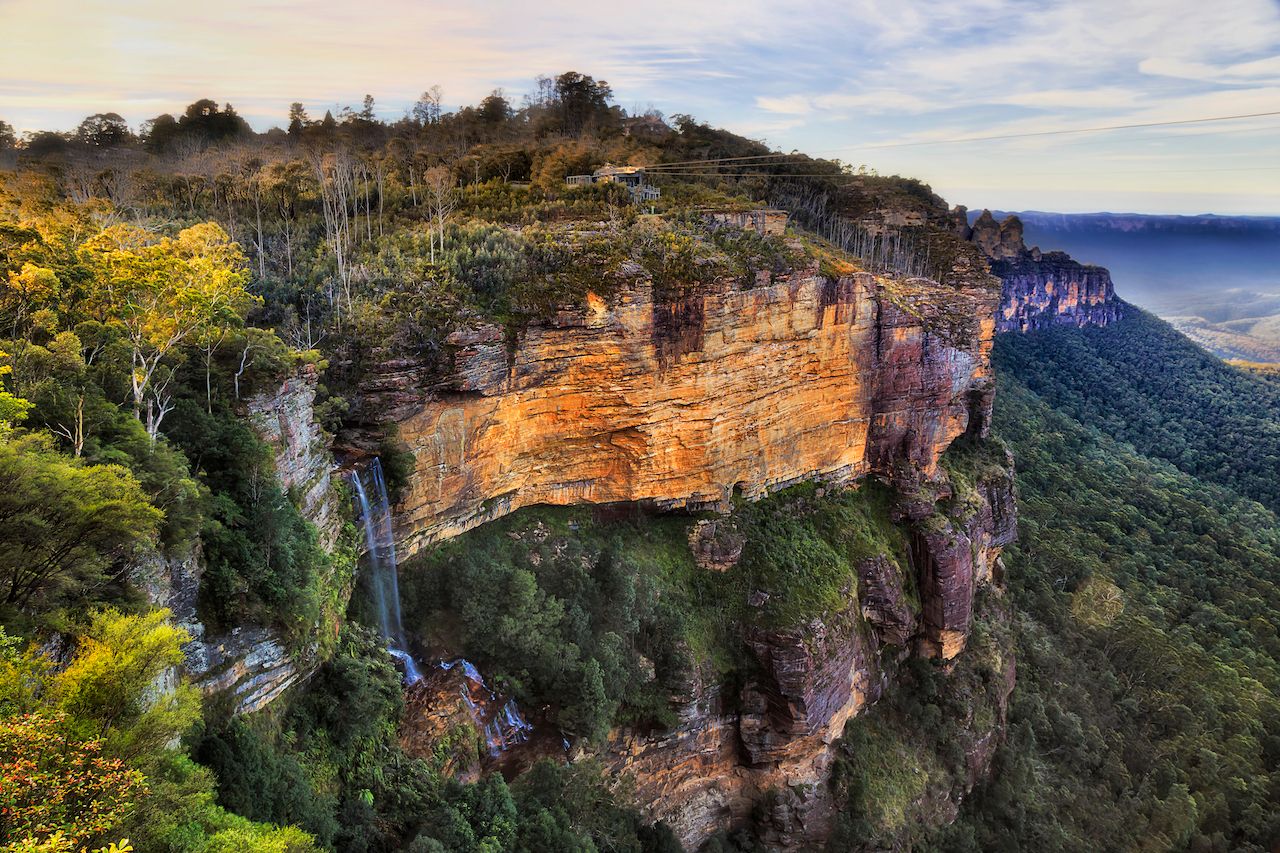
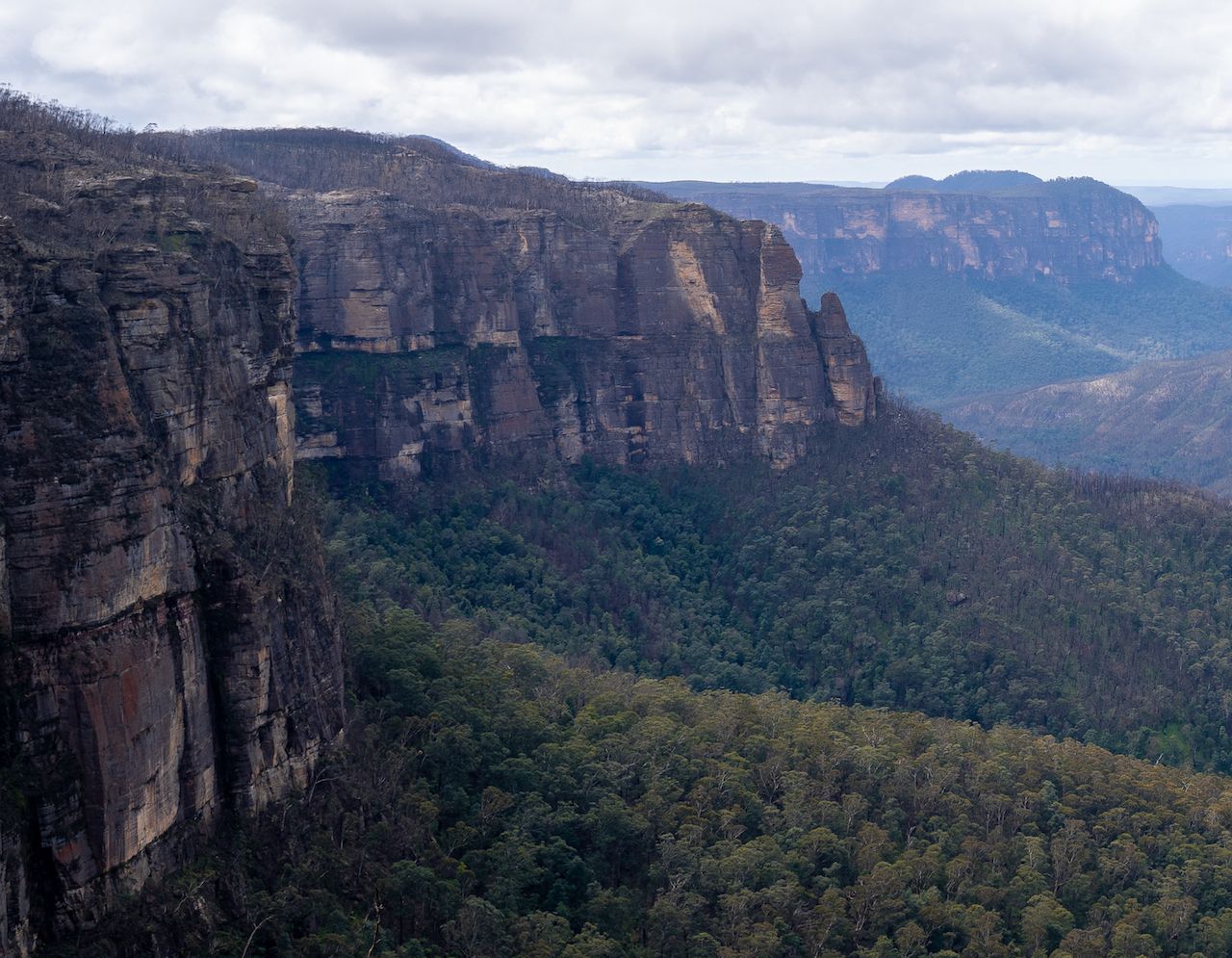
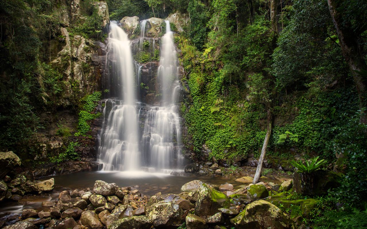
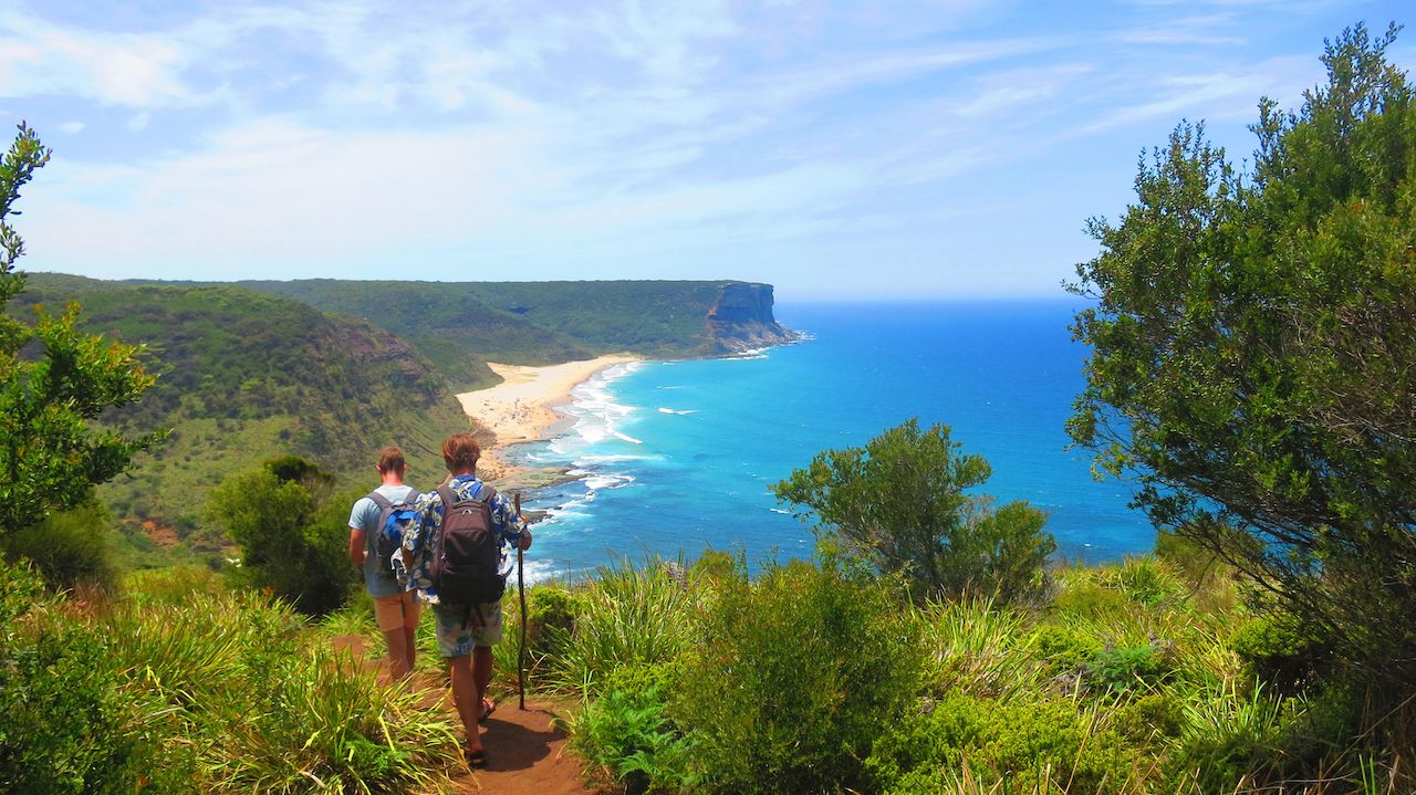
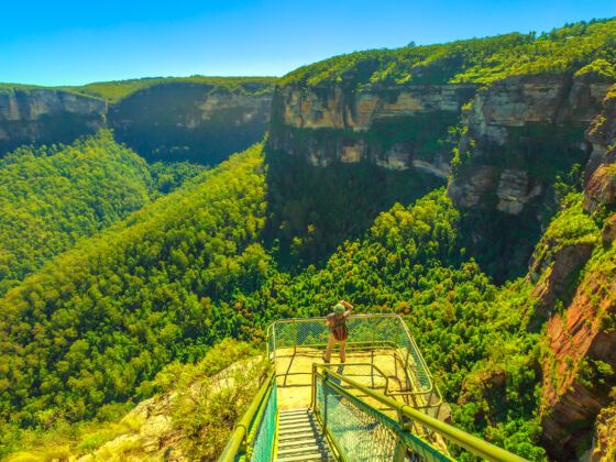
Sydney, Australia, is famous for its busy harbor, framed by the Sydney Harbor Bridge, Royal Botanic Gardens, and the white plumes of the Sydney Opera House. But many travelers don’t know about all the natural beauty that lies outside the city center. There are waterfalls, mountains, cliffs, valleys, rivers, and pristine, uncrowded beaches.

Hiking is one of the best ways to explore these beautiful places around Sydney. Most national parks and hiking trails in the province of New South Wales are free and well-marked. So if you prefer a dirt path to a concrete sidewalk, many epic hiking trails lie within a two-hour drive from Sydney and can be easily incorporated into an epic day trip. So check out one of these, the 10 of the best hiking trails near Sydney.

Note: With each hike, we tell you how to get there by car or public transportation. If you are able, consider renting a car, as it will get you closer to the trailheads. Also, before doing any of these hikes, visit the NSW National Parks website for maps and trail updates.

1. Sublime Point Walking Track

Australia scenery

Photo: Gabrielle Boucher

Just south of Sydney lies the Illawarra Escarpment, a tall string of cliffs covered in cool, coastal rainforest. The cliff face overlooks the small beach towns below like a faithful guardian. The Sublime Point Walking Track begins at the base of the Escarpment in the town of Austinmer.

It’s a tough hike that leads all the way to the top of the cliffs. The trail is short, but steep the entire way, with vertical ladders at the top. Most relatively fit people can make it to the top in 30 minutes to an hour. The Sublime Point Lookout at the top of the Illawarra Escarpment offers an incredible view over the curving coastline dotted with parks, palm trees, and houses below.

Distance: 1 mile roundtrip

Getting there by car: Put Sublime Point Walking Track into your GPS and you’ll find street parking at the base of the trail. It’s a one-hour drive south of Sydney.

By train: Take the South Coast Train Line to the town of Thirroul and walk 45 minutes from Thirroul station to the hiking trail. Alternatively, change trains at Thirroul and ride one stop north to Austinmer Station, then walk 20 minutes to the trailhead.

2. Wodi Wodi Walking Track/Forest Walk

Australia scenery

Photo: Gabrielle Boucher

Another amazing hike in the Illawarra Escarpment is the Wodi Wodi Walking Track, which is more leisurely than Sublime, as it’s longer and less steep. There are two options for this hike. The Wodi Wodi Trail is a loop that starts at Coalcliff Station and ends at Stanwell Park Station. It doesn’t take you very high up the Escarpment so the views aren’t as special.

Instead, we recommend starting the Wodi Wodi Trail at Coalcliff Station and then turning onto the Forest Walk. You’ll reach a fork in the path, indicating a left turn for the Forest Walk. Framed by eucalyptus trees, the Forest Walk snakes up the cliffs and ends with a few different lookouts. The best view is of Stanwell Park, a cozy surf town framed by two massive hills.

This is a popular hike to do at sunrise. It takes about one hour to reach the top and it’s only an hour south of central Sydney. Bring a flashlight or headlamp, as the trail is quite rocky and could be difficult in the dark.

Once you reach the top and enjoy the views, you can descend the way you came. Alternatively, the Forest Walk actually continues along the top of the escarpment, all the way to the Sublime Point Walking Track. If you’re feeling ambitious, you can combine the two into one massive day of hiking.

Distance: The Wodi Wodi Trail is a four-mile loop. The Wodi Wodi Trail combined with the first section of the Forest Walk is around 2.5-mile roundtrip. The entire Forest Walk is 8.5 miles one-way, or 17 roundtrip.

Getting there by car: By car, drive to Coalcliff Station on Lawrence Hargrave Drive and park anywhere on the side of the road; look for a small trail branching off the west side of the road.

By train: Take the South Coast Train Line to Coalcliff; the start of the hike is right next to the station.

3. Mount Keira Ring Track

Australia scenery

Photo: lreedfl/Shutterstock

Wollongong is a small city about 1 hour and 25 minutes south of Sydney. It’s a vibrant, multicultural place that makes an exciting day trip. Just west of Wollongong lies Mount Keira, a small mountain with some fun hiking trails and viewpoints that overlook the city.

The best hike here is the Mount Keira Ring Track, a 3.5-mile loop that encircles the entire mountain. The trail is relatively flat, so it’s also perfect for trail running. Bird-watching and animal-spotting is fun here as well, as the coastal rainforest is flourishing with wildlife. I’ve lived in Australia for over two years, and I saw my first and only echidna on this hiking trail. These spiny little creatures are one of the few egg-laying mammals on the planet.

Distance: 3.5-mile loop

Getting there by car: Park at Byarong Car Park and follow the Mount Keira Ring Track from there.

By train: Take the South Coast Train Line to Wollongong. The trailhead is a one-hour walk from the station, or a 10-minute taxi or Uber.

4. Barrenjoey Head Lighthouse Hike

Australia scenery

Photo: Taras Vyshnya/Shutterstock

At the northernmost point of Sydney, the Barrenjoey Head Lighthouse sits atop a skinny headland. But this isn’t just any boring old lighthouse. The view from the top of this headland is absolutely breathtaking

You can see the vibrant blue ocean, the golden sands of Palm Beach, and the nearby forests of Ku-ring-gai Chase National Park. The Pacific Ocean shines a vibrant blue, and there are lots of protruding rocks that are great for posing for photos. The hike is straightforward and only takes around 30 minutes. The trail splits into two paths: a visibly steeper trail and a longer, flatter trail. Take the steep trail if you want a challenge.

Distance: 2 miles round-trip

Getting there by car: Navigate to Palm Beach and parking at the metered lot at the end of the road. The hiking trail starts at the northern end of the parking lot.

By bus: Take the Line 199 Bus from Wynyard Station north to Palm Beach. There is no direct train, so the public bus is the easiest form of public transport.

5. Bouddi Coastal Track

Australia scenery

Photo: Paul Leong/Shutterstock

Bouddi National Park is located on the Central Coast, about 1.5 hours north of Sydney. This is the perfect place to spend a quiet, relaxing weekend in nature. There are a few cozy beachside campgrounds, and plenty of opportunities for surfing, snorkeling, and hiking.

The Bouddi Coastal Track is the highlight of this national park. It stretches from Putty Beach in the south to Macmasters Beach in the north, traversing entire beaches, forest paths, and cliffside trails along the way.

Whales, wildflowers, and native birds are all common sights along the Bouddi Coastal Track. The unique rock shapes and formations are also notable. One spot near the start of the hike has a sign for “Tessellated pavement,” where the cliffs have naturally formed into a grid. You’ll also see lots of swirling sandstone, with white, orange, and brown hues layering on top of each other.

Distance: 10.5 miles roundtrip

Getting there by car: The easiest route from Sydney is driving to Putty Beach, as the hiking trail starts at the northern end of Putty Beach. You can also park at Macmasters Beach and hike from north to south instead of south to north.

By train: Take the Central Coast/Newcastle line from Central Station to Woy Woy Station, then ride 20 minutes by taxi or Uber to Bouddi National Park.

6. Prince Henry Cliff Walk

Australia scenery

Photo: christian_b/Shutterstock

In the Sydney area, the Blue Mountains are one of the most popular destinations for hiking, camping, and escaping the hectic city. Within the Blue Mountains, the Prince Henry Cliff Walk is one of the best hikes. This leisurely but long walk covers some of the best sights near the tourist towns of Katoomba and Leura.

You’ll see the multi-tiered waterfalls of Katoomba Falls, and the smaller, tumbling falls of Leura Cascades. You’ll also pass the Three Sisters, a famous sight of three, natural rock towers resting side by side like sisters. At over four miles in length, the hike takes about 3-4 hours. It’s not very steep, and plenty of side trails also lead deeper into the nearby valley. In fact, you can get up close to Katoomba Falls by branching off the main hike and following a set of descending stairs; signeage indicates the path.

Distance: Over four miles one way, 8.5 miles roundtrip. It’s common to do the hike one-way, then catch the train from Leura back to Katoomba or vice-versa.

Getting there by car: Navigate to the Katoomba Falls parking lot, which is free, and start the walk at the falls.

By train: Take the Blue Mountains Train Line to Katoomba Station, which is 20 minutes from the Prince Henry Cliff Walk.

7. Grand Canyon Track

Australia scenery

Photo: Taras Vyshnya/Shutterstock

While the Katoomba area of the Blue Mountains is the most popular, with the most famous sights, it can get quite crowded. In contrast, the Blackheath area boasts its own attractions. It’s much less touristy and just as gorgeous. The Grand Canyon Track is one of the best hikes in Blackheath. Starting at the top of the valley, the trail travels down to the forest floor and eventually loops back up.

It isn’t necessarily the most scenic hike, but it’s a great workout that allows you to immerse yourself in nature. Hear the rushing of small waterfalls and the songs of native birds. Feel the temperatures drop and the air moisten as you hike downwards into the valley. See giant ferns and palms sway in the breeze. Cup your hands in a stream and then taste the frigid, fresh water. You’ll return to the top of the valley after a couple of hours feeling refreshed and invigorated.

Distance: 4.5-mile loop

Getting there by car: Drive two hours west of Sydney to the town of Blackheath; park at Evans Lookout for the start of the Grand Canyon Track.

By train: Ride the Blue Mountains Train Line to Blackheath Station, then catch a 10-minute taxi or Uber to Evans Lookout.

8. Pulpit Walking Track

Australia scenery

Photo: Roberto Garcia Photograph/Shutterstock

Also located near Blackheath in the Blue Mountains, this hike supplies all the jaw-dropping views that you could ever want. The Blue Mountains are jam-packed with scenic lookouts, and we think the Pulpit Walking Track has the best ones.

The hike begins at Govetts Leap Lookout, which will blow your mind before you even start hiking. Layers upon layers of hills and cliffs draped in trees fill the scene. The valley appears so vast and so untouched by man, that you could almost picture a Pterodactyl soaring overhead.

After gazing at the view, follow the signs for the Pulpit Walking Track. The hike is relatively easy, with a few inclines here and there. You’ll be walking along the edge of the Grose Valley, enjoying little waterfalls, cliff carvings, and viewpoints along the way. The hike ends at Pulpit Rock, a giant, layered rock blade that juts out from the edge of the cliffs. There is a fenced-in walkway on Pulpit Rock, so you can walk onto it and feel like you’re floating in the middle of the valley.

Distance: Over four miles roundtrip

Getting there by car: Drive to the Govetts Leap Lookout Car Park, then follow signs for the Pulpit Walking Track.

By train: Take the Blue Mountains Train Line to Blackheath, which is a 5-minute taxi ride or a 40-minute walk to Govetts Leap Lookout.

9. Minnamurra Falls Walk

Australia scenery

Photo: Paul Looyen/Shutterstock

Minnamurra Falls makes you feel like you’re much farther away from the city than you really are. Located in Budderoo National Park, Minnamurra Falls is a 1 hour and 50 minute drive south of Sydney. But the contrast in scenery and climate makes it feel like another world entirely.

Though New South Wales is full of coastal rainforest, this particular area feels much more tropical than what you might see near Sydney. The forest is saturated with bright green hues, the air is thick with humidity, and the screeching sound of cicadas seems like if couldn’t be any louder.

The hike to Minnamurra Falls is pretty short but steep. You’ll definitely be sweating, if not from the hike then definitely from the humidity. Minnamurra Falls itself is a mesmerizing waterfall. You can’t swim in it, but there is a spacious viewing platform for enjoying the view.

Distance: 2.5 miles roundtrip

Getting there by car: Drive to the Minnamurra Rainforest Center, then follow signs for the Falls Walk.

By train: Take the South Coast Train Line to Kiama, then take a 20-minute Uber to Minnamurra Rainforest Center.

10. The Coast Track: Royal National Park

Australia scenery

Photo: Travelling.About/Shutterstock

For travelers in Sydney, visiting the Royal National Park is a must. Directly south of the city, before you reach Thirroul, Wollongong, and the Illawarra Escarpment, there is a massive expanse of protected wilderness known as the Royal National Park.

The Coast Track is the ultimate multi-day hike in the park. It trails from the town of Bundeena in the north of the park, all the way to the town of Otford in the south, hugging the coastline the entire way.

It isn’t necessary to hike the entire track in one go. You can also opt to do smaller sections of the Coast Track for a few hours at a time. Here are a few of my favorite areas along the Coast Track that make for easy day hikes, listed from north to south. So if you were hiking the entire Coast Track, you’d pass all of these sections on the way.

The Balconies to Wedding Cake Rock

This is the very first section of the Coast Track, starting on the outskirts of Bundeena. At the beginning of the hike you’ll reach “The Balconies,” where the white and gray cliff edges layer on top of each other like balconies. It’s a fantastic sight, as the deep blue of the ocean contrasts with the sharp, bright white cliffs. Further down the coast track lies Wedding Cake Rock, a massive, smooth slab of chalky white cliff that resembles a wedding cake.

Distance: 1.7 miles one way, or 3.4 miles roundtrip

Getting there by car: Drive to the town of Bundeena and follow Beachcomber Ave all the way to the end. Park on the street, and the start of the Coast Track is at the end of the road.

Wattamolla to Curracurrong Falls and Eagle Rock

Near the northern end of the Coast Track, this hike takes about 3 hours. Highlights include Curracurrong Falls, the waterfall that cascades right into the ocean, and Eagle Rock, a cliff edge that is shaped like an eagle head. Wattamolla Beach is also a fun place to have a picnic, and there is a thrilling jump rock for those who want an adrenaline rush.

Distance: 3.5 km one way, or 7 km round trip

Getting there by car: Park at Wattamolla Car Park, section p5.

Garie Beach to Era Beach

Just south of Eagle Rock lies Garie Beach, a quiet and beautiful beach that is popular among surfers and fishermen. Hiking along the rocky trail south of Garie Beach brings you up over a grassy hill and down to North Era Beach. Continue walking across the beach and the rocks until you reach the tiny Era Beach.

Distance: 2 miles one way or 4 miles round trip

Getting there by car: Navigate to Garie Beach and park anywhere.

Figure 8 Pools Hike

The natural phenomenon of the Figure 8 Pools is famous among instagrammers and travel bloggers. Set on a slippery rock shelf next to the ocean, there is a perfectly symmetrical rock pool shaped like an 8. It’s big enough to swim in, and if you visit early enough you might have the pool to yourself. But you can only do this hike at low tide. The area is too slippery and dangerous at high tide.

Distance: 2 miles one way or 4 miles round trip

Getting there by car: Park at Garrawarra Farm Car Park. Follow the trail through the forest, across Burning Palms Beach, and over the rock shelf until you find the pool.

The entire Coast Track

If you want to tackle the entire Coast Track, it’s 16 miles one way, from Bundeena all the way down to Otford. Most people recommend two days for the entire hike, and you’ll have to camp along the way as there are no facilities in the park.

You’ll pass all the interesting sights and highlights mentioned above, so if you don’t have the time to venture to and from the Royal National Park often, then this is the best way to see everything all at once.

Distance: 16 miles one way

Public Transport in the Royal National Park: The only public transport in the Royal National Park is a bus service that runs from Thursdays to Sundays and costs $10 per person. After completing the entire Coast Track, you’d probably want to take the bus back up to your car at Bundeena. If you want to do any of the day hikes I mentioned without a car, the bus travels to Wattamolla, Garie Beach, Garrawarra Farm Car Park, and other key points along the Coast Track.

Discover Matador