Photo: CLAY Partners /Shutterstock

Celebrate 100 Years of Route 66 With These 9 Beautiful Park Detours

Road Trips Parks National Parks
by Suzie Dundas Apr 6, 2026

Route 66 is best known for neon signs, roadside diners, and the kind of motels that feel permanently stuck in the year 1950. It was built for road trips, with long sections of drives through small towns dotted by gas stations, counters slinging house-made pie, and flashing motel signs designed to convince drivers to pull over.

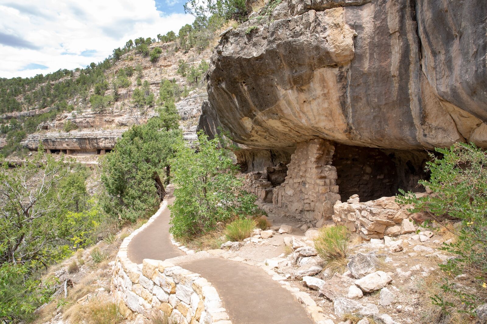
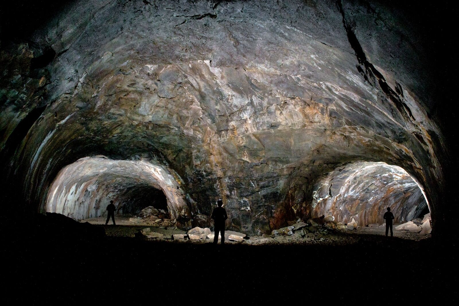
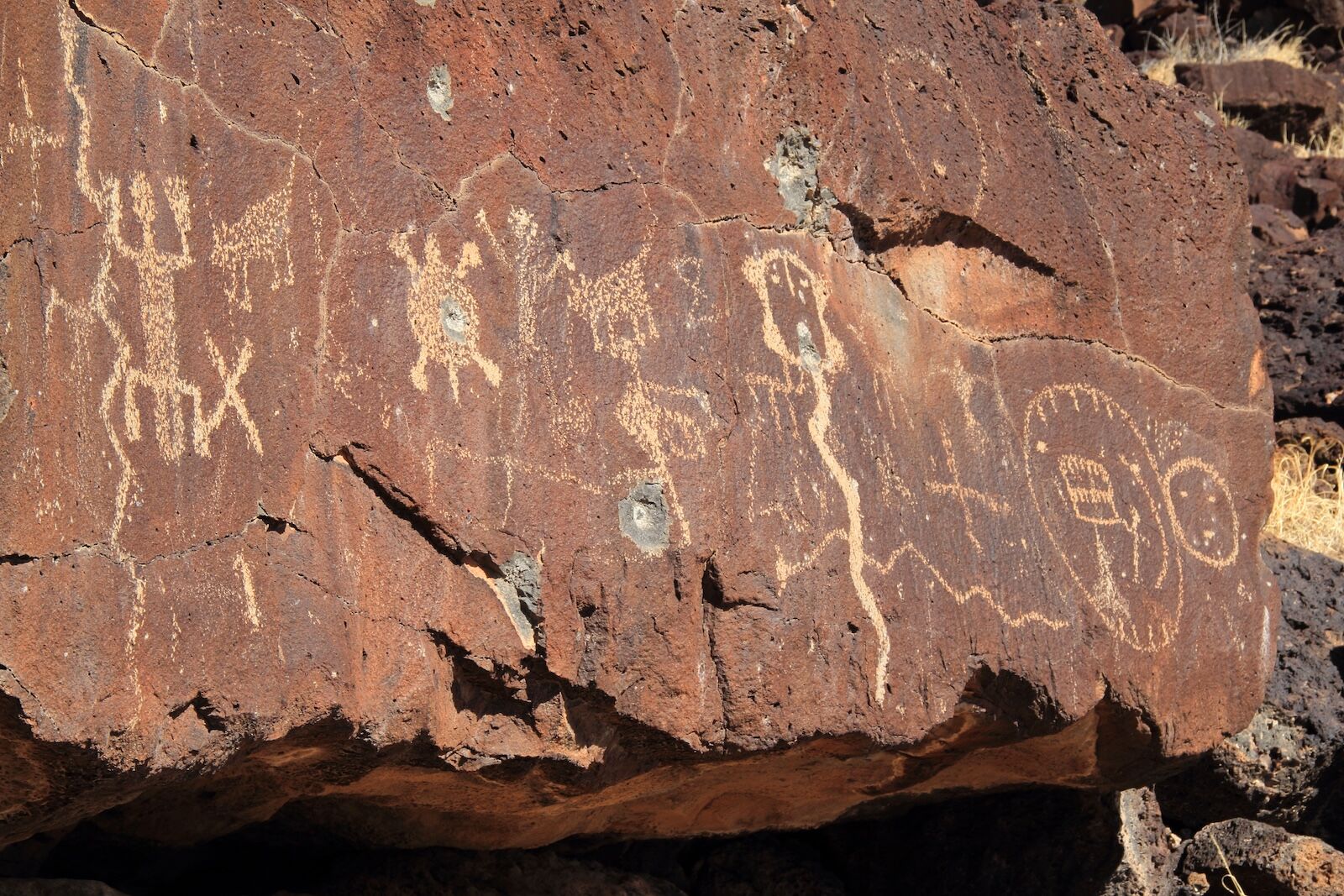
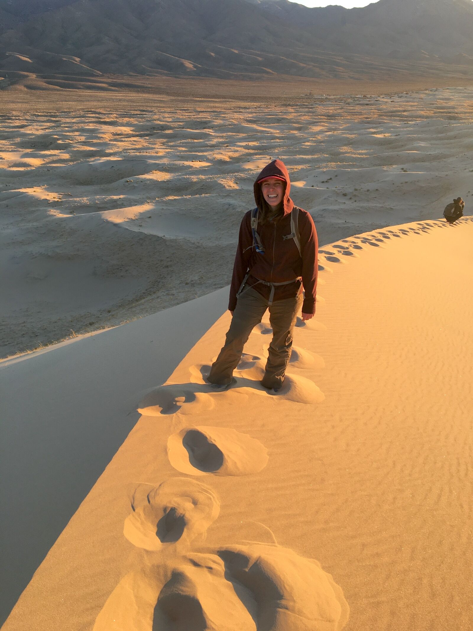
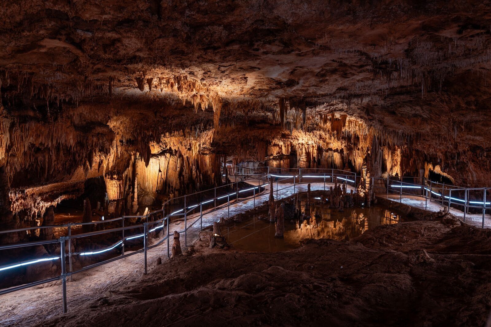
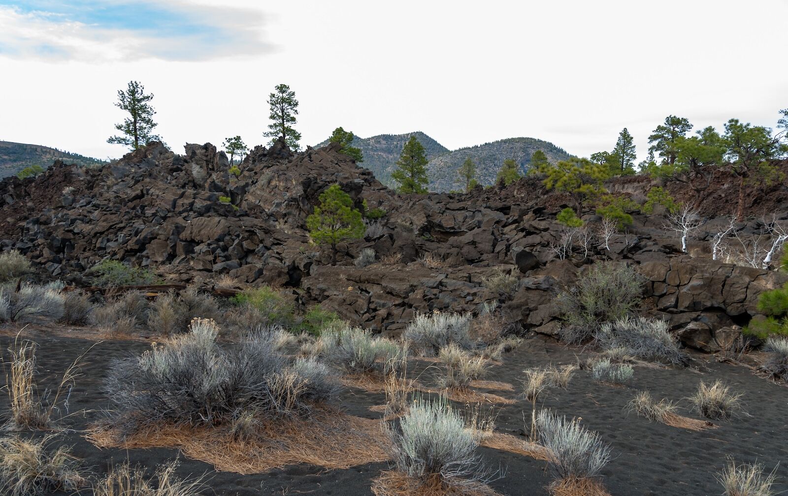
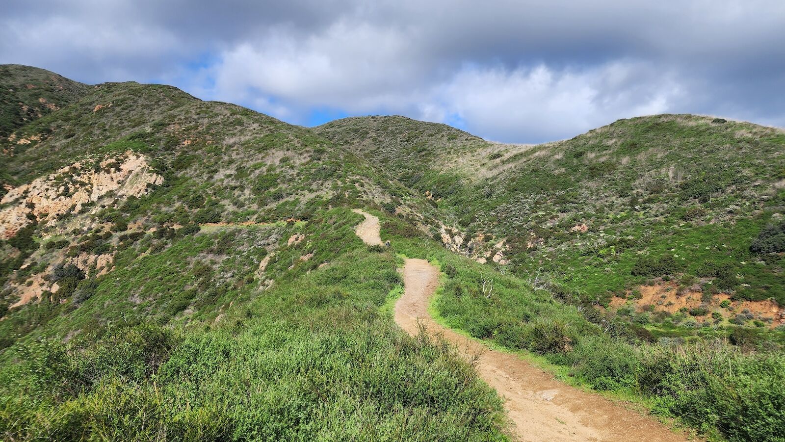
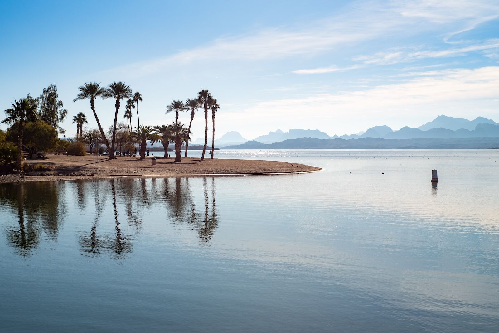
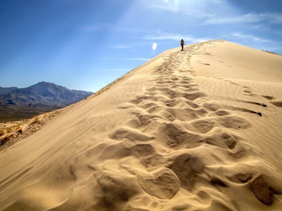
But the Mother Road, as they call it, also has roadside attractions that are much bigger — literally. The road stretches for more than 2,400 miles, coming close to absolutely sprawling stretches of protected lands. From the Midwest to the Pacific, it passes caves, canyons, lava fields, mountains, and deserts, many of which are now national parks, state parks, or national forest lands. And many are just a short detour from the highway. In fact, some of the parks sit directly on Route 66, so you’ll be visiting them just by driving the road.

These state and national parks reveal a different version of Route 66. It’s one where you trade kitsch for cliffs, motels for trailheads, and parking lots for places that will make you pull out your camera to take photos of pure natural beauty, rather than the usual retro Americana. Here are nine unique parks you’ll want to add to your Route 66 itinerary.

Walnut Canyon National Monument (Arizona)

parks near route 66 - walnut canyon

Photo: Traveller70/Shutterstock

  • Detour off Route 66: 5 miles
  • Entrance fee: $25 per car (cash not accepted)
  • Address: 3 Walnut Canyon Road, Flagstaff, Arizona 86004

Just outside Flagstaff, Walnut Canyon preserves a series of alcoves cut from natural limestone that were homes for the region’s Sinagua people between about 1100 and 1250 CE. The dwellings are built directly into the canyon walls, and many are still clearly visible today, with overhangs that protect them from weather and erosion.

The main hike is the Island Trail, a 1-mile loop that drops about 185 feet into the canyon via steep steps. Along the route, you pass about 25 cliff dwelling rooms, many just a few feet off the trail. It’s a short hike, but the elevation and the climb back out make it more strenuous than you’d expect. Budget about 1-2 hours for the hike alone, and bring everything you’ll need. The closest place to get water is the Island Trail visitor center, and there’s no place to refill while hiking. The trail closes every day at 4 PM, so plan accordingly.

Indiana Dunes national and state parks (Indiana)

best parks near route 66 - indiana dunes

Photo: Indiana Dunes National Park/Public Domain

  • Detour off Route 66: +/- 30 miles
  • Entrance fee: $25 per car
  • Address: 1215 N State Road 49, Porter, IN 46304

Indiana Dunes National Park sits along the southern shore of Lake Michigan, protecting about 15 miles of coastline with a mix of beaches, wetlands, forests, and some of the tallest sand dunes in the Midwest. You’ll find multiple short trails that pass through very different landscapes within a small area. It’s just east of Chicago, so plan to visit before you start your Route 66 drive.

The most popular stop is the Dune Succession Trail at West Beach, where a short and steep climb leads to views over Lake Michigan and the surrounding dunes. Other options include Mount Baldy (one of the tallest dunes in the park) and flatter shoreline trails if you want something easier. In warmer months, the beaches are open for swimming, making it one of the few Route 66 stops where you can actually get in the water.

Most people spend a few hours here, either hiking or heading straight to the beach. Trails are well-marked, but bring water and snacks. Climbing the dunes can be a lot more tiring than you might think.

Lava River Cave (Arizona)

lava river cave arizona

Photo: Michael Landrum/Shutterstock

  • Detour off Route 66: 14 miles
  • Entrance fee: Free
  • Address: Forest Road 171B, Flagstaff, AZ (no formal street address)

Lava River Cave is a lava tube in northern Arizona’s Coconino National Forest. It formed around 700,000 years ago when the flowing lava hardened on the outside and the non-hardened lava continued to seep out. It left an underground tunnel about three-quarters of a mile long, making it the longest known lava tube in the state. It’s open to the public and anyone is welcome to walk in it without a guide or reservation (though some precautions are necessary).

Unlike developed cave parks, there are no lights or railings. Parking is fairly close to the cave, which has uneven terrain that requires some scrambling. The ceiling height varies quite a bit, so watch your head and consider bringing a helmet, as you may need to crouch in some areas.

The cave often is only reachable by snowshoes in winter and stays at a year-round temperature between 35 and 45 degrees Fahrenheit, so it feels like walking into a refrigerator. Read up on the requirements to visit in advance, and make sure you have at least two sources of light.

Petroglyph National Monument (New Mexico)

parks near route 66 - petroglyph

Photo: William Silver/Shutterstock

  • Detour off Route 66: 8 miles
  • Entrance fee: Free
  • Address: GPS Lat: 35.139 GPS Long: -106.711, Albuquerque, NM 87120

Petroglyph National Monument is one of the most unique historical parks off Route 66, with signs of human creativity and culture that go back thousands of years. It’s home to more than 20,000 images carved into volcanic rock by Indigenous peoples and early Spanish settlers centuries ago, almost all of which you can see via a few relatively short hikes. From the visitor center, you have to drive a few minutes to one of three canyon trail areas: Boca Negra Canyon, Rinconada Canyon, or Piedras Marcadas Canyon.

The petroglyphs at Boca Negra Canyon are easiest to see, requiring just a quick 15-minute walk. Rinconada Canyon is about a 2.5-mile loop where you can spot art on canyon walls as you hike, and the 1.5-mile trail at Piedras Marcadas Canyon is the least-developed, but has the most petroglyphs.  You can pick up maps and info at the self-serve station at the park visitor center, where there’s also a small gift shop (open only when staffing allows).

Mojave National Preserve (California)

parks near route 66 - mojave

Photo: Mojave National Preserve /Public Domain

  • Detour off Route 66: +/- 20 miles
  • Entrance fee: Free
  • Address: 90942 Kelso Cima Rd, Essex, CA 92332

As Route 66 moves into California, it skirts the bottom edge of one of the largest protected desert areas in the US: Mojave National Preserve. It protects 1.6 million acres of dunes, lava tubes, volcanic craters, and dense Joshua tree forest. It’s quiet, dramatic, and usually empty, with long stretches where you might not see another person for miles. Perhaps needless to say, the stargazing is amazing.

The Kelso Dunes Trail is a standout trail in the park. It’s only about three miles roundtrip but it’s tough, as you’ll be hiking on sand where every step sends you a little bit backward. But at the top, you’ll have sweeping, 360-degree views across the 45-square-mile dune field. Sometimes, you can even hear an unusual humming sound caused by the extremely dry sand shifting and vibrating. And if conditions are right, the dunes can actually “sing”—a low, rumbling sound created when dry sand shifts and vibrates beneath your feet as you walk or slide down.

The park is a real departure from the rest of Route 66 if you’re driving from the east. Instead of roadside kitsch and historic towns, you get nearly endless desert without crowds, development, or flashing neon signs.

Onondaga Cave State Park (Missouri)

  • Detour off Route 66: 7 miles
  • Entrance fee: Free, with a fee for tours
  • Address: 7556 Highway H, Leasburg, MO 65535

Onondaga Cave State Park sits just south of Route 66 in central Missouri and is one of the easiest places along the route to do a full, guided cave tour. The park protects two major caves: Cathedral Cave and Onondaga Cave; the latter is a National Natural Landmark.

Tours leave from the visitor center and follow paved, lit walkways through the caves, making it accessible for most beginner hikers. The main Onondaga Cave tour is just under a mile long and takes about 1 hour and 15 minutes, with opportunities to see an underground river that runs through the cave. Cathedral Cave tours run about 90 minutes and are slightly more strenuous as they have a short uphill area. Temperatures inside stay around 57 degrees Fahrenheit year-round, so bring a layer even in summer. Tours are seasonal and can fill up, especially on weekends, so it’s worth making a reservation in advance if you know you want to stop. However, if space allows, you can buy walk-in tickets. Tours cost between $15 and $32 per person.

Sunset Crater National Volcanic Monument (Arizona)

best parks near route 66 - sunset crater

Photo: Sergey Demo SVDPhoto/Shutterstock

  • Detour off Route 66: +/- 15 miles
  • Entrance fee: $25 per car (includes Wupatki National Monument)
  • Address: 6400 N US Hwy 89, Flagstaff, AZ 86004

Sunset Crater Volcano National Monument preserves a landscape shaped by an eruption that was relatively recent, at least on a geological timeline. This volcano erupted around 1085 CE and covered the area in lava and ash. Today, visitors can hike through black lava flows, cinder fields, and pine forest, with the cone of Sunset Crater rising above the landscape.

The primary trail most people check out is the Lava Flow Trail, a 1-mile loop across hardened lava. It’s a relatively easy walk through an otherworldly landscape, with jagged basalt rock, piles of other volcanic rock, and views of the actual crater. There’s also the longer Lava’s Edge Trail, at 3.4 miles, in case you want something a little longer.

While you’re here, it’s worth it to swing by and check out nearby Wupatki on the same loop drive. There’s not much shade and no services, so bring plenty of water (and anything else you’ll need).

Santa Monica Mountains National Recreation Area (California)

santa monica mountains hiking trails

Photo: Alia Ollikainen/Shutterstock

  • Detour off Route 66: 19 miles
  • Entrance fee: Free
  • Address: 26876 Mulholland Hwy, Calabasas, CA 91302 (King Gillette Ranch Visitor Center)

Santa Monica Mountains National Recreation Area covers about 150,000 acres of protected land just outside Los Angeles, making it one of the largest urban national parks in the world. It’s just north of the Santa Monica Pier, where Route 66 official ends, making it an excellent add-on if you want to spend another day or two near the coast. Depending on where you are in the park, you’ll find everything from coastal views to rolling hills to dramatic canyons.

The park has more than 500 miles of hiking trails, with options ranging from short canyon hikes to the length of the Backbone Trail, which stretches for 67 miles along the mountains. Also popular are hikes in Solstice Canyon, with a small waterfall and historic ruins, and the hike to Escondido Falls, one of the tallest waterfalls in the area (managed as part of the abutting Escondido Canyon Park). A lot of famous movies and TV shows have filmed in the park at Paramount Ranch, and while it’s been damaged by wildfires, you can still see where many of the sets from your favorite Hollywood hits once stood (and are being rebuilt).

There’s also a busy schedule of ranger-led programs and public events like guided hikes and seasonal wildflower-viewing events. You can’t camp in the federally managed sections of the park, but the state-managed sections have multiple options for frontcountry or hike-in camping. You can also stay in hotels in Thousand Oaks or Santa Monica and be just a quick drive from the park entrances.

Lake Havasu State Park (Arizona)

like havasu arizona

Photo: Sara Gordon/Shutterstock

  • Detour off Route 66: 17 miles (from I-40)
  • Entrance fee: $20 per car
  • Address: 699 London Bridge Rd, Lake Havasu City, AZ 86403

Lake Havasu State Park is one of the best places along Route 66 for a true beach break, with a wide, sandy shoreline on the Colorado River and clear water. Unlike most parks along Route 66, this one is purpose-built for swimming, with swim areas, gradual entry into the water, and plenty of space to spread out on the sand. Just note that some areas of the lake have a rocky bottom, so water shoes can be helpful.

The main spot for swimming is Windsor Beach, and the water stays relatively warm. It also has picnic tables, some shady covered areas, restrooms, and showers, making it easy to spend a few hours or an entire afternoon there. You can also rent on-site cabins, tent camp, or take out everything from kayaks to jet skis for a few hours. Reservations for almost everything in the park are available on the Arizona State Parks website.

Discover Matador

Save Bookmark

We use cookies for analytics tracking and advertising from our partners.

For more information read our privacy policy.