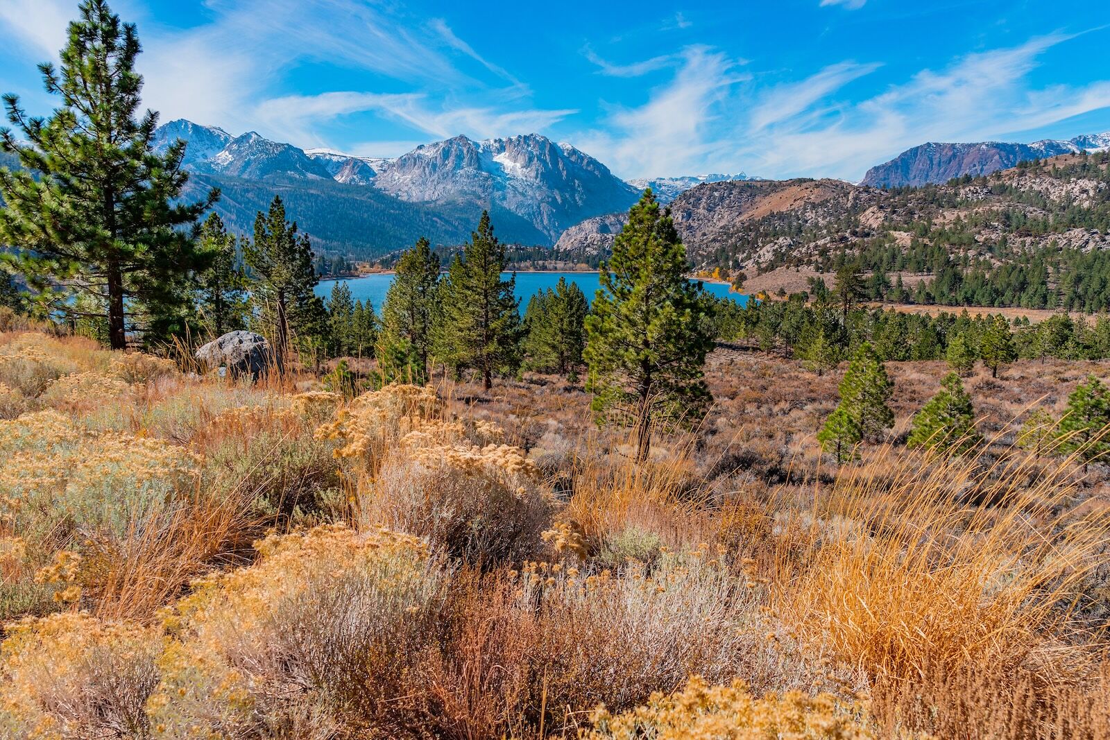
The East side of the Sierra Nevada is most often considered as the host to distinct destinations along Highway 395: the 14,505-foot Mt. Whitney towering above the town of Lone Pine, Bishop for its rock climbing, Mammoth Mountain for skiing, and maybe even Bridgeport if you’re a fan of summertime rodeo or hot springs. All too often, the 395 is considered a prettier detour alternative to Highway 5, providing a more scenic vista out of the windshield on the way from Los Angeles to Lake Tahoe. The miles inbetween resorts or trailheads for outdoor recreation are simply sped by at 65 miles per hour. It is exactly this fast-paced place hopping that makes the Eastern Sierra one of the last best places in the western United States for finding solitude, nature, and community just off the asphalt. As a local to Lake Tahoe, this is where I escape from the summer and autumn crowds to find groves of orange aspens, clean flowing creeks, and wonders of nature and history, all without a soul in sight, allowing for a slowing down of the pace of life, right in tune with the seasonal change towards winter.
Bikepacking Lake Tahoe to Mammoth Lakes Showcases the Sierra Nevada's Best Small Towns
Finding a few days away from the Lake Basin alongside my partner, Kenzie, and pups meant planning a trip that could simultaneously include mountain biking, hiking, dog-friendly camping, and the opportunity to experience local communities along the way. In the end, we landed on my personal favorite form of travel – the credit card bikepack. Beginning in South Lake Tahoe, I’d ride my way along interconnecting single track and old dirt roads, loaded down by little aside from the water and snacks I’d need for each 30-to-50-mile segment, as well as a radio for communicating with home base – our Subaru Outback loaded with the rest of the family who would go for hikes at my end destinations until I caught up.
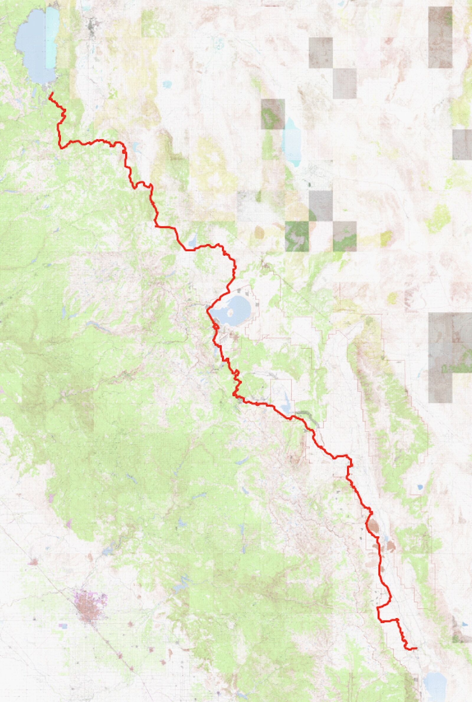
The route the author biked from north to south, beginning near Lake Tahoe and ending in Mammoth Lakes. Map courtesy Dillon Osleger
Each segment of bike touring from Tahoe to Mammoth was planned according to my primary interests and obsessions in life: geology and history, with specific attention afforded to experiencing autumns changing hues across the Sierra, not to mention intersecting with a few of my favorite local haunts. While I savored the solitude found out on the “East Side,” I couldn’t help but see the joy in the eyes of local shop owners and waitresses as I rolled up on my mountain bike and support their economy through the purchase of baked goods, coffees, homemade beef jerky, or my 3rd hamburger of the day. If encouraging a slower version of tourism found in bikepacking can bring economic opportunity to these small towns, I can certainly bear to share a few lines across maps and landscapes that have taken some time and experimentation to put together. This was my route along what promised to be an incredible and unique journey from Tahoe to Mammoth, testing the course for an interconnected trail network bridging the two regions.
South Lake Tahoe to the 395
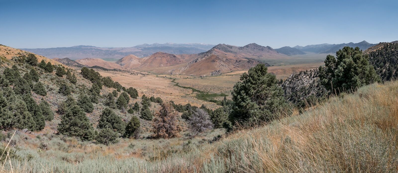
The view from Leviathan Peak. Photo: Remo Nonaz/Shutterstock
Beginning at the lake shore, I rode my Specialized Epic Evo up the Armstrong Trail outside South Lake Tahoe towards the eastern crest of the Sierra Nevada Mountains. Linking together a series of alpine single track including Horse Meadows Trail across Carson Pass led to old dirt roads in Hope Valley first used by the 1884 John C. Fremont expedition across California, all of which set up a 3,000-foot descent down granite slabs and rarely traveled deep soil between aspen groves towards Grover Hot Springs State Park and the town of Markleeville. A short stop at the general store, which provides a microwave for frozen burritos bought on sight, as well as a fresh natural spring across the street, made for a welcome respite. From town, the Carson River sits just over the road’s edge as the grade of climbing inches ever skyward. Long stretches of six percent grade allow for a slow winch up and over Monitor Pass, where sagebrush covered hills break off into views over the great plains of Nevada.
Double track en route. Photo: Dillon Osleger
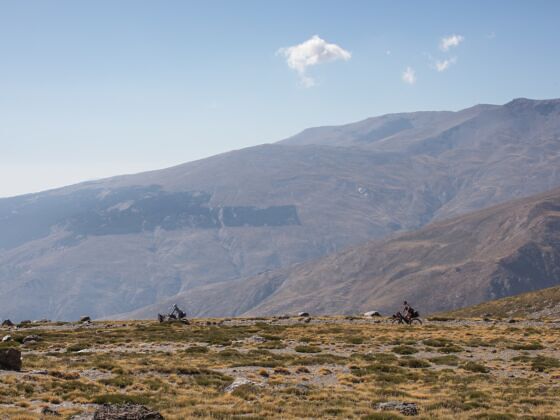
Down dirt double track alongside the last stretch of Highway 89 from Leviathan Peak, a split off into Slinkard/Little Antelope Wildlife Area allows for an avoidance of Highway 395, providing a remote and scenic entrance into the lonely outpost of Walker. At the far edge of town a stop at Walker Burger is obligatory, settling stomachs for a night spent in the next town over – Bridgeport. Finding ourselves trapped between the western views of jagged Eastern Sierra peaks cast under setting sunlight and Easterly foothills blanketed in alpenglow, it took a fair amount of willpower not to book an extra night in this small hamlet known for hot springs, backcountry skiing, fly fishing, and cattle ranching.
The East Side – Bridgeport to Mammoth
June Lake. Photo: Patricia Elaine Thomas/Shutterstock
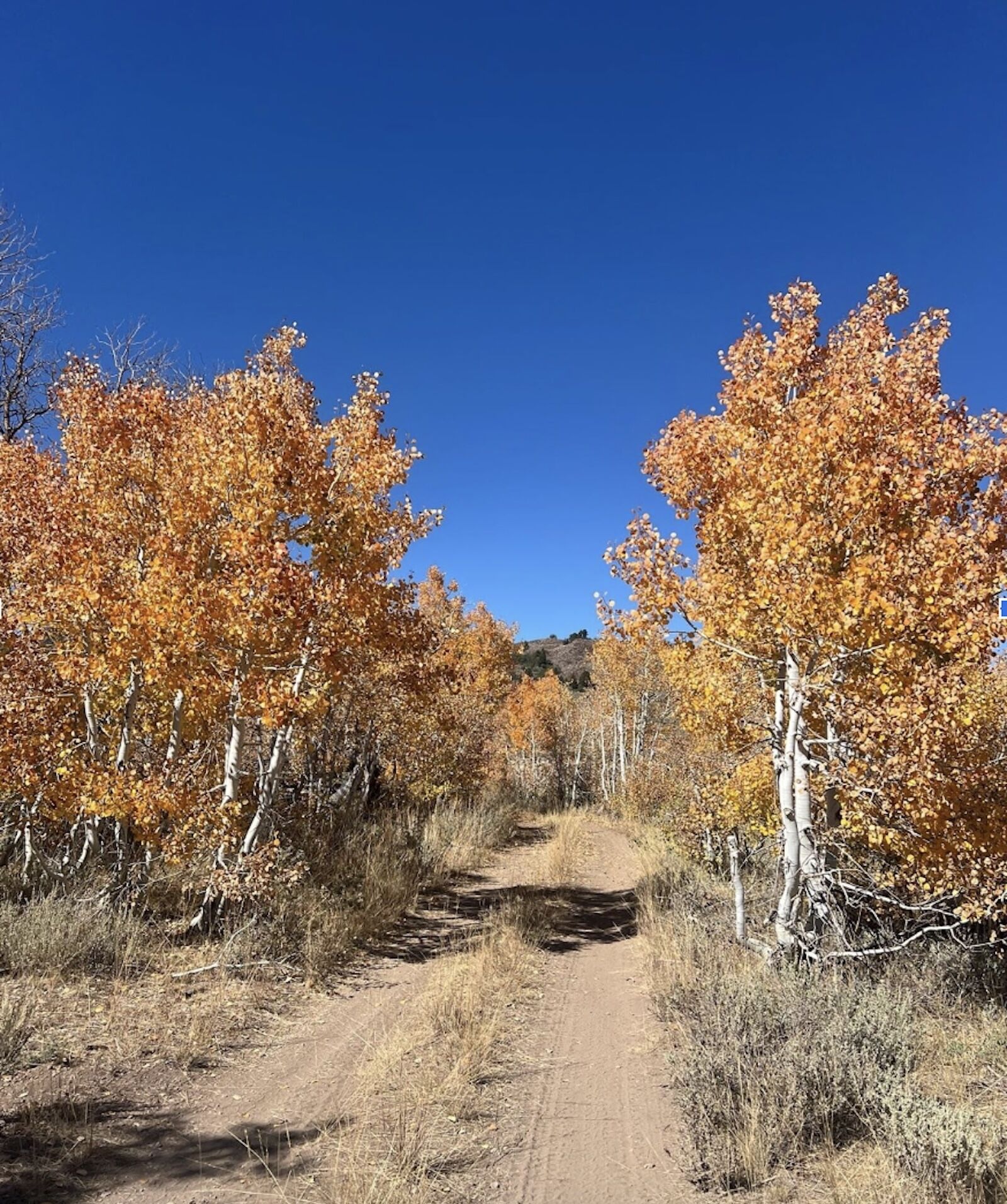
Much of the trip’s elevation had come and gone with the descent off of the Sierra towards the Great Basin, but thankfully a gentle decline in topography along with copious historical context, geologic wonder, and enviable local bakeries remained along the latter half of this route. Wrapping around the moderate slopes east of Bridgeport, dirt roads originally hewn by oxen train lead to old mines, namely those of Bodie – the epicenter of gold extraction in the early 1800s – which now stands as a state historic park preserving the since abandoned township. Passing through places and times forgotten to the south, around the dry shore of Mono Lake and into Lee Vining offered reprieve in wild fruit trees, something the entirety of the Eastern Sierra was once known for before the draining of its waterways for the expansion of Los Angeles.
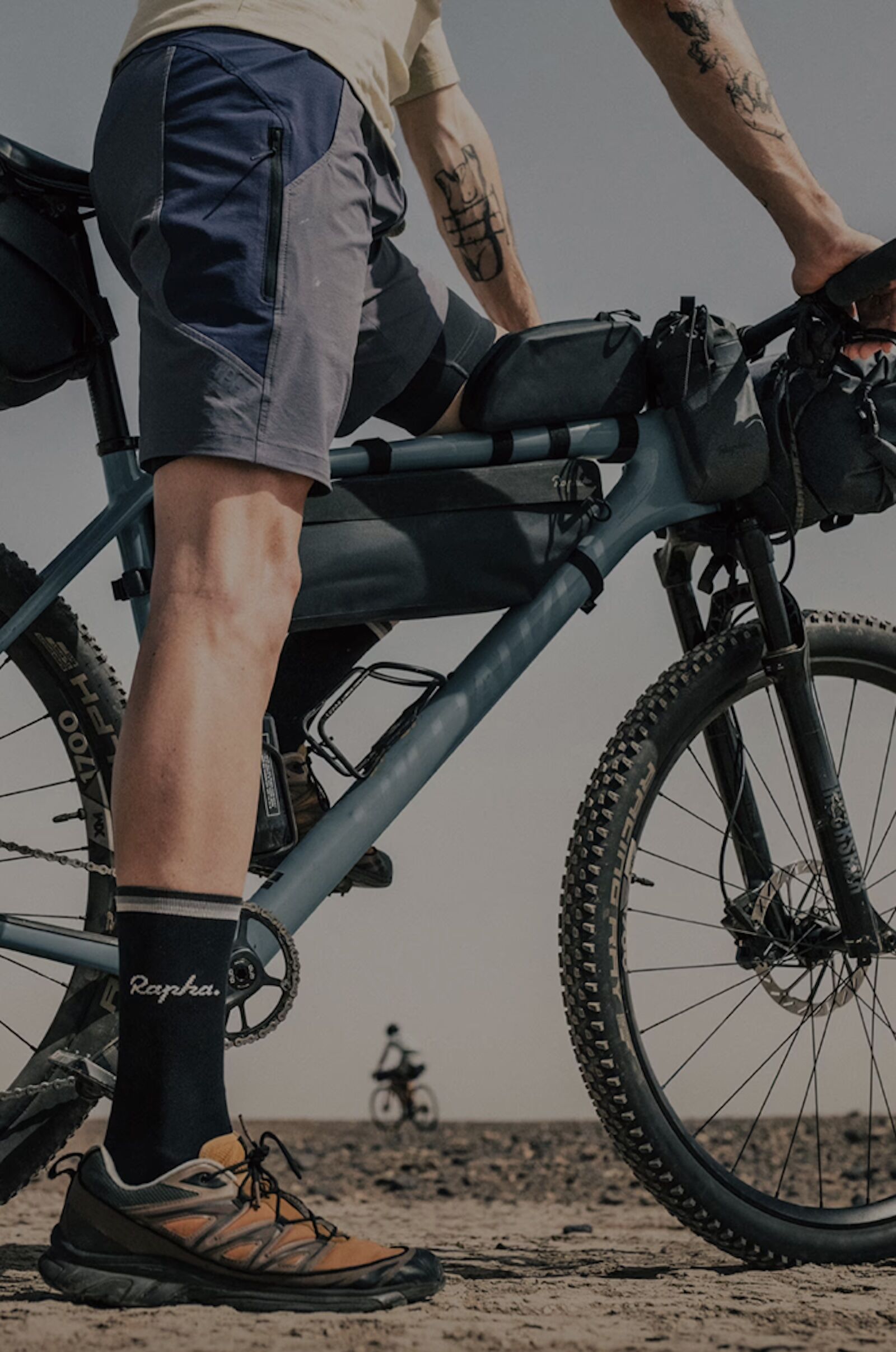
The bike setup. Photo: Dillon Osleger
As if to cement this legacy shift in landscape and economic fortunes, the beginning of LA’s aqueduct is found along dirt paths just south of town, bordering the roadway up and into Yosemite National Park. Riding along the creeks and canals that initiate the headwaters of this hydrologic project presents a positive note in pre-established right of ways through property of any ownership. It is this system of gravel roads and single-track trail that wind through June Lake, around the obsidian domes, volcanic post piles, and craters of historic landmarks, and into the resort town of Mammoth Lakes. A last stretch of parallel bike path or trail (pick whichever suits your fancy or fatigue at this point) lands tires at the village center, where time of day can determine next steps post bike packing: coffee, burritos, a stiff whisky or a dip in the river, to celebrate the end of this epic ride. ![]()