The idyllic town of Boulder, Colorado, is a haven for nature lovers and outdoor enthusiasts. Perfectly positioned at the edge of the Rocky Mountains, it’s home to spectacular natural scenery and miles upon miles of hiking trails to help you explore it. Here are four of the best day hikes to tackle during your time here, all within easy reach of the central Pearl Street Mall.
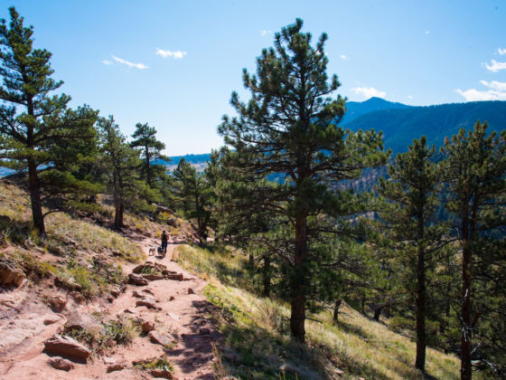
Photo: Sidra Monreal Photography/Shutterstock
The Four Most Exhilarating Day Hikes in Boulder, Colorado
1. Mount Sanitas
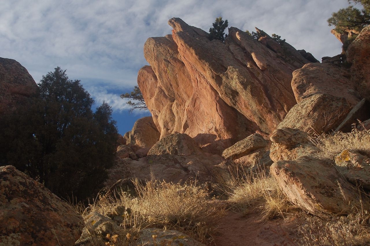
Photo: Steve Boice/Shutterstock
This popular peak on the edge of town is a great place to begin your Boulder hiking adventure. It’s easily accessible, and the trails are well-signposted, well-maintained, and dog-friendly. Mount Sanitas offers a roughly three-mile loop up to the 6,863-foot summit and back, with stunning views out over Boulder to the east and the snow-capped peaks of the Rockies to the west. The route has an elevation gain of around 1,300 feet, so expect to put in some effort!
To begin with, head north up the wide, gravel-covered Sanitas Valley Trail. This gentle, one-mile section is the perfect warm-up, especially if you’re not used to living at altitude. At the end of this path, turn left onto the 0.7-mile East Ridge Trail. This is where it gets interesting. The route becomes much steeper and rockier, and you’ll be doing a bit of scrambling on your way up. It’s nothing too technical, but do watch your footing — especially if climbing in cold weather, as it can get icy. Once you reach the summit you’ll be rewarded with panoramic views both east and west.
For the descent, follow the Mount Sanitas trail to the south, which will bring you back to the trailhead in a mile and a half. The red earth path is steep and rocky (although not as much as the East Ridge Trail) and sparsely lined with pine trees. Near the end you’ll also pass some designated bouldering areas popular with local climbers. Be on the lookout for wildlife, too, as bears and mountain lions are occasionally seen in the area.
Getting there: Several trailheads access Mount Sanitas, but the most convenient one for this hike is on Sunshine Canyon Drive, about a 20-minute walk from the Pearl Street Mall.
2. Royal Arch
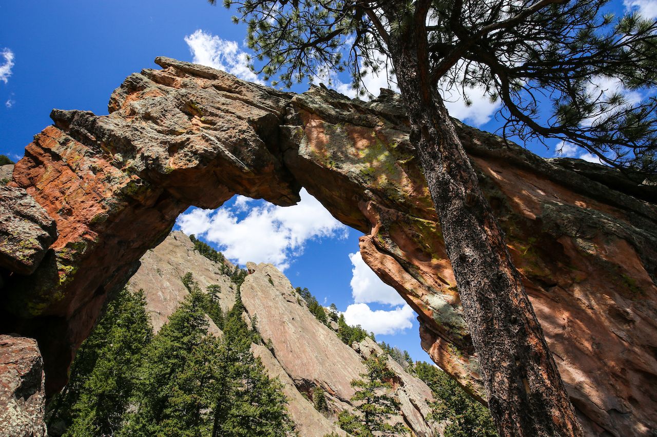
Photo: Steve Boice/Shutterstock
To the south of Boulder is a vast, breathtakingly beautiful area known as Chautauqua Park. It’s home to a large network of hiking trails that meander across grassy meadows, through towering pine forests, and up into the rugged mountains. One of the most interesting of these routes is the Royal Arch Trail.
Equal parts challenging and rewarding, this out-and-back trek takes you to a natural archway of sandstone that appears dramatically from between the trees and other rock formations. Once you pass through it, you’re treated to sweeping views of southeast Boulder.
But first you have to get there. This trail is not for the faint-hearted; it’s very steep in places, with loose stones underfoot and some technical spots where you’ll need to use your hands to climb up or down the rocks. The surrounding forest provides shelter though, and you can make use of plenty of rest spots along the route.
Around halfway up you’ll reach the false summit of Sentinel’s Pass. From here, you’ll climb down again before a final steep push up to the arch itself. Dogs are welcome on the trail, but it’s advisable to keep them on a leash, particularly when you reach the arch — because there’s a steep drop just the other side of it.
The total route length varies between 3.2 and 3.9 miles, depending on which access trails you take through Chautauqua, with around 1,500 feet of elevation gain. It’s a popular hike, so go on a weekday if possible to avoid the crowds. And keep an eye out for the adorable chipmunks scampering around the archway.
Getting there: Chautauqua Park is about a 30-minute walk from the Pearl Street Mall. Limited parking is available.
3. Flagstaff Mountain
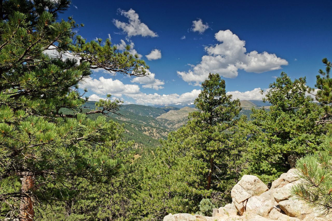
Photo: AlexBuess/Shutterstock
Standing proudly on the outskirts of town at 7,283 feet, Flagstaff is the fourth highest mountain in Boulder. It’s possible to hike directly from the town to the peak, which is a roughly 5.5-mile route there and back with around 1,500 feet of elevation gain. If that sounds a bit too strenuous, you can drive (or take an Uber/Lyft) part or even all of the way to the top and just enjoy strolling along the easier trails around the summit.
Assuming you want to hike the whole thing, you’ll first head up Viewpoint Trail to Panorama Point. As the name suggests, this route gives you great views out over Boulder right from the start, thanks to the rolling grassland and low density of trees. From here keep heading uphill on Panorama Trail and then Flagstaff Trail. You’ll cross the road that leads up the mountain numerous times, so be watchful of traffic as you go.
The higher you climb, the more forested the route becomes. The path isn’t technical, although it is steep in places. A couple of other paths branch off from the main one, but ignore them and stick with Flagstaff Trail. When you reach the summit you’ll find a wide area with plenty of picnic benches, which makes a perfect lunch spot.
Those who drive up or are looking to extend their hike can explore other paths that snake around the summit area. The Range View Trail has fantastic views of the Rockies, while the Sensory and Ute trails offer gentle forest walks suitable for all abilities. Dogs are welcome on all of Flagstaff’s routes, with the exception of the Boy Scout trail.
Getting there: The trailhead for this hike can be accessed via Arapahoe Avenue, which is about a 20-minute walk from the Pearl Street Mall.
4. The Flatirons
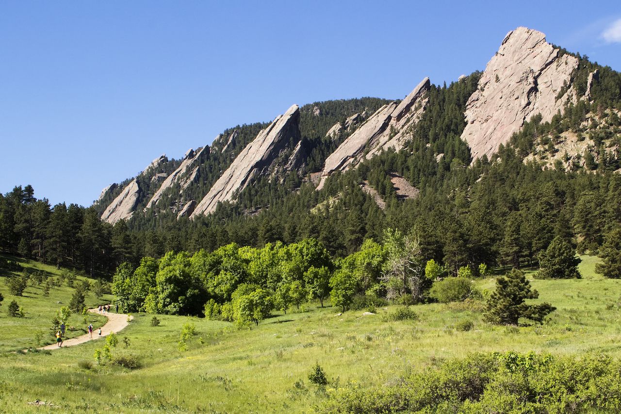
Photo: Nelson Sirlin/Shutterstock
No trip to Boulder would be complete without hiking the town’s iconic Flatirons. These striking shards of slanted rock have become the ubiquitous symbol of Boulder, gracing everything from clothing to business logos, and Chautauqua Park is the gateway to exploring them.
Begin by heading through the network of paths in the meadow and up into the forest, where you’ll find the start of the out-and-back 1st/2nd Flatiron Trail. It’s another popular route, both with hikers and climbers, so weekdays are the best time to tackle it. In total, the hike is about 2.5 miles with 1,400 foot of elevation gain, so you’ll be getting a good workout. Canine friends are welcome but should be kept on a leash.
The path takes you through groves of pine trees and across sloping masses of bulky rock fragments. The trail is well maintained, but do take care as there are plenty of loose rocks to navigate. As you ascend, you’ll get within touching distance of the characteristic striated sandstone of the first and second Flatirons. You can even climb them if you have the equipment.
As you cross the second Flatiron, keep an eye out for the impressive sight of the third Flatiron further along, jutting majestically up into the sky. The trail then continues through a series of switchbacks up to a flat area behind the top of the first Flatiron. Here you’ll find plenty of large boulders and shelves in the rock where you can have lunch. The view extends west as far as the eye can see, over the distant peaks of Colorado’s epic Rocky Mountains.
Getting there: Chautauqua Park is about a half-hour walk from the Pearl Street Mall. Limited parking is available. ![]()