If you’ve heard anyone talking about a trip to Iceland, you’ve likely heard them speak in a string of superlatives: the most beautiful, the cleanest water, the most geothermally active, the best hikes. But you don’t have to get deep into remote Iceland to experience these amazing natural features. Reykjavík, meaning “smoky bay” in Icelandic for the steam that rises from the ground, is an ideal hub for exploring many of Iceland’s diverse and wildly beautiful landscapes. Here is a collection of seven spectacular day hikes you can do if you are based in the world’s northernmost capital city.
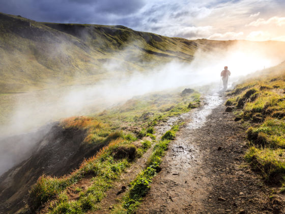
Photo: Alexey Stiop/Shutterstock
7 Spectacular Day Hikes From Reykjavík
Before you go
Icelanders love to tell visitors that if they don’t like the weather, just wait five minutes. Weather systems can move fast here. One moment it’s sunny and the next it’s raining sideways. Bring an umbrella only if you want to make the locals laugh as you struggle with it in the relentless wind.
You’ll need layered clothing, including a good wind and waterproof jacket, and we recommend bringing a pair of waterproof pants along on hikes. Trails in Iceland can be rough and strewn with sharp lava rocks, so make sure you wear sturdy hiking boots. While you’re at it, bring gloves and a hat, even when visiting in the summer. The trails below are all best visited from May to September.
1. Mount Esja
Round-trip hike: four miles
Distance from Reykjavík: six miles
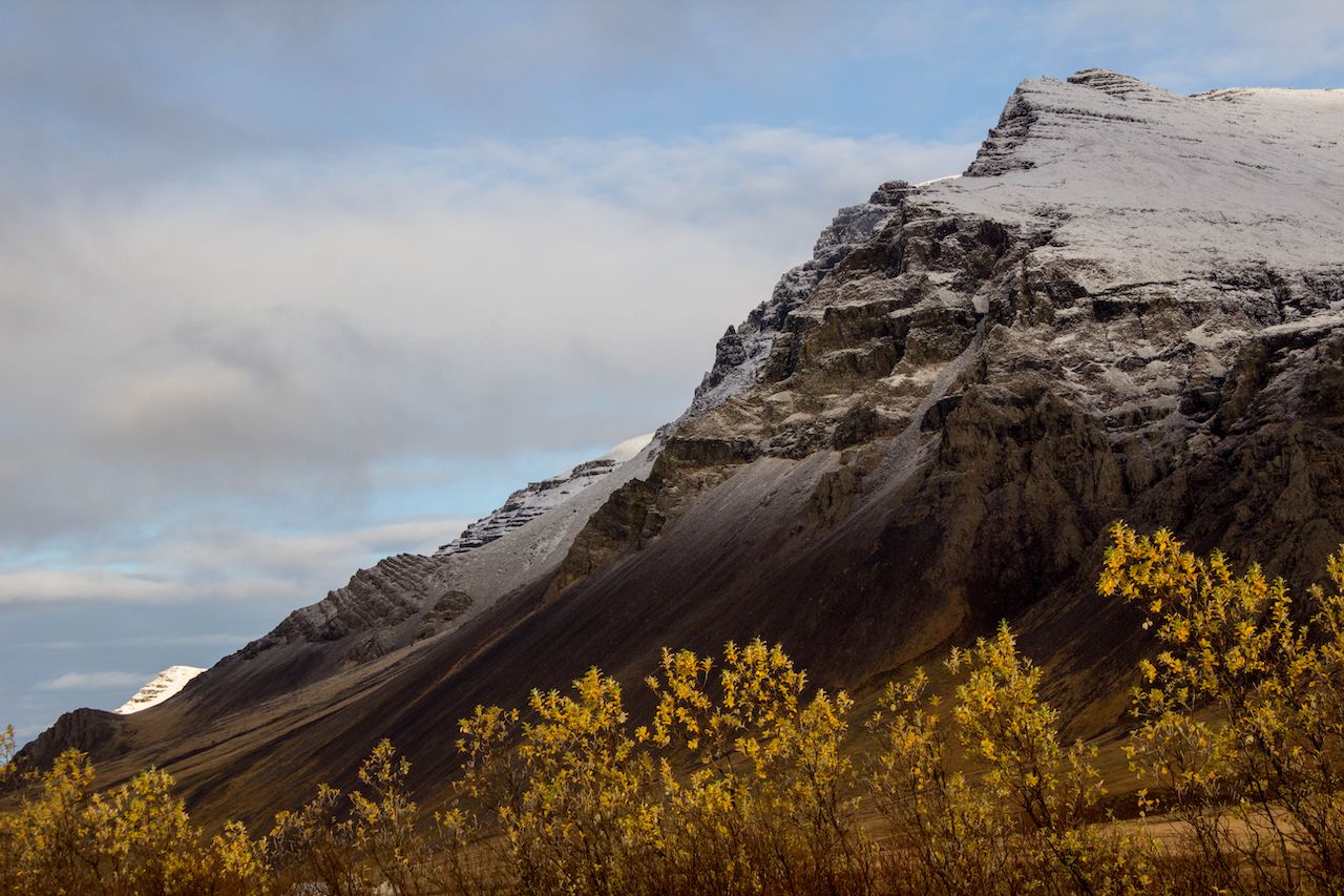
Photo: Agatello/Shutterstock
To really know Reykjavík, you’ve got to hike Esja. Viewable to the north from anywhere in the city, Esja is the long, flat-topped mountain range across the bay. There’s a reason this is the most popular trail in Iceland — in fewer than 20 minutes from downtown Reykjavík, your boots can be on the ground, making their way up to Steinn, a large stone marking the traditional turnaround point of the trail. The views from Steinn over Reykjavík are magnificent, especially on a clear day.
The trailhead is located about six miles north of Reykjavík on the ring road (Route 1). Look for the sign for the parking lot. At the trailhead you’ll find a sign showing all the possible routes you can take and their difficulty, but keep in mind that all routes are steep. One popular route takes you first through a forest of birch trees, which is a lovely thing to find Iceland — where many native forests were lost after humans arrived a thousand years ago.
Most hikers spend two to four hours here and will be comfortable with the four-mile, round-trip hike up to Steinn. More experienced hikers may want to continue on the rocky trail to the summit, which is nearly 3,000 feet above sea level. Don’t attempt this trail in poor weather or snow. After your hike, perhaps duck in to the Esjustófa Café near the trailhead for a snack.
2. Búrfellsgjá
Round-trip hike: four miles
Distance from Reykjavík: 10 miles

Photo: Neja Hrovat/Shutterstock
Búrfellsgjá isn’t frequented by many tourists, yet, but locals love to do this easy hike just a few miles southeast of Reykjavík. Here you’ll walk for two miles through an ancient lava channel up to the old volcanic crater. From there you’ll have expansive views over the lava canyon and nearby Heiðmörk Nature Reserve. Return the way you came. Búrfellsgjá is a great introduction to Icelandic volcanic landscapes, and you just might start to understand why over half of all Icelanders believe that elves make their homes in ancient lava flows.
Búrfellsgjá is located adjacent to Heiðmörk Nature Reserve just south of Reykjavík near Hafnarfjörður. The parking lot for the trail is on Heidmerkurvegur (Route 408). From downtown Reykjavík, take Route 40 toward Keflavík. At Vífilsstaðavegur make a left. Continue for two miles where it turns into Elliðavatnsvegur. Follow it for another 1.5 miles until you reach Heidmerkurvegur and make a left. The parking lot will be on your right after another two miles. Cross the road to get to the trail. Plan on spending two to three hours here.
3. Keilir
Round-trip hike: 4.5 miles
Distance from Reykjavík: 25 miles
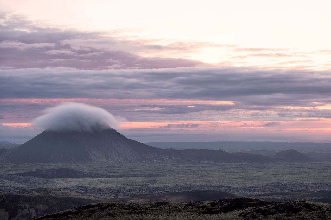
Photo: Johann Helgason/Shutterstock
As soon as you land in Iceland’s Keflavík airport, Keilir demands your attention. It’s that striking cone-shaped mountain in the distance. You’ll likely compare its shapeliness to Mt. Fuji, but unlike Fuji, summiting Keilir can be managed in a three-hour, round-trip hike. On a clear day you can see the ocean, a glacier, steam clouds rising from the nearby Blue Lagoon, and the city of Reykjavík from the summit.
Keilir is volcanic in origin but not a volcano itself. Rather, it was formed during the last ice age during an eruption under a glacier. You’ll likely find the hike to be moderately strenuous with about 1,300 feet of elevation gain in all. You should have a 4×4 vehicle to get to the Keilir trailhead as the gravel road can be quite uneven and bumpy. From the main road between Reykjavík and Keflavík Airport, take the exit toward Route 420 and follow the signs for Keilir. There is a parking lot at the trailhead. I recommend pre-booking a visit to the Blue Lagoon to follow your hike.
4. Reykjadalur
Round-trip hike: 4.4 miles
Distance from Reykjavík: 31 miles
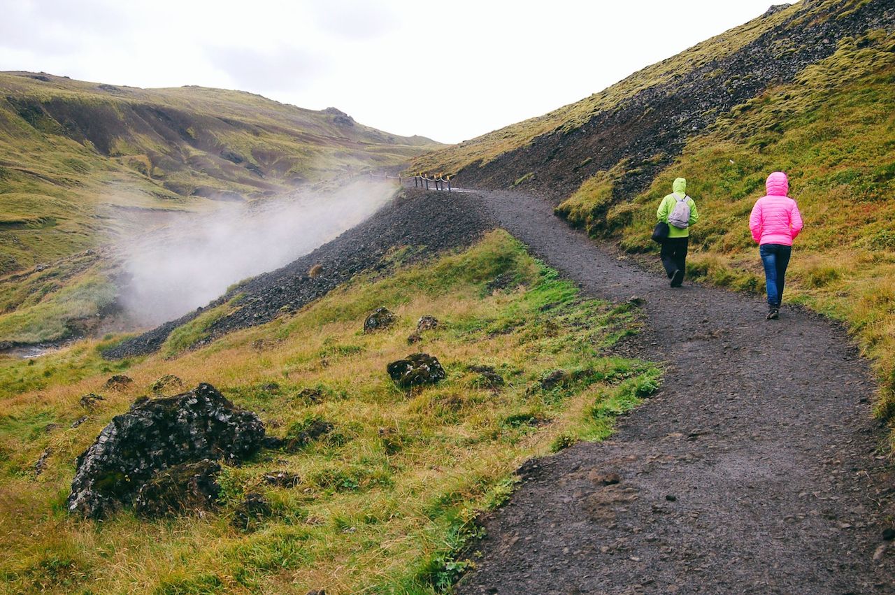
Photo: Ksusha Dusmikeeva/Shutterstock
Reykjadalur is a place where you can quite literally immerse yourself in one of Iceland’s most fascinating geothermal landscapes. The hike winds through a colorful valley dotted with hot springs, mud pots, steam vents, and, best of all, a thermal river. Bring a bathing suit and towel with you because you’ll want to break up your hike with a warm soak.
The Reykjadalur trail takes about an hour to hike each way. It’s a popular place these days so you’ll likely see plenty of other people relaxing in the water. Be careful to test the temperature before getting in; typically the water is hotter the higher up the trail you go.
Getting to the trailhead is easy. Follow the ring road (Route 1) south out of Reykjavík for about 29 miles to the town of Hveragerði. Make a left at the traffic circle here and follow the road until you see a sign for the Reykjadalur parking area. Expect to spend about three hours here. I also recommend visiting the Geothermal Energy Exhibition at Hellisheiði geothermal power plant either before or after your hike. It is located just off the ring road, about 10 miles before Hveragerði.
5. Glymur Waterfall
Round-trip hike: four miles
Distance from Reykjavík: 71 miles
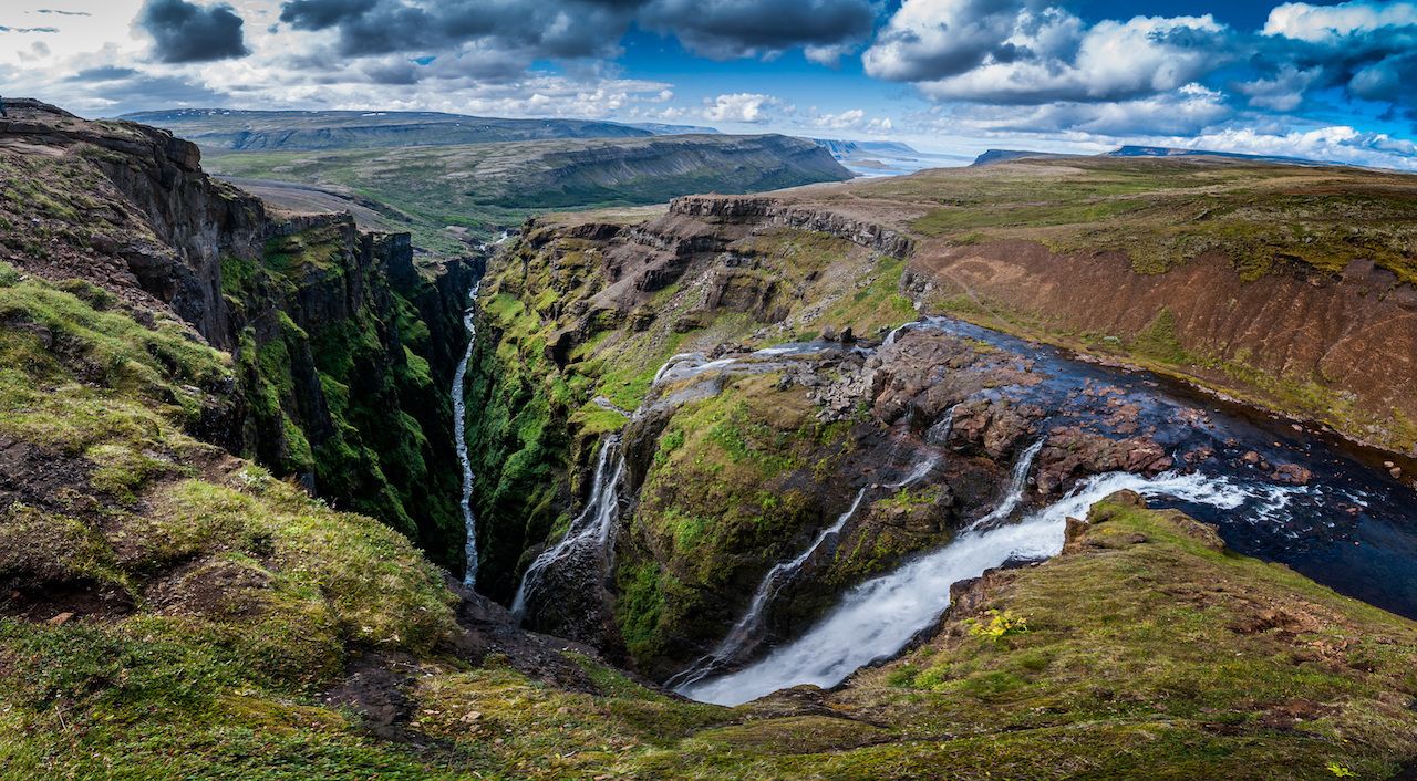
Photo: MikeDrago.cz/Shutterstock
Glymur is Iceland’s second-tallest waterfall and nothing short of dramatic. On this hike you’ll cross a river and then follow the steep trail along a deep, mossy canyon as white Arctic fulmars soar beneath you. Before long, the silver thread of Glymur will come into view at the head of the canyon, a breathtaking scene. It’s your choice to either return the way you came or continue to the top to cross the river again and come down the north side of the canyon. You should only attempt this hike during the summer when a log and hand-line are set up to assist hikers with the river crossing.
The parking lot for Glymur is a little over an hour from Reykjavík. Follow the ring road north and turn right on Route 47 at Hvalfjörður just before the tunnel. Drive to the head of the fjord where you’ll see a sign on your right for Glymur. Bring a pair of water shoes or sandals for wading in the river and a pair of trekking poles for balance. The water level will depend on how rainy it’s been. If you decide to follow the trail all the way to the top and return via the north side, the total hike is about four miles. Expect to spend three to four hours here.
6. Landmannalaugar
Round-trip hike: Varies
Distance from Reykjavík: 113 miles
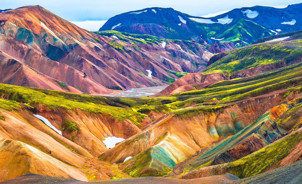
Photo: Oleg Senkov/Shutterstock
Jaw-dropping is the best way to describe the rhyolite mountains of Landmannalaugar, a remote region in the Icelandic highlands. It looks like Dr. Seuss painted it with watercolor — a kaleidoscope of greens, pinks, reds, and oranges liberally striped with black lava and white snow. You can choose your own hiking adventure on arrival; you’ll find several options on the signs posted at the visitor center. Start with the easy 2.7-mile Laugahraun loop and then either try another trail or soak in the natural geothermal pools near the visitor center.
Landmannalaugar is the northern terminus of the world-famous Laugavegur Trail. People typically take three to four days to hike the entire 33.5-mile-long trail and must pre-book campsites or mountain huts long before they travel. Coming here for a day hike allows you to see one of the most beautiful parts of the trek with a lot less time and planning.
Getting to Landmannalaugar is an adventure in itself. To do it on your own, you should ideally have a 4×4 although most cars could make it if the weather is good. Take Route 1 south from Reykjavík then turn left onto Route 26 after Selfoss. This becomes F26 after a while. Eventually you’ll turn right onto Route F208 and that will take you all the way to the parking lot.
Alternatively, a variety of outfitters in Reykjavík offer day tours with transportation, and Reykjavík Excursions and Sterna Travel run round-trip shuttle buses daily from June to September. Pre-book your tickets. You should expect to spend 12-14 hours total to do this day trip, half of that time driving. It’s worth it.
7. Þórsmörk Nature Reserve
Round-trip hike: Varies
Distance from Reykjavík: 93 miles
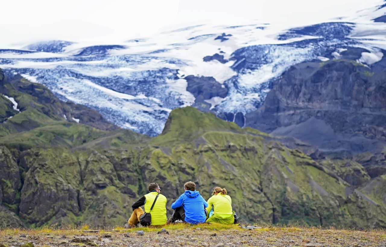
Photo: natalia_maroz/Shutterstock
My friends in Iceland tell me that visiting Þórsmörk will add five years to your life — its beauty and serenity are just that powerful. Þórsmörk, meaning “Thor’s forest,” is a region of the southern Icelandic highlands characterized by glacial river valleys, mossy birch forest, and craggy peaks. You can choose from a variety of well-marked trails of varying difficulty to explore when you arrive, all promising incredible views. Note that the Þ (Thorn) is pronounced like “Th,” and you may find it written that way on some websites.
Whereas Landmannalaugar is the northern terminus of the world-famous Laugavegur trek, Þórsmörk is its southern counterpart. And just like Landmannalaugar above, doing Þórsmörk as a day trip from Reykjavík is an ideal way to see one of the best parts of this trail without doing much pre-planning.
The thing about Þórsmörk is it’s tough to get to on your own. You’d need a sturdy 4×4 vehicle with high clearance to cross a couple of rivers on the way. So, I recommend booking either a guided tour or independent transportation from one of the many tour companies in Reykjavík. I like Sterna Travel’s independent tour because they give you six hours to explore on your own before returning to Reykjavík. The drive is four hours each way, so plan on being away from your hotel for a total of 15 hours. ![]()