California has some of the country’s most dramatic vistas — but between high inland temperatures, coastal fog, and crowds of tourists, it can be difficult to enjoy them in the summer. Fall brings cooler temperatures in the mountains, so you can hike comfortably, even in the middle of the day. Along the coast, fall also means the end of the fog that can make summer days gray and gloomy. And everywhere you go, from beaches to state parks to national parks, there are fewer crowds. Fall is simply the best time to explore California — here are six spectacular hiking spots to check out.
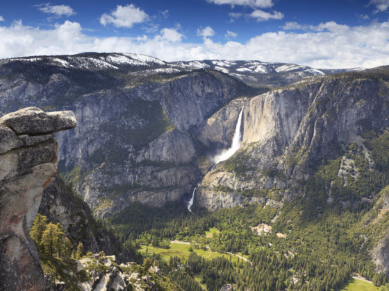
Photo: Sasha Buzko/Shutterstock
The 6 Most Stunning Places to Hike in California This Fall
1. Coastal Trail to Flint Ridge Camp, Prairie Creek Redwoods State Park
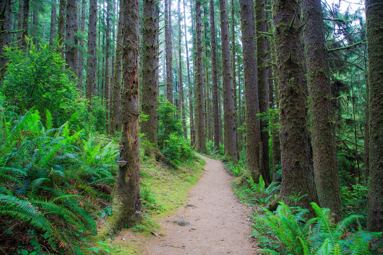
Photo: Radoslaw Lecyk/Shutterstock
If you want to experience California’s beautiful redwood trees in solitude, this hike offers some untouched old-growth stands without the crowds that spoil some of the most popular hikes. The trailhead is near Marshall Pond by the mouth of the Klamath River — about three and a half miles from the town of Klamath. The trail starts in alder and spruce before reaching the magnificent old-growth redwoods.
After two miles of uphill, you’ll reach the ridge and then descend to Flint Ridge Campground, where you can hear the Pacific Ocean surf. There’s an unofficial trail that leads to the water, but it’s steep and overgrown and not recommended. Bonus for fall: Blackberries grow in abundance near the pond.
Details: 9.2 miles; 1,520-foot elevation gain
2. Wright’s Beach to Goat Rock Beach, Kortum Trail, Sonoma Coast
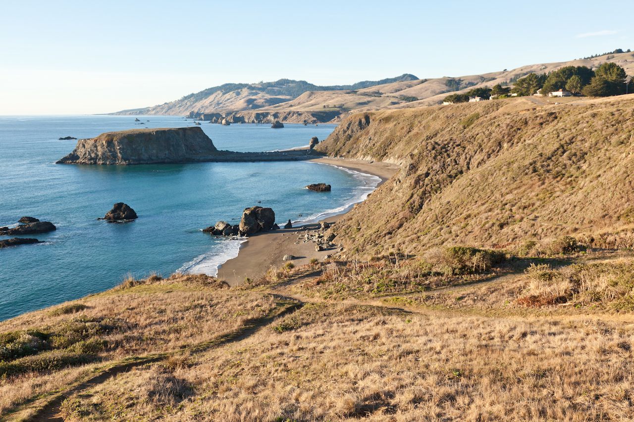
Photo: Mariusz S. Jurgielewicz/Shutterstock
This hike along the Sonoma Coast is high in drama but low in elevation gain. Start at Wright’s Beach, just over six miles north of Bodega Bay, and walk north across the top of the bluff over a double plank-wood walkway. You’ll see the ocean the entire time, as well as many stunning rock formations, including a giant offshore arch at Blind Beach.
The plank trail ends at Goat Rock Beach, and you’ll need to walk along the sand to continue north. There’s no swimming due to heavy surf and rip currents; however, you’ll see lots of seals, birds, and possibly even otters — but, despite the name, no goats. Just a short distance past Goat Rock you can see where the Russian River meets the Pacific Ocean in Jenner, California.
Details: Nine miles round trip; 900-foot elevation gain
3. Rubicon Trail, D.L. Bliss State Park
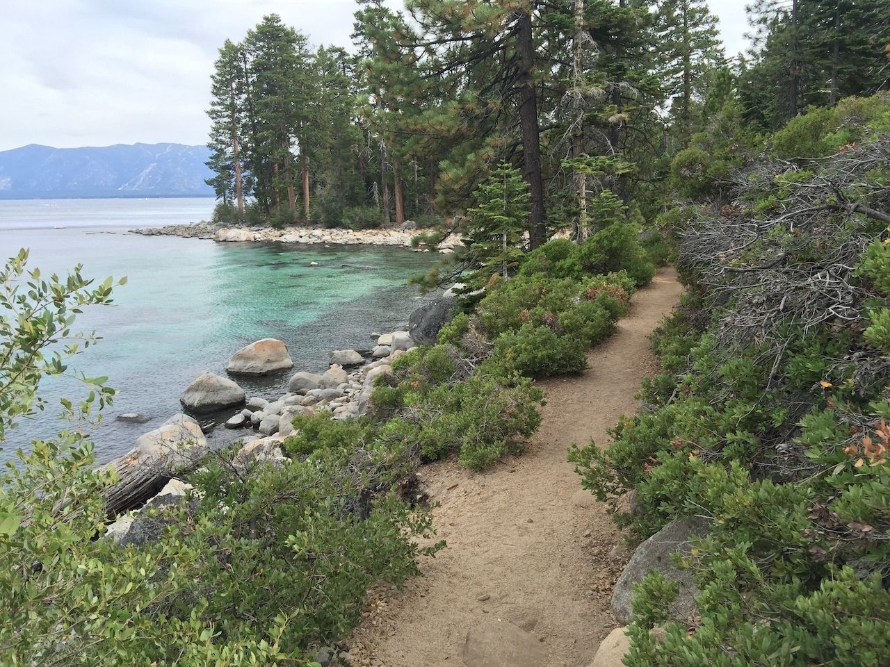
Photo: AJ9/Shutterstock
The Rubicon Trail offers sweeping views of Lake Tahoe and the surrounding area without a big elevation gain. The trailhead starts from the parking lot at Calawee Cove at D.L. Bliss State Park. The first half-mile runs along the top of steep cliffs that drop into some of the deepest water in the lake. In the early fall, watch for courageous locals who arrive by boat to use a precariously placed rope swing.
As you continue south, you’ll see osprey nests, rock formations, and turquoise coves. At almost four miles, you’ll reach Emerald Bay and the much-photographed Fannette Island — the only island in Lake Tahoe. Note that if the park road is closed, you can still access the trail. It’s two miles downhill from the D.L. Bliss Visitor Center or one mile downhill from the Emerald Bay parking lot.
Details: Nine miles round trip; 400-foot elevation gain
4. Alamere Falls, Pt. Reyes National Seashore
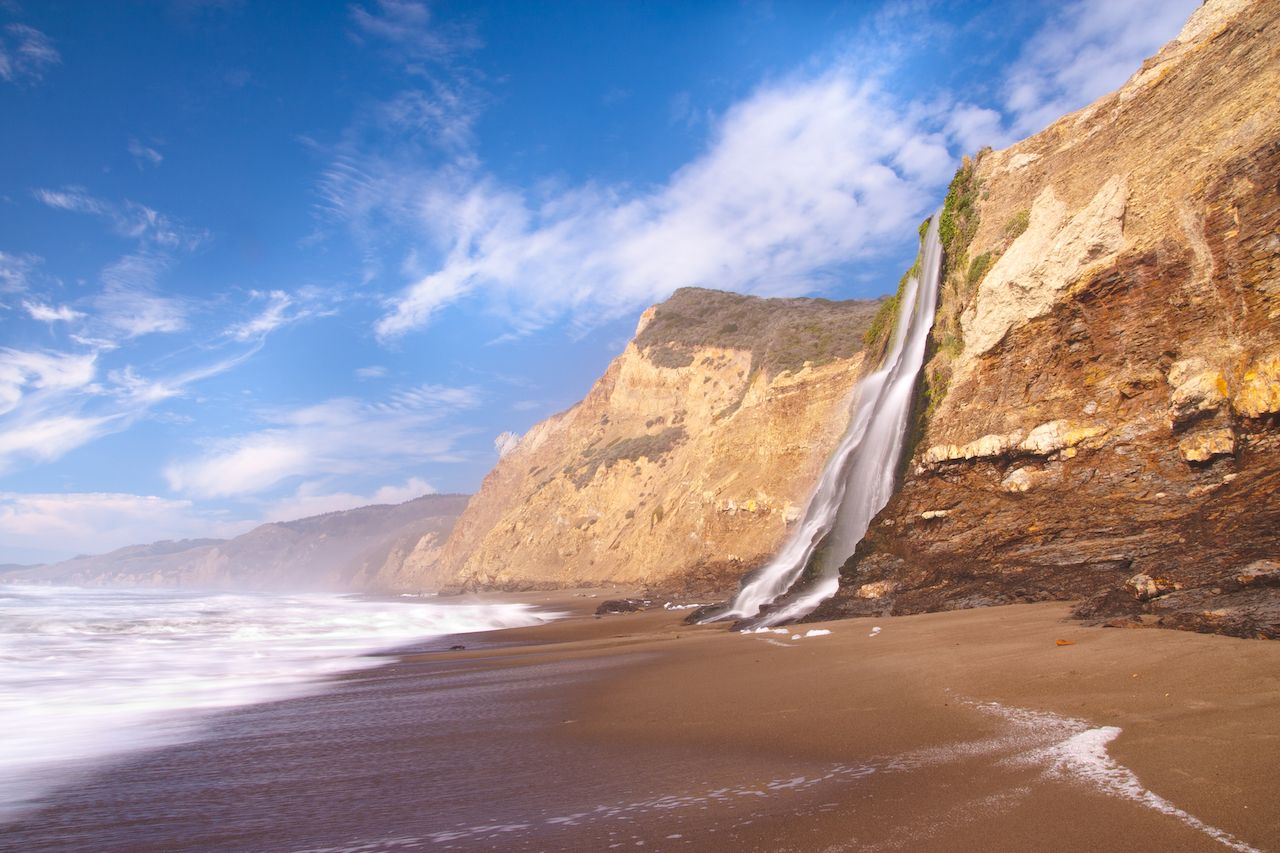
Photo: Radoslaw Lecyk/Shutterstock
This popular Bay Area hike starts from the Palomarin Trailhead at the end of Mesa Road just outside the town of Bolinas, and it ends with one of the state’s few coastal waterfalls. Water cascades over a 30-foot cliff onto the south end of Wildcat Beach. The trail offers expansive ocean views and passes by two lakes; the lake even comes complete with a rope swing.
On a clear day, you can even see the Farallon Islands. Be careful not to miss the rock arrow on the ground that marks the trail to the falls about four miles in. There’s a little climbing required at the end, so be careful if the rocks are wet.
Details: 8.8. miles round trip; 1,300-foot elevation gain
5. Four Mile Trail, Yosemite National Park
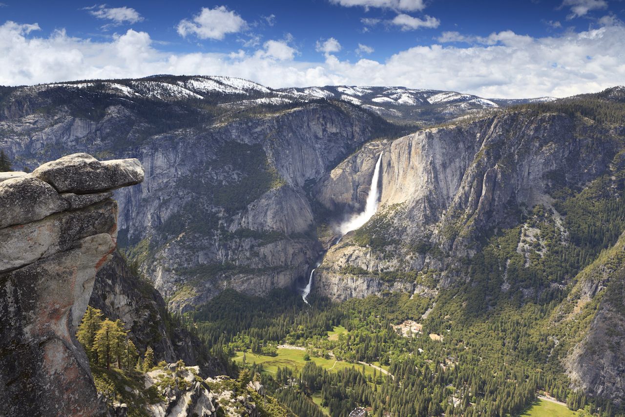
Photo: Sasha Buzko/Shutterstock
This hike literally climbs up the wall from the Yosemite Valley floor to Glacier Point, with a continuous and very steep grade. For the first mile you walk through trees, but after that you’ll experience open vistas, so you can see all of Yosemite’s famous sights.
Yosemite Falls is directly across the valley; it won’t be at its peak strength in the fall, but it’s still beautiful. You can also see Half Dome and El Capitan; bring binoculars if you want to try to spot the rock climbers. The hike finishes at a visitor’s center at Glacier Point where you can get snacks and ice cream, which you’ll definitely be hungry for. You could take a shuttle down, but you’ve earned the downhill, so you might as well enjoy it.
Details: 9.6 miles round trip; 3,200-foot elevation gain
6. Soldier’s Loop Trail and Moro Rock, Sequoia National Park
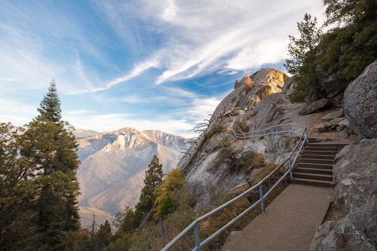
Photo: FiledIMAGE/Shutterstock
This hike offers unforgettable vistas without a huge elevation gain, but don’t be fooled by the pavement at the beginning. It isn’t appropriate for children or anyone with mobility issues. Start from the Giant Forest Museum and go clockwise to get the uphill out of the way early. After a 300-foot elevation gain within the first half mile, the path will be relatively flat until you reach the turnout for Moro Rock.
You’ll see many sequoias and dogwoods, which will be crimson in the fall. Near the end of the loop, take the short side trail and climb up 350 steps to the top of Moro Rock. With the narrow trail — at times only wide enough for one person — and metal railings at the top, this trail is particularly challenging for anyone who’s afraid of heights. At an elevation of 6,700 feet, the top offers panoramic views of the Great Western Divide.
Details: 4.5 mile loop; 700-foot elevation gain ![]()