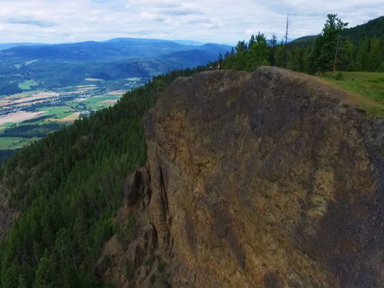
THE ENDERBY CLIFFS give hikers one of the best views in BC’s Okanagan-Shuswap region. They rise up around 1000 feet for commanding panoramas over the valley. The trail is part of the Enderby Cliffs Provincial Park and is well maintained, although care needs to be taken as the path does veer close to the cliff’s edge. There’s lots to see and do in the area as well, being close to cities like Salmon Arm and Vernon. Nearby Shuswap Lake is an excellent option for recreational boating and swimming, and is very popular for houseboat vacations.
How to get there
Enderby is a beautiful 5-hour drive northeast of Vancouver, and the trailhead for Enderby Cliffs is easily accessible from the town. Head east out of downtown Enderby following signs for Mable Lake. Around 2 km after crossing the Shuswap River (you’ll be on Mable Lake Road), turn left onto Brash Allen Road. At a fork about 1.4 kms after the turn, stay right and drive on an unpaved road about 1.6 km to the parking lot and the trailhead.