The first time I hiked Iceland’s 35-mile Laugavegur Trail — one of the most popular in the country and listed by National Geographic as one of the most beautiful in the world — was around two decades ago. It was a spontaneous decision, based on the realization that I could include it in my 2003 book Waking up in Iceland — a profile of the country’s prolific music scene that had steadily expanded into a travelog.
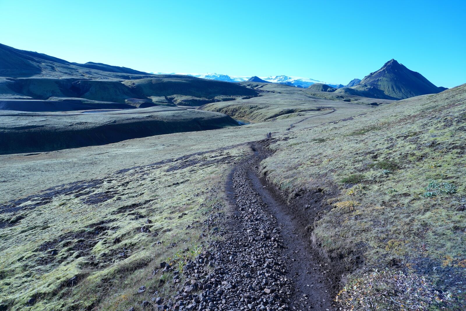
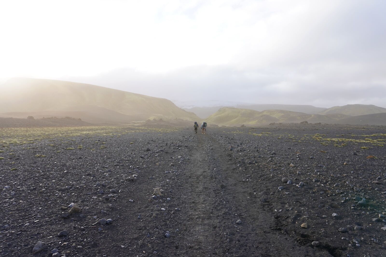
The next morning is sunny, too. Whoop! Everyone in our hut is up early, making breakfast and preparing for the day ahead. We set off with our backpacks to begin the 7.5 miles of the first stage; not so long, but generally regarded as the toughest section due to many steep climbs that combine to take us to an overall elevation of 1640 feet.
Camera Roll: A 5-Day Hiking Trip Through the Heart of the Icelandic Highlands
Truth be told, I had no idea about serious hiking back then. I pretty much just walked in what I had been wearing around Reykjavik while interviewing musicians: jeans, tee-shirts, and a heavy, non-waterproof jacket. I bummed a pair of hiking boots and a backpack that I panic-filled with heavy tins of fish and jars of pasta when I learned last-minute that there was no food en route. I also had to wade the trail’s glacial rivers barefoot because, obviously, I hadn’t done any proper research and hadn’t known about them. I honestly don’t know how I survived, but I did, and it blew my mind so much that I vowed one day to do it again.
An opportunity finally presented itself this year — it was time to finally make good on my past effort. I’ve learned a lot in the intervening years and this time I was accompanied by a friend, clad in technically appropriate clothing, carried a much lighter pack loaded with dehydrated food, and even bought a fancy pair of water shoes for the river crossings (my memory couldn’t erase the screams). If anything, this second time around felt even more mind-blowingly diverse than I remembered. The weather played ball for the most part, and the four days passed in a glorious and otherworldly parade of rhyolite mountains, fields of twinkling obsidian, geothermal springs, snow-capped glaciers, endless lava meadows, and stretches of black sand — ending in the leafy embrace of the forested area known as Þórsmörk.
Combined with some superb side-hikes to glaciers and gorges, I managed to almost double the trek to 60 miles, and was still quietly devastated when it ended. As before, I made use of the trail’s cabins along the way, which are all owned and maintained (as is the trail itself) by the wonderful team at Ferðafélag Íslands, the Iceland Touring Association. The huts are basic but have everything you need — hot water, heating, toilets, other hikers — and there are camping grounds at each one if you prefer to tent.
Although the trail is located deep in the highlands, it’s easy to get to and from during the hiking season (roughly between late-April and mid-September, approximately), thanks to bus companies such as Reykjavik Excursions, which took around 3.5 hours to get me to the starting point of the hike at Landmannalaugar, and runs services back to the capital from Þórsmörk.
The entire trail is so well marked it seems almost impossible to get lost but occasional memorials along the route testify to how easy it can be to succumb to a tragic mix of bad luck and bad weather if you’re not careful; heavy fog or a snow blizzard can change everything in an instant, and these can occur in summer so be sure to follow the rules at all times. Other than that, definitely don’t forget your camera…or your wading shoes. ![]()
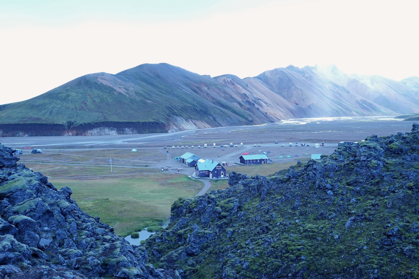
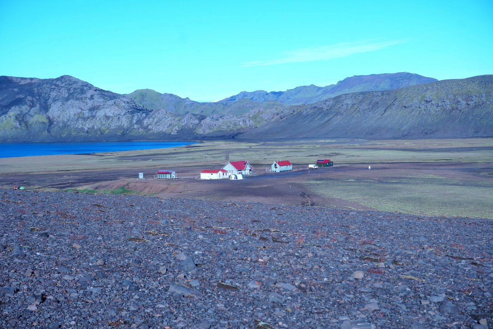
After a 7 AM start from Reykjavik, we arrive at the Landmannalaugar basecamp around 11 AM. The second half of the ride is bumpy as we drive through lava fields along gravel roads, giving us a great introduction to the lunar-esque landscapes of the Icelandic highlands. The basecamp comprises sleeping huts, a toilet and shower area, a very welcoming information hut, and a covered outdoor dining area. The sleeping rooms are dorm-style: simple, sociable, and comfortable enough with heating and well-equipped kitchens. Photo: Paul Sullivan
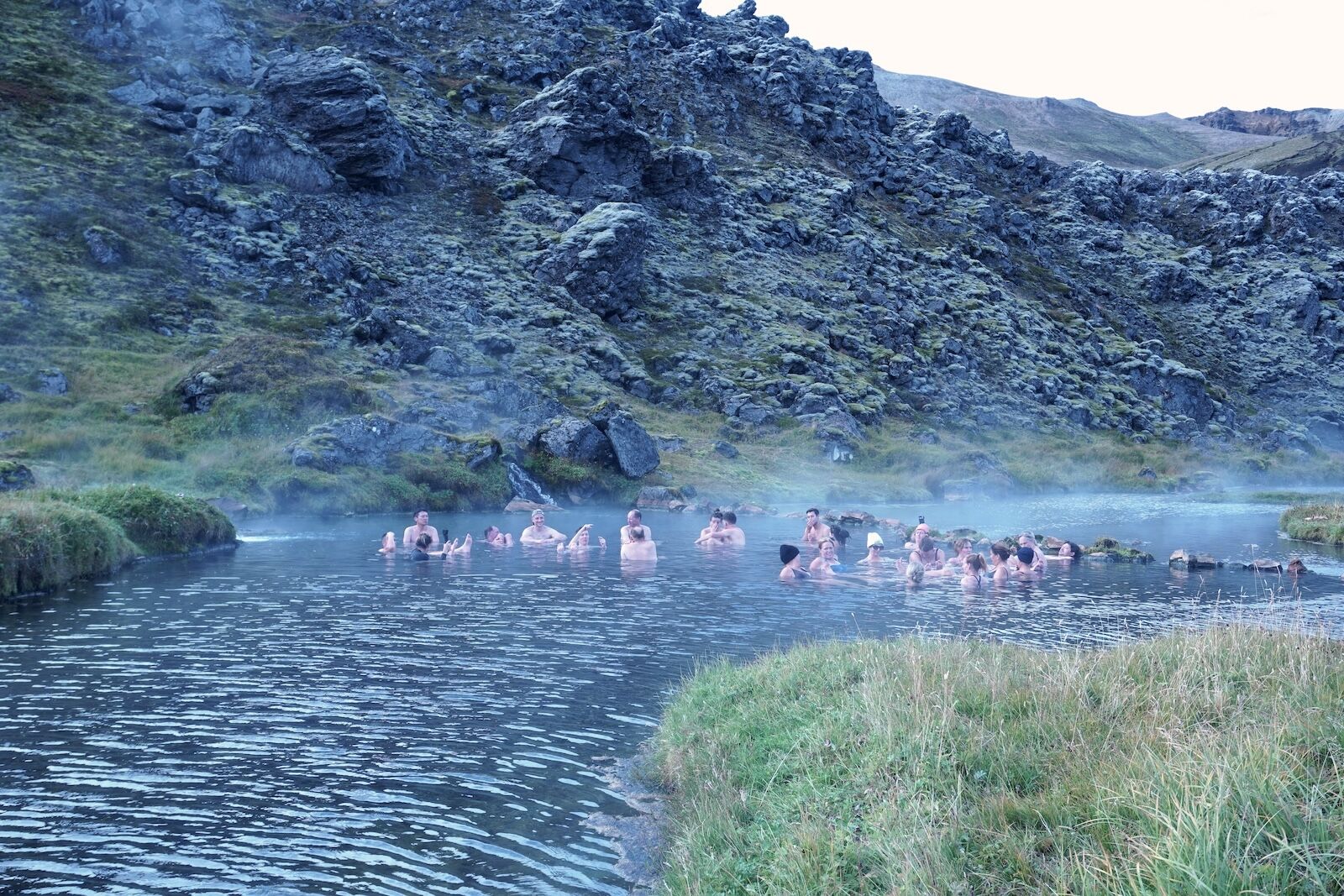
The weather when we arrive is pretty decent — around 40-50 degrees, sunshine, and pale-blue skies. Some people hike the first section of the trail straight from the bus but we are spending the night here so that we can enjoy and explore the area a little. After a brief nap we take on a two-hour loop that takes us past steaming geothermal pools, craggy rhyolite mountains, an emerald lake, and flower-dotted fields — a perfect introductory walk. Afterwards we take a dip in the basecamp’s very own geothermal hot spring and enjoy a whisky nightcap. Photo: Paul Sullivan
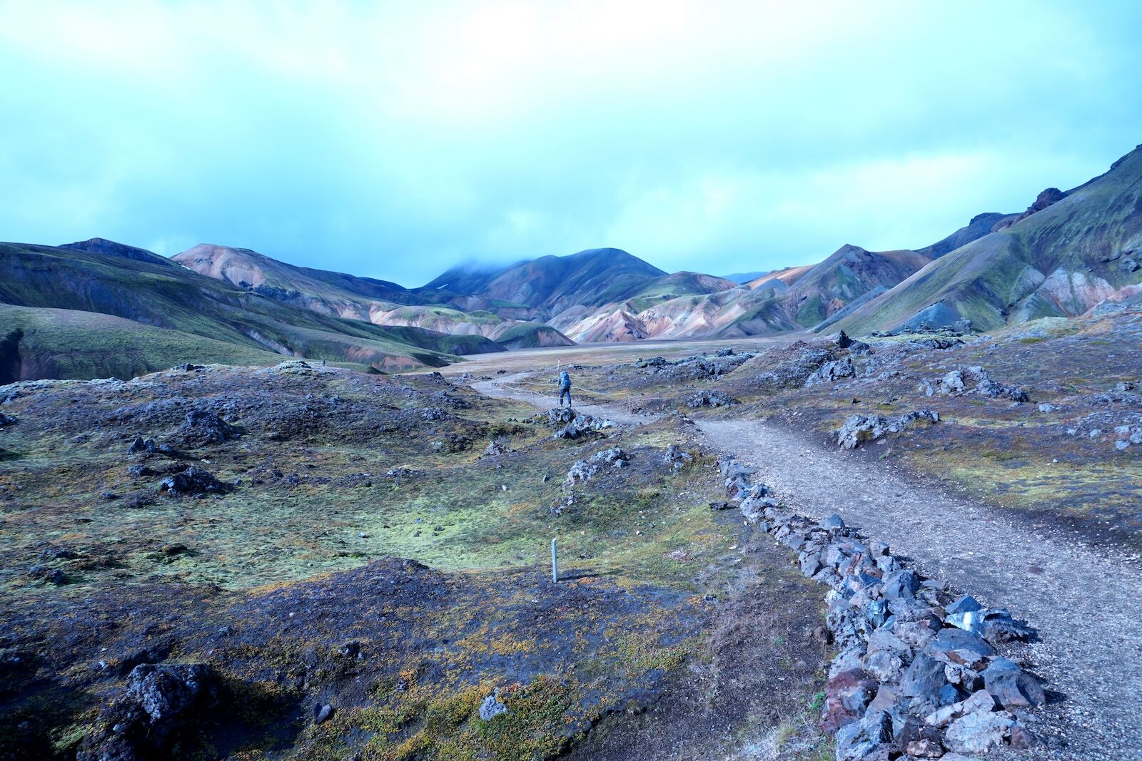
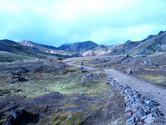
The next morning is sunny, too. Whoop! Everyone in our hut is up early, making breakfast and preparing for the day ahead. We set off with our backpacks to begin the 7.5 miles of the first stage; not so long, but generally regarded as the toughest section due to many steep climbs that combine to take us to an overall elevation of 1640 feet. Photo: Paul Sullivan
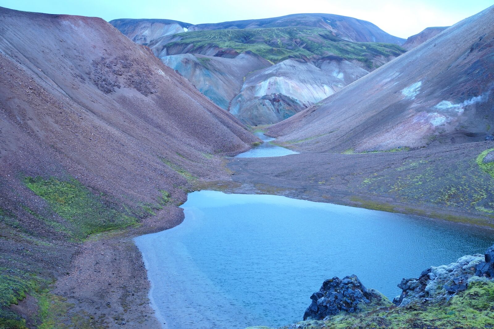
Within no time we are all but alone in what seems like a whole new world. We marvel and mutter to ourselves as each peak or turn seems to reveal yet another landscape, from harsh lava fields to the graceful folds and pastel colors of the Brennisteinsalda volcano and nearby mountains. A biting wind keeps us company but the day stays sunny and largely peaceful. Photo: Paul Sullivan
An example of the rhyolite mountains that are unique to this area. Rhyolite is a type of volcanic rock that’s known for its rainbow-like color palette. Contrasting with the darker basalt lava of the highlands area, it’s formed from the varied mineral composition inside the rhyolite that, when oxidized, create a vivid palette of hues, from deep blues and purples to vibrant yellows, reds, pinks, greens, and yellows. Photo: Paul Sullivan
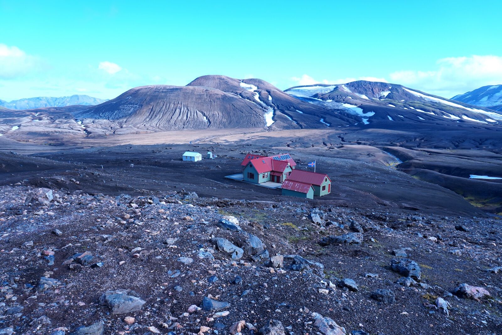
The huts at Hrafntinnusker look like toys amid the sprawling mountain scenery but after a tough three-to-four-hour walk, they’re a beautiful sight (even if the compost toilets are very far from a beautiful smell.) As before, the host — a Swiss guy who speaks fluent Icelandic — is very warm and welcoming. After a nap we take advantage of the ongoing sunshine to explore a nearby glacier. Photo: Paul Sullivan
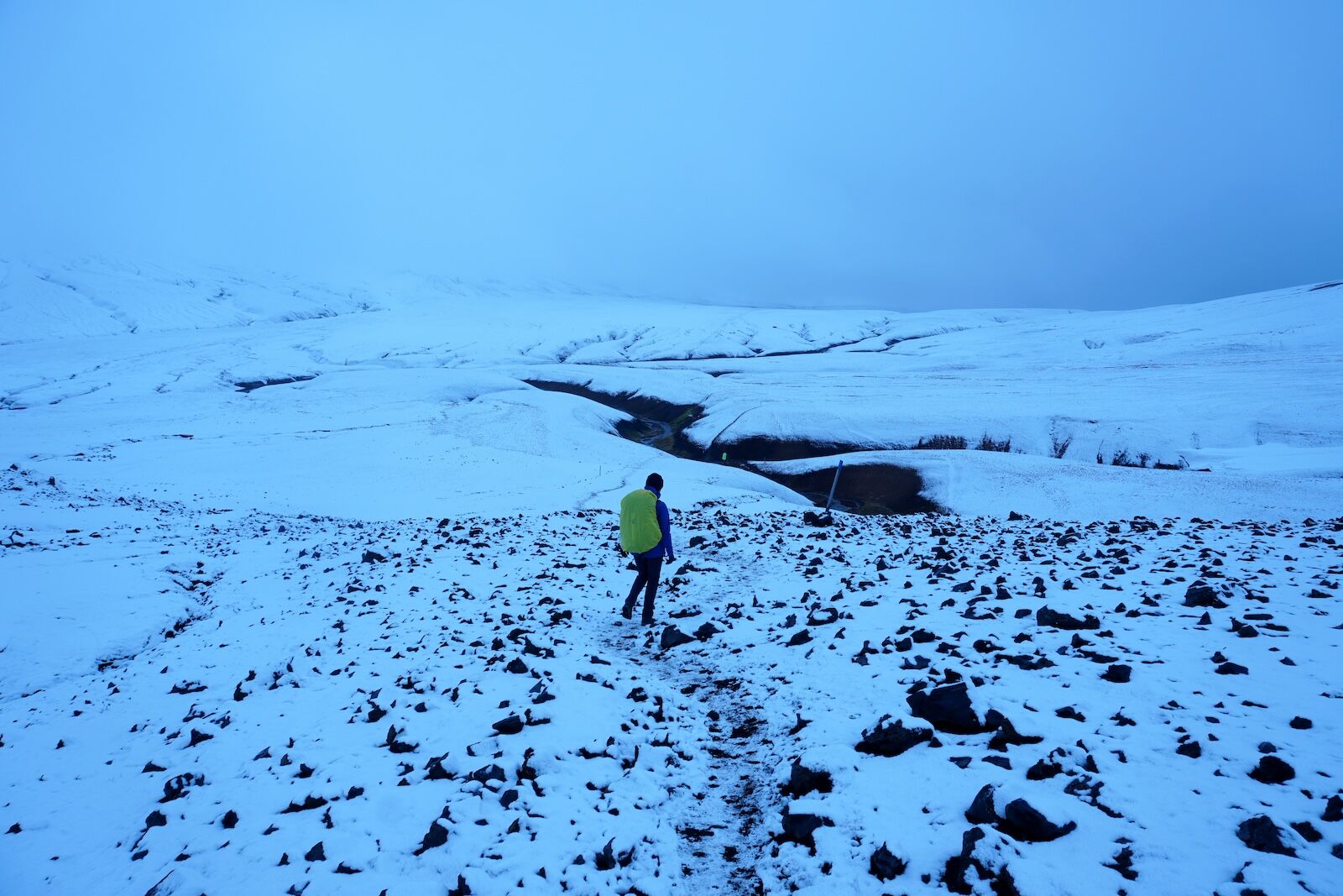
We wake up the next morning to…snow! It has apparently been falling the whole night as everything is covered in a fairy-tale white dusting. It continues as we follow the second day’s section along the slopes of Reykjafjöll. Although the trail already starts to gently descend again after yesterday’s climb, this is not a downhill walk. It undulates constantly with several steep climbs to remind us of our sore calves from yesterday — and takes five hours to walk the same distance (7.5 miles.) Photo: Paul Sullivan
By the time we reach the pretty huts at Álftavatn, which are located right next to a picturesque mountain lake, the snow has stopped and the sun is back out. The wind is still fierce and cold but there are hot showers on offer! Do they cost a little extra? Yes. Are they worth it? Hell, yes! Photo: Paul Sullivan
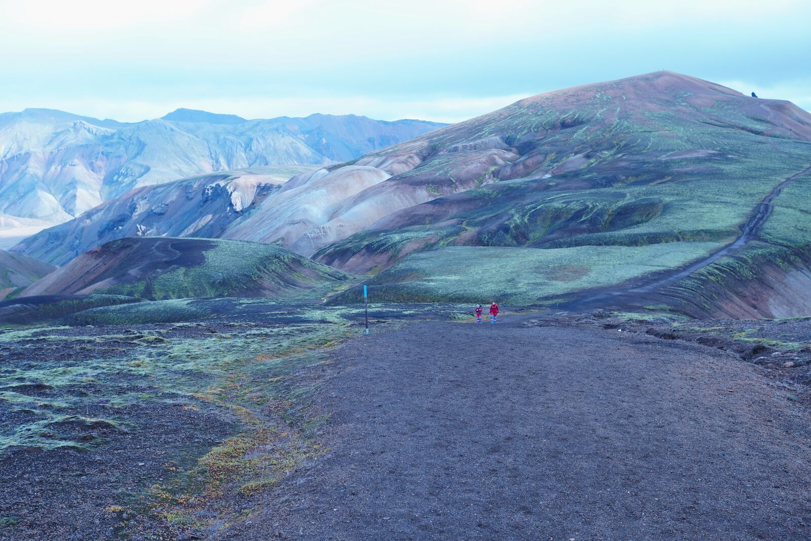
The next day brings more cold sunshine. Given this is almost mid-September and the weather on this route is notoriously unpredictable, we cannot believe our luck. We begin the 10-mile stretch that is Day Three, heading out across a striking moss-covered lava landscape to reach a black-sand desert that stays flat for several miles. It lacks the dynamic diversity of the days before but our legs are grateful for it — and the surrounding scenery is far from dull. Photo: Paul Sullivan
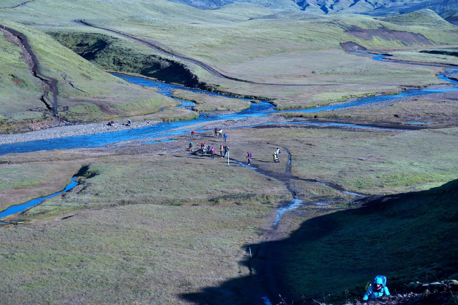
This third day also crosses the Bratthálskvísl river, where we get to finally test our wading shoes. It’s not a wide crossing but it is painfully cold, even with the shoes on. Photo: Paul Sullivan
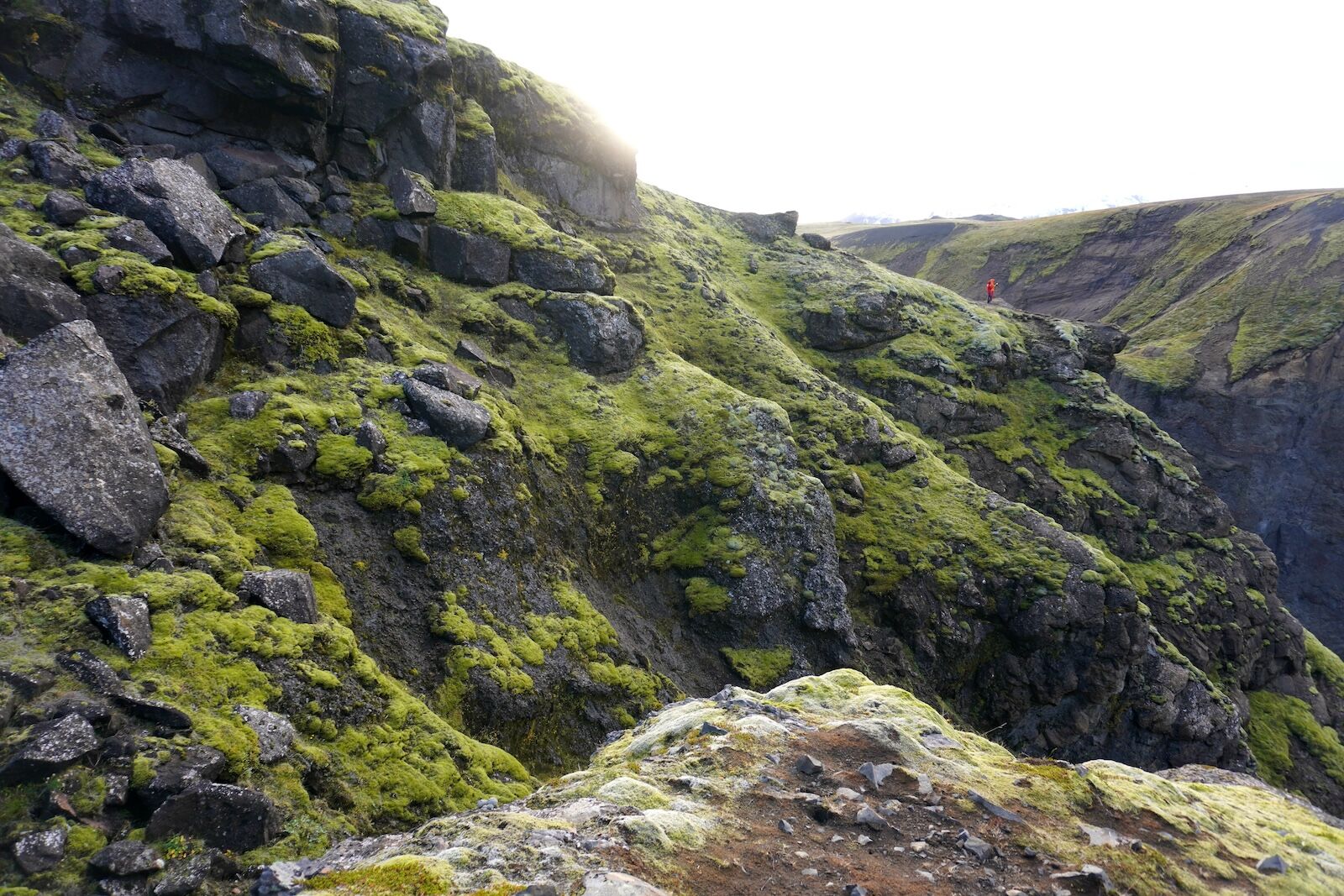
We reach the huts at Emstrur feeling pretty good. Another nap and then we meet excited fellow hikers talking about a nearby gorge canyon that really needs to be seen. The hiking boots are back on again and we notch up a few more miles with a trail that traverses one side of an immense and highly photogenic canyon before looping back to the hut. As side-hikes go, this one is amazing. Photo: Paul Sullivan
Before we know it, it’s the final day. More sun but also more wind, scarily intense as we traverse the occasional high ridge. Once again we are taken through a black-sand desert and more moss-covered mountains until we eventually descend into the Langidalur valley in Þórsmörk. The wonderful thing about this final section is the increase in vegetation as you near the finish point. True, there’s one more river to wade but we are lucky as it’s quite shallow today (sometimes the melting glaciers push it to waist-height.) Photo: Paul Sullivan
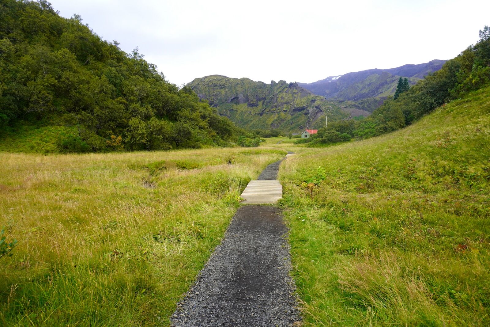
After the river, we enjoy the final couple of miles through the leafy Hamraskógar forest and reach the last hut with mixed feelings. In an ideal world we would continue hiking at least another few days, but it’s also good to be back to civilization. Luckily for us, we are picked up by the good people of Midgard Adventure, who feed us Icelandic hot dogs and bring us to their nearby basecamp hotel for a decent bed and a soak in their rooftop hot tub. Photo: Paul Sullivan