When visiting a new city, many prefer to walk their way through the neighborhoods in search of hip hangouts and a dose of sight-seeing. Some adventure travelers have even been known to get extreme and walk across entire countries or continents. But the longest straight-line overland walk one can undertake without having to cross an ocean puts all other notable treks to shame.


This Is the Longest Straight-Line Walk You Could Do Without Ever Hitting the Ocean
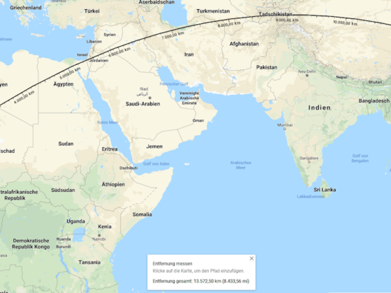
The route begins at the Atlantic coast in the West African nation of Liberia and culminates on the Pacific coast of eastern China. Three continents, the Arabian Peninsula, and climates ranging from parched desert to towering mountains must be conquered in the 13,572.5 km (8,433 miles) journey. The route passes close to, but not directly by, both the Caspian and Mediterranean Seas.
Sound like something you and your crew are up for? Reddit user yellakc created an elevation chart for the map, noting that you’ll conquer about 62.5 km of elevation gain and loss. When planning your pan-continental journey, be sure to do some research on visa requirements and don’t forget to pack your passport (you should take into consideration that the route passes through some areas that are currently in conflict, as many Reddit users pointed out). If you can’t read the map (which is in German) and you aren’t up on your geography, this journey would take you through Liberia, the Ivory Coast, Ghana, Burkina Faso, Niger, Libya, Egypt, Israel, Jordan, Iraq, Iran, Turkmenistan, Uzbekistan, and Tajikistan before finishing up in China.
Along the way, you’ll have the opportunity to visit chapel sites in every major world religion. The culinary options en route will be equally as diverse. The same goes for languages you’ll hear spoken throughout the journey, of which you’ll likely encounter at least 12 including 3 variations of Chinese — and these are just the widely spoken languages.
The craziest thing about this trek is that actually is a straight line. Although it certainly doesn’t appear that way on a map, which must account for the curvature of the earth and connect each latitude and longitude line in a process that skews proportions across the world.