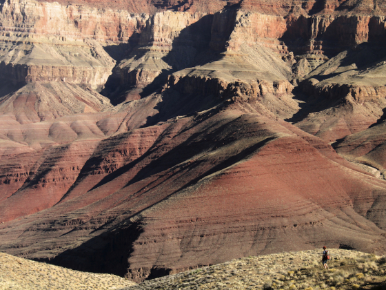
Coordinates: 36°00’58.3″N 111°58’37.3″W. We are standing on the Tonto Plateau, having hiked three miles down the Grandview Trail from the South Rim of Grand Canyon National Park. Two miles to the north the Coconino Saddle rears up and obscures the canyon rim, and down below, deep in the gorge, the Sockdolager rapids blast through mile 78.5 of the Colorado River.
Open This on Your Phone and You're Standing in Grand Canyon National Park
[Note: Click on image and move cursor or swipe with your finger to see different perspectives. You can also zoom in and out.]
Before us a towering and flower-studded yucca stalk points the way to Horseshoe Mesa where a handful of hikers are making camp. The sun is an hour and a half from setting, the still air is becoming suffused with golden late afternoon light. It’s warm. We hear nothing except the a low and rolling whooooosh of canyon wind against red rock. We are alone.
Across the canyons and chasms to the east, Coronado Butte and Ayer point seem to be filling with a lavender light while westward folds of the park begin to glow yellow-white. Ravens ride the canyon thermals, scooping themselves up with warm canyon winds. We watch as dozens of lumbering bees busy themselves on the yucca stalk and drink from the small yellow blossoms.
For a topographical view of our position, we refer to Google Maps:
What views are you getting today? ![]()
Feature image by Matador Ambassador Henry Munter.