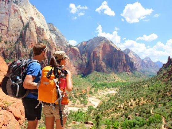
1. Wasatch Mountains
Photo: Scott Sporleder
The Wasatch Range, which runs north-south from the border with Idaho down into the center of the state, can be considered “Utah’s mountains” — a full 85% of the state’s residents live within 15 miles of these peaks. They grace the eastern skylines of Salt Lake City and the other major population centers of the Salt Lake Valley.
The Wasatch is also where you’ll find your favorite Utah ski resorts, from Beaver Mountain in the north to Sundance in the south, and everything in between (which happens to include top-rated mountains like Snowbasin, Deer Valley, Park City, Alta, Snowbird, and a half-dozen others). But as you can see in the images above, this landscape is worth exploring year round, and with such easy access from Logan, Ogden, Orem, Provo, and Salt Lake City, among other jumping-off points, you can keep going back for more.
2. Canyonlands National Park
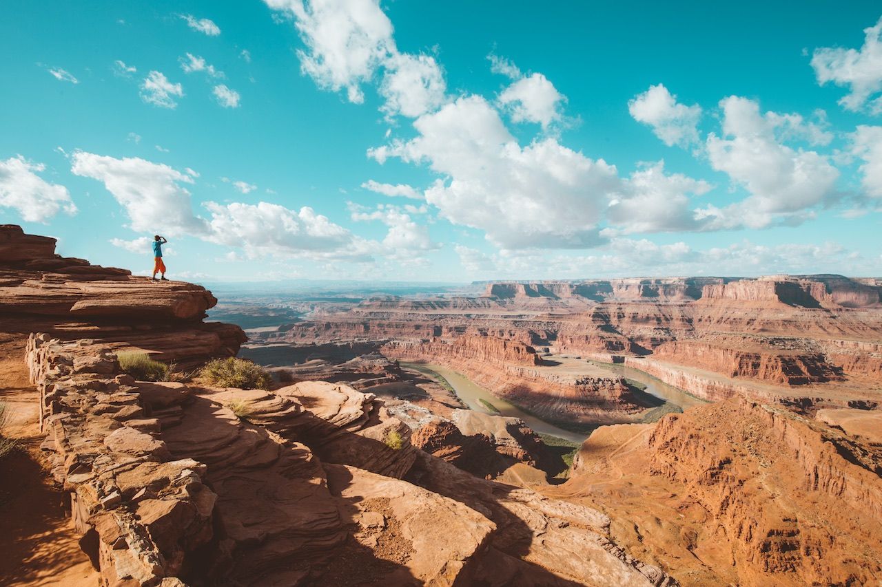
Photo: Shutterstock/canadastock
Canyonlands is aptly named. This 337,500-acre national park covers a tremendous expanse of southeast Utah, a short drive from Moab, and protects the canyons of the mighty Colorado and Green Rivers both above and below their confluence. You’ll find many other iconic Utah rock formations here as well: arches, buttes, mesas.
Many visitors to Canyonlands come specifically for the rivers — Cataract Canyon, just downstream from the Confluence, is one of America’s premier whitewater destinations. But there are also truly epic hiking, climbing, and backcountry exploration options in the other three sections of this massive national park: Island in the Sky, the Needles, and the Maze. The vastness of Canyonlands alone underscores the “mighty” in Utah’s Mighty 5® national parks.
3. Grand Staircase-Escalante National Monument
Photo: Shutterstock/kojihirano
As big as Canyonlands is, it’s dwarfed by the 1.8 million acres that make up Grand Staircase-Escalante National Monument, the largest national monument in the country. This region abuts Lake Powell to the south, Capitol Reef National Park to the north, Bryce Canyon National Park to the west, and is proximate to both I-15 and I-70. So getting there is easy…deciding which section to explore, not so much.
Start with one of America’s most scenic drives, State Route 12. This All-American Road is at its best between the towns of Boulder and Escalante and passes over many of the creeks and other waterways that cut through the colorful stone landscape. From there, try canyoneering in the Canyons of the Escalante Area, hike among hoodoos and arches in the Devil’s Garden, check out the slot canyons and Native American petroglyphs along the Paria River — the possibilities are endless.
4. Arches National Park
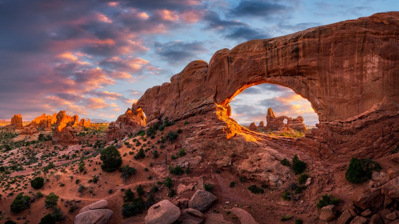
Photo: anthony heflin/Shutterstock
An estimated 2,000+ sandstone arches, formed as a result of the area’s unique geology and millions of years of erosion, give this national park north of Moab its name. A number of these arches and other formations have become so archetypal (and so well photographed) that they’re recognizable on sight, including those seen above: Double Arch, Balanced Rock, and Delicate Arch, respectively. And still, mere photos can never do them justice.
The Moab area is probably most often associated with its world-class mountain biking (Watch: Moab is a bikers’ playground); incredible climbing, backpacking, and whitewater rafting round out the region’s adventure activities.
5. Monument Valley
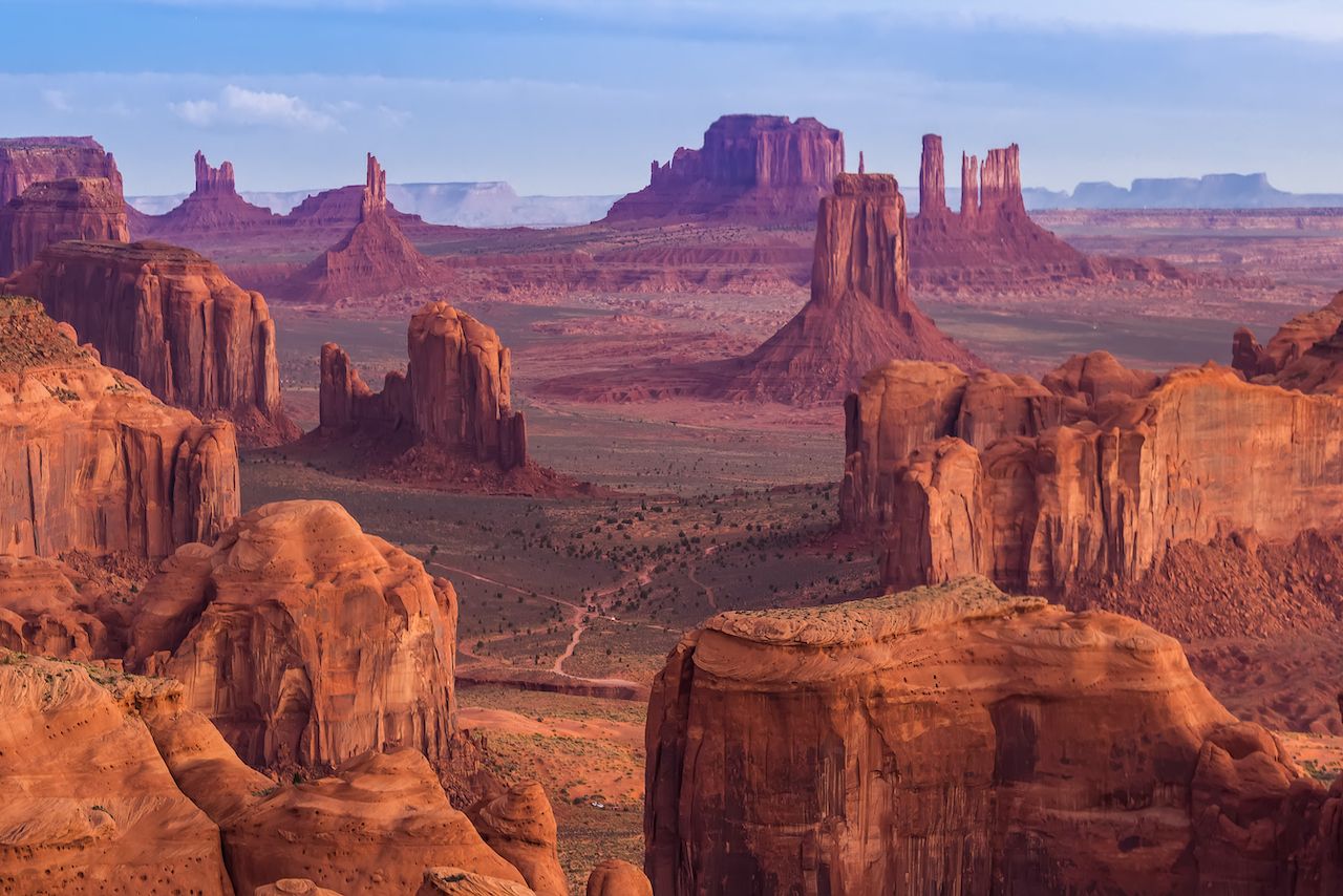
Photo: Zhukova Valentyna/Shutterstock
Speaking of iconic landscapes — if you identify one horizon with the “American West,” it’s likely this one. Monument Valley straddles the Utah-Arizona border near the Four Corners. You’ll get the best views by driving south on Highway 163 in Utah (as in photo #3 above).
The sandstone buttes, which rise as tall as 1,000 feet, are typically only observed from the road (and from behind the lens), but there are plenty of options for getting closer. Just note that a small chunk of this part of Utah falls within Monument Valley Navajo Tribal Park, and some hikes require a guide.
6. Bryce Canyon National Park
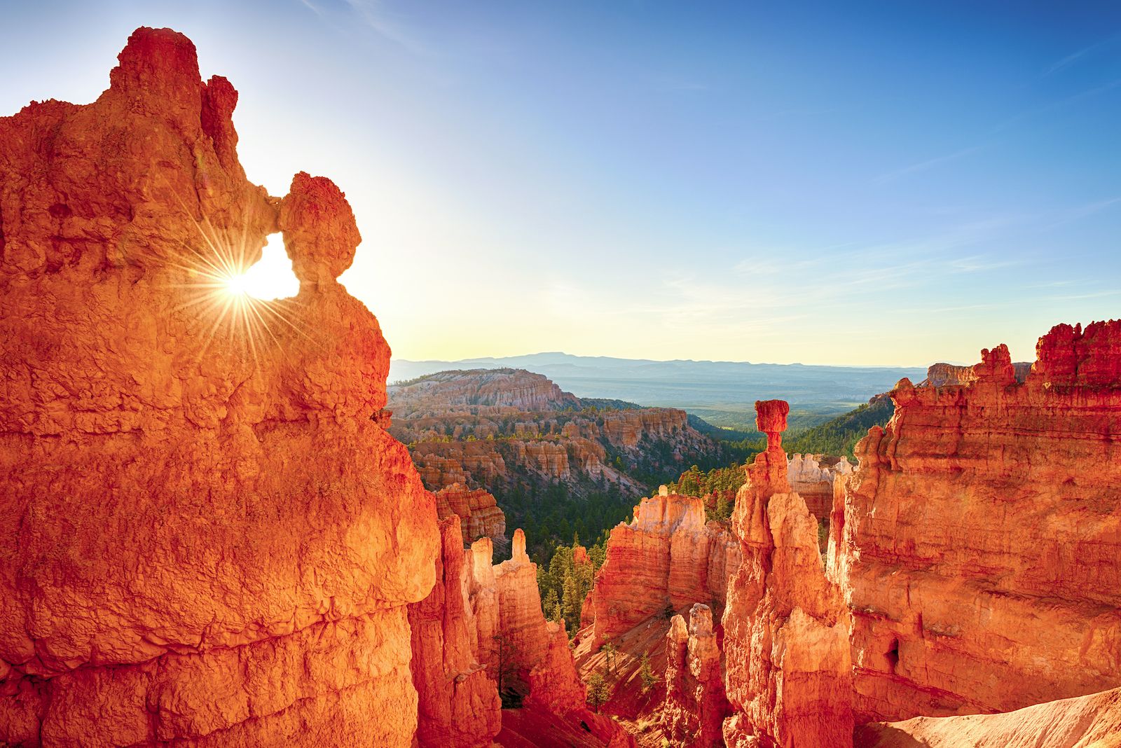
Photo: Shutterstock/Filip Fuxa
A vast natural amphitheater, full of hoodoos naturally carved from red-and-white-striped rock, ringed by forests of spruce and pine, with some of the darkest night skies in America — this is Bryce Canyon, and it’s most definitely a landscape you’ll find nowhere else.
Get a feel for the park via the 13-viewpoint scenic drive, and then dig into a day hike on the Rim Trail, Navajo Loop, or Tower Bridge routes. Longer backcountry treks are also possible. In winter, the cover of snow changes everything, and you can see it all from a fresh perspective on snowshoes or cross-country skis.
7. Bonneville Salt Flats
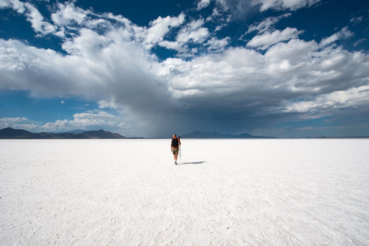
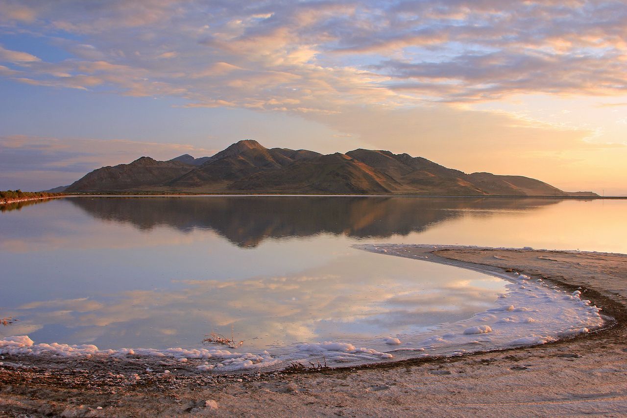
An ancient lake far larger than today’s Great Salt Lake once dominated Utah’s Great Basin. The Bonneville Salt Flats, due west of Salt Lake City, remain as evidence of its existence and create one of North America’s most notable landscapes. Flanked by the Silver Island Range to the north, the salt spills out for miles in a radiant white carpet (in winter, when standing water collects on the salt pan, the effect is mirror-like).
For the past 100 years, the unique characteristics of this terrain have drawn speed enthusiasts seeking to test the limits of technology and human endurance. The first land speed record was set in Bonneville in 1914, and modern-day events like Speed Week and World of Speed continue to pit custom vehicle designs against the laws of physics on the long, flat salt plain.
8. Lake Powell
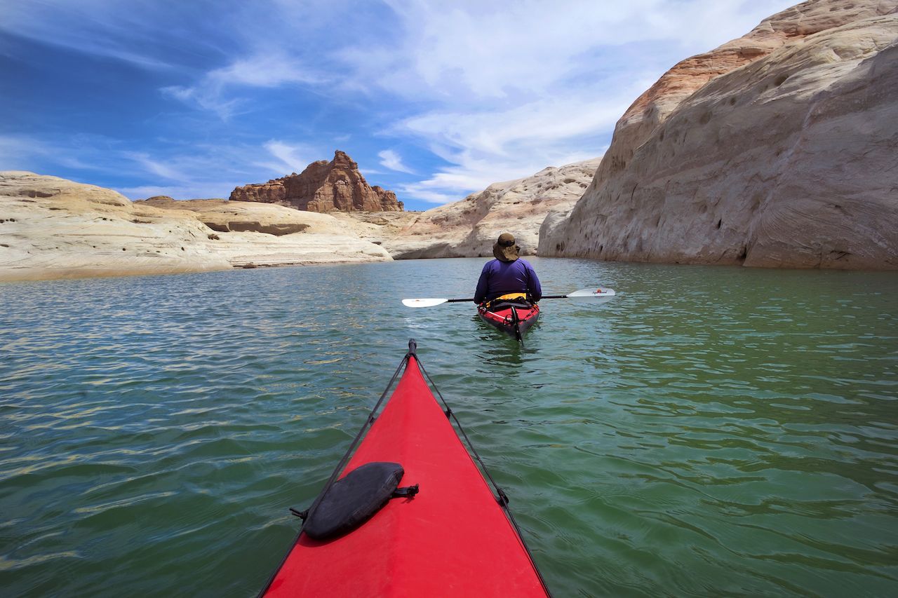
Photo: oksana.perkins/Shutterstock
Fed by some of the West’s great rivers — the San Juan, the Escalante, and of course the Colorado — among many smaller tributaries, Lake Powell represents the second-largest manmade reservoir in the US. Paired with the surrounding Glen Canyon National Recreation Area, it receives over 2 million visitors every year to fish, ski, paddle, and hike on or around its waters.
Despite its popularity, development on the lake is sparse. Depending on where you are, you might have this mighty Utah landscape all to yourself.
9. Zion National Park
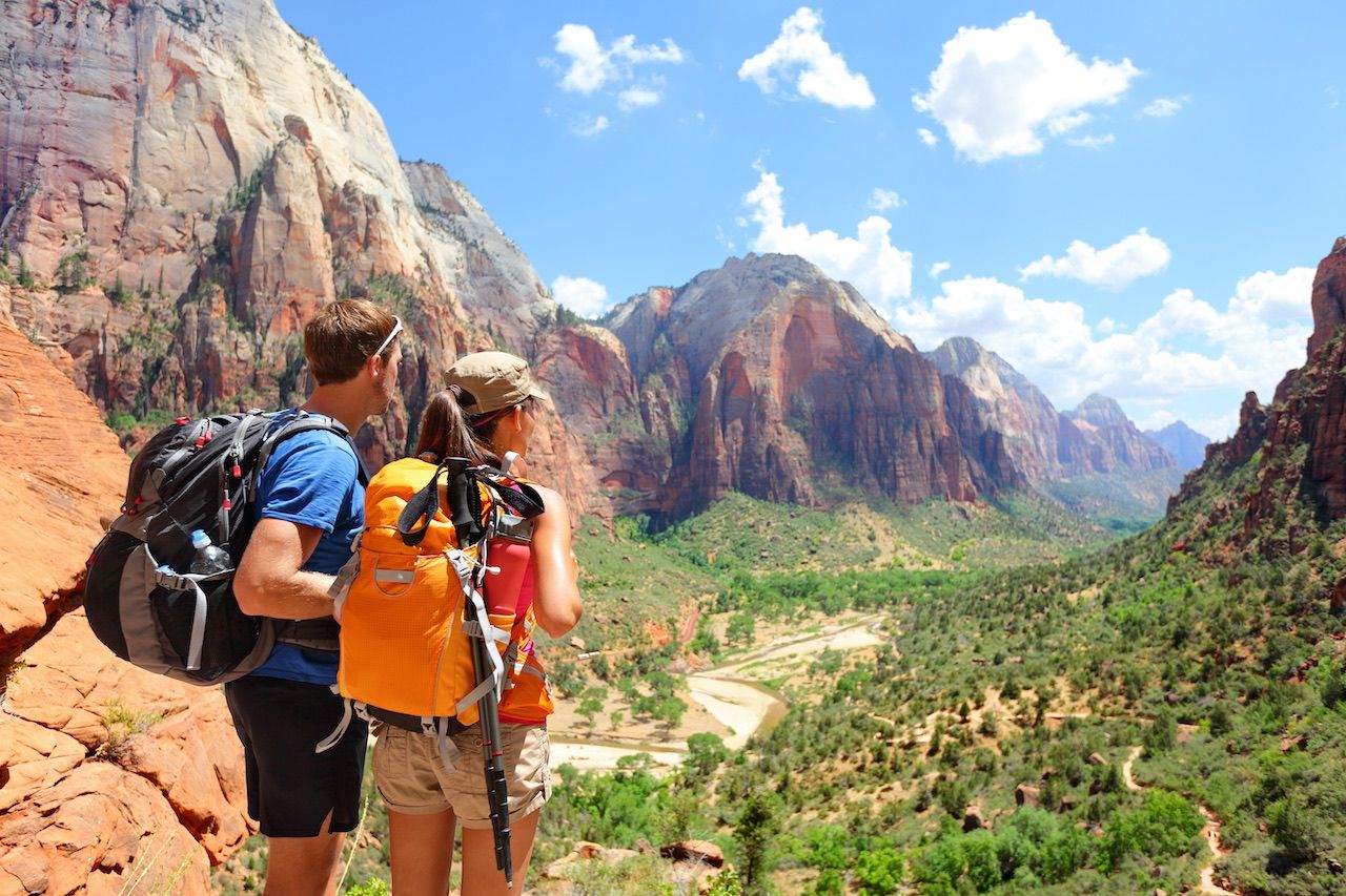
Photo: Shutterstock/Maridav
In the southwest corner of the state, the North Fork of the Virgin River plunges through 15 miles of one of the most gorgeous canyons in the world. Zion National Park is centered on this namesake canyon, while also spilling out to cover miles of the desert landscape that surrounds it.
From climbing the precipitous ridge of Angels Landing, to canyoneering in the Narrows, to heading out into lesser-explored backcountry for a multi-night trek, Zion holds some of the most rewarding adventures in all of Utah, if not the country. Find yours in our Travel guide to Zion National Park.
10. Great Salt Lake
One of the features Utah is perhaps best known for, the Great Salt Lake covers around 1,700 square miles just west of Salt Lake City. Its surface area (it’s the largest saltwater lake in this hemisphere) belies its depth — an average of just 16 feet.
A great way to view the lake is from the beaches and gentle hills of Antelope Island, a state park in the southeast corner of the lake that’s a quick drive from downtown SLC. Hiking, biking, and equestrian trails crisscross the island, sharing space with herds of free-ranging bison, bighorn sheep, and antelope. Or give yourself a few hours and you can get a more elevated view — at 6,596 feet, Frary Peak is the highest point along the island’s mountainous spine. To get on the water, your best option is a sailboat.
11. High Uintas Wilderness
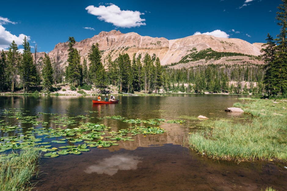
Photo: Scott Sporleder
The northeastern corner of Utah is dominated by the Uinta Mountains, which run from east to west and intersect the Wasatch Range. The High Uintas Wilderness spans much of the range, encompassing numerous mountain lakes and streams as well as the tallest peaks.
Access is via the Mirror Lake Scenic Byway (State Route 150) out of Kamas, which is just east of Park City. This road offers plenty of opportunities for picnicking, camping, and roadside photography, but it doesn’t venture too far into the wilderness area. If you want to get deeper, you’ll need a pack and a good pair of boots.
12. Capitol Reef National Park
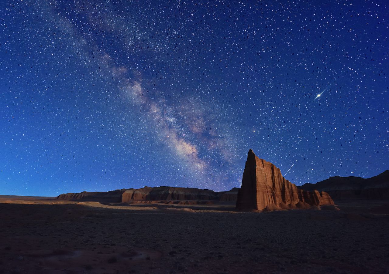
Photo: Lijuan Guo/Shutterstock
A 100-mile-long, skinny strip of land, Capitol Reef National Park runs from the Cathedral Valley area — not too far south of I-70 — all the way down close to the shores of Lake Powell. It gets its name from a series of Navajo sandstone domes and cliffs that resemble the US Capitol building.
The small town of Torrey, situated on Highway 24, is your gateway, from where you can easily get to the park visitor center and miles of little-traveled hiking trails. Grab an overnight camping permit and it’s just you and Utah under the stars. It doesn’t get much better. ![]()