By pretty much any measure, Zion is one of America’s most remarkable national parks. The dramatic Southwest scenery, the vibrant plant and animal life, and the array of top-tier outdoor adventure activities — both within park boundaries and the surrounding area — bring upwards of 3 million visitors a year to this southwestern corner of Utah.
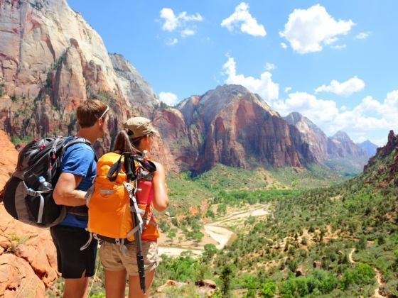
The park is centered on the 15-mile Zion Canyon, where the North Fork of the Virgin River has been sculpting a channel through red-and-khaki Navajo sandstone for the last hundred million years or so. The result is one of the most striking canyons anywhere in the world. At the same time, Zion is situated at the nexus of several different geographic and ecological zones, giving it a diversity and uniqueness you won’t find in any other US park. Combine that with world-class hiking, rock climbing, overnight backpacking, canyoneering, horseback riding, and photography opps, and you start to get a sense of exactly why the park is so popular.
There are two ways into Zion: from the east (via Kanab or Bryce Canyon) and from the west (via Springdale).
The eastern route
Entering from the east gives you a fantastic introduction to the park. Following Utah State Route 9, you first encounter Checkerboard Mesa, a pockmarked sandstone pyramid that will have you scratching your head as to how it came to be. As you continue along the winding #9, you eventually reach the Zion-Mt. Carmel Tunnel, an engineering feat that took three years to complete (1927-1930). Drive slowly on approach, as there can be backed-up traffic to allow an oversized vehicle to pass through from the other direction (it’s a very narrow tunnel).
The show truly begins after you exit the tunnel and get your first look at Zion Canyon. Just try to keep your eyes on the road as you descend some incredibly scenic switchbacks to reach Canyon Junction, where you’ll turn left and follow the Virgin River toward the park entrance (visitor center) and Springdale — unless you’re staying at the Zion Lodge and already have a park permit, in which case you’d turn right.
The western route
Driving from the west you’ll also be on SR-9, perhaps coming from St. George or Salt Lake City (I-15). This approach keeps you at canyon-floor level, from where you’ll see the sandstone cliffs gradually growing taller and more sheer as you reach the town of Springdale. Once you hit the park entrance, the views will have already reached epic status, but just wait — it only gets better as you make your way farther and farther up-canyon during your visit.
If you’re lodging outside the park, you’ll most likely want to find parking in town and take the Springdale shuttle in, as the visitor center lot fills up fast. If you’re camping or staying at Zion Lodge, continue through the park entrance with your vehicle.
The shuttle
The Zion Canyon shuttle system was implemented in 2000 as a welcome response to increasing visitation and traffic congestion on the canyon’s single road. The ability to simply sit back and take in the views out of the oversized bus windows, instead of having to concentrate on driving yourself, makes exploring Zion notably less stressful than the experience you get in parks with comparable visitation numbers in the US.
The shuttle operates April to October (and weekends in November) and takes you from the visitor center to the northernmost point of the main canyon (making nine stops along the way) and back. In the winter months, private vehicles are allowed on the canyon road.
Biking in the park
I highly recommend bringing bicycles, as they’re a fantastic way to explore the park and feel much more immersed in the grandeur of Zion. Load your bike onto the shuttle (all are equipped for this), take it up to the last stop in the park, then bike the road back toward the entrance. You take advantage of the slight downhill this way — although it certainly wouldn’t be much more difficult to ride up-canyon.
Cyclists are only allowed on paved roads and on the Pa’rus Trail, a 1.75-mile paved path between the visitor center and Canyon Junction. Taking bicycles off-road is prohibited, as is cycling through the Zion-Mt. Carmel Tunnel.
Important note: Shuttle bus drivers aren’t allowed to pass cyclists. When approached from behind by a shuttle, stop riding and let the bus by.
Park fees
Private vehicles pay $25 for a permit, which is valid for seven days. This allows the vehicle and all occupants (up to 15!) into the park. Individuals (cyclists and pedestrians) are charged $12 each, valid for seven days (15 years old and younger get in free). Entrance also includes Kolob Canyons access. A handful of days each year are “fee free” — check the park website for details.
LODGING AND CAMPING
There are Zion lodging options for all budgets in Springdale, including affordable cabins and Airbnbs near Zion National Park. Zion Lodge, a historic structure designed to blend with its surroundings, which has been hosting visitors since the 1920s, is the only non-camping option inside the park.
There are two campgrounds inside the park: Watchman Campground and South Campground. Unless you’ve made reservations at Watchman, you’ll want to head to South, the first-come first-served option (arrive early in the morning for your best shot at securing a site).
Just outside the park entrance in Springdale is the Zion Canyon Campground, behind the Quality Inn. We stayed here the first night as everything inside the park was full when we arrived. It’s on the expensive side for camping (free showers though), so we took off early the next morning and scored a site at South Campground.
Tip: Be prepared for wind if you’re camping inside the park. Unfortunately for us, we had a largely mesh tent with a fly; the ubiquitous red sand blew into the tent when it got really windy, which was often, and got very annoying very quickly. If you have a tent with solid walls, pack it.
EXPLORING ZION
Each shuttle stop on the drive up Canyon Scenic Drive gives access to a Zion trail or other point of interest. This is where most of the activities and sightseeing are, so it attracts by far the most visitors, but the eastern section of the park and Kolob Canyons are equally worth a visit. First, though, we’ll look at some of the ways to explore the main canyon.
On the gentler side
Pa’rus Trail: This 1.75-mile trail is the only one in the park that’s bike- and dog-friendly (also accessible by wheelchair). It runs between the visitor center and Canyon Junction and takes in stunning canyon views along the way. You can access South Campground, the Zion Human History Museum (see below), and the Virgin River — awesome for cooling off on a hot day — from this paved path. Keep an eye open for colorful cactus flowers along the trail.
Zion Human History Museum: Definitely worth a stop if you’re interested in the geologic and cultural histories of the area. Besides exhibits, they have a very interesting 22-minute video that includes views of Zion you won’t get any other way, and which explains how the area was formed and eventually inhabited by humans. Get off at the first shuttle stop, or find it via the Pa’rus Trail (the short connecting dirt track is off limits to bikes, so make sure to get off and walk).
Grotto Trail: This is an easy walk that connects Zion Lodge and the Grotto, a green, peaceful area where you can find shade under cottonwood trees, break for lunch at a picnic table, refill your water, and use the public bathrooms. The Grotto can serve as a de facto meeting point, as other trails end and begin here as well.
Riverside Walk: At the end of the shuttle line is the Temple of Sinawava stop. From here you can walk farther north, tracing the riffled Virgin River on a paved trail past surprisingly lush hanging gardens. It’s just over a mile to where the river starts to disappear into the narrower sections of the canyon. Here you’ll see hikers outfitted in neoprene crossing the river on their way to check out the tail end of the Narrows (more on this hike below).
On the break-a-sweat side
Emerald Pools: This classic Zion hike is broken into three sections, leaving you with plenty of options for more or less hiking: Lower, Middle, and Upper Pools. The trail actually passes behind some small waterfalls on the way to the Middle Pools, which can provide a refreshing mist on a hot day — after a good rain, the falls may be thundering. From the Middle Pools and on, views back to the canyon are magnificent. Look for the bulks of Red Arch Mountain and Lady Mountain to dominate the tableau. Allow a couple hours if you’re hiking to all the pools.
Kayenta Trail: From the Grotto, this is a steep-ish trail that leads to the Upper and Lower Emerald Pools, further expanding your hiking options in this section of the park and negating the need to backtrack. Expect more killer vistas of the lush canyon floor, threaded by the Virgin River.
Watchman Trail: It’s all about the views on this hike. You’ll be set up for excellent shots of iconic Zion sights like the Towers of the Virgin, Beehives, lower Zion Canyon, and even back to Springdale. The trail starts at the visitor center and proceeds for two miles. After an elevation gain of 450 feet, you’ll end at a viewpoint looking out on the red spire known as the Watchman.
On the adventurous side
Angels Landing: Angels Landing is one of the premier hikes in Utah, if not the entire US national park system, and as such is a “must-do” for any visitors physically fit enough and capable of handling the heights and exposure. Note that there have been a handful of deaths over the years (careless hikers) and that it’s not recommended for kids, but with care and attention it’s relatively safe. The trail is around 5.5 miles round trip, is steep, and includes many switchbacks — the Walter’s Wiggles section alone has 22. It’s a strenuous but straightforward hike to Scout Lookout, a good resting spot with an outhouse (closed when we were there in April) and spectacular views up the canyon. This is also where many hikers will turn around or wait patiently for other members of their party to complete the route.
The last portion of the hike follows a trail along a narrow ridge, many parts of it very exposed to sharp dropoffs, right to the top of Angels Landing at 5,790 feet. There are chains along the way to grasp for support; I witnessed many a white knuckle on the way up and down. If you fear heights, this is either a great way to overcome the phobia, or a terrible idea. Once you’ve made it, you’re rewarded with those views you keep seeing on all the Zion postcards — in a word, epic.
Note for climbers: There are several routes up the north face of Angels Landing. One of the more popular (and challenging) is the 13-pitch Lowe Route. Inquire at the visitor center for more details if you brought your gear.
The Narrows: This is another hike within the park that many visitors come for specifically, and gives even Angels Landing a run for its money on the list of “America’s best hikes.” More than half of it takes place in the Virgin River over uneven ground and slippery rocks. Sections of the canyon are only 20-30 feet wide, while the walls rise to a monolithic 2,000 feet — all of which can make you feel very, very small.
For the full experience, you’ll need a permit (only 80 hikers are allowed in daily) and transportation from Springdale to the trailhead at Chamberlain’s Ranch. Shuttles can be arranged in town. The full hike is 16 miles of downstream traverse, which will take you all day to complete. Alternatively, you can hike as far as five miles up-canyon from the end of the Riverside Walk trail without a permit (proceeding any farther than Big Spring in the upstream direction is prohibited).
It’s common for the Narrows to be closed from around March to June, as spring snowmelt makes water levels too dangerous. Before attempting the hike, stop at the visitor center to check the forecast and potential for flash floods, and be prepared with the right footwear, clothing, and gear.
West Rim Trail: For those who want to get away from the crowds within the main canyon, this 16-mile hike to Lava Point (one of the highest elevations in the park) is a sure bet. It starts at the Grotto and follows the same route as Angels Landing, then veers off from Scout Lookout. Once you ascend out of the main canyon, you’ll be in a high alpine environment with more comprehensive views of the park than most visitors ever get.
If you’re backpacking (it’s suggested to overnight if you’re hiking the entire trail from the canyon) get a wilderness permit from the visitor center. The hike can also be done from the opposite end, from Lava Point down into the canyon, as a long day hike.
The eastern side
The eastern portion of the park is accessed either from the East Entrance on SR-9 or through the Zion-Mt. Carmel Tunnel. There’s great hiking here, which gives you a true sense of what this national park has to offer beyond the canyon that bears its name. Try the Canyon Overlook Trail (views of Pine Creek Canyon and lower Zion Canyon) and the East Rim Trail, a long, ascending route through ponderosa forest that skirts the canyon rim before connecting up with the Observation Point Trail (accessible from the main canyon) and descending over 2,300 feet to Weeping Rock.
Kolob Canyons
This section of Zion, northwest of the main park, is seen by a small fraction of overall visitors, but shouldn’t be missed if you have the time — especially if you’re after more peace and quiet. The entrance is off I-15 (exit 40), and there’s a separate visitor center where you can pay for park access, or present your pass if you already have one. Wilderness permits can be obtained here for overnight backpacking trips.
Scenic drive: A 5-mile scenic drive ends at Kolob Canyons Viewpoint, where you can get out to stretch your legs and walk a short trail for a closer look at your surroundings — which, in many places, mirror what’s on offer in the main canyon.
Taylor Creek Trail: This is a great moderate hike that follows and crisscrosses Taylor Creek into a narrow box canyon. If you only have time for one hike, make it this one. The trail passes old and abandoned homestead cabins built in the 1930s and ends at Double Arch Alcove, an immense amphitheatre with colorful streaks from the minerals in the rock. Allow four hours roundtrip.
Kolob Arch via La Verkin Creek Trail: At 287 feet long and with a thickness of 75 feet, Kolob Arch is one of the largest natural arches in the world. The 14-mile hike to reach it takes around eight hours — pack a tent and register for a wilderness permit so you can overnight at one of a number of sites along the trail.
Canyoneering
No question — my favorite part of our visit was the canyoneering trip we took with Zion Adventure Company. My partner and I were fortunate to get a guide to ourselves, who took us to a wet canyon for a day of descending into and hiking out of a narrow canyon with running water. The fact that there’s so much canyoneering — as well as hiking, climbing, and biking — to be done outside the park is one of Zion’s best-kept secrets. I highly recommend booking a guided trip.
SPRINGDALE
For a town of 500, Springdale has an amazing breadth of amenities — no surprise, though, as it accommodates a good bulk of the close to 3 million Zion visitors per year. A comprehensive town guide would be an entirely different article, but I’ll highlight a few things we enjoyed while staying in the area for a week.
Read more about Springdale
Cafe Soleil was our go-to spot for great breakfast, lunch, and coffee. I was especially convinced after meeting a local and being told this is where a lot of residents go.
Sol Foods Supermarket has a great deli at the back to get fresh sandwiches to take with you on your day trips. They also have a nice selection of freshly baked goods. Right next door is their hardware store (Sol Foods Hardware), where you can pick up all sorts of items, from water filters to camping gear to auto and RV supplies. There’s a small used bookstore as well — it truly is a one-stop shop.
The Canyon Community Center is the place to find out what’s happening locally and join any number of fitness classes. It’s also excellent for meeting Springdale residents and taking the pulse of the area. ![]()