Photo: Joshua Resnick/Shutterstock

23+ Spots That Will Make You Proud to Be From California

California Insider Guides
by Matador Creators Feb 25, 2017

The state of California with its natural setting, world-class surf spots, mountains, wine country, and desert terrain make it the most populated state in the US. Here are some highlights of the diverse natural environments of California that will make any local proud.

Editor’s note: These spots are all taken directly from travelstoke®, a new app from Matador that connects you with fellow travelers and locals, and helps you build trip itineraries with spots that integrate seamlessly into Google Maps and Uber. Download the app to add any of the spots below directly to your future trips.
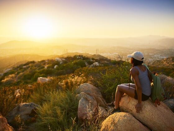
The Eye at Hidden Valley campground, Joshua Tree

 Hidden Valley campgroundTwentynine Palms, United StatesOne of my favorite places in California! Watched the sunset from The Eye at Hidden Valley Campground!

Joshua Tree National Park gets its name from the iconic Joshua tree forests that abound on the 780,000+ acres of the park. Mountains run along the south-west edge, but the park is mostly desert: the higher Mojave and lower Colorado. The park is popular with rock climbers and scramblers because of its large boulders and rock formations, and there’s also camping facilities (backcountry camping is allowed with registration) and trails for hiking, biking, and horseback riding.

Badwater Basin, Death Valley National Park, Inyo County

 Badwater BasinInyo County, United StatesThe salt flats in Badwater Basin are 282 feet below sea level. In the summer it is extremely hot walking out on the salt flats. It was about 115 degrees when I was there. Bring lots of water! The salt crystals are really a cool sight to see. If you want you can taste the salt. #nationalpark

Standing at 282 feet below sea level, Badwater Basin is a salt pan extending in all directions as far as the eye can see. The white path is created by the many footprints of Badwater visitors crushing the salt beneath their sneakers.

Artists Palette, Death Valley National Park

 Artists PaletteInyo County, United StatesThis was one of my favorite spots in Death Valley. Absolutely stunning natural colors. Be sure to leave the lookout area and walk through the colorful hills. #nationalpark

When it comes to Death Valley, as Californians like to say, “half the park is after dark”. It’s a prime location to see the stars — in fact, it is certified as a “Gold Tier” international dark sky by the International Dark Sky Association, which essentially means the night sky retains its darkness with minimal interruption from city lights. Whether you have a telescope or just look up at the sky, you should definitely star-gaze in Death Valley.

Baker Beach

 Baker BeachSan Francisco, United StatesSimply the most beautiful beach in SF. #beach #dogbeach #sunsets

Little Lakes Valley Trail, Bishop

 Little Lakes Valley Trailhead (Gem Lakes)Bishop, United StatesGreat short hike to #BoxLake in #LittleLakes valley #Inyo #nationalpark
We camped here two nights, caught lots of fish and were blown away by the good weather and great views.

Little Lakes Valley, in the Central California backcountry, has some of the most well traveled and well-loved trails in the Sierra. In winter, stop for a cross-country ski tour along Rock Creek on a groomed trail flanked with Jeffrey and lodgepole pines.

Mesquite Flat Sand Dunes, Death Valley National Park

 Mesquite Flat Sand DunesDeath Valley, United StatesAmazing place to come for golden hour and sunset. It’s tough work walking along the dunes as your shoes fill with sand. #nationalpark #sanddunes

The Mesquite Flat Sand Dunes are the best-known dunes in Death Valley and just minutes from the Stovepipe Wells Village Hotel. The sand dunes are best visited around sunrise or sunset when the pastel light paints the mountains in shades of pink and blue.

Los Angeles National Forest Park Matador Network

 Angeles National ForestPalmdale, United StatesLos Angels National Forest Park offers one of the most scenic routes to drive through. The sights of mountains are endless. #nationalpark #outdoor #mountains #mountain #driving

Explore a nature playground, hit the trails & learn about the surrounding area and wildlife at the park’s education center.

Lower Yosemite Falls, Yosemite National Park, Yosemite Valley

 Lower Yosemite FallsYosemite Valley, United States#hiking #beautiful #unitedstates #yosemite #nationalpark

Besides being a national park, Yosemite is a designated World Heritage Site. Around the size of the state of Rhode Island, it has thousands of lakes and ponds and has around 1600 miles of streams and 800 miles of hiking trails.

Mattole Point, Lost Coast

 Lost Coast Mattole PointPetrolia, United StatesThe Lost Coast Trail is beautiful stretch of California coastline too rugged for roads. Highway 1 veers 30 miles inland. But the determined adventurer is well-rewarded.
#hiking #camping

The Lost Coast is located in the King Range National Conservation Area and is definitely one of California’s premier outdoor trips. Start the hike at either Shelter Cove / Whitethorn in the south or Mattole Beach in the north; a few shuttle services can help you out with transport.

Terranea Cove Beach

 Terranea Cove BeachRancho Palos Verdes, United StatesThis tiny cove is surrounded by sea cliffs and although it is within the Terrranea Resort grounds it is assessible to the public as are all of the nature trails and beaches on the resort. Look for migrating grey whales in the spring. #beach #resort

San Gorgonio Peak, Mount San Gorgonio

 San Gorgonio PeakForest Falls, United StatesSan Gorgonio is the tallest mountain in Southern California. Old Grayback is a beast of a day hike, clocking in at ~18 miles. And it’s peak six in the Six-Pack of Peaks Challenge.
#hiking #camping #snow #sixpackofpeaks

At 11,503 feet, Mount San Gorgonio is the highest peak in Southern California. There are a few ways to hike to the peak. The Vivian Creek trail is the quickest way to the summit at 10 hours roundtrip. It’s a tough hike but doable in a day.

Ewoldsen Trail

 Ewoldsen TrailBig Sur, United StatesAn incredible moderate hike is the Ewoldsen Trail, it starts in Julia Pfeiffer Burns state park and climbs 1520 feet up out of the redwoods and onto an elevated ridge line where you can take in views of a long section of the coastline. It’s a 5.3 mile round trip hike, and has some fairly steep climbing along the way. If you’re there to see one of Big Sur’s iconic sunsets, don’t forget to bring a headlamp for the hike out. #hiking #bigsur #views #viewpoint #accessbigsur

An incredible moderate hike is the Ewoldsen Trail, it starts in Julia Pfeiffer Burns state park and climbs 1520 feet up out of the redwoods and onto an elevated ridge line where you can take in views of a long section of the coastline. It’s a 5.3 mile round trip hike, and has some fairly steep climbing along the way.

Tioga Pass

 Tioga PassTuolumne County, United StatesHoly cow, I was fortunate enough to drive through the Tioga Pass four times on my trip, and each time I was more and more breath-taken! Coming in through the backside of Yosemite was such a treat!

Tioga Pass in the Sierra Nevada mountains is the highest highway pass in California. Just about every bend in the road reveals another awesome view, here are three famous stops you won’t want to miss on the eastern section of the road at Tioga Pass, Olmsted point, Tenaya Lake and Lembert Dome.

Montage, Laguna Beach

 Montage Laguna BeachLaguna Beach, United StatesBeautiful grounds for walking and beach access. Parking is 1.50 an hour and there is free yoga (donations accepted) every morning at 830am.

Ubehebe Crater

 Ubehebe CraterInyo County, United StatesI don’t think a lot of people bother making it here in Death Valley in favor of Artist’s Pallete, Zabriskie Point, and Mesquite Sand Dunes. But you should go here. It’s reallllly impressive. Not cause by a meteorite or anything but a gas explosion from underneath the ground it’s a lot bigger than what you’d expect and even what this picture implies. And the colors are amazing but that’s a given in Death Valley. #hiking #hiking

Ubehebe Crater is 777-foot deep and half-mile-wide from the rim trail. Scientists are still unsure of how old it is and the estimate of its age range from 800 to 7,000 years old.

Phantom Spires

 Phantom spires parking lotKyburz, United StatesPhantom Spires – climbing epic granite towers (in this case with legend, Alex Honnold!) #climbing #hiking #camping

Julia Pfeiffer Burns State Park

 Julia Pfeiffer Burns State ParkBig Sur, United StatesIf you’re looking for easy access to beautiful redwood forests, Julia Pfeiffer Burns state park is my go to spot. Within moments you’ll be in the midst of a huge grove of redwoods. I recommend using your time here to wander rather than to hike. Logs criss-cross the creek and lead to spots off the beaten path. For me, this area is about taking it all in and having a moment in these ancient trees. There are other spots to go if your goal is to go far. Bring a picnic basket and relax here for a while. #hiking #accessbigsur #redwoods #wandering

If you’re looking for easy access to beautiful redwood forests, Julia Pfeiffer Burns state park is a go to spot. Within moments you’ll be in the midst of a huge grove of redwoods. Logs criss-cross the creek and lead to spots off the beaten path. Bring a picnic basket and relax here for a while.

Point Reyes National Seashore

 Point Reyes National SeashorePoint Reyes Station, United StatesMy heart is in Point Reyes. Point Reyes rivals and often beats anywhere I have hiked in the world. I am lucky to have it just a 45 minute drive away from me and I never take that for granted. Any day hike will take you through a beautiful variety of landscapes and vistas. There are also some awesome campsites to spend a few days in. Not much beats watching the Pacific waves crash along the rocky shoreline, or the fog roll in/out in the mornings and evenings. Point Reyes I love you! #hiking #camping

Just an hour north of San Francisco, Point Reyes provides 150 miles of excellent hiking trails and camping opportunities within easy reach of the city.

Bonsai Rock, Sand Harbor

 Bonsai RockNew Washoe City, United StatesThe coastline around Sand Harbor is some of my favorite in Lake Tahoe. Giant round boulders line the beaches and offer secluded spots to hang out. Sand Harbor itself is super crowded, but half a mile south is Bonsai Rock. I carried a paddle board down and used it to wander the shoreline while I waited for sunset. Being on the east side of the lake, it’s a very popular vantage point for photographers, and for good reason. #paddleboarding #sunset #photography

Sand Dollar Day Use Beach, Big Sur

 Sand Dollar Day Use BeachBig Sur, United StatesSand Dollar beach is one of the easiest access and friendliest breaks in Big Sur. It’s no secret spot, but the fact that it’s so far from any major town means you’ll likely only have a few other people in the water with you. It’s the biggest beach in Big Sur, so it’s also a good spot to find some sand and spend the day. #hiking #surfing #bigsur #adventure #accessbigsur

Sand Dollar beach is one of the easiest access and friendliest breaks in Big Sur. It’s no secret spot, but the fact that it’s so far from any major town means you’ll likely only have a few other people in the water with you. It’s the biggest beach in Big Sur, so it’s also a good spot to find some sand and spend the day.

El Matador State Beach, Malibu

 El Matador State BeachMalibu, United StatesA few miles north of Malibu is a magical beach named El Matador. It is lined with sea facing cliffs and riddled with huge rock structures that rise from the sand and surf. The little tunnels and caves are crowd favorites. Warning: this place is very popular with film, commercial and photo shoots…which can really kill the vibe… #beach #malibu

Six miles north of Malibu and 25 miles from Santa Monica, it’s past just past Leo Carrillo Beach, accessible via a steep gravelly path. Wear shoes and don’t bring too much gear.

Salmon Creek

 Salmon CreekBodega Bay, United StatesWild beach with miles of shoreline for undisturbed wandering.

Sonoma Coast State Beaches are windswept and wild. Salmon Creek at the southern end is great for kids as they can swim in the much-warmer creek, while Goat Rock Beach at the northern end is especially dramatic with the Russian River pouring into the Pacific.

Huntington Dog Beach

 Huntington Dog BeachHuntington Beach, United StatesDog surfing festivals are a few of the seasonal events that take place at Huntington Dog Beach. This spot is perfect for your Canine friend to roam around in the surf and play with other dogs unleashed! #huntingtondogbeach #beaches #beachlife #beachtown #surfing #dogsallowed #coastaltowns #roadtrips

Huntington is one of the many dog-friendly beaches in Los Angeles and a great place to hang out with the family.

Discover Matador