Growing up on the California coast, “leaf peeping” was as distant a concept as beaches lined with palm trees for those in New England. Fall road trips to see leaves die in a blaze of color before falling to the ground ahead of winter was the stuff of family movies and commercials.
That changed when I moved to New York City. I didn’t make it a priority to be surrounded by deciduous trees at the peak moment when chlorophyll production comes to a halt to reveal the range of other colors present. Yet the colors have a way of finding you, whether in the city’s many parks or on a short train ride out of the metro area. When I moved to Denver in 2020, fall road trips to Breckenridge, Cripple Creek, and elsewhere in the mountains became the norm — even if timing everything just right to see the aspens in all their yellow glory while avoiding the hordes of people seeking the same is a challenge.
During a mountain trip with friends to Crested Butte on the last weekend in September, the timing lined up just right. Not for avoiding the crowds — leaf peeping traffic was in large part responsible for adding two hours to a four-hour drive back to Denver — but for fall colors unlike any I’ve seen. The former coal mining town is famous for its backcountry skiing, wildflowers, mountain biking, rock climbing, and fishing. Fall foliage is also at the top of that list for me after this trip.
We hope you love the stays we recommend! Just so you know, Matador may collect a small commission from the links on this page if you decide to book a stay.
Getting to our mountain Airbnb
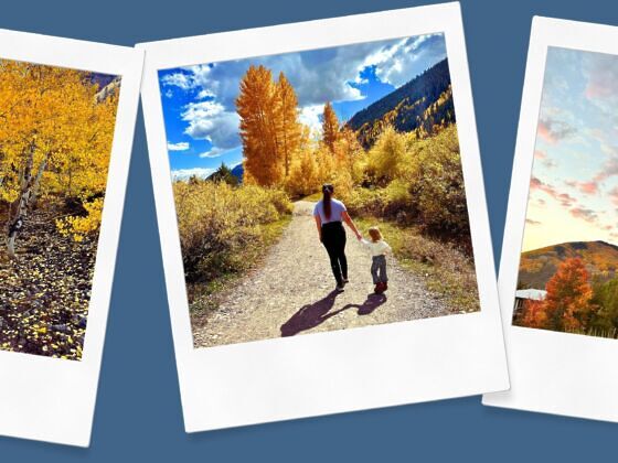
My wife and I left Denver with our toddler, Margot, at about 7 AM on Friday. We took Route 285, and within a couple of hours we were over the continental divide and greeted by bunches of aspens along the side of the highway and covering the mountainside. The number of times we gasped at the sights and pulled out our phones for pictures would have been embarrassing if it wasn’t just us in the car. Even Margot got in on it with exclamations of “wooooow!” and “yellow tree!”
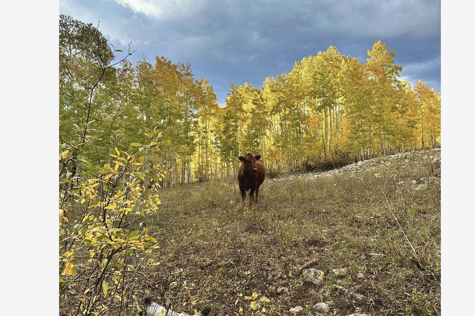
We thought we’d seen the best of the best by the time we went through Cottonwood Pass, between Chaffee and Gunnison counties. Then we reached Highway 135. The road has historically been used for cattle drives, and the animals still graze public lands and roam along much of the route freely. Sure, this makes driving slow in the early hours to account for cow crossing, but slow speeds allow time to better appreciate the scenery (and baby cows jogging to keep up with their moms only adds to the picturesque drive). Little did we know, cows would become a recurring theme.
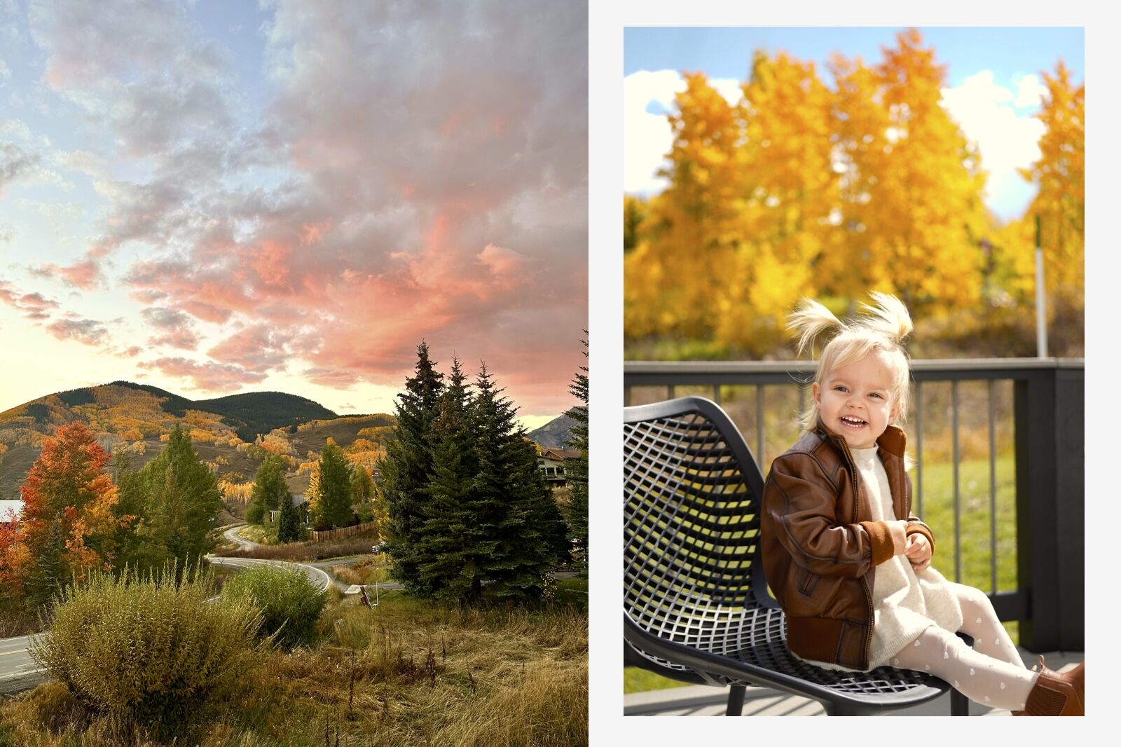
The sunset view from the porch at our Airbnb ended each day in a burst of color. During the day, the back porch was the perfect spot to be surrounded by aspens without having to leave the property. Photos: Nickolaus Hines / Heather Leyva
Our home for the weekend with eight adults and two toddlers was an impressive house just outside of Crested Butte proper. Mountain views could be soaked in from all angles along the patio, porch with a hot tub, and large windows. We were there to see more than the immediate area around the Airbnb, but some of the best sights were right outside the door: dramatic sunsets, roaming bucks and families of deer, and, of course, yellow aspens.
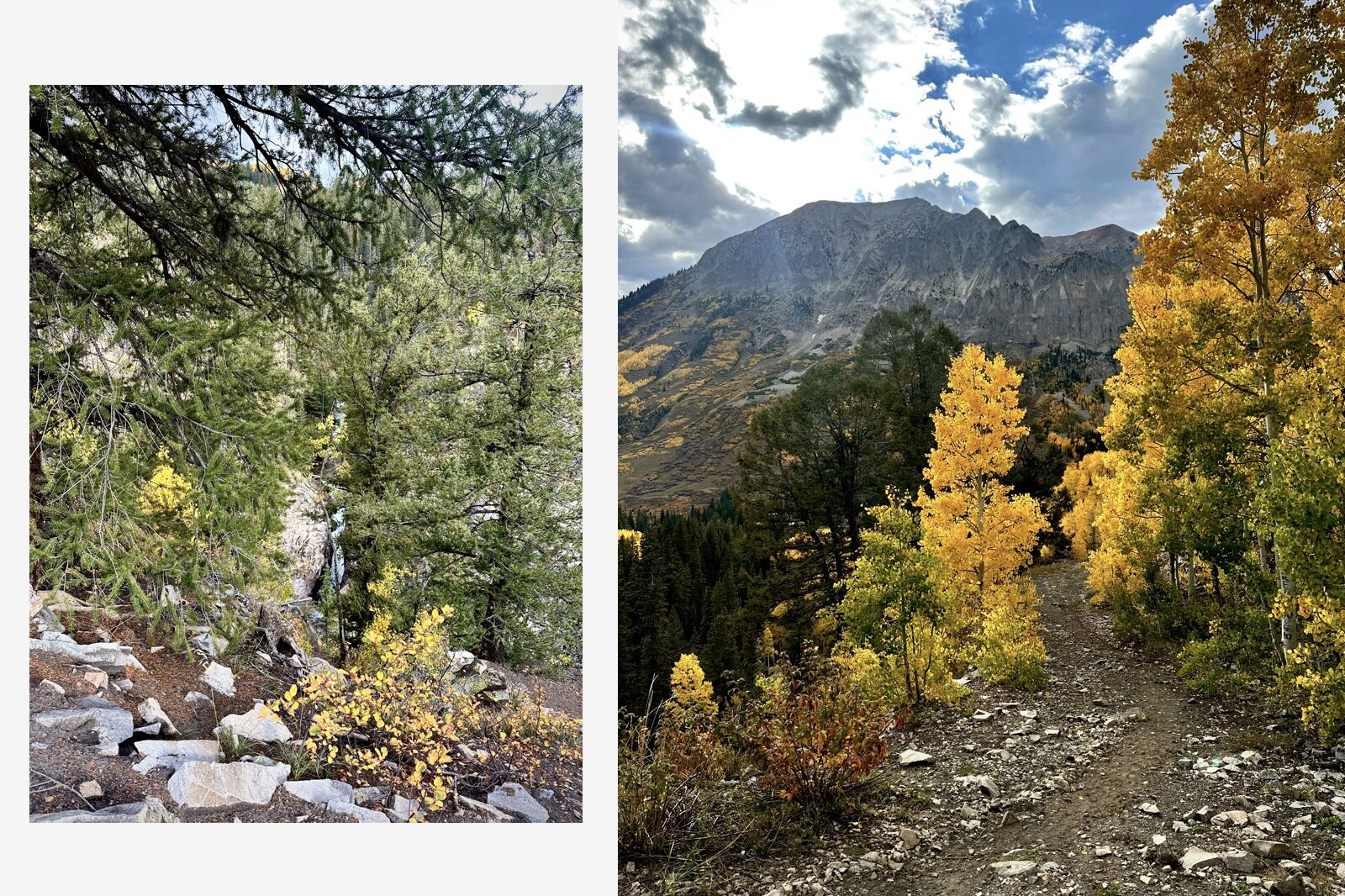
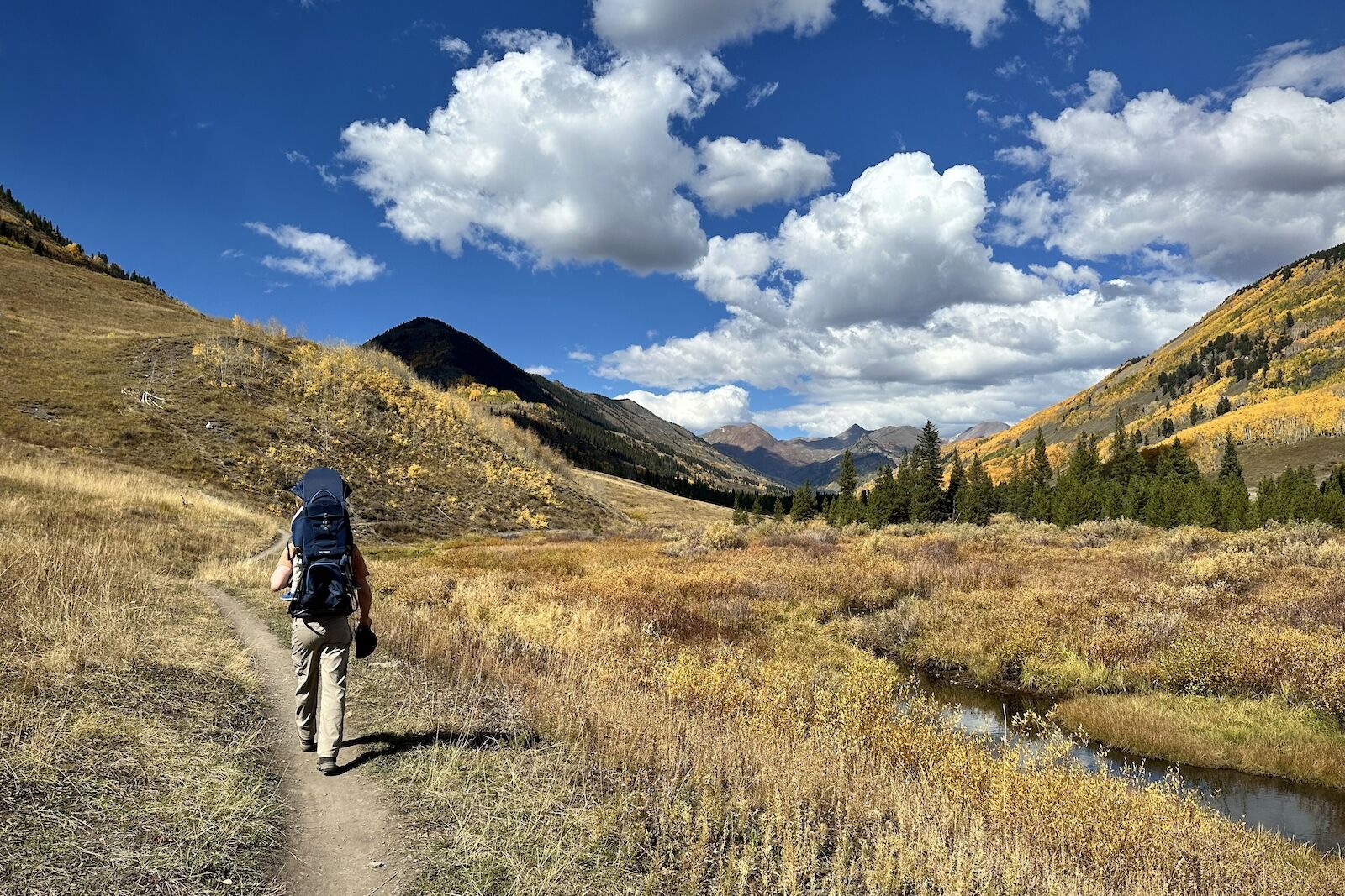
Getting there: Drive Highway 135 from Crested Butte toward Gothic. Park at the Copper Creek lot at the base.
Distance: 1 mile
Max elevation: 9,882
Elevation gain: 166 feet
Difficulty: Easy
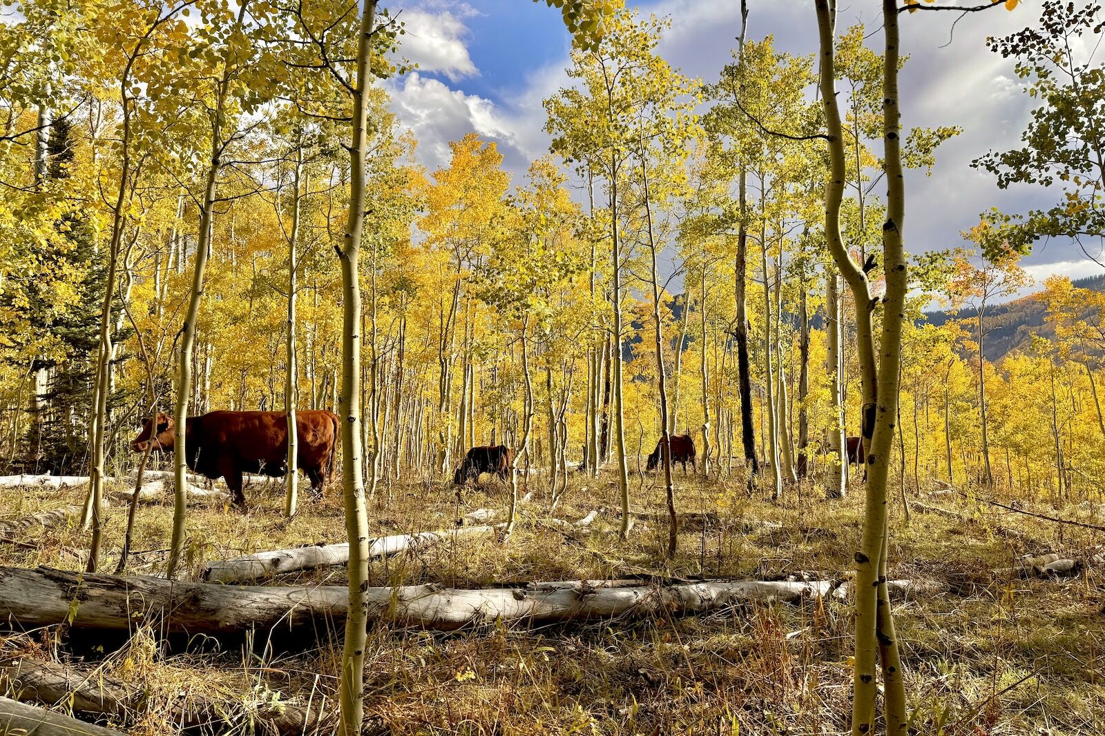
The hike to Judd Falls is a short drive from Crested Butte past the town of Gothic, an abandoned mining town that has been home to the Rocky Mountain Biological Laboratory since 1928. In addition to field researchers, the town is filled with many cows that wander up to the trails to graze. Photo: Heather Leyva
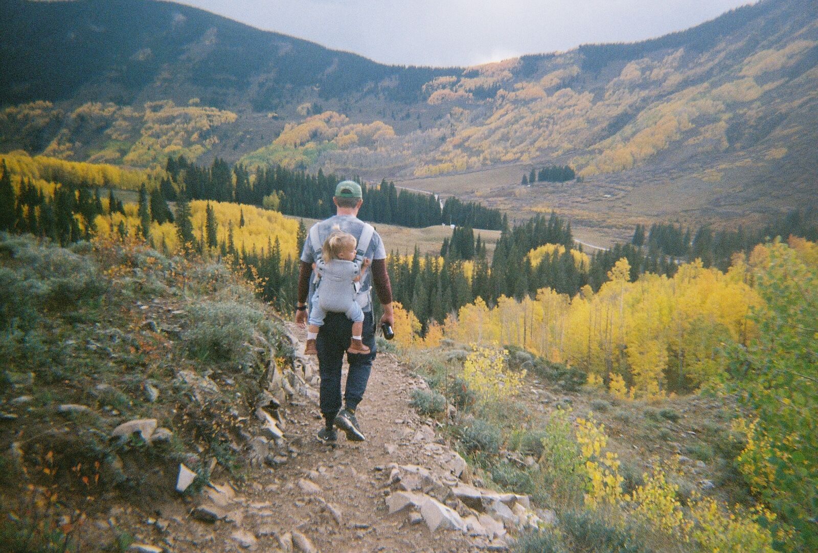
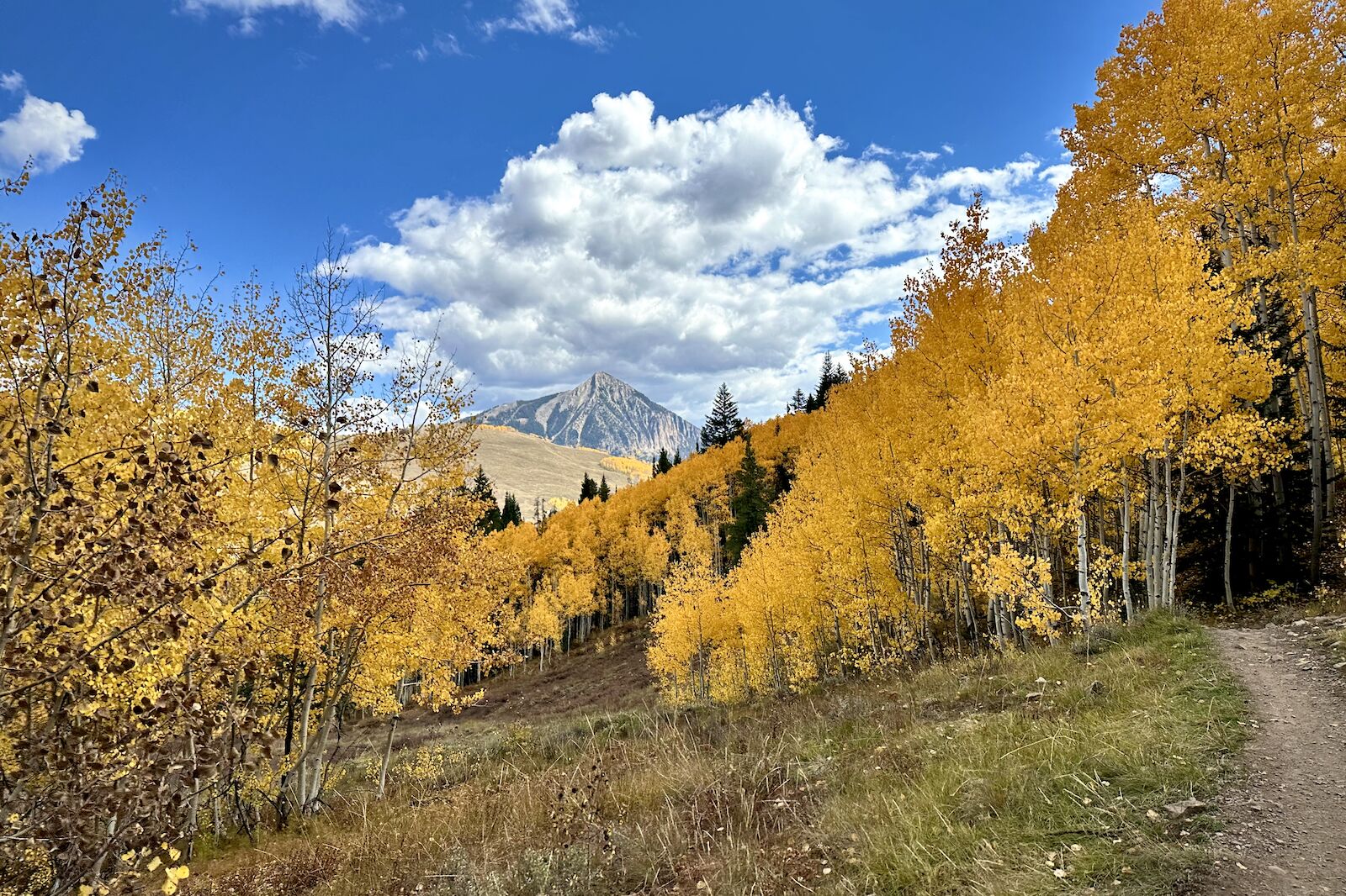
Descending into the aspens at their peak is something hard to translate to a photo — whether on film like this one or with a fancy mirrorless or DSLR. That Doesn’t slow the groups of people who try (us included). Photo: Heather Leyva
The cows stay close to the trail and tolerate photo-hungry hikers, but always keep a safe distance. Photo: Nickolaus Hines
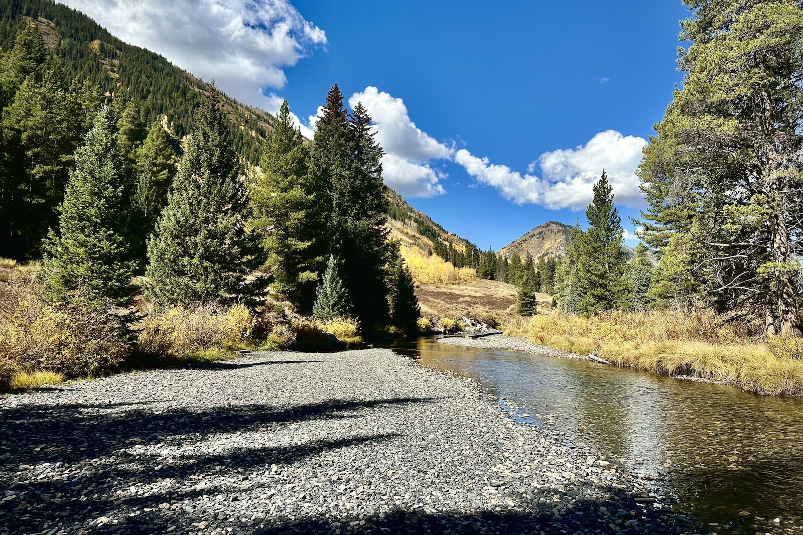
The waterfall at the top of the one-mile hike isn’t the most striking in the world, but the path to get there with the sound of falling water in the background is the perfect quick afternoon jaunt. Photos: Nickolaus Hines
Leaf peeping along Lower Loop in Crested Butte
Getting there: Take a left on First Street in Crested Butte and drive the unpaved Peanut Lake road. Park in the designated spot, or the family and wheelchair accessible parking spot half a mile up.
Distance: 6.4 miles
Max elevation: 9,096
Elevation gain: 640 feet
Difficulty: Easy
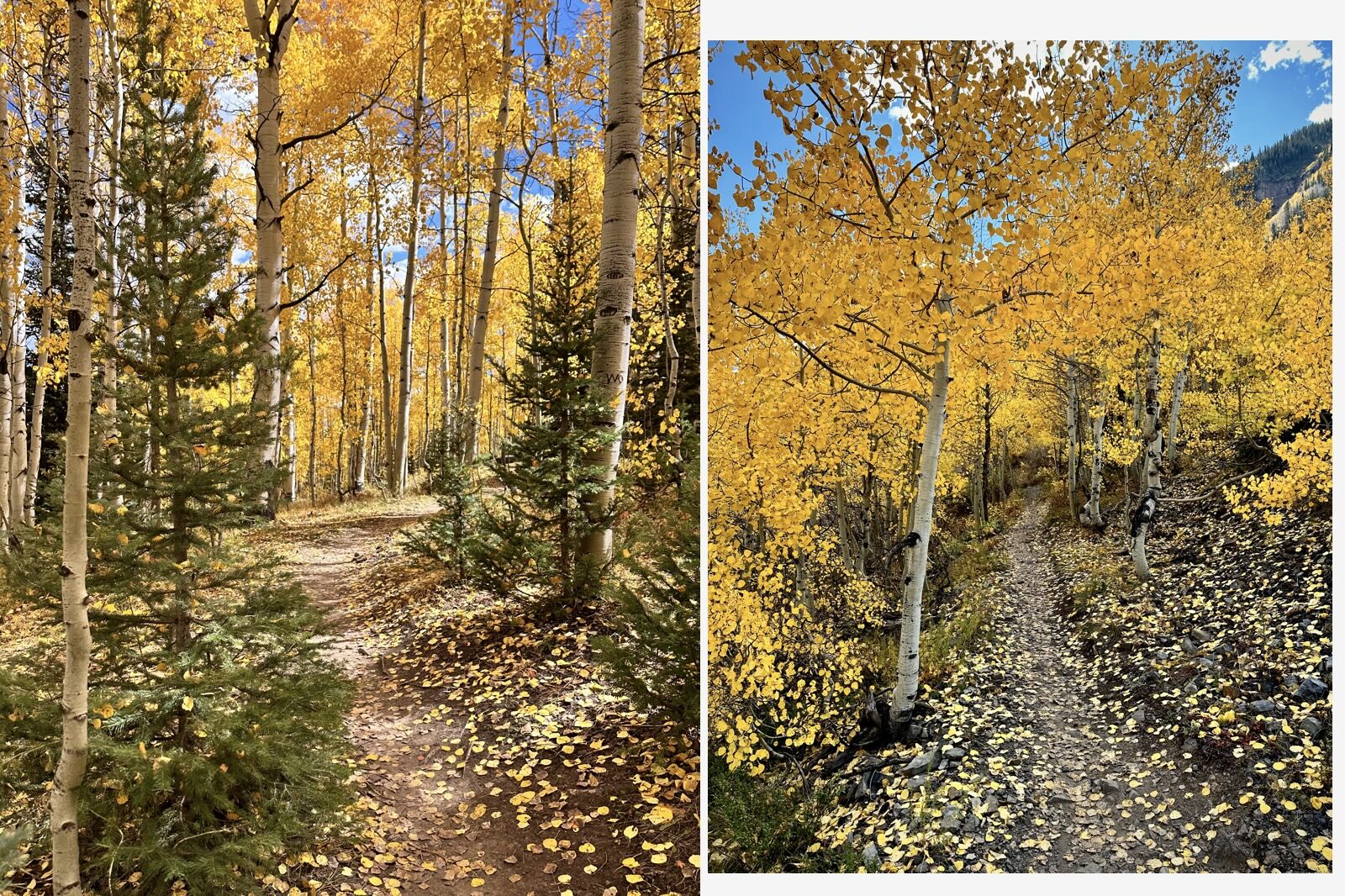
Lower Loop trail runs just over six miles with a max elevation of about 9,000 feet. It’s relatively easy with a clear path and low elevation gain through trees with mountain views in abundance. Photo: Nickolaus Hines
Perhaps the most striking part of the Lower Loop trail in the fall are the aspen tree tunnels along the path. Photos: Nickolaus Hines
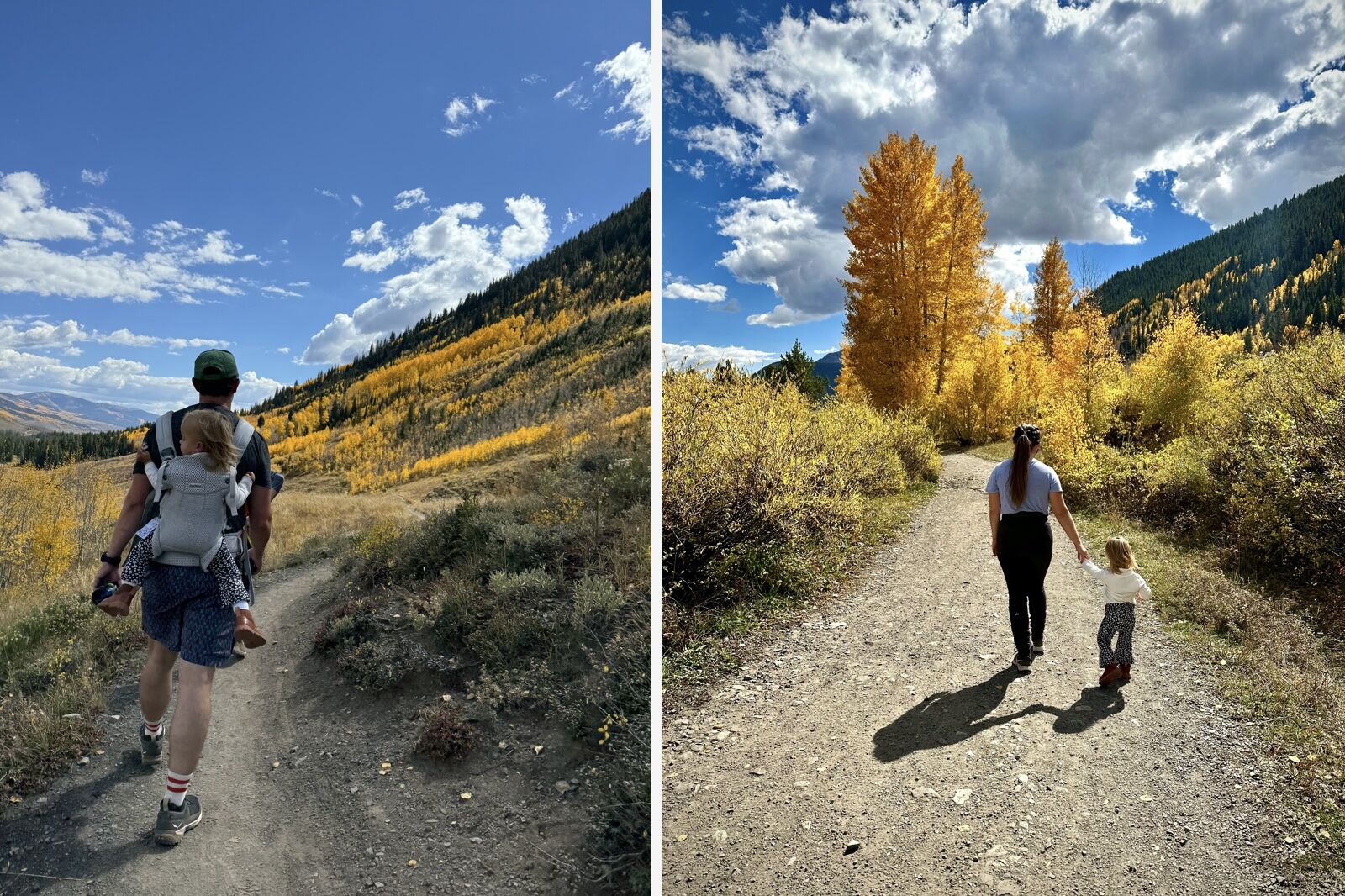
While the path is easy to follow even with a baby in tow, note that it’s also popular with local mountain bikers who aren’t too pleased about the popularity of Lower Loop for people walking. Photo: Nickolaus Hines
Lower Loop stays close to the Slate River. Near the start of the loop (or the end on the way back), there’s a nice place to stop off to skip rocks and dip toes in the water. Photo: Nickolaus Hines
Lower Loop is a great hike for people with little ones, with portions that even the newest walkers can manage. Photos: Nickolaus Hines / Heather Leyva