Several times a year, I head to Nevada to indulge my passion for dark skies and night photography. With 2.5 people per square mile, once you get out of the Reno and Las Vegas areas (compared to 29,000 per square mile in New York City), Nevada’s vast expanses of wide-open spaces and undeveloped public lands mean some of the darkest skies in the US. Two ginormous areas are among 245 dark sky places designated by DarkSky International: Great Basin National Park to the east and Massacre Rim in the northwest. But stars galore don’t stop there — Nevada has little to no light pollution across many millions of its 70 million acres and is a hotspot for growing interest in astrotourism.
All photos by Therese Iknoian
Camera Roll: Chasing America’s Darkest Skies on a Nevada Road Trip
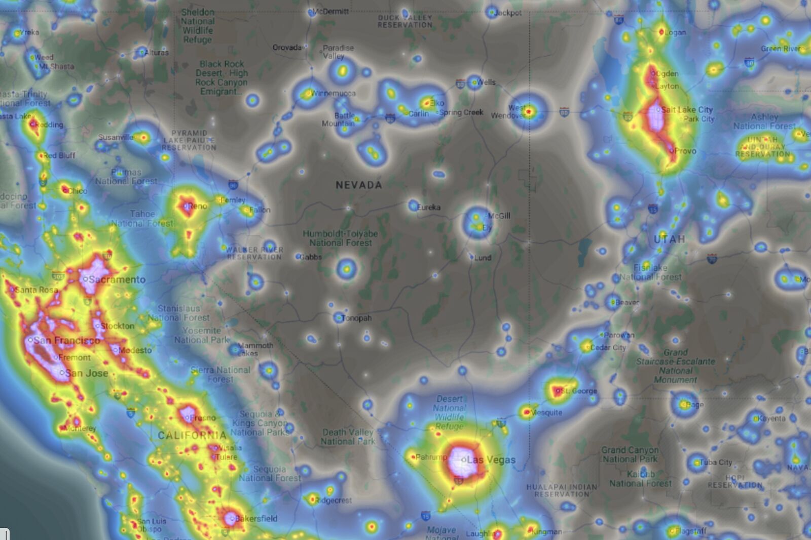
A light pollution app can help you track and avoid light pollution. This shows Nevada and its expansive areas of dark skies. Photo: Therese Iknoian
To illustrate the lack of light, I show people my light pollution map: blue marks areas with the least light pollution. No color means it’s so dark that experts don’t even rate it. Nevada is nearly one big swath of no color. This is a level of darkness very few ever experience, especially since light pollution is growing at about 10 percent a year, according to DarkSky International.
I’d planned a night sky photography road trip in early summer that would take me on a big loop from Reno, down to Fort Churchill State Park south of Fernley, then up into the more remote northwest through Gerlach and into Massacre Rim. My goal was to get awesome night images with some light painting to draw out foreground elements.
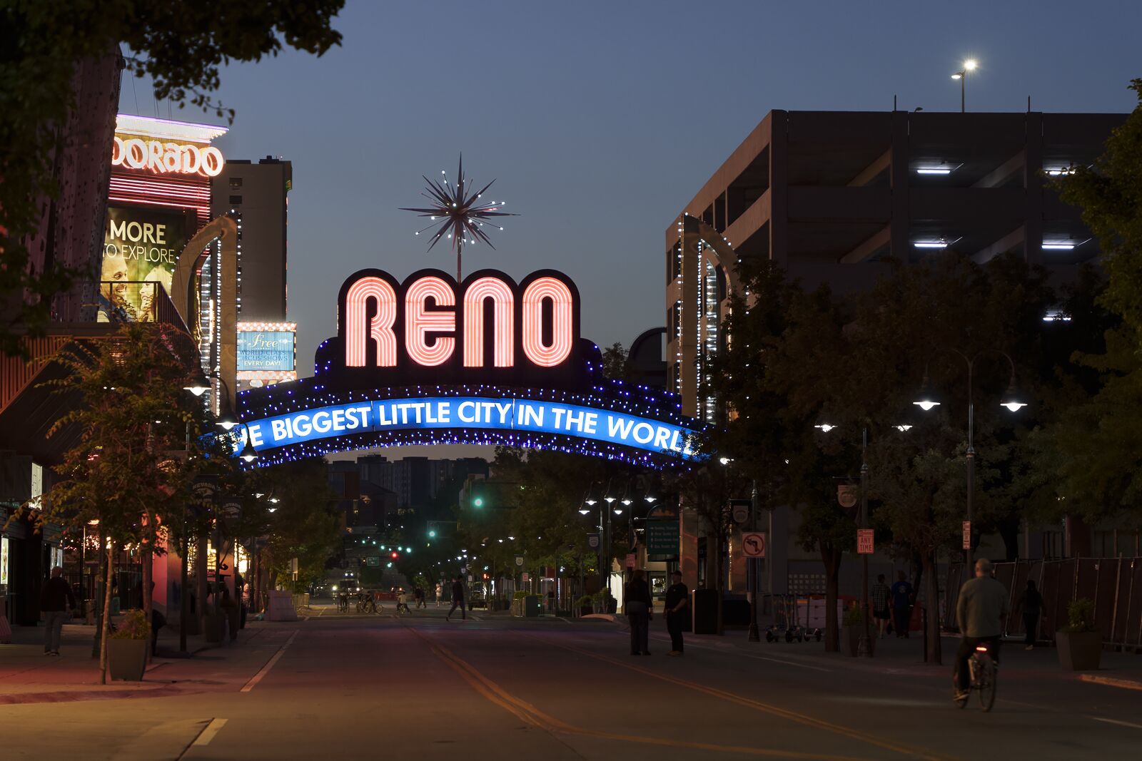
This neon welcome sign for Reno has been there since 1987, replacing the original that was installed in 1926. Photo: Therese Iknoian
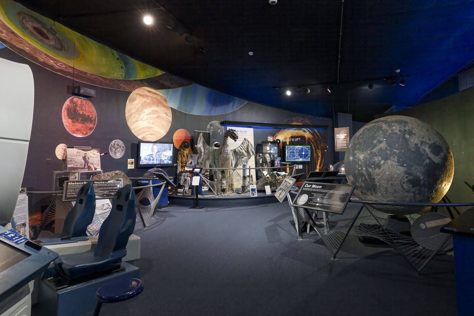
The Fleischmann Planetarium in Reno serves as a great start to a night sky adventure to help you understand the stars. A historic landmark in Reno, it was built in 1963 and was the first in the world to showcase 360-degree projections in its full-dome theater. Photo: Therese Iknoian
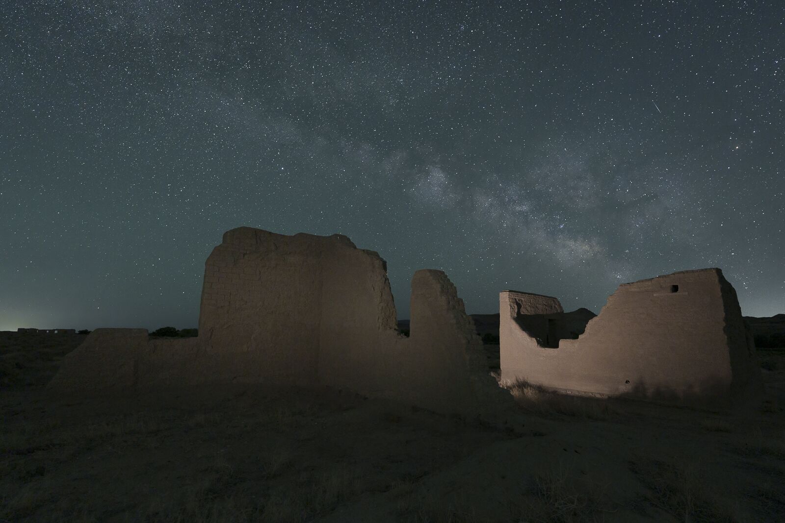
About 30 minutes south of Fernley, the crumbling adobes at Fort Churchill State Park were first built in 1860 as a US Army outpost. Its goal was to protect emigrants, the Pony Express, and telegraph lines. It was abandoned in 1869 and became a state park in 1957. It‘s open 24/7, and its adobes allow a lot of photographic possibilities with the dark skies. Photo: Therese Iknoian
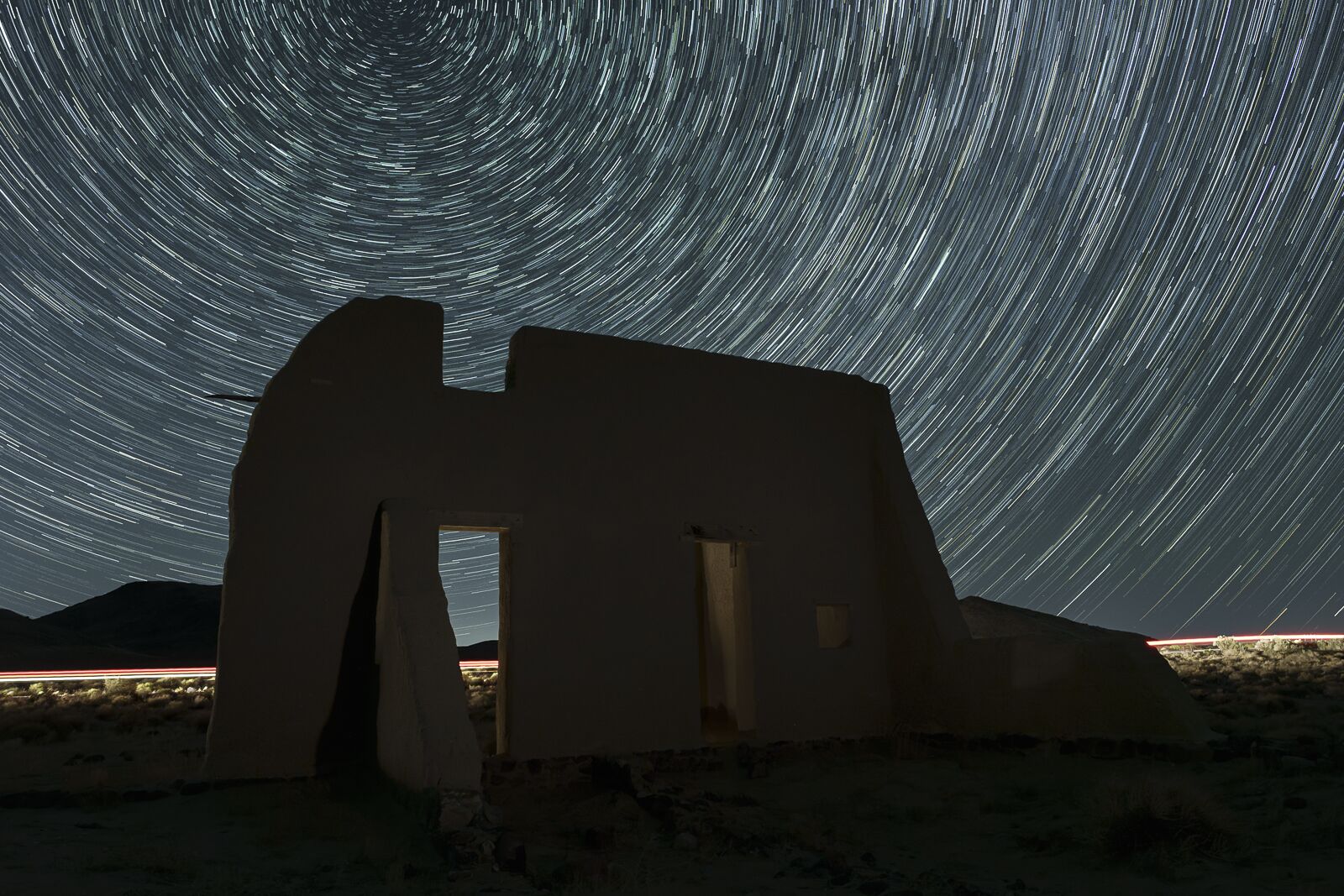
For this photo, I was facing north-northeast, so I could create “circles” of stars moving around the North Star over the adobe ruins. After focusing and testing light settings, I set my camera to take a series of 30-second photos with one second between each. This ran for approximately 35 minutes. A dirt road behind the ruins is traversed infrequently — but I was lucky enough to get a car passing by to create trails of light — and help illuminate the scene behind the ruins. Photo: Therese Iknoian
The gear I packed included my tripod (OK, two, just in case), my cameras (I use the Sony A7IV), and several “fast” Tamron and Sony lenses (meaning the aperture can be opened very wide, such as F/2.8, to gather more light). I also carry several handheld light panels that can be adjusted to a cooler or warmer light and to desired degrees of brightness to help me illuminate parts of a scene, as well as a handful of small flashlights not only to get around but also to use in “painting” a composition to brighten certain areas. I also use a photo app called PhotoPills with an AR function, so you know precisely where stars will be at any time to help plan compositions.
If you shoot primarily with a smartphone (less desirable for most detailed night photography), there are apps you can download to achieve the adjustments of aperture, shutter speed, and ISO (which is the camera sensor’s sensitivity to gathering light). But even with a smartphone, you’d need a tripod or a stability device and some lights.
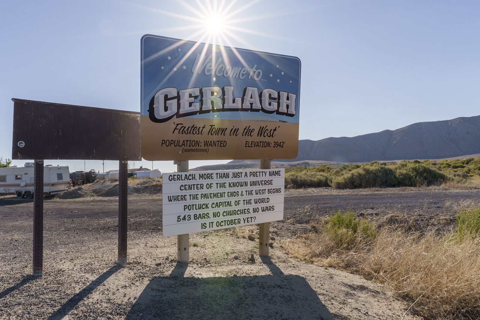
As the gateway to Burning Man on the Black Rock desert, Gerlach has a lot of attitude for a small town of about 120. In 2017, it was named rather randomly as the “Darkest Town in America” by an ABC news program — and the title has stuck. The town blossoms to about 80,000 when Burning Man participants come through. Photo: Therese Iknoian
There are plenty of lights in Gerlach. High above at the so-called “Passionate” overlook (a local’s place for canoodling), I could lower my tripod and block out most of the direct light, leaving only a glow that complements the Milky Way overhead. Photo: Therese Iknoian
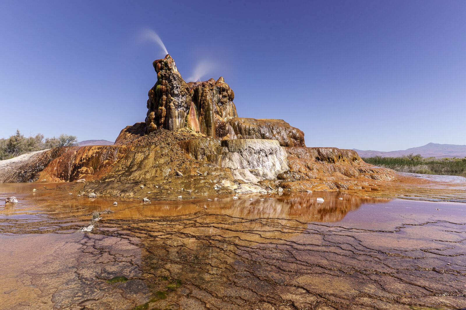
The Fly Geyser just outside Gerlach can only be visited on a Saturday tour — and is well worth it. Its formations and colors aren’t to be missed. There are hot springs all around the area, but this one sat bubbling for decades until a geothermic company drilled, seeking water to harness energy. Only the water wasn’t hot enough. So the company capped it but didn’t seal it well, so it kept leaking and created the formations that continue to grow to this day. I used a neutral density filter to take this photo — it makes the scene darker so you can lower the shutter speed and smooth out water. Photo: Therese Iknoian
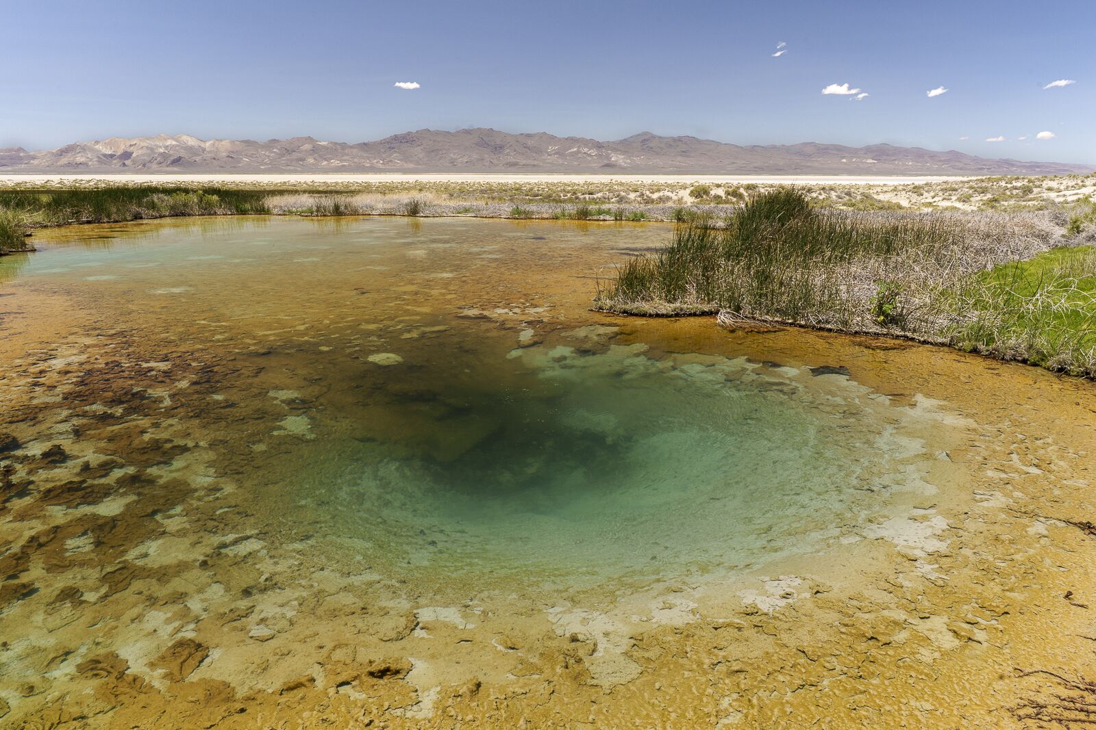
On the edge of the playa made famous by Burning Man, these natural hot springs supplied water to emigrants in the 1800s as they crossed the country. Today, it’s one of several in the BLM-managed Black Rock Desert area — some of which are so hot, it’s not safe. To see more clearly into the water, I used a circular polarizer/linear filter to reduce reflections. Photo: Therese Iknoian
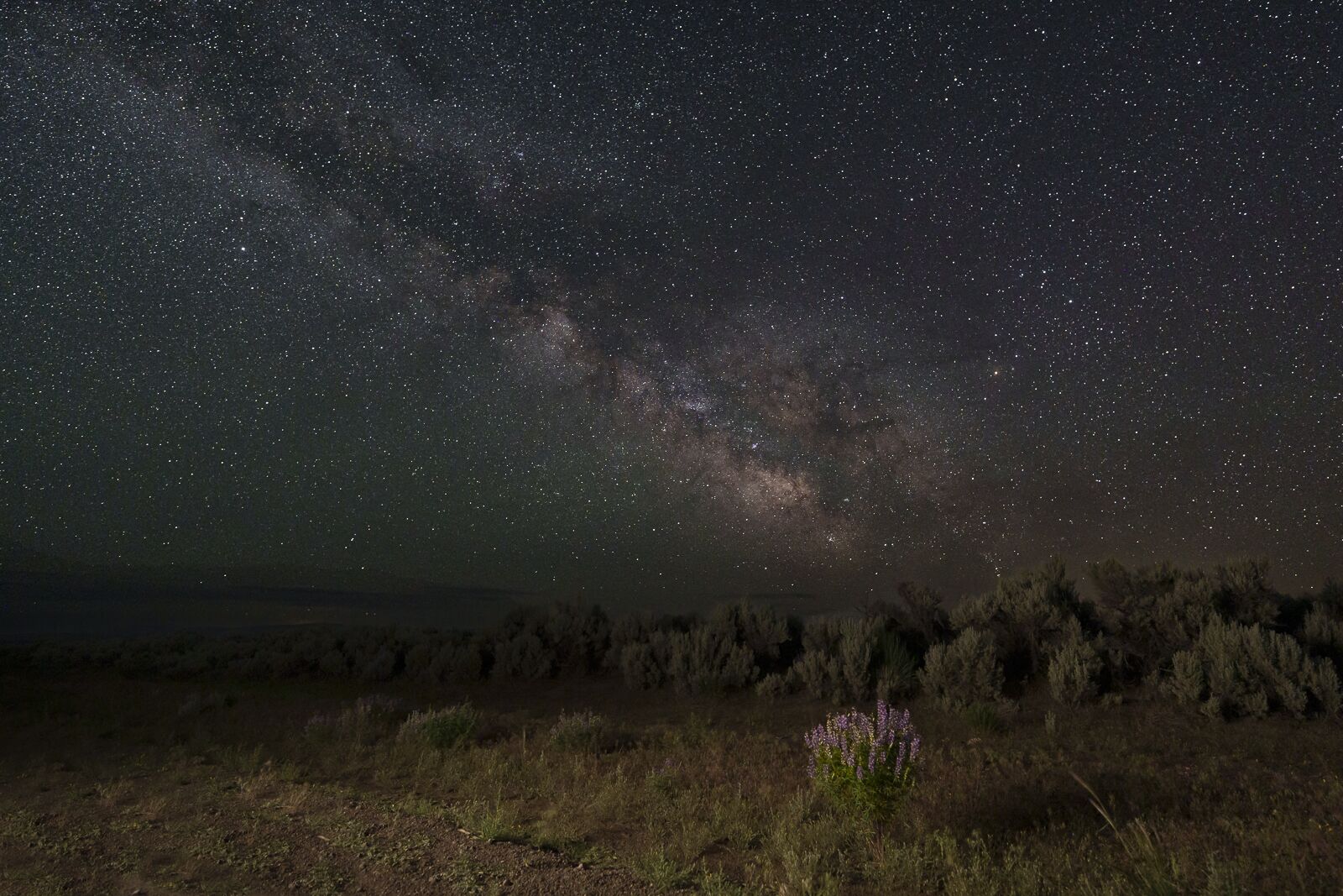
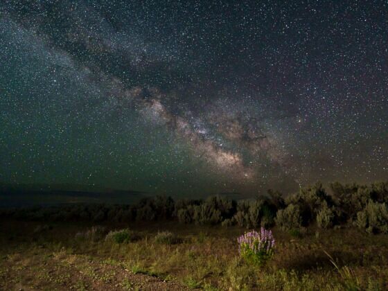
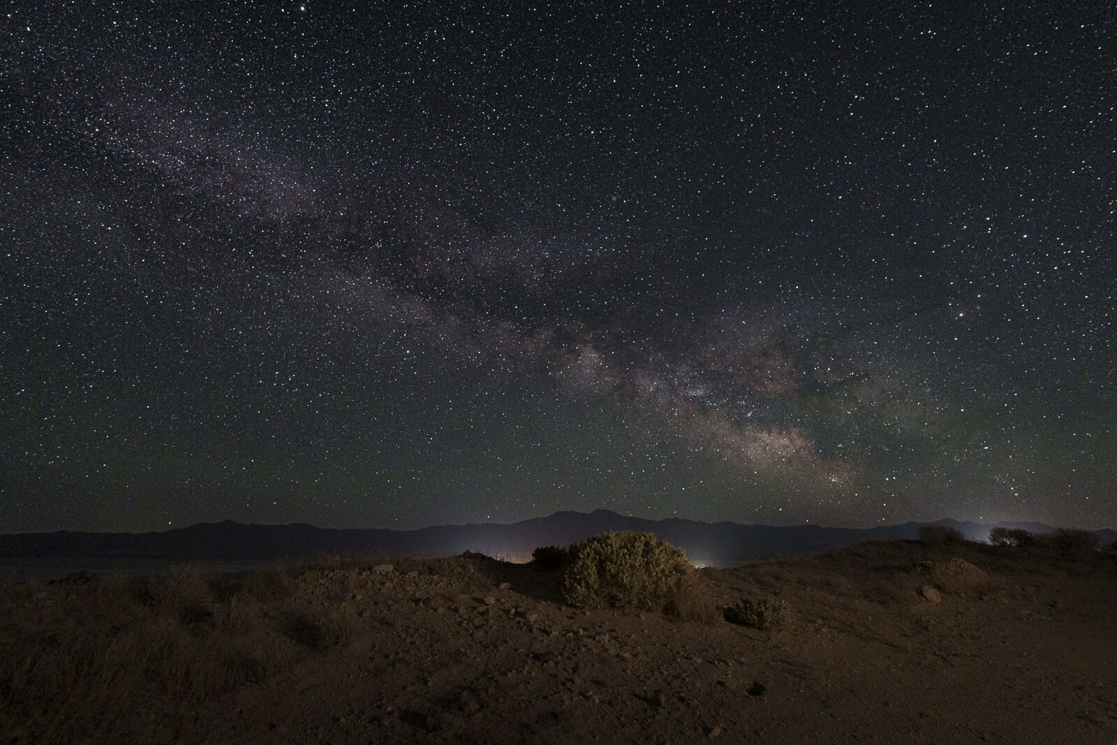
On my first night in Massacre Rim, I had a short window when I could shoot to the southeast without clouds. That was great because that’s where the Milky Way is in June. I drove along a dirt road and found some wild lupine. What a great foreground for a simple Milky Way shot. I illuminated the flower with a flashlight. Photo: Therese Iknoian
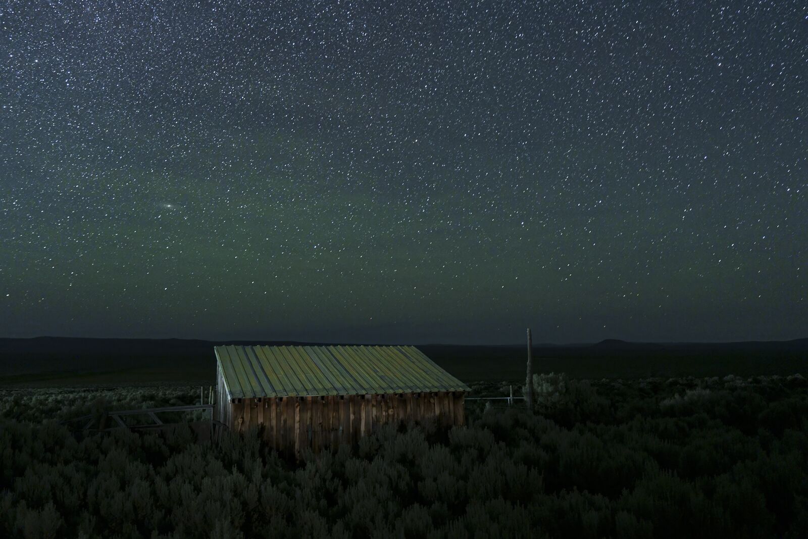
Once I returned to Old Yella Dog Ranch the first night, I realized I had a photo right from the back deck since the clouds had then moved out of the eastern sky. The small barn next to the ranch lodging provided foreground, which I illuminated slightly with a light panel. What I didn’t realize until I took the star-filled photo is that there was a hint of aurora in the sky. Photo: Therese Iknoian
The reality of night photography is that you can’t control the weather — a reality I faced during part of my trip. Nevada experiences a “monsoon” season for much of the summer. Still, mid-June is usually moderately safe, with July and August often being months to avoid — unless you can allow extra time to wait out a passing storm or two. Even though it was June, I was welcomed with hail, snow, and rain — with a lot of clouds — in the Massacre Rim International Dark Sky Sanctuary. This was part of a freak storm that moved through Northern California and Nevada.
What’s a photographer seeking stars and skies to do? After you finish a prayer and rub your lucky amulet, you hope to find a section of sky that’s not cloudy and shoot just in that direction — as I did one night in Massacre Rim. If there’s no clearing? Well, you find something to light paint and hope the clouds create a great background. I tried that the second night with a vintage fire truck with moderate success. The best scenario is to have an extra day or two in case a storm rolls in and clouds out your stars.
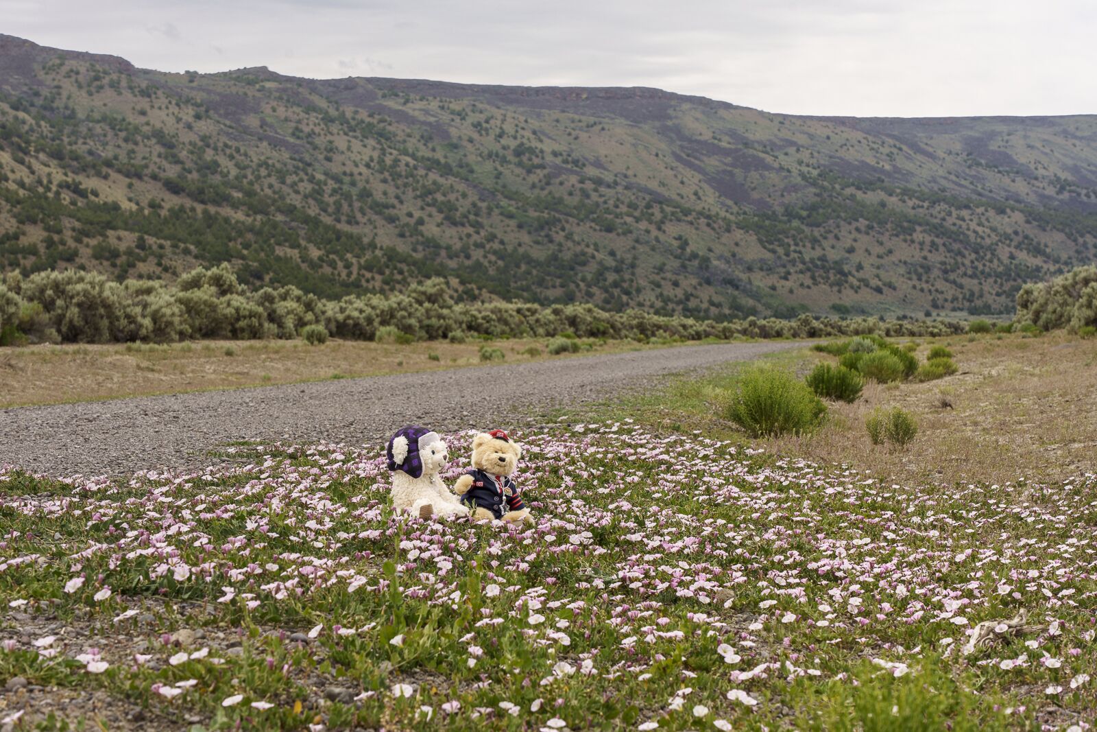
Sometimes you need travel companions. Meet Bennie on the left and Dieter on the right. The pink wildflowers made them quite happy on this very gray, cloudy day. Photo: Therese Iknoian
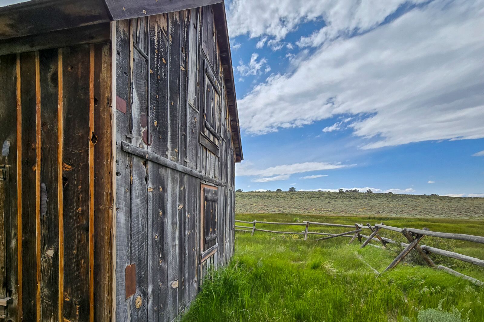
The Sheldon National Wildlife Refuge borders Massacre Rim — and also has plenty of open space. You can take a one-day loop drive that takes you up one side of Massacre Rim, through and across the refuge, and back down the other side of Massacre Rim. In Sheldon, you drive past the historic Last Chance Ranch, built in 1890. Today, the ranch is preserved and provides spring water to wildlife in the area. There are several remote campgrounds in Sheldon. Photo: Therese Iknoian
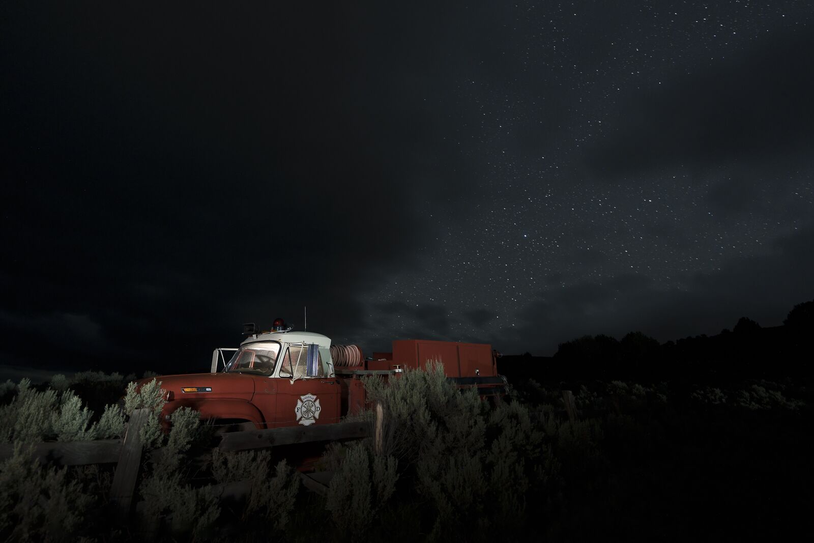
On my second night in Massacre Rim, the skies refused to clear. As I paced the cabin hoping for stars, I spied a clearing to the west-southwest. There was a vintage firetruck sitting next to the Old Yella Dog Ranch property positioned just right. If I couldn’t get pristine night skies and stars, I could light paint the truck and get a few stars. The small opening started closing immediately after I was set up, as the black storm clouds that were to drop hail and snow that night rolled in. Nevertheless, the stars “spewing” out the back of the truck are fun, and it shows you what you can do if you don’t have a star bounty. Photo: Therese Iknoian
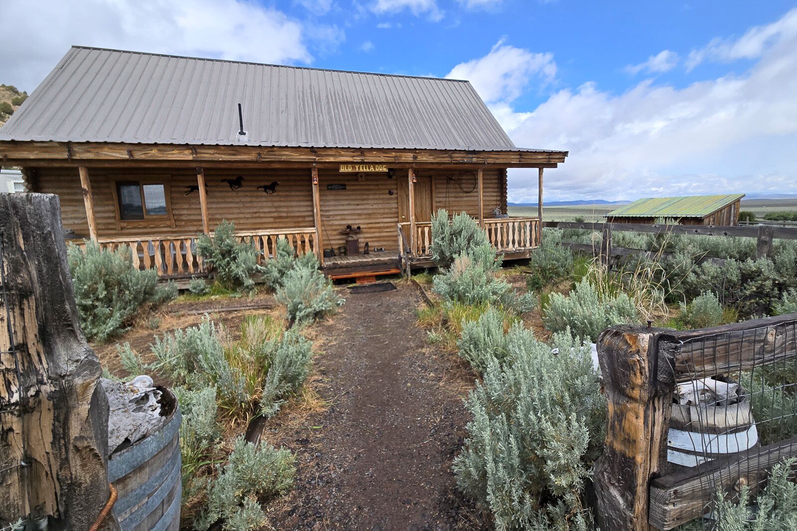
With only a couple of places to stay, Old Yella Dog Ranch is an oasis in the middle of seemingly nowhere. Rustic, yet equipped with everything you may need. Photo: Therese Iknoian
Despite that, I was able to enjoy my days, touring some indoor sights in Reno, exploring some towns and outdoor areas in Nevada’s northwest, and staying at the Old Yella Dog Ranch at the edge of Massacre Rim. Old Yella Dog is a cozy retreat and one of only two places you can lodge in the immediate area unless you camp.
You can enjoy the Nevada adventure — and maybe start planning your own — using the photos from my trip, including a few dark sky images I managed to capture despite the stormy weather. ![]()