North Carolina is pure heaven in the summer. The breezes along the Outer Banks make the humid beach days feel like a tropical paradise. The cities are alive with summer festivals. And the mountains in the west are warm enough to hike — and usually dry enough to do it comfortably. Of course, in spots like Great Smoky Mountain National Park and much of Asheville, you’ll find tens of thousands of other people who are in on North Carolina’s beauty too. In other areas, however, you can still find hikes where you’ll be alone with nature. Here are seven of the best hikes in North Carolina you shouldn’t have to share with too many other people.
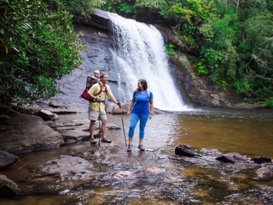
7 North Carolina Summer Hikes Most of the World Hasn’t Discovered
1. The Richland Balsam Overlook
One would think going to the highest point along the Blue Ridge Parkway would be a grueling, daylong trek up rock boulders and mud. However, it’s actually a pleasant, 1.5-mile jaunt through a spruce-fir forest, with wildflowers that make it the best-smelling trail along the Parkway. The hike, which takes you up 700 vertical feet to 6,053 feet above sea level, is at milepost 431.4 of the Parkway and a calming roadside respite.
Getting there: Going towards Asheville on the Blue Ridge Parkway, head to milepost 431 and turn left into the Haywood-Jackson overlook parking lot. The trail starts in the left corner of the lot.
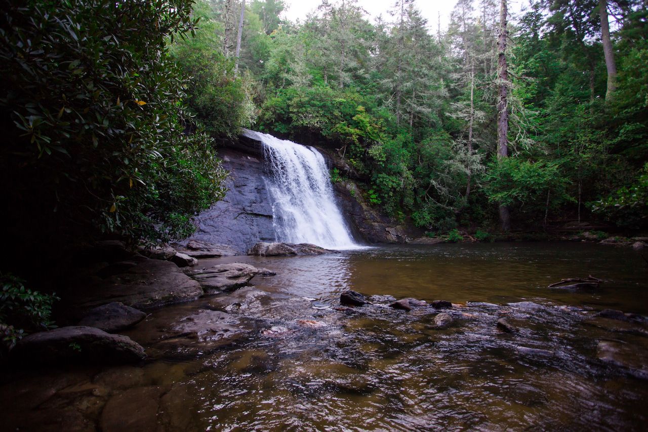
2. High Falls Trail
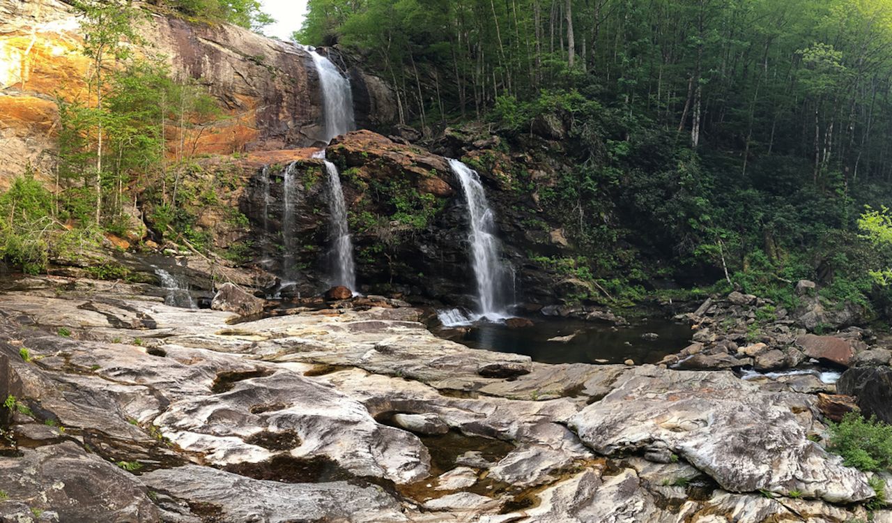
Photo: Nick Breedlove
There’s no shortage of spectacular waterfall trails in North Carolina, but this one is rarely full of people and nearly all downhill. On the way there, anyway. The trip starts at either an upper or lower trailhead, the former off Pine Creek Road in Jackson County, the latter off unpaved Shoal Creek Road near US-64. The upper trail is much easier, about a mile to the falls along a graded road with a good number of steps. The lower trail is a little tougher, about two miles across Shoal Creek, around a ridge, and past Rough Run falls. The two-falls-for-the-price-of-one adventure ends at High Falls, a 100-foot drop fed by the Tuskegee River with a two-section free-fall off a cliff. Whichever route you take, you’ll need to work through some slippery boulders to get to the swimming hole at the base.
Getting there: For the upper trailhead, start in Cashiers and take NC 107 north to Pine Creek Road (SR 1163). About two miles down, park on the right at the Pines Recreation Area. For the lower trailhead, take NC 107 north only eight miles and turn left onto Shoal Creek Road.
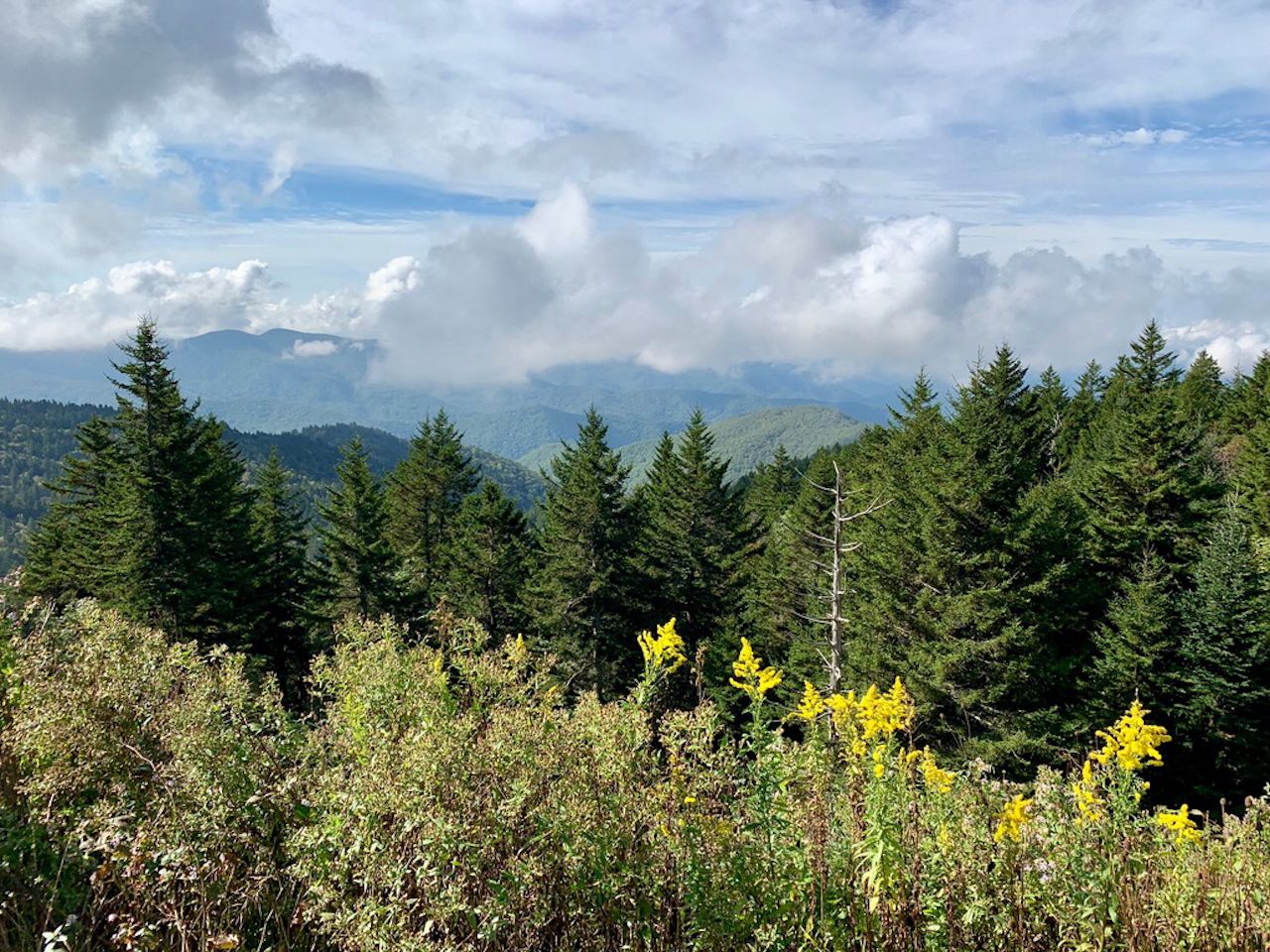
3. Waterrock Knob Trail
The most bang for your mileage buck this summer is the Waterrock Knob trail, a 1.2-mile round trip to the 6,292-foot summit. The 412-feet of elevation gain in the brief three-fifths of a mile to the top might have you stopping to catch your breath a time or two. Which is totally fine since this trail is full of mesmerizing vistas out over western North Carolina. The best views are reserved for the top, though, where the panorama stretches for nearly 50 miles on clear days.
Getting there: From Sylva, take US-23 North/US-73 East 11 miles to the Blue Ridge Parkway entrance at Balsam Gap. Then head south towards Cherokee to Waterrock Knob at milepost 451.2.
4. Owl’s Roost Trail
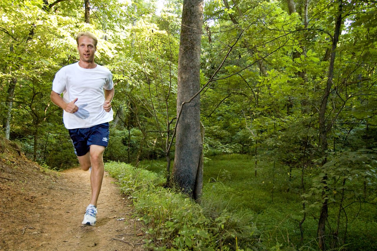
Photo: Robert Seth
Despite this trail near Lake Brandt being named the best urban mountain-biking trail in America by Bicycle Magazine a few years back, hikers still have the right-of-way along its steep hills and tricky descents. The trailhead begins near the end of Bur-Mil park and can run anywhere from four to 5.6 miles, depending on how many of the other lakeside trails you explore. It’s a calming route to walk by the water and challenge yourself with some vertical terrain, and some of the paths are even paved for a pretty easy technical adventure.
Getting there: From downtown Greensboro, take US-220 (Battleground Ave.) north for 5.7 miles. Turn right onto Owls Roost Road, then left onto Bur-Mil Club Road. Head all the way to the Wildlife Education Center at the end of the road, and begin your journey from there.
5. Whiteside Mountain Trail
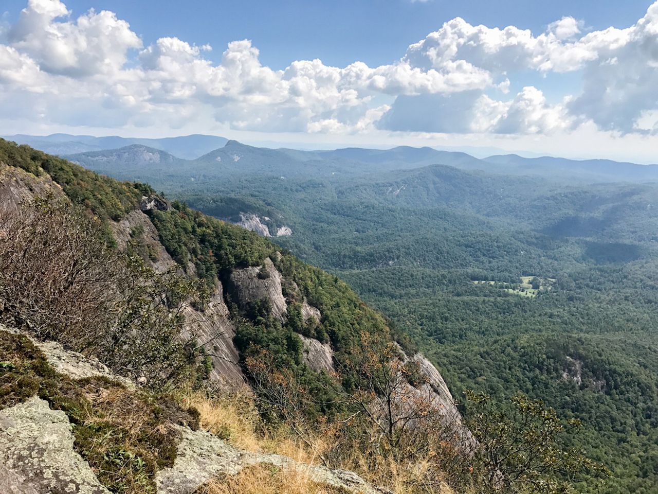
Few outside of the climbing community probably know the highest vertical cliffs in the eastern United States are at Whiteside Mountain. The cliffs measure about 1,800 feet and draw climbers from all over the world during season. Whiteside’s peak stands at 4,930 feet, and the two-mile trail along the cliffs still takes most people about 90 minutes to complete. The path is filled with purple wildflowers and panoramic views, with peregrine falcons swooping over the valley in the distance. You’ll also find yourself walking through a forest of Canadian hemlock, Fraser magnolia, and yellow and black birch trees, with Carolina rhododendrons filling in between them.
Getting there: Whiteside Mountain sits south of US-64, between Highlands and Cashiers. Look for signs for SR-1600 Whiteside Mountain Road. Head down the road then follow the signs to Forest Service Parking and Trailhead.
6. Pinnacle Park Trail
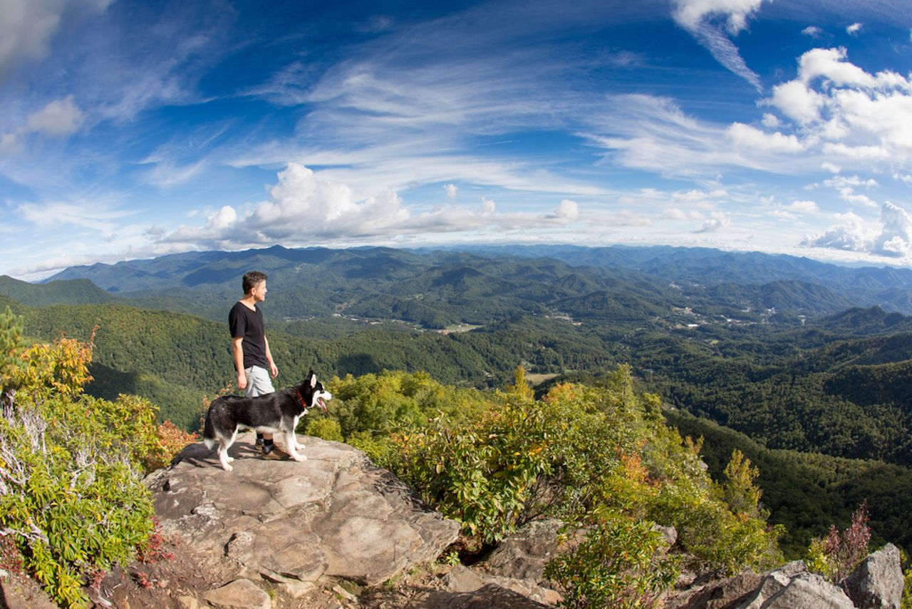
Photo: Nick Breedlove
If you’re looking to put a few more miles on your shoes, try this seven-mile trek through Pinnacle Park. It’ll take you about half a day, going 3,000 feet up the side of the mountain, past small waterfalls, streams, and peeks at the mountains in the distance. The out-and-back trail sits in a 1,000-acre town park in Sylva, running up an old logging road, through some grass, and on to a challenging rocky section. It’s not exactly an expert technical trail but will involve a little bit of skill traversing the boulders. Once at the top you’ll find sweeping views of Sylva and Scotts Creek Valley.
Getting there: Pinnacle Park is in the town of Silva, in the Plott Balsam Mountains about 50 minutes west of Asheville. Once in town, find your way to Fraser Creek Road and take it two miles to park’s gravel parking lot.
7. Silver Run Falls
This will, without a doubt, be the easiest waterfall hike you’ll take in North Carolina. At a small pullout off NC-107, you’ll find a short trailhead that dips down next to an American holly tree. A brief stroll to a footbridge over the Whitewater River brings you to the base of a 40-foot waterfall. This may not sound overly impressive, but for a small waterfall, it’s one of the most photogenic in America, with free-falling water and vertical slides dropping into an expansive pool. Silver Run Falls is a great place to take a short dip or a slew of vacation selfies — and looks a lot further away than 500 feet from a major highway.
Getting there: Turn onto NC-107 off US-64 and go about five miles to the turnout. ![]()