Photo: Visit Arizona/An Pham Photography

Road Tripping Route 66: Amarillo, Texas to Kingman, Arizona

Santa Fe Albuquerque Arizona New Mexico Road Trips
by Suzie Dundas Feb 2, 2026

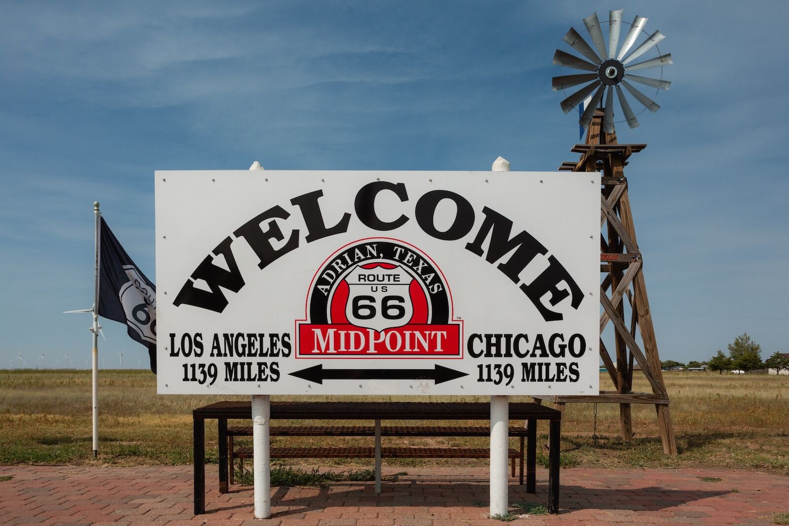
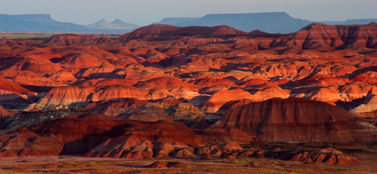
Route 66’s section through the American Southwest from the flat Texas Panhandle to the high desert of New Mexico and Arizona is the portion that many people imagine when they think of the Mother Road. From Amarillo, Texas, to Kingman, Arizona — the third leg of the route if you’re breaking it into four sections — is where the views get vast. The miles west of Amarillo have landscapes so dramatic, bright, and colorful (especially at sunrise and sunset) that it feels at times like you’re driving through a 1950s Western movie set.

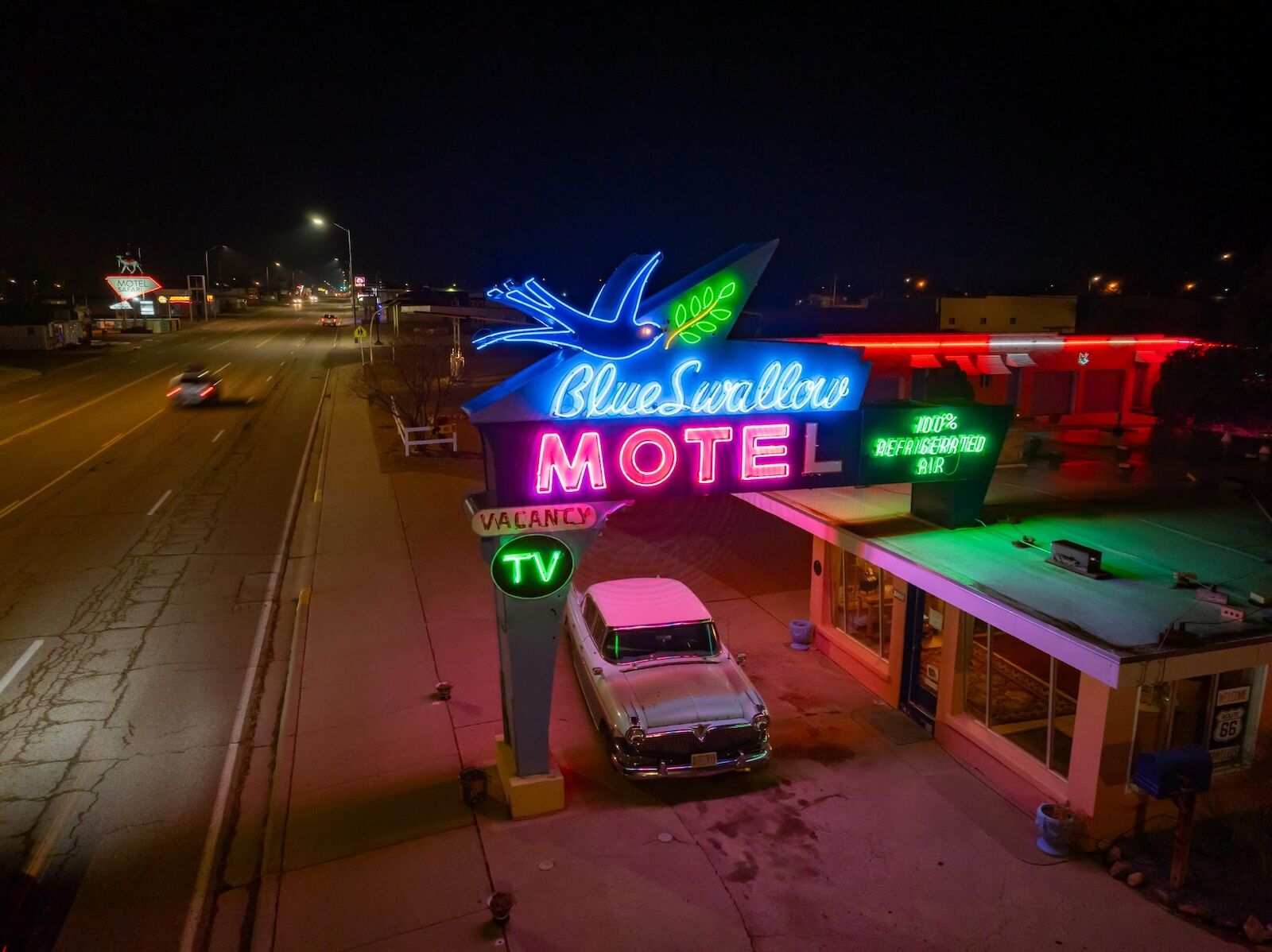
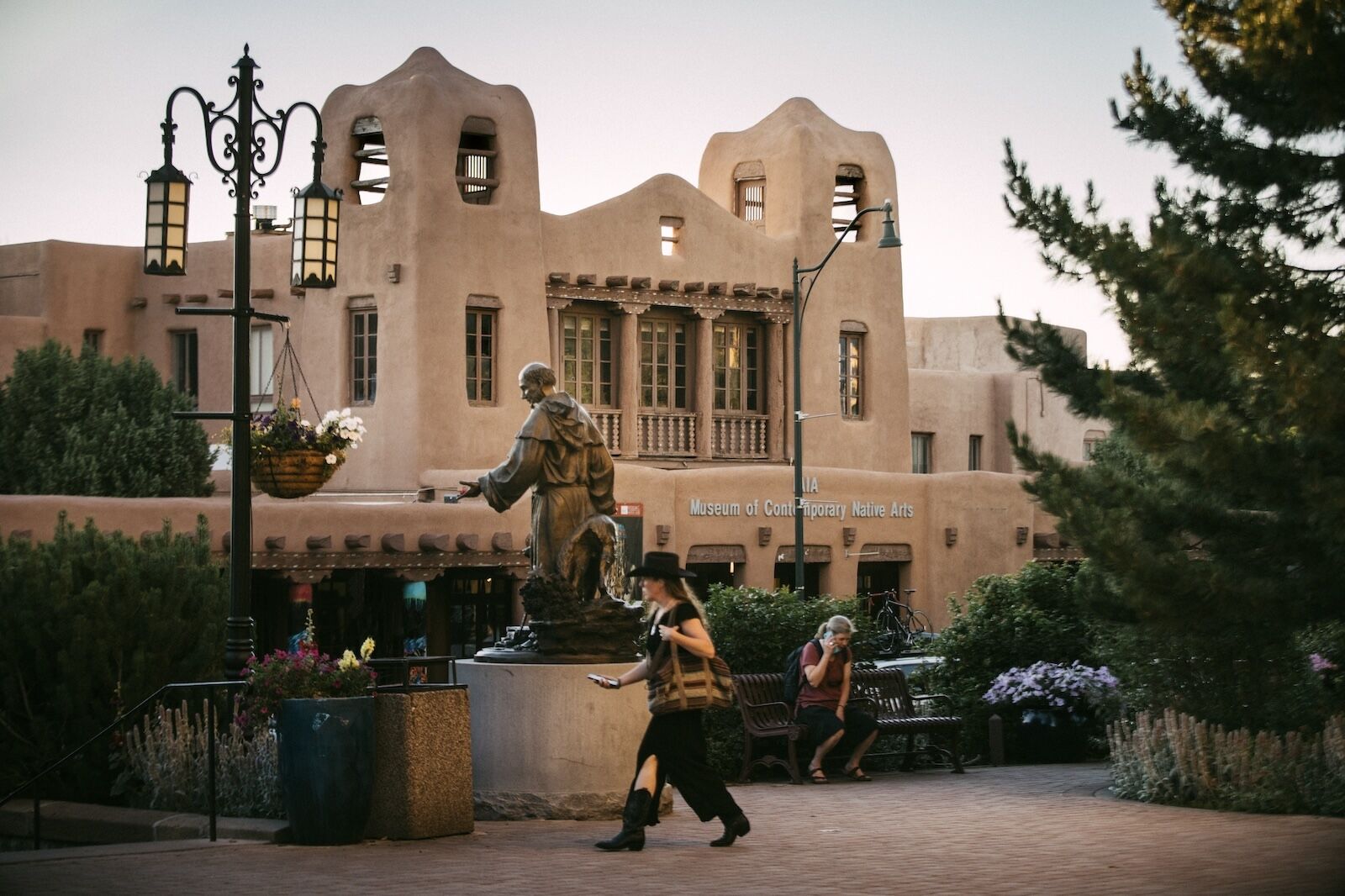
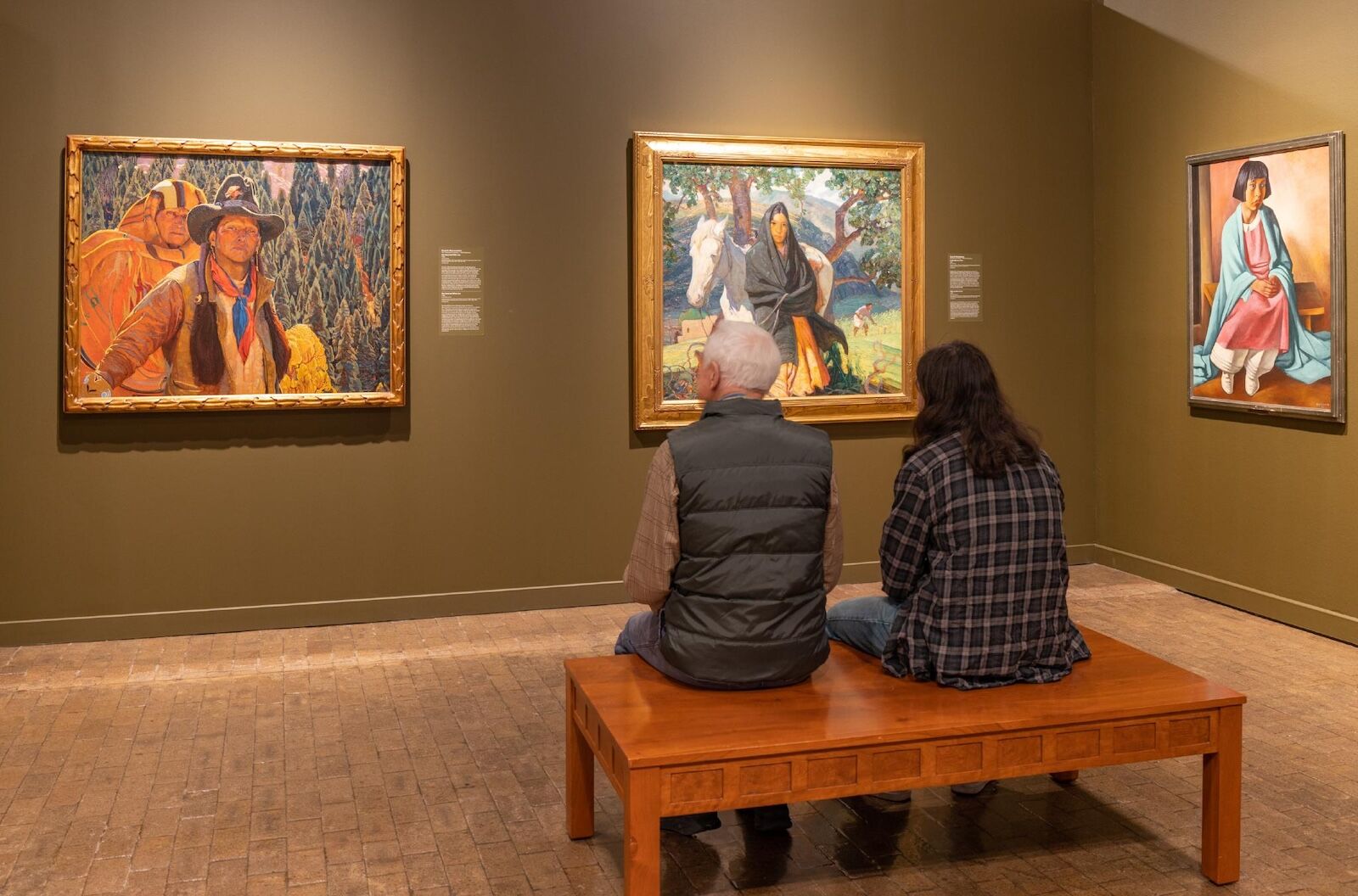
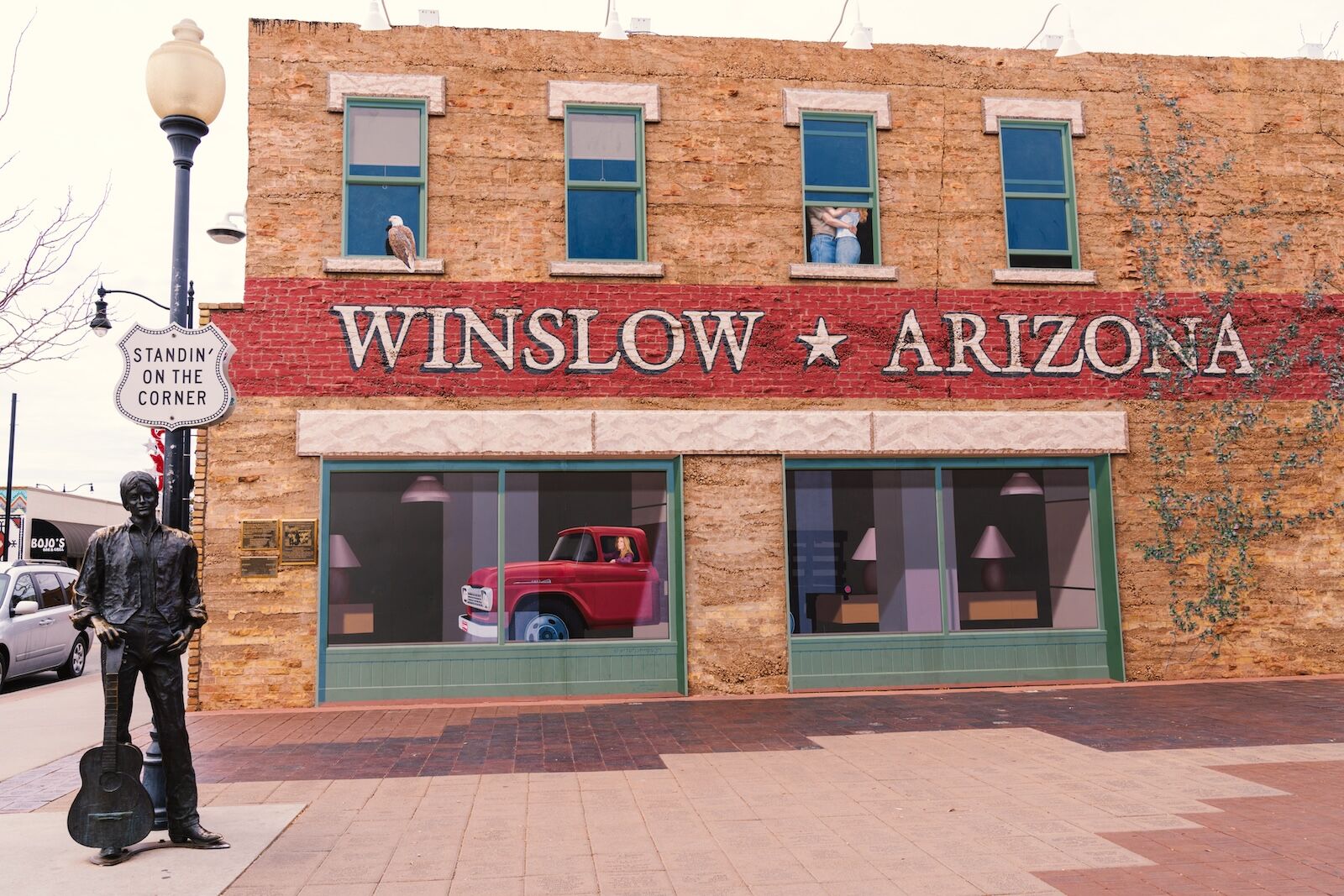
Many Indigenous tribes and nations have lived in this part of the country for thousands of years, with histories that go much deeper than neon signs and Space Age diners and motels. In this part of the drive, you’ll get the chance to learn multiple histories, with stops ranging from a 50,000-year-old crater impact site, to a museum of modern Indigenous art, to a collection of dinosaur fossils to kitsch road signs from the 1950s.

A Route 66 Amarillo to Kingman road trip


This guide picks up in Amarillo and heads west through the New Mexico mountains, past ancient geological wonders, and into the Arizona desert, ending in Kingman. The full stretch covers roughly 650 miles and is best enjoyed over five to seven days — or more, if you want to camp and check out some of the area’s all-day or half-day hikes. Carry water, top off your gas tank whenever you get the chance, and take every dirt turnout that looks interesting.


Sections:


Adrian and Glenrio, Texas: The midpoint and the ghost town

route 66 road trip amarillo to kingman - halfway point

Photo: Logan Bush/Shutterstock

Amarillo to Adrian drive time: 50 miles/45 minutes

The first stop west of Amarillo is a small one, but it carries a lot of weight. Adrian, Texas, is the geographic midpoint of Route 66, sitting exactly 1,139 miles from both Chicago and Santa Monica. The Midpoint Café has served pies, burgers, and strong coffee since it opened in the 1920s. The sign out front is a popular spot for a photo op, and the “ugly crust pie” is one of the more famous food offerings available along the entire route.

About 30 miles west, just before the New Mexico state line, is Glenrio — a must-stop for anyone interested in history and forgotten Americana. It’s one of the eeriest ghost towns on the highway. It was never large, but it had diners, gas stations, and motels catering to drivers. When the Interstate 40 Highway was built, travelers began to bypass the town and it quickly emptied out. The abandoned State Line Bar and Motel (with a sign reading “First Motel in Texas” and “Last Motel in Texas, depending which way you’re facing) is likely the town’s most photographed building. It’s slowly being reclaimed by the desert and the sign is partially destroyed, so there’s no telling how much longer the buildings will stand.

Tucumcari, New Mexico: The neon capital of the Southwest

Glenrio to Tucumcari drive time: 42 miles/40 minutes

Tucumcari arguably makes the strongest nighttime impression on this section of Route 66.

For miles in every direction, roadside billboards used to advertise “Tucumcari Tonight! — 2,000 Motel Rooms.” It became one of the most well-known marketing campaigns of Route 66. Those billboards are down now, but the buildings they advertised still stand. Route 66 runs right through the town’s main drag, Tucumcari Boulevard, and is lined with restored neon signs, vintage motels, and retro restaurants from the 1950s. At night, the strip glows in pink and green neon lights, some of which have been pulling in guests since Eisenhower was president. The most photographed building in town may be the Blue Swallow Motel, which opened in 1942.

Tucumcari packs in a surprisingly high amount of things to do for a small town — you may want to book a room at Blue Swallow Motel and dedicate two days. The town has dozens of large-scale murals inspired by its ranch and farming history, railroad roots, and Route 66 culture, with a map available online. Also worth a stop are two significant museums: the Tucumcari Historical Museum and Railroad Museum, and the robust paleontology museum Mesalands Dinosaur Museum and Natural Sciences Laboratory.

For food, Del’s Restaurant on Route 66 is an unofficial must-stop for Route 66 drivers, in business since 1956. No matter what you order, get it topped with green chile. Adding green chile is basically a legal requirement in New Mexico.

Santa Fe side trip: Adobe, art, and altitude

Tucumcari to Santa Fe drive time: 167 miles/2 hours, 30 minutes

Route 66 originally ran through Santa Fe, though the route was shifted south in the late 1930s. But New Mexico’s state capital is worth the detour, sitting 7,000 feet above sea level in the Sangre de Cristo Mountains. Being removed from the official Route 66 map did little to hurt its popularity, and Santa Fe remains one of the most popular tourist destinations in the state.

The city’s central Plaza has been a hub of commerce and culture since Spanish colonial times, and the Palace of the Governors on its north side is the oldest continuously occupied public building in the United States, dating to 1610. On most days, you’ll find Indigenous Pueblo artisans nearby selling jewelry, pottery, and weavings. Though there are plenty of places on the route going forward to buy similar items, but this is a rare chance to buy crafts directly from the makers themselves.

Santa Fe’s Canyon Road is a walkable, half-mile stretch of galleries, studios, and garden spaces that makes for an excellent place to spend a leisurely afternoon, even if the art is a bit out of your budget. All businesses on the strip are happy to have people come in and admire the work on display. The New Mexico History Museum and the attached New Mexico Museum of Art are both world-class and within easy walking distance of the Plaza, and the Georgia O’Keefe Museum has the world’s largest collection of art from one of the most iconic American landscape painters of the 20th century. There’s also the Museum of Contemporary Native Arts, focused solely on modern art from Indigenous Americans.

For an overnight, Piñon Court dates to the 1930s and is close to the restaurants and bars of the Plaza, in case you want to throw back a spicy margarita without any worries about how you’ll get home. La Fonda on the Plaza hotel, open since 1922, is also atmospheric and oozes high-end Southwestern vibes.

Albuquerque, New Mexico: Old Town and the road through the city

Santa Fe to Albuquerque drive time: 60 miles/1 hour

Before you roll into Albuquerque proper, consider a quick detour to Tinkertown Museum in Sandia Park. It’s a wonderfully weird, family-built folk-art maze packed with hand-carved displays, vintage oddities, and moving miniatures. It’s exactly the kind of quirky, homemade attraction you expect to find along Route 66 and has been delighting road tripping families since the early 1960s.

Route 66 runs directly through Albuquerque along Central Avenue, a section of town with plenty of mid-century commercial architecture. The Nob Hill neighborhood is packed with vintage signage and independent restaurants.

Old Town Albuquerque dates to 1706 and is the historic center of the city, predating the United States by 70 years. The cluster of adobe buildings is arranged around a shaded plaza, with sights like the Church of San Felipe de Neri from 1793 and surrounding blocks lined with galleries, jewelry shops, and small museums, including the Albuquerque Museum.

A short drive from Old Town is the Indian Pueblo Cultural Center, one of the most important cultural institutions on Route 66. Owned and operated by the 19 Pueblos of New Mexico (sovereign Native American nations within the state), it has exhibits on histories, art, and living cultures of Pueblo peoples without a Western (i.e. European-derived) lens. It often hosts weekend cultural events that are open to the public.

One more quirky (if controversial) stops awaits: the American International Rattlesnake Museum on San Felipe Street. It carries on a niche tradition of Route 66: the roadside reptile attraction. There are about 50 live rattlesnakes on display alongside tarantulas and a giant Gila monster. If you want to stay in town, just down the street is El Vado, a restored motel from the 1930s with its own on-site taproom and rotating lineup of local restaurants offering pop-up service.

While heading west toward the Arizona border, Route 66 passes through Gallup, a town with an unexpected Hollywood history. The surrounding desert made it a popular filming location for Westerns in the 1940s and ’50s, and Hotel El Rancho hosted John Wayne, Katharine Hepburn, and Ronald Reagan, among others. It’s still open, still gloriously over-the-top, and still worth stopping for a drink in the lobby or to check out the on-site trading post.

Petrified Forest National Park and the Painted Desert: Ancient color

route 66 road trip amarillo to kingman - painted desert

Photo: NPS/Stuart Holmes/Public Domain

Albuquerque to Petrified Forest drive time: 210 miles/3 hours

The Painted Desert has views that will truly take your breath away, especially if it’s your first time in the American Southwest. No matter how many photos you’ve seen, nothing on Route 66 quite prepares you for the landscapes.

The badlands north of the highway near the Arizona border are covered in bands of purple, pink, and red, caused by ancient volcanic ash, iron, and manganese. Look-out points along the northern section of Petrified Forest National Park (the only National Park System site containing a section of Historic Route 66) provide some of the most accessible views, but make sure you visit at the right time. Ideally, that’s “golden hour” — a.k.a. the hour right before sunset. What looked interesting at noon can be truly mind-blowing at 6 PM.

Also within the park is the namesake Petrified Forest, which is exactly what it sounds like: an ancient forest of 225-million-year-old trees that fell, got buried in volcanic ash, and slowly fossilized. The Crystal Forest trail (0.75 miles) is the best easy stroll for seeing the petrified logs up close. However, the park has more than 800 archaeological sites, including Newspaper Rock, where Pueblo people carved images into a sandstone boulder about 2,000 years ago, and the Puerco Pueblo site, preserving a village from about 1300 CE. It has a working solar calendar, with sunlight passing through a crack in just the right place every summer solstice.

Budget at least three hours for driving Route 66 through the park.

Meteor Crater and Winslow: Cosmic crashes and classic rock

winslow, arizona - route 66 road trip amarillo to kingman

Photo: melissamn/Shutterstock

Petrified Forest to Winslow drive time: 58 miles/53 minutes

About 20 miles east of Flagstaff, just off I-40, you’ll see a sign pointing toward Meteor Crater — one of the best-preserved meteorite impact craters on the planet. About 50,000 years ago, a meteorite with a roughly 150-foot diameter hit the desert at 26,000 miles per hour, smashing a 550-foot-deep hole into the landscape. Visitors can access the rim via a short trail, and the visitor center covers how NASA used the site to train astronauts for Apollo missions in the 1960s. It’s a truly unique site and well worth the short 15-minute detour each way.

Back on Route 66 proper, the town of Winslow built an entire identity around a single lyric from a song you probably know: “Take it Easy” by the Eagles. “Well, I’m a-standin’ on a corner in Winslow, Arizona / Such a fine sight to see. / It’s a girl, my Lord, in a flatbed Ford / Slowin’ down to take a look at me,” goes the song, and the corner of 2nd Street and Kinsley Avenue in Winslow is dedicated to the tune. It’s goofy in the best possible way, with a few photo ops, including the chance to take a photo next to a hitchhiker standing on the corner in Winslow, Arizona.

If it works with your schedule (and budget), spend a night at La Posada Hotel. It was built in 1930 by the Santa Fe Railway railroad company to serve train passengers before most Americans traveled by car. It was designed by architect Mary Colter, best known for her buildings at the Grand Canyon, in a grand Spanish hacienda style. It closed in the 1950s and was nearly demolished at one point, but now, it’s one of the most luxurious historical hotels on Route 66. It’s also a change of pace from many of Route 66’s vintage, neon-lit motels, with plaster walls, massive beams, carved wooden doors, wrought iron details, tiled floors, and other elements that harken back to the property’s early days.

If you have an extra day to spare, about 90 minutes west of Winslow is Williams, the starting point for the Grand Canyon Railway. It’s one of the cheesiest (and most fun) ways to explore the Grand Canyon, especially if you like over-the-top historical reenactments. Oh, there’s a museum of dinosaur poop, too.

Kingman, Arizona: Deeper into the desert

route 66 road trip amarillo to kingman - kingman

Photo: Visit Arizona/An Pham Photography

Winslow to Kingman drive time: 200 miles/3 hours

West of Winslow, Route 66 heads to Seligman. It’s a good place to stop for a bite to eat, especially at Delgadillo’s Snow Cap Drive-In. The diner was built in the 1950s and doesn’t take itself too seriously, as you can tell by the “Sorry, we’re open” sign on the front door.

West of Seligman, the road enters land belonging to the Hualapai Tribe, headquartered in a town called Peach Springs. It’s a long, quiet, uninterrupted stretch that will give you a sense of the vastness of the open desert. Peach Springs is also the main gateway town to Grand Canyon West, the Hualapai-owned section of the canyon that includes the glass-bridge Skywalk. You’ll also find some excellent glamping options along this stretch.

route 66 road trip amarillo to kingman - hackberry general store

Photo: Visit Arizona/Dan Shewmaker

As you keep going on Route 66, you’ll eventually pass Hackberry, where the cluttered Hackberry General Store is a must-stop for vintage gas pumps, rusty cars, and every imaginable piece of Route 66 nostalgia. Don’t rush yourself, and spend plenty of time checking out all the memorabilia plastered on the walls. It’s also one of the few places to pick up snacks and drinks along this segment.

The last stop in this third section of Route 66 is the town of Kingman, which sits at the base of the Mojave Desert’s Cerbat Mountains. The Route 66 Museum inside a 100-year-old former powerhouse, takes a deep dive into Arizona’s section of the famous road. Just outside, there’s a Route 66 photo op where you can take a photo with your car under a recreated drive-through arch.

The best meal in town is at Mr. D’z Route 66 Diner, a teal-and-pink, 1950s-style diner that still draws a line out the door on weekends. It’s known for its root beer made on-site as well as the root beer floats.

From Kingman, the road west pushes on toward the Mojave and, eventually, the Pacific.

Next up: (Part 4): Road tripping Route 66: Kingman, Arizona, to Santa Monica, California

Discover Matador

Save Bookmark

We use cookies for analytics tracking and advertising from our partners.

For more information read our privacy policy.