A byway is a lane that diverts from a main road, and the newly designated Tracks Across Borders Byway is certainly off the beaten path — connecting towns in Colorado and New Mexico that have fewer than 30,000 residents between them. Yet this secondary road crosses significant borders, taking you across state lines, opening windows into historical and cultural eras, and showcasing stunning and diverse natural landscapes. Here’s how to spend the day traveling along this historic passageway in the American West.
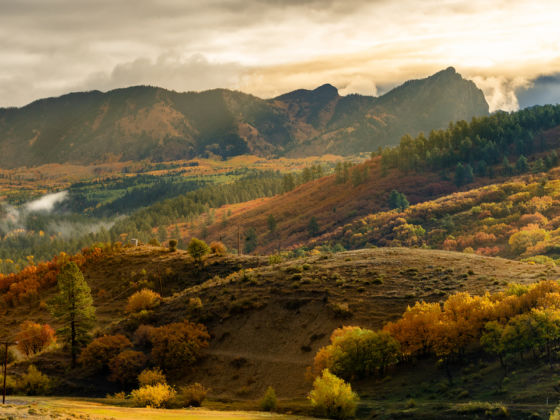
Photo: jesmo5/Shutterstock
This Historic Byway Will Reshape Your View of the American West
Planning and routing the trip
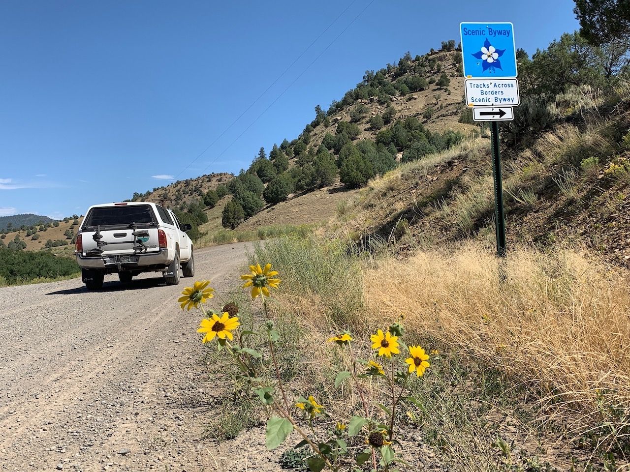
Photo: Alisha Wenger
Technically, the “borders” part of the Tracks Across Borders Byway refers to the fact that the tour takes drivers across state lines from Colorado to New Mexico. But the rugged San Juan Mountains don’t stop the moment Colorado ends, so you’ll hardly notice this distinction.
The more important border crossing is from the college mountain town of Durango, Colorado, to the vast and diverse landscapes of the Southern Ute Indian Reservation on the tour’s front end and eventually onto the Jicarilla Apache National Reservation closer to Chama. En route, you’ll challenge your understanding of American history — and your car’s off-road capability.
The drive itself is just under 100 miles and takes about four hours from Durango to Chama, with another 45 minutes north to Pagosa Springs. With the recommended stops, allow a full day for the trip. If you plan to ride the Cumbres Toltec Scenic Railway, as we discuss below, allow an overnight in either Pagosa Springs or Chama, with the Fireside Cabins in Pagosa being an ideal spot to crash.
While much of the driving is on a gravel road, it’s well-maintained and free of pesky washboard ruts, so most vehicles with decent tires can do the drive. Have breakfast in Durango before heading out, and bring a cooler stocked with lunch, snacks, and cold beverages including plenty of water.
Stay in the hotel where the Old West comes alive
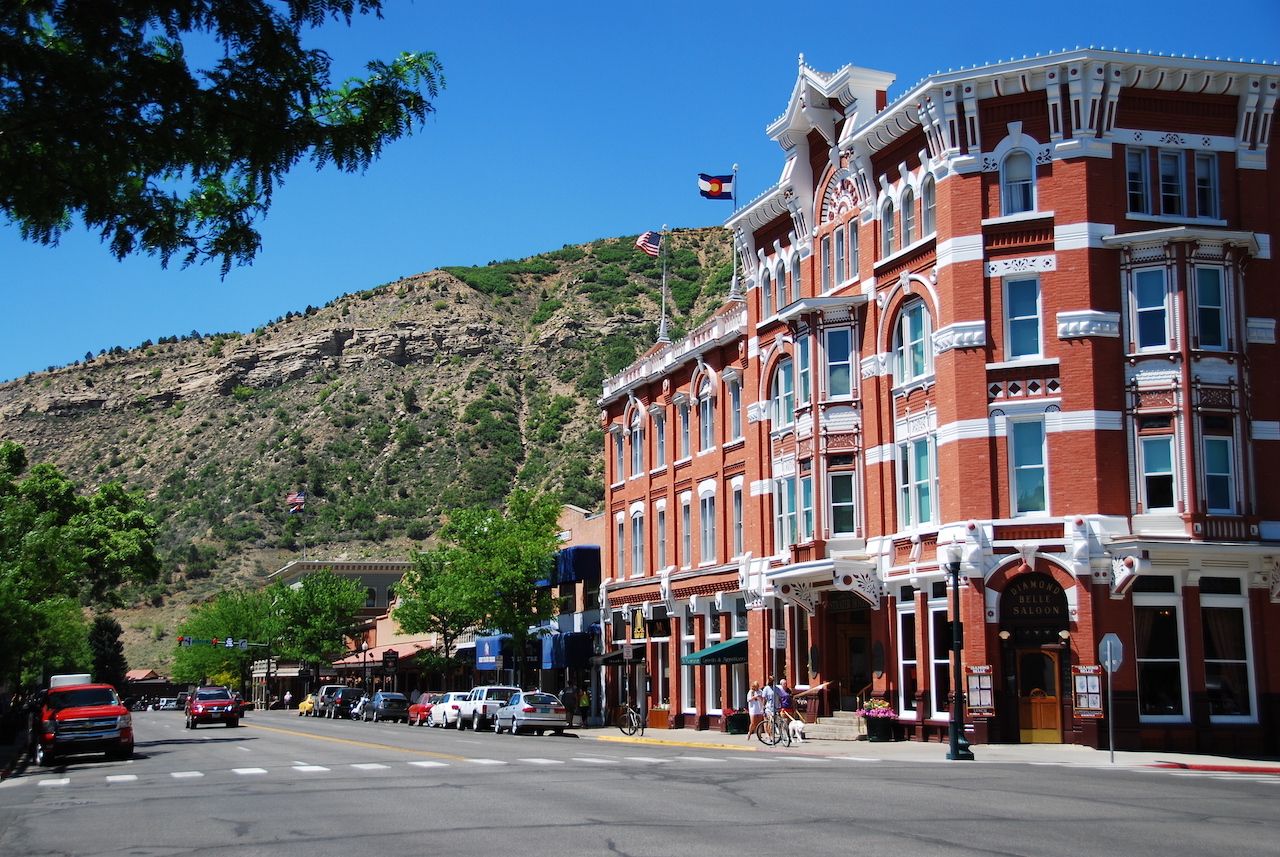
Photo: WorldPictures/Shutterstock
Start your historical tour at the aptly historic Strater Hotel in Durango. This hotel opened in 1887 and is about as close as one can get to actually being inside a Western movie. The hotel has, in fact, been a filming location of multiple flicks, including National Lampoon’s Vacation, wherein Chevy Chase himself strolls up to the hotel’s front desk.
What you don’t see in the movies, though, are the subtle pieces of American history tucked into the hotel’s walls. A knurl in the wall holding up the main stairwell in the lobby pulls out to reveal a small crevice. During Prohibition, guests would deposit cash into this crevice before retrieving a bottle of the good stuff from a similar opening hidden further inside the hotel.
If you can, reserve Room 222, which is where the writer Louis L’Amour spent multiple extended stays and crafted much of his Sackett novels. The room is also directly above the Diamond Belle Saloon, which reenacts old Western looting scenes on the regular and will probably have a horse and carriage parked out front when you arrive.
Reserve well in advance, though, as Room 222 is frequently booked by aspiring writers looking to catch a whiff of L’Amour’s linguistic magic. You can stay at the Strater or just stop by for a tour and a drink at either the Diamond Belle or The Office Spiritorium.
Crossing onto the Southern Ute Indian Reservation
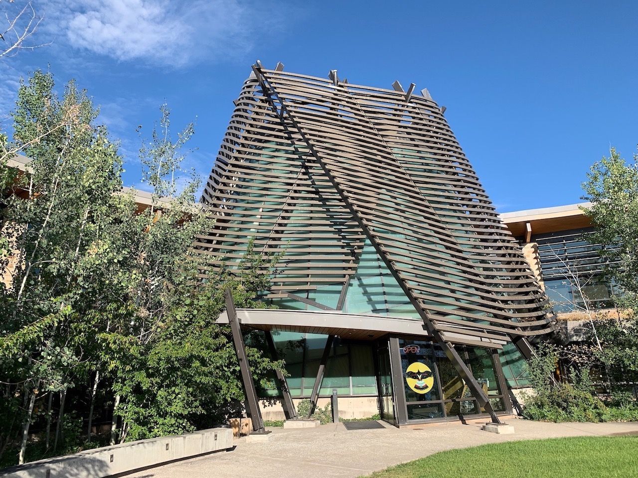
Photo: Alisha Wenger
The next stop and the first official point on the Tracks Across Borders Byway is the Southern Ute Cultural Center in the Southern Ute town of Ignacio, about 30 minutes southeast of Durango. Ignacio, a town of fewer than 1,000, houses a few architectural standouts that would not look out of place either on the Santa Fe Plaza or the Vegas strip.
The town’s skyline, as it were, is dominated by the massive Sky Ute Casino Resort, which greets arrivals to Ignacio with a Ute facade lit by the sun as it passes over the San Juans. Adjacent to the casino, in contrast, stands the Cultural Center, which opened in 2011.
It’s anchored by a graceful gallery hall ringed in opaque glass symbolizing a teepee, while its top is wrapped in a metal lining to represent a traditional domed structure called a wickiup. The center itself stands as a multi-fold mission, aiming to preserve the traditions and lifestyle of the Southern Ute tribe and, for the elders born of them, as a living museum of their stories.
“It was started so that tribal members had a place to bring their Ute objects,” the center’s Director Linda Baker told me as we walked through the open gallery space. “Not so much for show but as a way to protect them.”
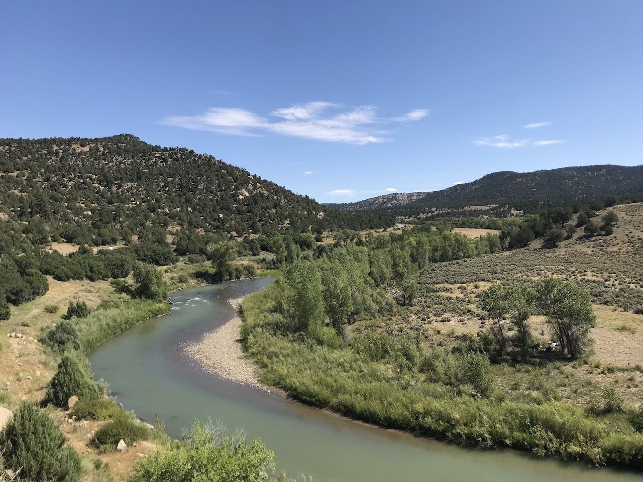
Photo: Tim Wenger
The Cultural Center highlights the history of not only the tribe but also of the reservations on which they’ve been cast by the United States government. In Ute culture, the wolf represents the creator providing for its pack and serving as its protector. Here, you’ll see the wolf depicted in many of the 4,000 items kept onsite. The exhibits showcase, through centuries of struggle, the tribe’s determination to keep their culture alive.
The Cultural Center is a signal of the tribe’s success at these efforts. Beyond the reservations themselves, neither government schooling nor being forbidden from speaking their own language managed to puncture the spirit of the Utes. While it’s impossible to say that full reparations have been made, or ever will be, today, the Utes are a self-governing nation, carrying on their traditions and connecting them to the modern world.
There is one permanent gallery of Ute artifacts on site: a small exhibit honoring Ute military veterans, and a rotating cast of exhibits that tend to switch every six months or so. The aesthetic is calming and peaceful, full of natural light and vivid colors, and welcoming for individuals or tour groups.
“We want to show what makes us Utes and what defines the tribe,” Baker said. What you stand to gain as a visitor is an appreciation for the land the Utes have called home for centuries and the history of their people here.
Head off the paved road and into the past
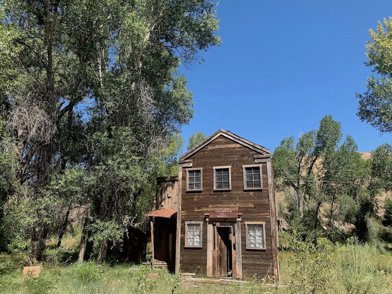
Photo: Alisha Wenger
From Ignacio, the Tracks Across Borders route takes you south from Ignacio on Archuleta County Roads 500 and 551, with a sharp right turn onto CR 169, depositing you into New Mexico. Along the way, you’ll wind along gravel road past Old West structures that, despite being all but dilapidated now, evoke the Old West of the 1800s. You’ll pass several old wooden homes and a barely standing structure labeled “Children’s Aid Society.”
Much earlier than the 1800s, though, this area was more populated than it is today. When Spanish conquistadors stormed onto the hillsides surrounding Chimney Rock in the 1600s, they encountered no fewer than 60,000 Ancestral Puebloans, and many archaeologists believe that numbers were higher earlier on.
The scenery here is picture-perfect Southwest: rolling, tree-covered hills converging head-on with rugged, barren, high-altitude desert. Imagining the Native Americans creating entire villages in this brutally beautiful and intimidating environment without the use of modern tools and transportation is enough to make one question our own architectural and domestic prowess.
You’ll want to stop repeatedly to photograph the structures and the landscape beyond the winding San Juan and Navajo Rivers as they carve the terrain and simultaneously lead your way through it. By the time you cross state borders, you’re firmly out into the undeveloped countryside surrounding the region’s relatively isolated towns. You’ll pass the La Juita and Ishkoten Canyons, which aren’t necessarily hikeable but make a solid spot to pull over for a picnic lunch.
The route is marked by Tracks Across Borders Byway signs, but do yourself a favor and screenshot the directions on your phone before leaving Ignacio. There’s no cell service for most of the route, and a wrong turn could take you quite far in the wrong direction. You’ll pull back onto paved road shortly before reaching the town of Dulce, capital of the Jicarilla Apache Nation. From here, Chama is 30 minutes down US Highway 64.
Hop the train in Chama
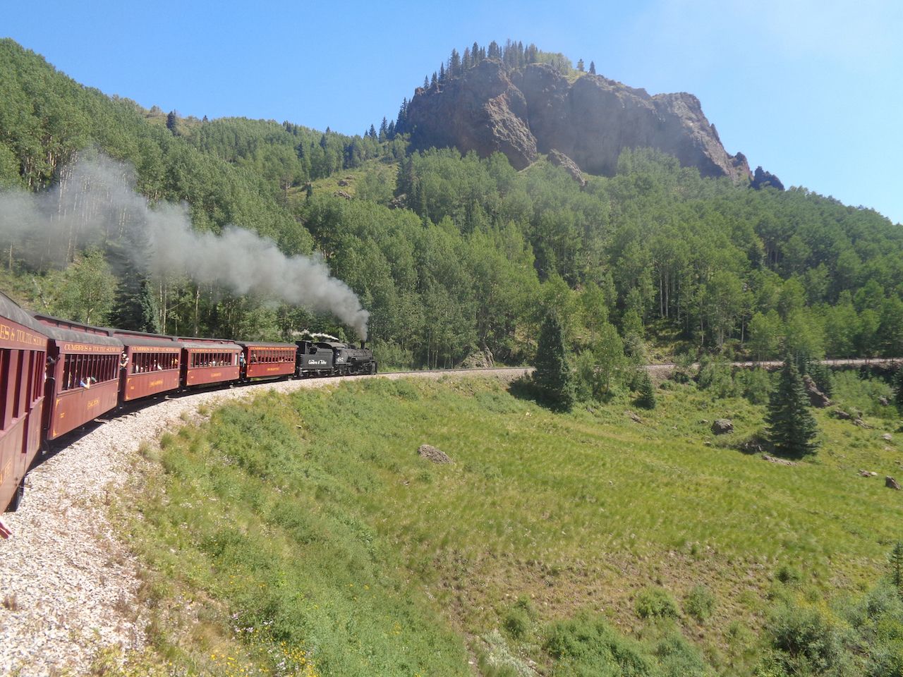
Photo: Donna Chance Hall/Shutterstock
Chama, a town of about 1,000 people in northern New Mexico, is the final official stop. This is the ideal place to learn about one of the most important aspects of the American West: the Denver & Rio Grande Railroad. In 1920, the railroad connected the country to this part of the West and sent into full swing the mining, oil, and gas exploration that drove the economies of the isolated small towns far removed from the bustle of the East Coast. It was Colorado’s first narrow gauge railway and would be the nation’s largest.
You can experience this narrow gauge railway through Chama’s primary attraction, The Cumbres Toltec Scenic Railroad, which has been in operation in one form or another since 1880 — as part of a cross-country railroad and serving the mining communities of the San Juans. Back then, rail was the only mode of accelerated transport, allowing isolated towns like Chama, Silverton, and Telluride to remain in operation through the cold and snowy winter months. When the nearby city of Farmington experienced an oil boom in the 1950s, the train was there to transport products, workers, and materials in and out of town.
These days, the train is another living piece of Southwest history and offers stunning views of the peaks surrounding Cumbres Pass. Ride the train on a half or full-day trip if possible. The “borders” thing comes back into play here, as well, as the train crosses the Colorado-New Mexico border 11 times during its 64-mile journey between Chama and Antonito, CO.
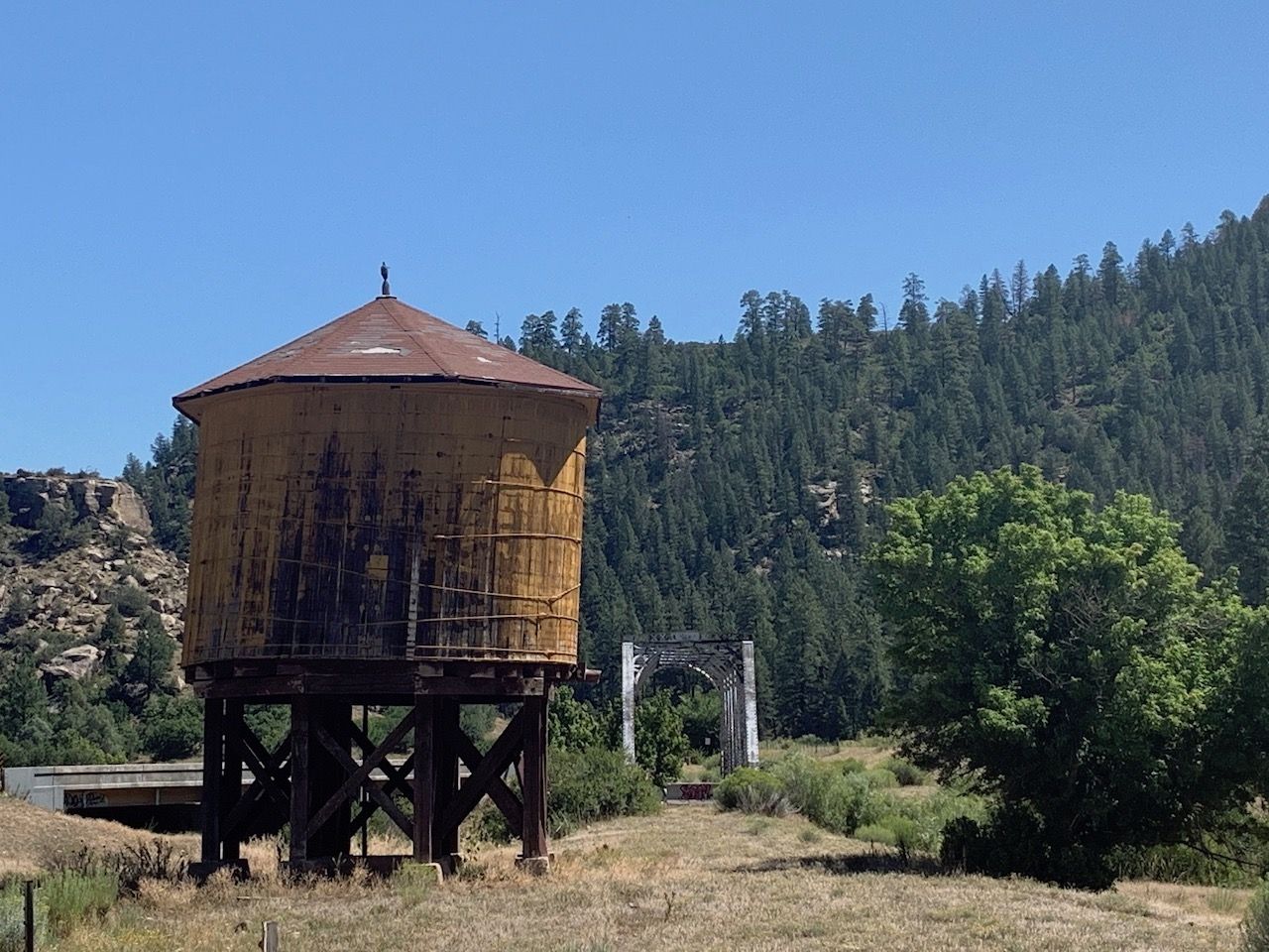
Photo: Alisha Wenger
The Cumbres Toltec stands as a reference point to the history of the Southwest, documenting the rise and fall of multiple industries and the people who shaped them and, in turn, shaped the America that we know today.
“This railroad was built by immigrants looking for a better life, and it still stands as a symbol of that,” said John Bush, the railroad’s President and General Manager. “It’s a time capsule of what the world looked like in 1920… It’s too cool and too important to let it die. If you don’t know where you’ve been, it’s hard to chart a course forward.”
The fact that the railroad is still in operation, even as a tourist attraction, also serves as a significant symbol for the resilience of the Four Corners region. Oil and gas and mining, two industries that shaped the area, have been in sharp decline, and the region is capitalizing on its recreational and tourist offerings to revitalize its economy.
“Our challenge now is to convince the younger generation that [the railroad is] a way to not only connect with the past but to experience the authentic West,” says Bush. In 1969, the states of Colorado and New Mexico purchased the train with two goals: tourism and historic preservation. A 10-year program is now in place to make the train self-sustaining through improved ridership and continued support from the states.
Visit Ancestral Puebloan ruins at Chimney Rock National Monument
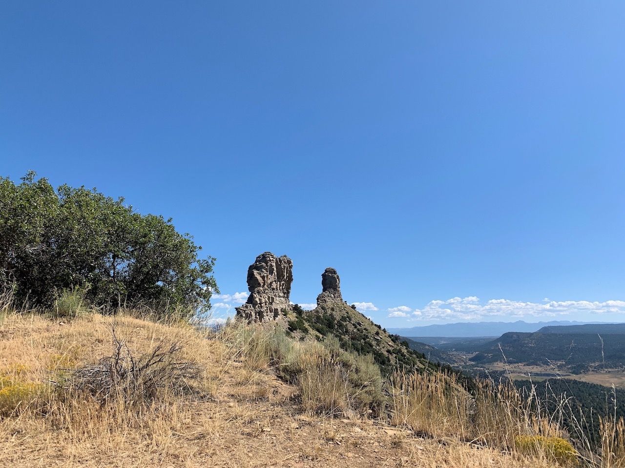
Photo: Alisha Wenger
Pulling out of Chama, head north to Pagosa Springs and Chimney Rock National Monument. This is the best way to add a bit of physical exertion to your trip after driving the Tracks Across Borders Byway. At 7,400 feet in elevation, Chimney Rock’s highest hikeable point is barely a scratch on the surface of Colorado hiking.
But the Ancestral Puebloan ruins along the way are the highlight, offering a glimpse into the Puebloan way of life that dominated this area from about the years 100 to 1600. Preserved and often modified versions of their shelter, communal cooking, and gathering spaces are located along the short hike, which can be done individually or with a guide. Finish your evening soaking in the sulfur and mineral baths at The Springs Resort in downtown Pagosa, a collection of two dozen hot springs baths along the San Juan River. ![]()