So, turn left at the river? Photo by Google.

Google Takes Street View to the Amazon

Technology + Gear
by Jason Wire Aug 24, 2011
The Amazon has long been plagued by a lack of turn-by-turn directions.

Not if Google has anything to say about it.

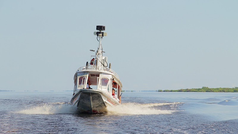
Last week, Google announced on its blog that in addition to Antarctica and mountain peaks in Whistler, Street View will soon have boated and tricycled through remote portions of the Amazon Rainforest.

Google’s working alongside Brazil’s Amazonas Sustainable Foundation (FAS), the leading conservation effort for the Amazon region, and will eventually leave much of the equipment behind so that both conservationists and locals alike can continue documenting and sharing their “points of view, culture, and ways of life with audiences across the globe.”

I doubt very much that turn-by-turn directions from Minneapolis to unnamed and remote regions of the Amazon will be available anytime soon, but it’s worth considering the psychological effects the project may end up having upon the locals when they realize that millions of people from Buenos Aires to Baghdad are cruising the waters and villages in their back yard. As technology’s toolbox of ways to capture and deliver reality continue to improve, perhaps those locations we consider most remote will become some of the most-seen.

Just what is distance these days, anyway? It takes me longer to drive 500 miles than it does to fly 1,000. I’ve had instant conversations with four different people on four different continents at the same time, but couldn’t scream loud enough for anyone near me to hear if I wanted to. I’ve probably seen the New York skyline more times than my own city’s. Yet no matter how far or wide technology takes us, there’s plenty of reality that’s impossible to truly replicate.

Discover Matador