Mapped: Canada's Incredible Population Density

Canada Maps + Infographics
by Marie-Louise Monnier Apr 7, 2017

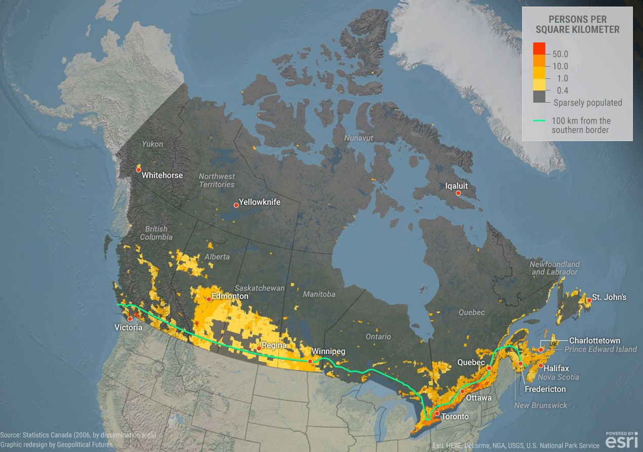
WHILE Canada is the second largest country in the world after Russia, in 2015, it had a relatively small population of 35.8 million people, ranking at the 222nd spot for population density out of 233 countries (the least densely populated area was Greenland).

It’s understandable that Canada’s population density is low: Most of the country’s large landmass is very far north where the climate is bitterly cold most of the year, making is inhospitable. That said, if you check out the map below, you’ll notice that there are people who do live in Nunavut, the Northwest Territories, and Northern Quebec, but Canada’s population is mostly concentrated in a strip of land within 160 km of the border with the United States, explains Geopolitical Futures.

If you plan to visit, the country is loaded with epic properties from mountainside Banff Airbnbs to big-city Toronto Airbnbs.

An even more striking map is the one created by Reddit user DonOntario. The red areas show where 50% of the Canadian population lives. For those with little knowledge of North American geography, the blue areas are The Great Lakes and the big grey gap in the middle is the Hudson Bay.

The most densely populated areas are, unsurprisingly, the large urban centers such as Metro Vancouver, Calgary, Edmonton, the Great Toronto Area, Ottawa, and Montreal.

Have you every visited Canada? Did you check out some of the most sparsely populated areas of the country? Let us know in the comment section.

Discover Matador