As the gateway town for Arches and Canyonlands national parks, as well as globally celebrated mountain biking, off-roading, and hiking destination, the town of Moab in southern Utah sees some three to five million visitors per year, according to the local tourism department’s most recent statistics. But drive an hour south on US 191, and the crowds fall away faster than the sun sets over the red rock canyons. In about an hour, you’ll roll into Monticello, the seat of San Juan County, where the main drag is quiet, despite being similarly surrounded by equally stunning public lands.
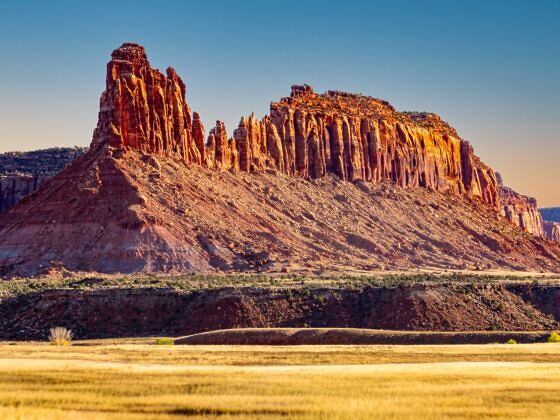
Photo: David Rajter /Shutterstock
The Best Way to Help Protect Bears Ears Is to Go See It This Fall
“San Juan County is one of the poorest counties in the country,” says Ashley Korenblat, managing director of Public Land Solutions, a Moab-based advocacy group. Korenblat, along with a growing chorus of outdoor recreation advocates, believes that nearby Bears Ears National Monument is helping the county build a sustainable long-term economy that provides jobs while protecting natural resources. The key to that plan succeeding, she says, is bringing visitors to the monument — and this fall is lining up to be the best time to do so.
On July 13, 2026, President Trump signed a proclamation that cuts Bears Ears National Monument outside Monticello from roughly 1.36 million acres to 121,096 acres — a reduction of 91 percent. The order also terminated the Bears Ears Commission, the body of tribal representatives that co-manages the monument with the Bureau of Land Management (BLM) and US Forest Service (USFS). The 1.24 million acres no longer protected will reopen to mineral leasing and mining claims this month, though lawsuits challenging the proposed leasing rules are coming.
Travelers just might be the best people to fight for the landscape’s protection, as they have in protecting other national monuments. Capturing just one-quarter of Moab’s tourism potential would provide San Juan County with more jobs and their increased equivalent financial output, creating a more stable and more long-term economic backbone for the town that avoids the volatile boom-and-bust cycles of working in the finite natural resources industries, according to economic data from ACE USA.
A homeland and a battleground
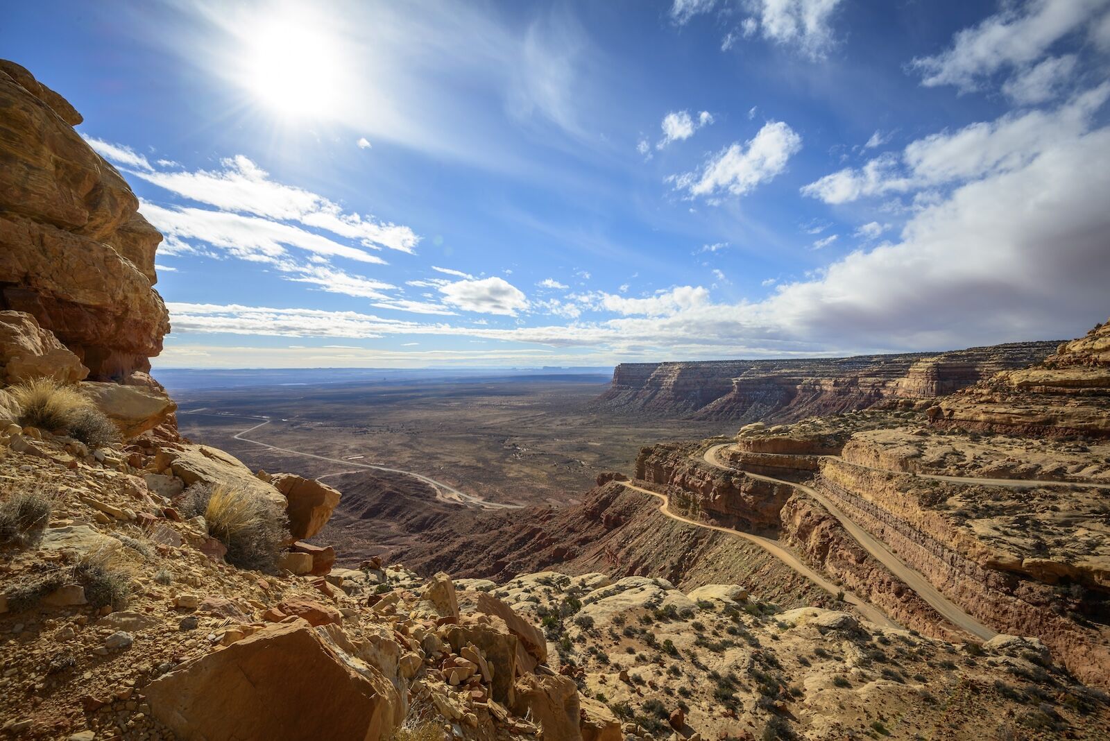
Moki Dugway overlooks the edge of Cedar Mesa in Bears Ears National Monument. Photo: imageBROKER.com /Shutterstock
Through Public Land Solutions, Korenblat works with Western communities trying to move their economies beyond fossil-fuel extraction. She’s also the founder of Western Spirit Cycling Adventures, a multiday mountain bike outfitter that is one of the largest holders of recreation permits on the public lands system. She’s spent time as a Wall Street trader and is well-versed in economic development. Her take on San Juan County is that it’s sitting on the most valuable asset in the region.
Five tribes call the twin buttes above Cedar Mesa, what are known today as the Bears Ears, by a different name, each meaning the same thing. Hoon’Naqvut to the Hopi, Shash Jaa’ to the Navajo, Kwiyagatu Nukavachi to the Ute and Ansh An Lashokdiwe to the Zuni. The canyons below hold cliff dwellings, granaries, kivas, and rock art panels spanning thousands of years of continuous human presence, and the looting of those sites was part of what pushed Congress to pass the Antiquities Act in 1906. Advocates at the time named the Bears Ears region as one of seven places in the Southwest needing immediate protection.
Dr. Andrew Gulliford, a historian at Fort Lewis College and a former professor of mine during my undergraduate years, lays out that arc in his book Bears Ears: Landscape of Refuge and Resistance. He notes that Bears Ears has been a refuge for Native people protecting ancestral homes, Since 1880, it’s also been a refuge for Mormon families and their descendants who arrived by wagon train through Hole-in-the-Rock, the pioneer trail that has become a roadside attraction near Moab. Both groups see the land as important to defend, but don’t agree on exactly what that means.
President Obama designated Bears Ears National Monument in December 2016 at the request of the Hopi Tribe, Navajo Nation, Ute Indian Tribe of the Uintah and Ouray Reservation, Ute Mountain Ute Tribe, and Pueblo of Zuni, making it the first national monument created at the formal request of a tribal coalition. President Trump cut it by about 85 percent in December 2017 to roughly 201,876 acres. President Biden restored and slightly expanded it in October 2021. Now, it’s been cut again, deeper than before, despite a Utah State University poll released in February 2026 that found a majority of state residents support keeping Bears Ears at its original boundaries.
Left after Trump’s cuts is the 106,816-acre Shash Jáa Unit, a part of the monument that includes the buttes themselves, Arch Canyon, Mule Canyon, Comb Ridge, and part of the Butler Wash archaeological district, plus the 14,279-acre Indian Creek Unit. What’s no longer protected once the proclamation goes into effect on September 11: nearly all of Cedar Mesa, including Grand Gulch, along with Valley of the Gods, White Canyon and Dark Canyon. The proclamation is explicit about why. It names silver, copper, molybdenum, lead, uranium, vanadium and zinc as resources important to economic and national security.
The threat against Bears Ears National Monument
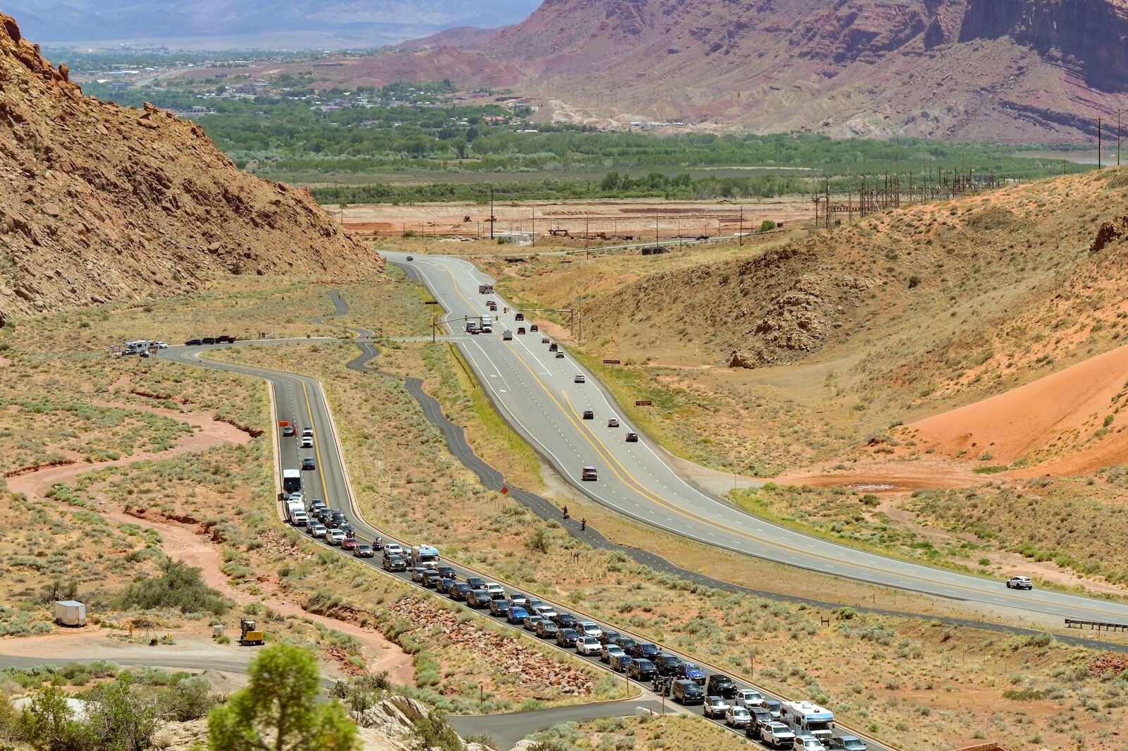
Residents of San Juan County have expressed concerns about their region moving towards the overtourism that has plagued Moab. Here, a line of cars on the entrance road to Arches National Park. Photo: Ceri Breeze /Shutterstock
Beyond the shifting of the monument’s boundaries, Korenblat is worried about a pair of rule changes. The first is speculative leasing. Under the federal system, companies can nominate and lease parcels of public land for oil and gas whether or not there’s a realistic prospect of drilling them.
“The system is a little bit like venture capital,” Korenblat says. “They go lease parcels on public lands wherever, and then they’re tied up for decades, and they don’t have to do anything really.”
When it comes to other uses on that land, a leased parcel is a cloud over every investment.
“You can build a trail on top of them,”Korenblat says, “but then you kind of live in fear.”
The second is bonding. When a well gets drilled, the operator posts a bond meant to cover plugging and cleanup when it’s done. If the bond is too small, walking away is cheaper than remediating, and the public inherits an orphaned well. In April 2024, the BLM finalized a rule that raised those minimum bond amounts for the first time in more than 60 years. The same rule formally adopted screening criteria requiring the agency to weigh conflicts with recreation, cultural resources, and sacred sites before offering a parcel for lease.
“This oil and gas rule was one of the first times where recreation was mentioned and preferential treatment was given to recreation assets,” Korenblat says. “It’s the first time recreation assets were officially acknowledged as important to the community and something that should be considered before you determine that you’re going to lease a parcel.”
But in June 2026, the BLM published a proposal to rescind that change and return bond minimums to pre-2024 levels, dropping the statewide minimum from $500,000 back to $25,000, and said it is considering reinstating the nationwide bonds the 2024 rule had eliminated. The compliance deadline for the higher amounts had already been pushed to June 2027. On August 19, Sen. Michael Bennet and Rep. Jared Huffman led 39 Democratic colleagues in a letter urging the agency to reverse course.
Korenblat notes that it costs an “average of $75,000 to cap and remediate a well site, and the average cost to drill a site is around 10 to 20 million. So giving them a break on the bonding is not going to convince anyone to drill if they weren’t ready to drill anyway. It’s like offering a 2% discount on a plane ticket.”
What the rollback does accomplish, she argues, is to tie up local BLM staff’s time running lease sales for parcels nobody will develop, which “delays the ability of those offices to be able to meet local demands like building trails for their future economy,” she says.
The overtourism that has plagued Moab is another concern that San Juan County residents would like to avoid. Arches introduced timed entry in 2022 after visitation surged 74 percent between 2011 and 2021, an increase the Park Service said contributed to traffic backups, temporary park closures, crowding, and resource concerns including a lack of affordable housing. Of the roughly 59 single-family homes without short-term-rental zoning that sold in Moab in 2025, the median price was $653,000.
What a landscape is worth
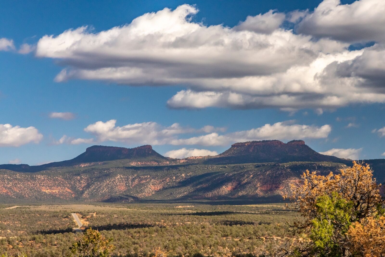
The Bear’s Ears landscape. Photo: John Doe/Shutterstock
Korenblat has a shorthand for what she thinks San Juan County is missing. “San Juan County could be the Machu Picchu of North America in about 15 minutes,” she says, referring to economic impact. Machu Picchu generates roughly $40 million a year in direct revenue, about $30 million from entrance tickets and $10 million from Inca Trail permits, on visitation that grew from about 80,000 people in 1991 to 1.5 million in 2019. The rail line, the hotels in the Sacred Valley, the guides, the restaurants, and the porters aren’t even calculated in those figures, and the Cusco region, along with the national government, clearly recognizes that the citadel is worth vastly more standing than as anything else.
Peru also shows what to avoid. Much of the money has historically leaked out of the valley. PeruRail is foreign-owned and at one point moved 92 percent of visitors between Cusco and the ruins, and residents of Aguas Calientes complained for years that the revenue never benefited the local economy. UNESCO once proposed that 10 percent of ticket revenue be directed to the town itself. The lesson for southeast Utah isn’t to become Aguas Calientes but to become a better-managed area that optimizes the economic benefit and keeps business local.
The new math of Bears Ears
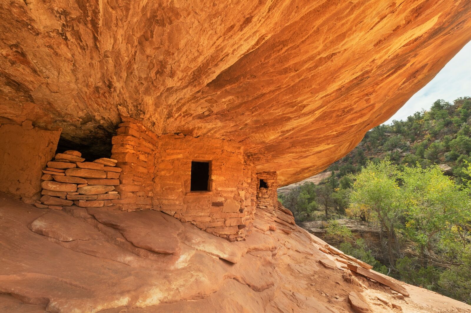
House on Fire Ruins in Mule Canyon of Cedar Mesa is among the biggest draws in Bears Ears National Monument. Photo: Danita Delimont /Shutterstock
If applied to the Bears Ears and Monticello region, a mandated local revenue split from entry permits or federal passes would guarantee that San Juan County has the continuous funding needed to repair local roads, manage waste, and expand municipal services without relying solely on volatile county property taxes. The hard part, Korenblat says, is convincing people who are accustomed to extraction and agriculture to look forward in that manner.
“It’s all about getting people to acknowledge that land does not equal money in the traditional way,” she says. “The new way is that people want access to the outdoors and people value land in its natural state.”
She has a thought experiment for the idea that federal ownership is what keeps San Juan County poor.
“We could give every person in San Juan County, Utah, 10,000 acres tomorrow,” she says. “A couple of them might get a pool of ruin in the Bears Ears, and a few might get somewhere where there might be oil, but their median income is not going to go up because they all got 10,000 acres. It’s just not. It doesn’t work that way.”
What can move median income, she argues, is the economy that forms around visitation.
“Recreation, the amount we pay for our permits is tiny,” Korenblat says. “But the money we generate for our communities, and what you see in communities with strong visitation, is you see more lawyers, accountants, dental hygienists, all these peripheral businesses that are thriving because of visitation. These places with outdoor access are attracting not just visitors and tourists, which does bring capital, but also they’re attracting business investment because of the quality of life. Why did Adobe and Goldman Sachs pick Salt Lake? Because there you can go skiing before work, for crying out loud.”
The data from San Juan County backs her up, even after only a few years of monument status. Researchers at Utah State University’s Institute of Outdoor Recreation and Tourism compared the three years before and after designation and found a 50.6 percent increase in the concentration of outdoor recreation in the county, alongside significant growth in food, professional, scientific and technical services, as well as retail, and the accountants and law firms Korenblat is talking about.
But there is a long way to go. The median household income in San Juan County was $54,890 in 2023 and 18.4 percent of residents lived below the poverty line, against a national rate of 12.4 percent.
“The only way to really make an honest living in the early West 150 years ago was to own land, and everything else was snake oil,” Korenblat says, empathizing with the resistance to economic shifts.
Why your trip matters, and how to take it
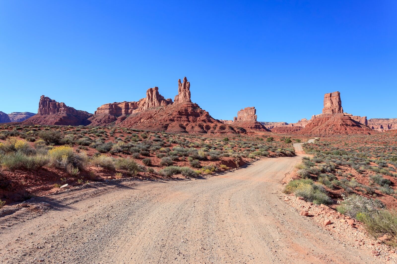
Boundary reductions have placed Valley of the Gods outside the official monument designation. Photo: Kasbah /Shutterstock
The thing that eventually settles fights like this — in Moab, in Cusco, in Grand Staircase’s gateway towns — is an economy that makes protection the obvious choice. That economy is from the ground up, with travelers being the differential. Every guided day, every booked campsite, every dinner in the gateway towns of San Juan County, and every permit fee is an entry in the ledger that county commissioners, judges, and the community need. Responsible travel is the key to success in this approach, following Leave No Trace principles and spending money in a manner that benefits local residents.
So go to Bears Ears. And go correctly, because the excluded acres are about to lose the extra protections monument status brought.
Where: The buttes, Mule Canyon, Butler Wash, and Comb Ridge remain inside the monument. Cedar Mesa and Grand Gulch are still public land and still open to hiking but lose monument-level protection after September 11. The Bears Ears Partnership’s education center in Bluff is the place to start.
How: Stay on established routes. Don’t touch rock art, don’t enter structures, don’t move or pocket anything, and don’t geotag site locations. Hire a local or Indigenous guide when you can; that’s the multiplier Korenblat is describing, in practice.
When: Now, meaning this fall, while the boundaries are in flux and the record is being written. And then again, because places depend on people who come back. When enough people who have stood under the Bears Ears have a stake in what happens next, the place will have the voice it needs to remain as it is. That’s something you can be a part of. 