If you’re an avid hiker, you know that not all trails are created equal. It might be hard work getting to the top of the tallest peaks, but the view is definitely worth it. Sure, the United States doesn’t have a mountain as towering as Mount Everest at 29,032 feet, but if you’re looking for a challenge without leaving the country, there are some states that massive mountains with high peaks perfect for the most adventurous climber. Other states, well, not so much.
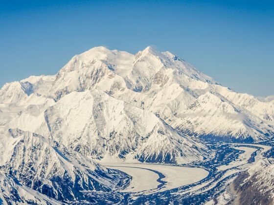
Photo: Jnjphotos/Shutterstock
This Map Shows the Highest Peak in Every State
A map posted on Reddit puts each state’s tallest mountains into one handy visual with the highest peaks (all measurements in feet).
The states with the highest mountain peaks in the US:
- Denali, Alaska — 20,310 feet
- Mt. Whitney, California — 14, 498 feet
- Mt. Elbert, Colorado — 14,433 feet
- Mt. Rainier, Washington — 14, 411 feet
- Gannett Peak, Wyoming — 13,811 feet
On the other side of the coin are flatlands that just don’t have the same landscape for large mountain ranges.
The states with the lowest mountain peaks in the US:
- Briton Hill, Florida, — 345 feet
- Ebright Azimuth, Deleware — 450 feet
- Driskill Mountain, Louisiana — 535 feet
- Woodall Mountain, Mississippi — 806 feet
- Jerimoth Hill, Rhode Island — 812 feet
When you set out for your next hiking adventure, it’s good to know the dos and don’ts of the trails. And if you’re looking to try out some more difficult trails before your big trip to climb Mt. Whitney, try some of the more difficult hikes you can do at national parks that will only take you a day to complete. ![]()