Photo: ironbell/Shutterstock

The 3 Most Unforgettable Mountain Bike Rides in England’s Peak District

England Manchester National Parks Insider Guides Cycling
by Stephen Connolly Nov 22, 2019

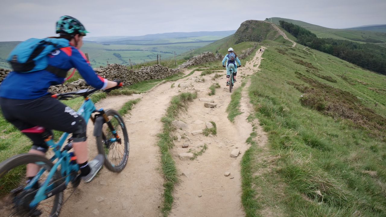
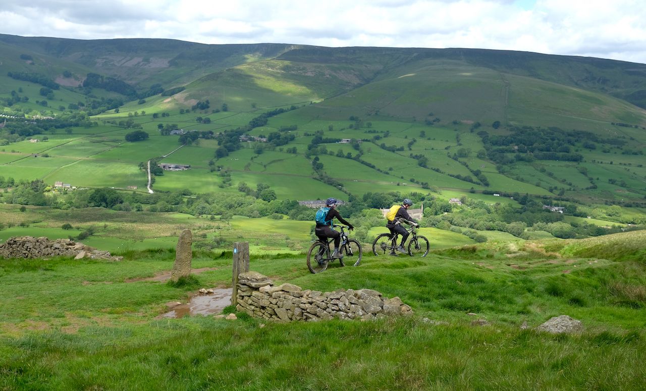
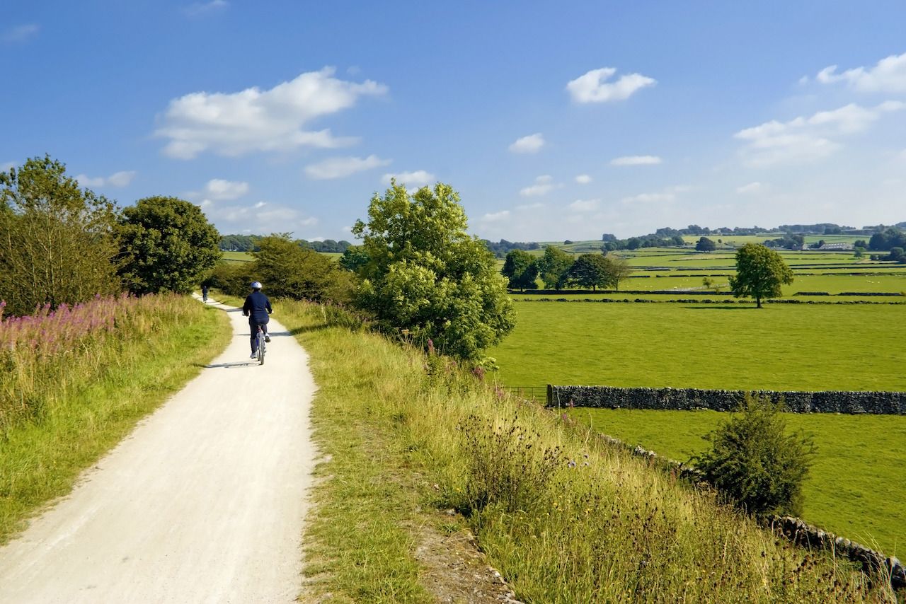
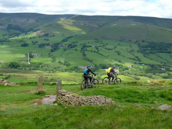
The mixed landscape of Peak District National Park is one of the UK’s most popular playgrounds for mountain bikers of all ages and abilities. The miles of single-track paths that traverse this rolling green space in the middle of the English countryside cover everything from precipitous drops to endurance rides overexposed moorlands.

In the north, there’s the Dark Peak, with its rugged gritstone edges, which are popular with walkers and climbers. Further south, around Dovedale, the White Peak is made up of gentler grasslands, limestone valleys, and rivers. Across the entire 555 square miles of the park, though, you’ll find a variety of trails to suit all biking skill levels and temperaments. Whether you want a gentle ride through the countryside or hair-raising technical descents, here are three great rides in the peak district.

Gearing up and winding down

You’ll also have plenty of opportunities to stop afterward for some post-ride relaxation, and we list our favorite stop at the end of each ride. Peak towns like Bakewell, Baslow, and Buxton all offer more in the way of entertainment and accommodation, but places such as Castleton in the north or Ashbourne in the south are closer to the trails.

If you want to rent bikes and gear, or get repairs, one of the best options is Bike Garage Peak District, which has a permanent workshop in Hope Valley near Castleton. If you want to be based elsewhere and you’re able to rent for several days, then MTB&B also offers a delivery service where they can come to your accommodation. If you’ve tried the trails below and are ready for more, both companies also offer guided rides, and their websites have a wealth of information on their own favorite routes.

1. Ladybower Loop
16.4 miles, medium for experienced riders

Photo: ironbell/Shutterstock

In the heart of the Dark Peak, the area around Ladybower Reservoir offers a range of long and shorter trails with a challenging variety of conditions. This clockwise 16.4-mile route covers some of the fastest descents and technical climbs the area has to offer.

One of the beauties of this route is its proximity to Edale and the Hope Valley, which are extremely popular with hikers for the steep, dramatic drops around Mam Tor and the Great Ridge.

  • From the Ladybower Inn head towards the reservoir and left onto the A6013.
  • After you pass the Ladybower Dam on your right, turn right on Lydgate Lane and head south on a gentle climb to the village of Thornhill, where you’ll turn right and head for Aston.
  • At Aston there’s a sharp turn right onto your first off-road section, a stream path with greenery to negotiate. Heading northwest, there’s a long climb through the scenery before you crest for a fast and technical descent down to Woodlands Valley.
  • Catch your breath and head sharp right on the track, crossing Snake Road (A57) before heading back into the woods for another climb through Lockerbrook Farm. Once past Lockerbrook there’s another fun drop down to the reservoir through the narrow paths in the woods.
  • When you reach the reservoir, head right along the tarmac path towards Fairholmes Visitor Centre where there’s a sharp pull to the left and then a resumption on the path south with the reservoir on your right.
  • Beyond Mill Brook, take a sharp turn left for another steep climb up to the peak views from Derwent Edge.
  • The trail then heads southwest before a sharp jag to the right towards Cutthroat Bridge and one last heady descent through fields of heather.

As you’re starting and finishing at the Ladybower Inn, it would be rude not to stop at this traditional, stone-built pub for stick-to-your-ribs food and a pint of Batemans ale.

2. Jacob’s Ladder: Hayfield to Castleton
10 miles one way, difficult

Photo: ironbell/Shutterstock

Down in the shadows of the Peak District’s highest point, Kinder Scout, sit the lovely villages of Edale and Castleton. They both have a wealth of attractions for hikers, nature enthusiasts, and sightseers, but the area is also well known among mountain bikers for the classic route that takes in the trails around Jacob’s Ladder, a steep and technically difficult set of steps on Kinder Scout.

This short but demanding route begins at Hayfield and is filled with some of the area’s trickiest descents and most lung-busting climbs through rocky terrain. For double difficulty, head back the same way when you’ve reached your goal at Castleton.

  • Start at St. Matthew’s Church in the center of Hayfield and head left over the bridge on Church Street.
  • Follow the road to the right, taking the first turn on Bank Street up to another right on Kinder Road. Follow this for around a mile and then just before you reach the Bowden Bridge Quarry car park, take the lane over a bridge on the right. Follow the lane up the first of several climbs. At the top, take the gate on the right and climb up to a tarmac path at the top. Veer left and enjoy a quick descent down.
  • Take the gate at the bottom and embark on your first taste of what it takes to reach the top of Jacob’s Ladder. It’s a wide path, mainly gravel, so there’s plenty of room for cyclists, but it can be scrabbly under your wheels. Farther up, the track becomes rockier, but the harshness of the ascent tapers off. This, however, is where your skills will be tested to the max, when the trail becomes beset by very technical obstacles that most find challenging.
  • After the summit at Edale Cross, there’s a short but fun descent before you reach the start of the journey down Jacob’s Ladder, a steep singletrack of cobbles, rocks, and boulders. Turn right through the gate at the bottom and follow another path as it varies through tight bends, big ruts, and some gravelly sections.
  • Use the bridge at the bottom to cross the stream and then follow the track on another easy descent towards farm buildings, where the track descends into a tarmac section and a lane beyond that. The lane is a medium climb to Upper Booth Farm. When you reach it, turn left down the lane and descend past a car park on the right, heading for a junction at the bottom.
  • Turn left onto the road towards Edale. Head along this road for about one mile, where there’s a junction with a lane heading off to the right. Take this descending lane right before climbing again through a tree-lined section.
  • Just after the house at the top of the track, branch left through the gate and follow the trail up a gated path and then into a trickier climb up the hillside towards Hollins Cross.
  • Heading right, there’s a paved track towards one of the area’s notable peaks, Mam Tor. Work your way from the paved track onto the natural track adjacent to the path, then climb towards the summit before making a gentle descent to Mam Nick. Turn left on the road and head down to Castleton.

Castleton is filled with welcoming pubs and cafés like The George, which has a splendid outdoor beer garden where you can tuck in to a well-earned meal and look back across the landscape you’ve just traversed.

3. Carsington Loop
17 miles, easy

Photo: David Hughes/Shutterstock

It would be a shame to venture into the Peak District only to miss some of the gentler landscapes and ride routes that populate the southern end of the region. On a sunny day, the placid Carsington Water near Ashbourne is a fine place to drink in the high greens of summer as they spread out over the undulating pastures of the English countryside.

More a simple off-road ride than a challenging trail, this loop around the reservoir and surrounding area offers the opportunity to enjoy a few moderate climbs and some easy freewheeling down through handsome villages and leafy lanes.

  • Beginning from the visitor center, head left on the signposted Carsington Water Circular Track, keeping the water on your left as you follow the blue arrows to the car park.
  • Continue with the water on your left until you hit the bay and building, which signal a track that’ll take you to the right, up to Riddings Farm and the junction beyond it. Take a right here, and follow the road to another junction with Blackwall Lane. Taking a left up the lane here will lead you on to another left turn to Kirk Ireton.
  • As you ride through this pretty Derbyshire village, head left at the church and take the road up to the junction with Topshill Lane, where it’s another left and a climb towards a further junction where a left turn will lead you back towards the water and back onto the Carsington Water Circular Track at Upperfield Farm. Follow the track north to the head of the reservoir.
  • Once you’ve passed the two small islands in the bay, the track heads left into Hopton, where you rejoin the road. At the first turn, head right for a sharp climb to a main road that’ll indicate the start of the High Peak Trail. Take the trail left and climb again past the interesting formations of Harboro Rocks.
  • At Longcliffe, there’s another trail to the left. Take this quick descent into Brassington. Once there, take the road right towards Bradbourne. When you reach the tiny hamlet of a few typical limestone buildings, take the road left on Brackendale Lane to Carsington.
  • After the Knockerdown Inn, you can rejoin the cycle path around the water and arrive back at the visitor center you started from.

As you’re in the area, you might try a visit to the Pudding Room, a local bakery and tea room that offers light snacks and a range of sugary treats including Derbyshire’s famous Bakewell Tart, an almond and jam pastry that’s one of the county’s best-known inventions.

Discover Matador