Palm Springs, in California’s Coachella Valley, is a popular desert destination known for its sunshine, mid-century modern architecture, and world-class wellness and spa resorts. But beneath the glitz and color lies a network of scenic hiking trails that take hikers deep into the rugged beauty of the Sonoran Desert, encountering diverse landscapes ranging from towering palm groves and dramatic canyons to stark, rocky slopes and hidden waterfalls.
10 Expert-Recommended Palm Springs Hiking Trails for All Levels
Because there’s so much variety within the different Palm Springs hiking trails, there’s something for most types of hikers, from beginner athletes looking for an easy stroll to expert hikers who want all-day hikes, and even yogis who just want a gentle walk to a meditative area without many people.
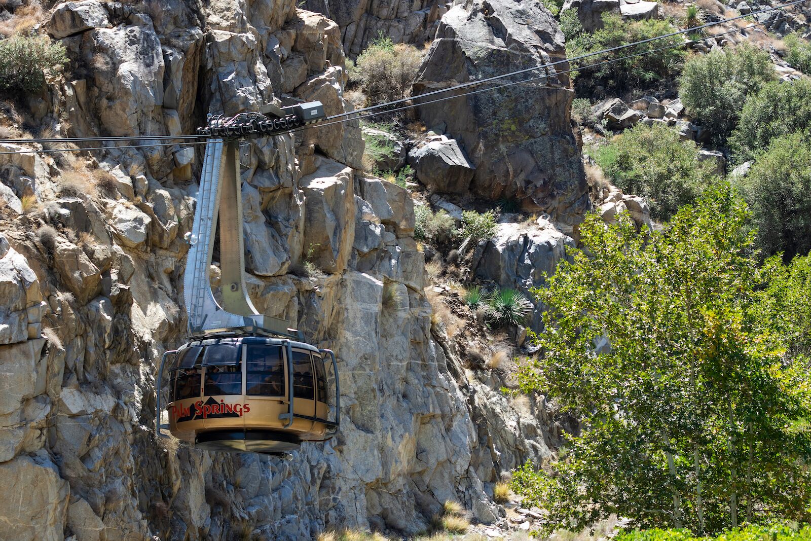
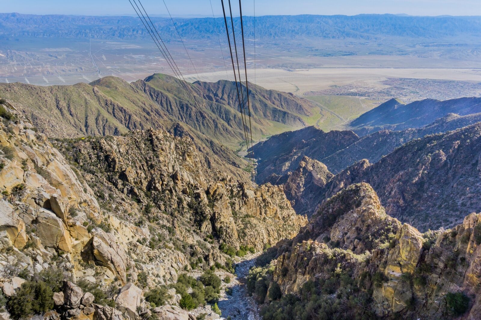
Several hiking trails start from atop the popular Palm Springs Aerial Tramway. Photo: Kate Scott/Shutterstock
The city of Palm Springs has several trailheads in and very close to the city limits. There’s the Indian Canyons, a collection of palm-fringed canyons managed by the Agua Caliente Band of Cahuilla Indians, as well as the Mount San Jacinto Wilderness, accessible via the Palm Springs Aerial Tramway. And venturing just bit further brings you to Joshua Tree National Park (about an hour from Palm Springs) and the Santa Rosa and San Jacinto Mountains National Monument (about 40 mins away). And about an hour to the north are trails leading into the wooded San Bernardino National Forest.
Because there are so many Palm Springs hiking trails to choose from, we reached out to area experts and popular trail-rating apps and companies to find out which are the best of the best.
Tips for hiking in Palm Springs
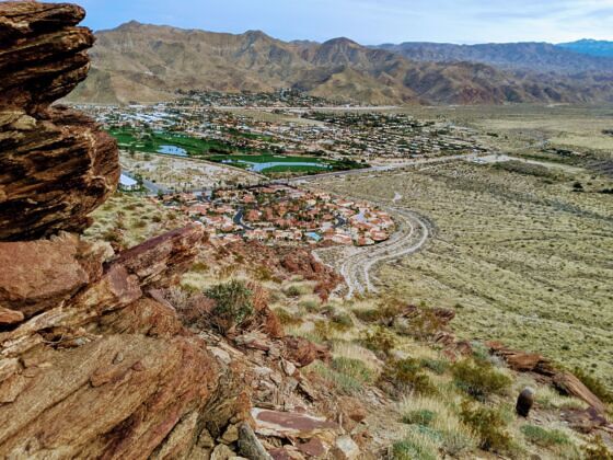
The city of Palm Springs is chic and developed, but it’s still surrounded by wilderness. Photo: KhanIM/Shutterstock
It’s always important to be knowledgeable about where you’re hiking, but there are a few specifics you’ll want to know when hiking in the Palm Springs area.
Weather: Palm Springs and the Palm desert are hot and dry climates. Temperatures can soar well above 100 degrees Fahrenheit in the summer months. Plan your hikes for early mornings or evenings to avoid the heat, as you’ll get dehydrated exceptionally quickly (as well as sunburned quickly). Flash floods are also possible during and after afternoon thunderstorms, which tend to happen during monsoon season (July to September). Be aware of the risk of flash floods and check the forecast before heading out. Don’t attempt to cross running water and cut your hike short if the rain picks up.
Winds and sun: Strong winds are frequent, particularly at higher elevations and along ridgelines. Be prepared for wind gusts that can affect your balance, as well as dust and sand in the air, as the lack of roots in areas with low vegetation can send dirt flying. Expect strong sun and a general lack of shade on most trails, so always wear a hat and wear plenty of sunscreen (and consider wearing sun-protective clothing).
Wildlife and dangerous plants: As far as dangerous plants on Palm Springs hikes, you’ll want to watch out for various desert thornbushes, as many desert plants have sharp thorns or spines that can puncture skin and clothing. Be cautious when brushing past unfamiliar plants, especially on narrow trails, and consider wearing tall socks or long pants. Ocotillo (tall, spiky staff-like plant) and cholla cactus (jumping cactus) are two common causes of light scratches and cuts on Palm Springs hiking trails.
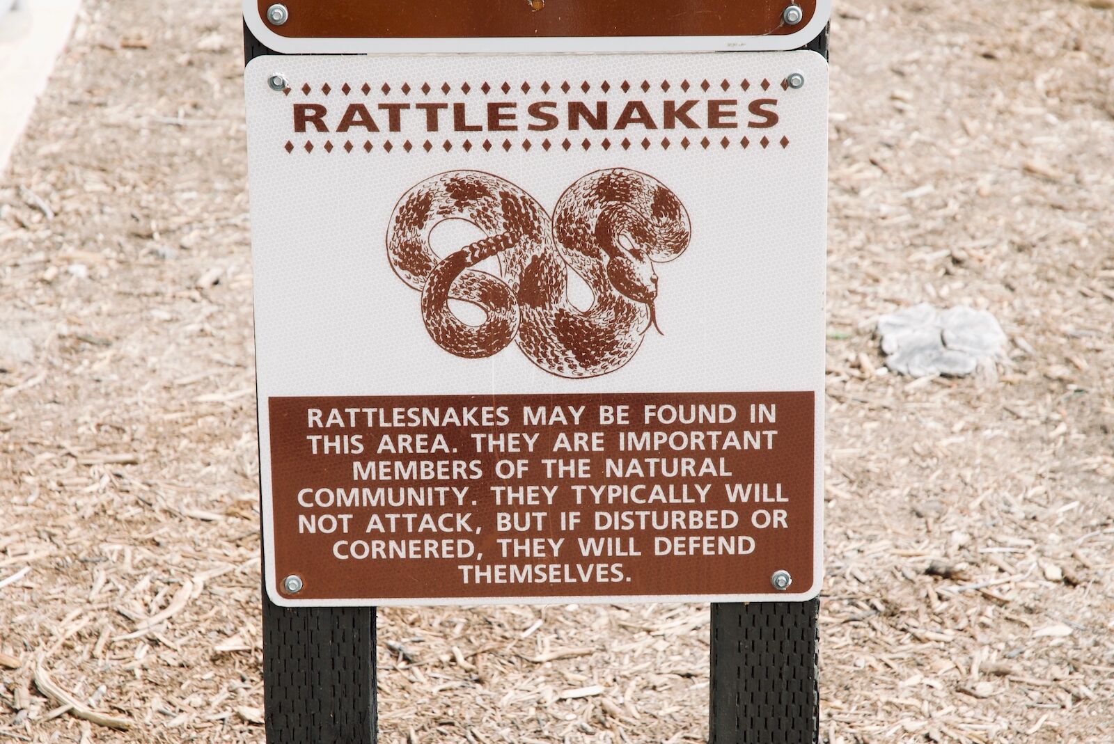
Watch for rattlesnakes while hiking in Palm Springs, and be sure to keep dogs from disturbing their dens. Photo: David Matis/Shutterstock
When it comes to wildlife, there’s not too much that could hurt you. There are lots of coyotes, but they don’t bother humans and will rarely come close (but you may want to be extra-cautious if you’re hiking with a small dog around dawn or dusk). Other than that, all you really need to watch out for are rattlesnakes, which tend to live in and around rock piles. Always watch where you step and put your hands, especially when scrambling over rocks.
In case of a rattlesnake encounter, the most important thing is to stay calm and slowly back away. Don’t try to approach or handle the snake. If bitten, seek medical attention immediately. And again, if you’re hiking with an off-leash dog, consider leashing them in rattlesnake territory. Dogs usually get bit on their noses (as they use their noses to sniff around rocks), which means the venom is very close to their brains, lowering how much time you have to get emergency treatment. You can buy rattlesnake anti-venom, but it’s expensive. For most people, keeping a close watch on curious pups is the best way to keep them safe.
Cell service and emergency services: Kimberly Renée, owner of Red Jeep Tours by Desert Adventures, recommends bringing enough water — but her second tip is always to have a back-up plan that doesn’t involve having cell phone service. “Let someone know where you’re going and when you’ll be back,” she says. “Check-in before and after your hike, and hike with a buddy if possible.”
The Desert View Trail
The view from the Palm Springs Aerial Tram. Photo: Sundry Photography/Shutterstock
- Distance: 1.5 miles
- Elevation gain: +/-334 feet
- Type: Loop
The Desert View Trail in Mount San Jacinto State Park is the top easy trail in the Palm Springs area on AllTrails.It’s a good option for families, inexperienced hikers, or anyone who just wants a gentle walk (combined with great views, of course). Unlike other Palm Springs hiking trails that require a challenging trek up the mountain, the Desert View Trail is at the top of the Palm Springs Aerial Tramway, so you get the benefit of great views without having to hike up.
It’s an easy loop with stunning vistas of the Coachella Valley below, stretching out towards the horizon. It has only a few uphill sections, and five designated viewpoints, each offering a slightly different perspective of the valley. The tramway is open daily and ticket are about $30. You can buy tickets in advance, but most of the tickets are reserved for day-of sales at the tram window. It runs non-stop throughout the day, so don’t worry about it selling out.
Note that snow is possible on mountain summits, so this trail is best avoided in the winter. It’s usually clear of snow by April, but it still gets quite chilly, so bring a jacket year-round.
North Lykken Trail
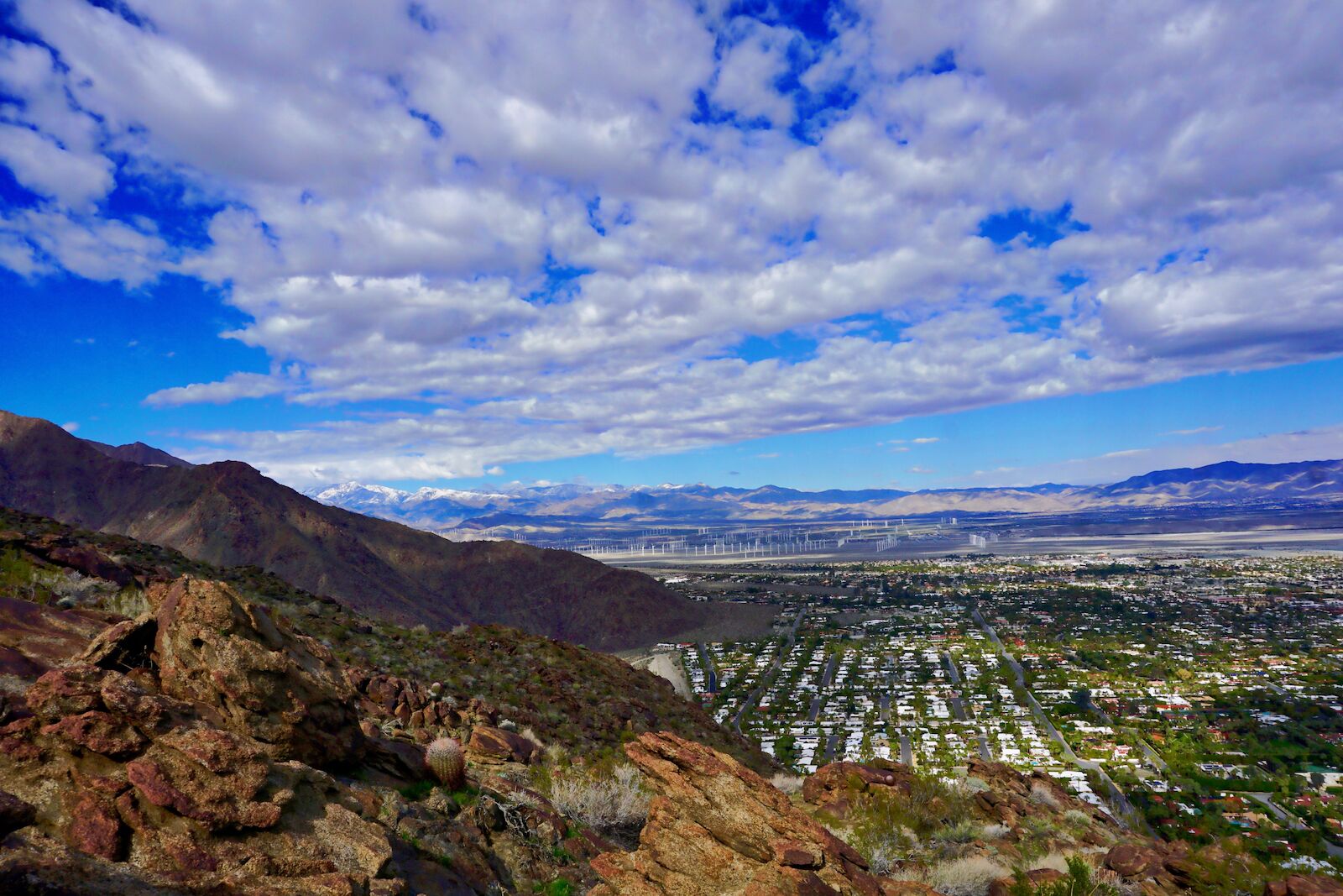
Photo: Kim Grosz/ShutterstockRed
- Distance: 2.8 miles
- Elevation gain: +/- 1,000 feet
- Type: Out-and-back
Gina Rosenthal, concierge at the Kimpton Rowan Palm Springs, recommends the North Lykken Trail to guests. But she also considers it her favorite trail to hike personally.
“I enjoy the North Lykken Trail as I get my workout in early by the onset incline,” she says. “Once atop, the terrain levels out, offering breathtaking valley views.” She notes that bighorn sheep are often seen around the trail, so always recommends guests have their phones or cameras readily available
But she also always reminds guests to be aware of the heat. She hikes very early in the morning, when the weather is comfortable and the color-changing sky provides a great backdrop for morning meditation.
“The quiet ignites instant serenity,” she say of the trail. “Get ready to be wowed.”
Photo: AllTrails
Tahquitz Trail
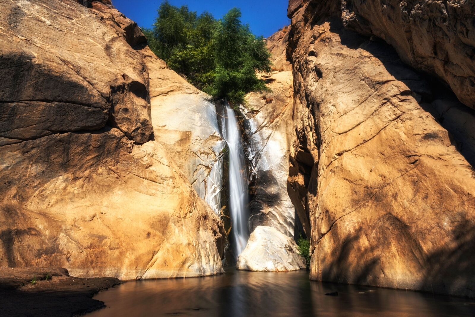
Photo: Tom Forbes/Shutterstock
- Distance: 1.8 – 2 miles (depending on source)
- Elevation gain: +/- 330 feet
- Type: Loop
Paulette Monarrez, General Manager at Korakia Pensione, often sends guests to Tahquitz Trail in Tahquitz Canyon, a private reserve just a few minutes south of downtown Palm Springs.
“We love to recommend the Tahquitz Trail, because it’s a short, two-mile loop that has a beautiful 60-foot waterfall in the center of it,” she says.
But the waterfall isn’t the only reason it’s one of the best Palm Springs hiking trails, in her opinion. “There are many dark-chocolate rock formations throughout, and some even say that they can feel the energy of the ancient ancestors when they visit,” she adds.
Tahquitz Canyon is on the Agua Caliente Band of Cahuilla Indians Reservation and has a $15 fee to access the facilities, including usage of the trails and optional guided interpretive hikes. Visitors can buy tickets at the trailhead, or at the Palm Springs Visitor Information Center (2901 N Palm Canyon Dr.) It’s open 7:30 AM to 5 PM daily from October 1 to July 4, and only open Friday, Saturday, and Sunday in the summer. That’s the slow season for hiking around Palm Springs because of one reason: heat.
“We always inform our guests that this hike has minimal shade, so it is best to do very early in the morning and in the cooler months,” adds Monarrez.
Palm Spring is a very popular wellness destination within California, with way more than just massages and facials. Many hotels, including Korakia, offer guided hikes and meditation sessions on area trails. On Korakia’s guided Sunday morning hikes (offered November to May), guides take it slowly, pointing out significant markings along the trail and regaling visitors with stories about the trail’s history and culture.
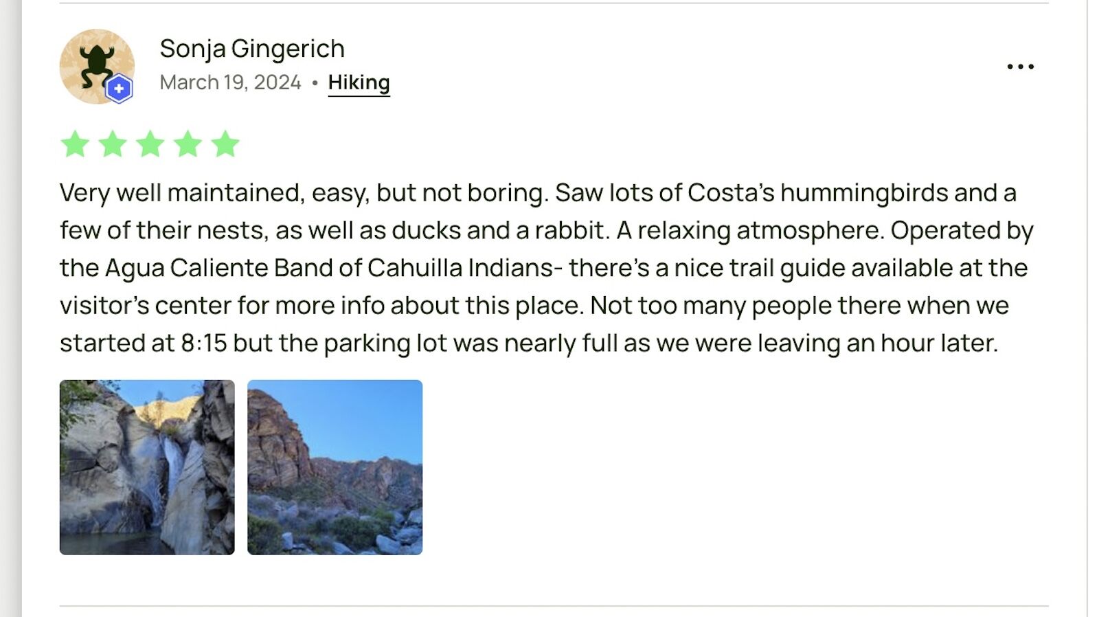
Photo: AllTrails
The East Indio Hills Badlands Trail
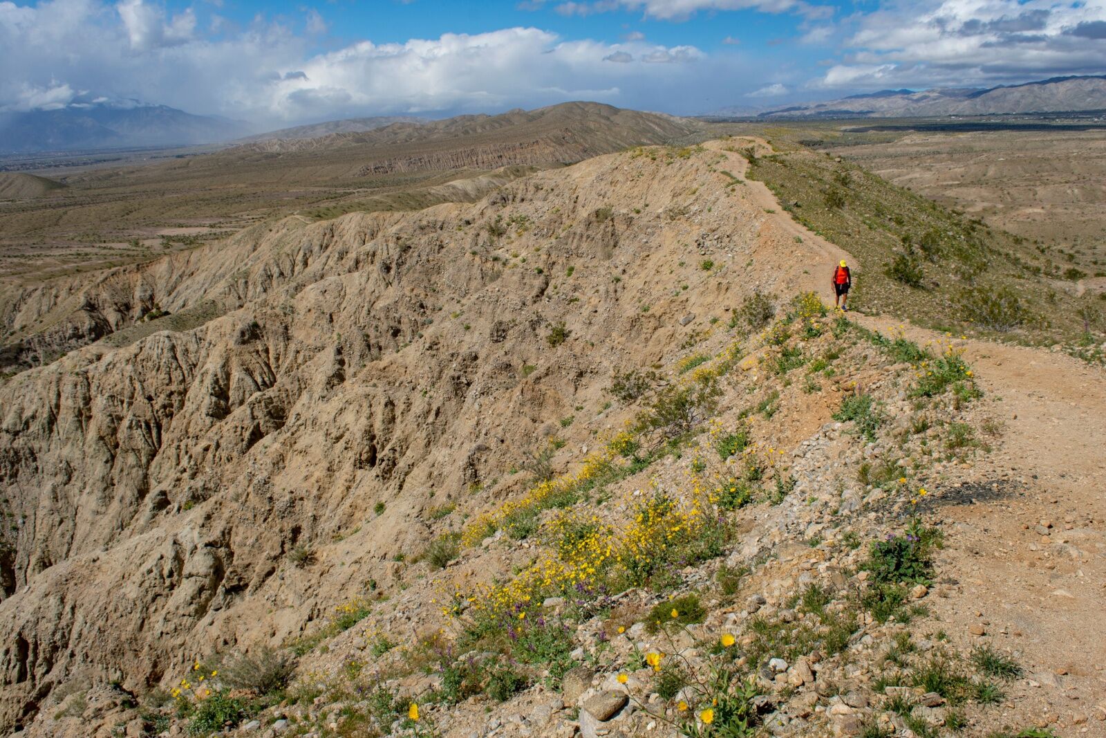
Photo: HeavyT Photography/Shutterstock
- Distance: 5.2 miles
- Elevation gain: +/- 777 feet
- Type: Out-and-back with a loop
Kimberly Renée of Red Jeep Tours recommends a trail in a relatively new area that tends to not get too crowded: the East Indio Hills Badlands Trail. “This scenic trail takes people through the San Andreas Fault Zone uplift created over a millions of years,” she says. “The loop trail twists and turns in sandy washes, through some slot canyons, and climbs up to a ridgeline with panoramic views of the Coachella Valley on one side and Sky Valley on the other.”
At five miles, it’s a moderate distance, but the elevation gain and exposure on the ridgelines makes it better suited to intermediate and experienced hikers. Renee notes that there’s also some rock scrambling, so it’s best for hikers with experience using their hands. However, it’s also one of the best Palm Springs hiking trails for wildflowers in the spring, and fortunately, you can see them without doing the full loop.
You can hike from the trailhead to the trail split and back, creating a two-mile out-and-back trail with only about 150 of elevation gain. But “the main loop is moderately strenuous,” says Renee, “and not recommended for those with a fear of heights.”
Photo: AllTrails
San Jacinto Peak via the Tramway
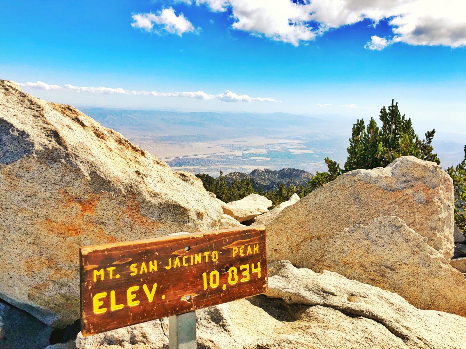
Photo: AJ9/Shutterstock
- Distance: 12 miles
- Elevation gain: +/- 2,580 feet
- Type: Out and back
If you’re keen on a challenging hike, the most popular “hard” trail on AllTrails is the hike to San Jacinto Peak via the Palm Springs aerial tram. Once you take the tram up, it’s a full six miles of hiking to reach the summit — and another five miles back to the tramway to take it back down.
It’s definitely one of the hardest Palm Springs hiking trails to do in a day. You’ll gain more than 2,500 feet of elevation in the first half (and have to descend it during the second half). That makes it very solidly a difficult, advanced hike, even if you have no trouble with the distance. Plan on a full day to do it, and remember that it gets icy and snowy near the summit in winter, making this a summer-and fall-only hike. If you do decide to hike it in the winter, you should have microspikes and know how to self-arrest with an ice axe.
You do not need to make reservations for the aerial tram — but you can, which may help you save some time in the morning if you’re trying to get an early start. Note that most hikers report the distance as being closer to 12 miles, even if AllTrails says 10.
Photo: AllTrails
Ranger-recommended hikes in Joshua Tree
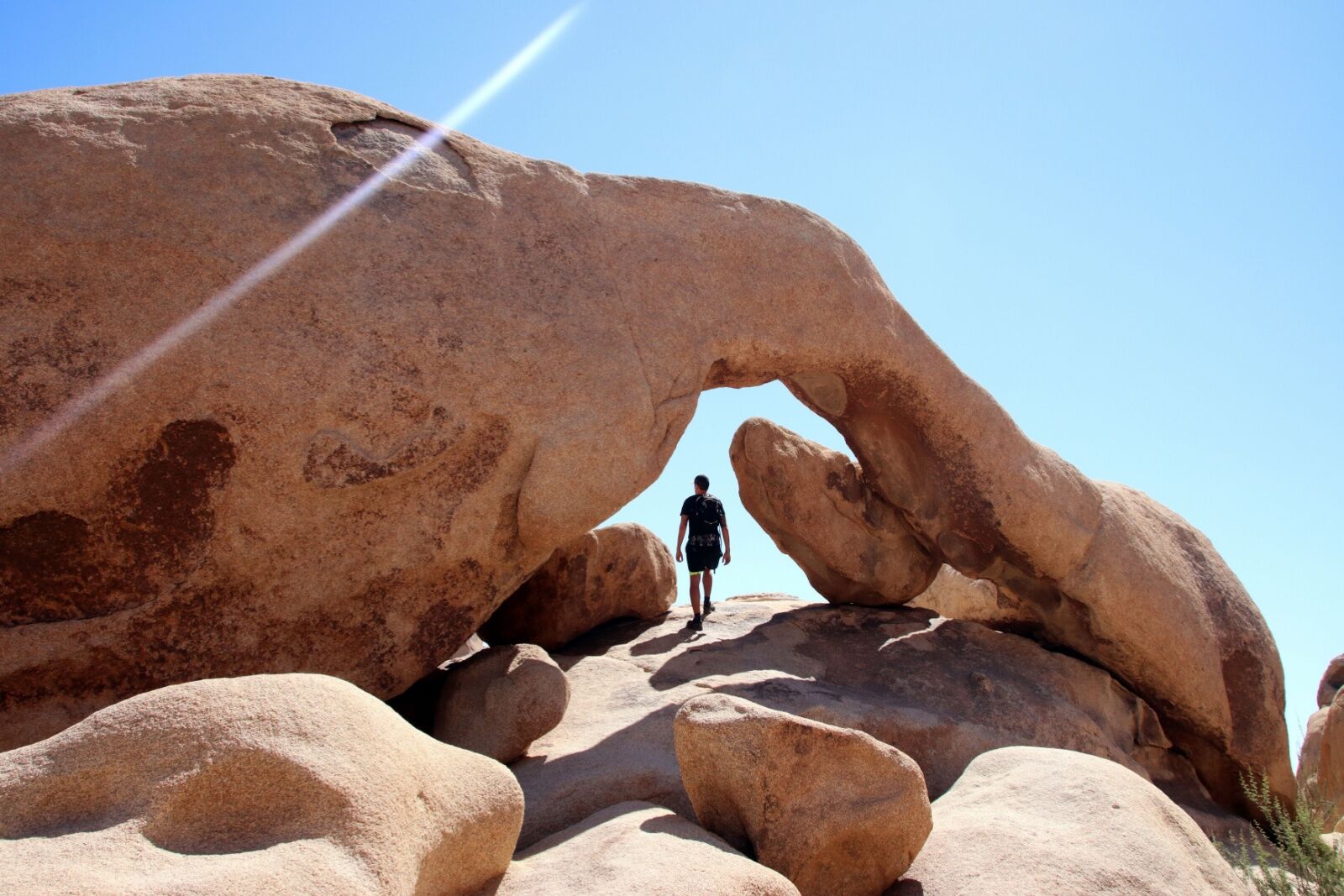
Photo: thomaslabriekl/Shutterstock
Visitors and residents in Palm Springs are lucky to have easy access to hiking trails in nearby Joshua Tree National Park. It’s only about a one-hour drive to reach the West Entrance of the park, and only about 10 minutes further to reach the South Gate. But the park has lots of trails, so it can be hard to know where to start.
“We recommend several hikes of all different moderations,” says Meg Rockwell, Park Guide within the Division of Interpretation at Joshua Tree National Park. “Our most doable hikes for a wide-ranging audience will be any of our easy hikes: Barker Dam, Hidden Valley, Cap Rock, Discovery Trail, and Arch Rock.”
Rockwell recommends those five as they show off the diversity of the park’s wildlife, as well as the world-class boulders the park is famous for. She also recommends wearing light-colored clothing and always having a sun hat for shade.
There’s also something all five trails have in common: Joshua trees. “These trails are for the visitor that wants to get a little closer to nature and be able to see the Joshua Trees up close,” she says, “or climb on some rocks.”
Barker Dam
- Distance: 1 mile
- Elevation gain: +/- 50 feet
- Type: Loop
For a very easy hike with minimal elevation gain, head to the Barker Dam Trail. The short trail has interpretive signage along the route and rock art along the trail, plus views of Mount San Gorgonio on clear days. Park at the Barker Dam Trailhead or the Echo-T parking lot (approximately .3 miles away).
Hidden Valley
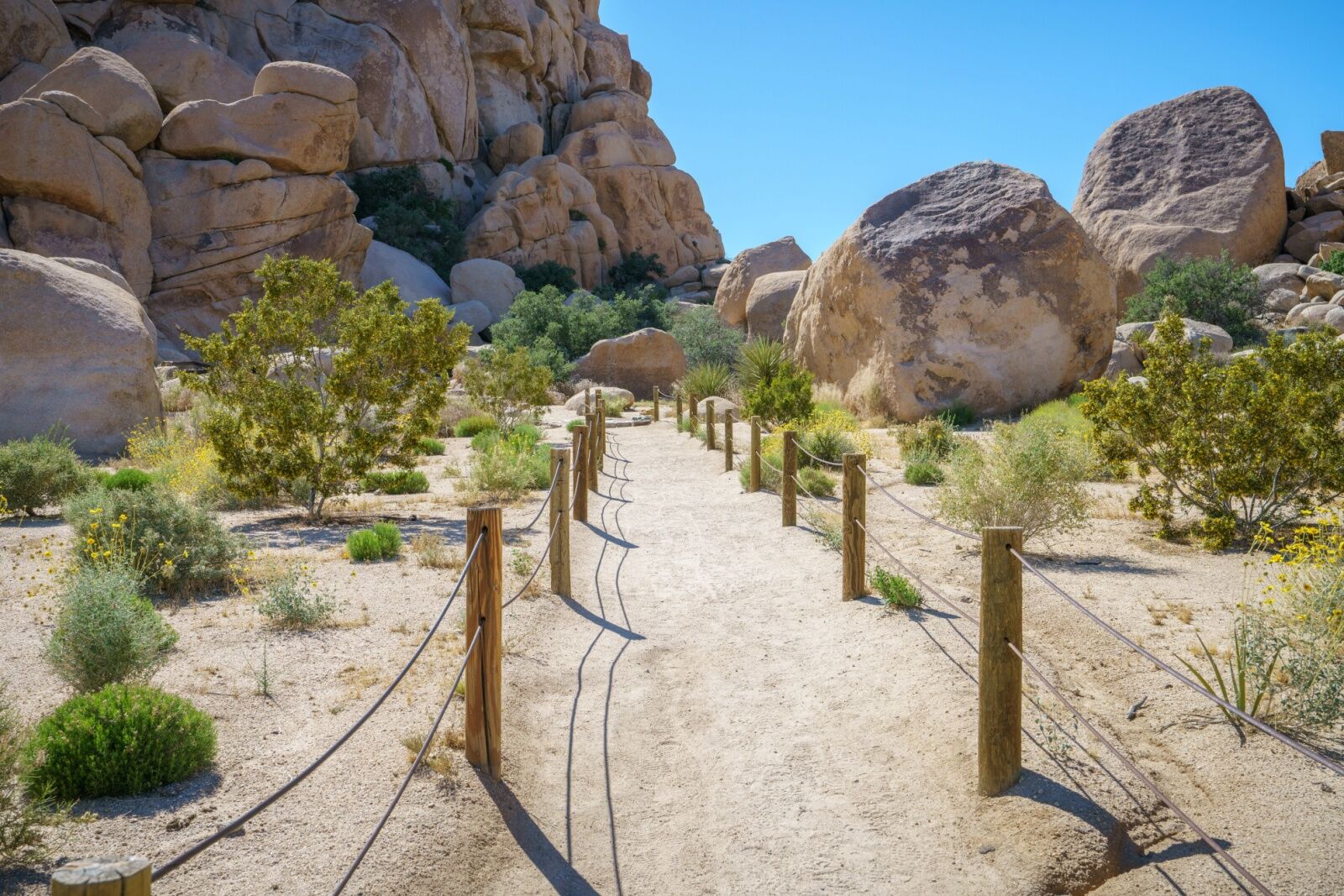
Photo: cb_travel/Shutterstock
- Distance: 1 mile
- Elevation gain: +/-100 feet
- Type: Loop
Hidden Valley is another fairly easy loop that meanders through the Mojave Desert. It’s one of the least-shady trails in the park (which is saying something, as much of the park has little shade). So skip it on hot days, or start very early in the morning. It starts at the Hidden Valley Campground.
Cap Rock
- Distance: .4 miles
- Elevation gain: n/a
- Type: Out and back
Cap Rock is a very short trail that meanders around one of the park’s most dramatic and impressive rock formations: Cap Rock. It’s an extremely popular photography location, as the huge boulder pile is surrounded by dozens and dozens of the park’s namesake trees.
The Discovery Trail
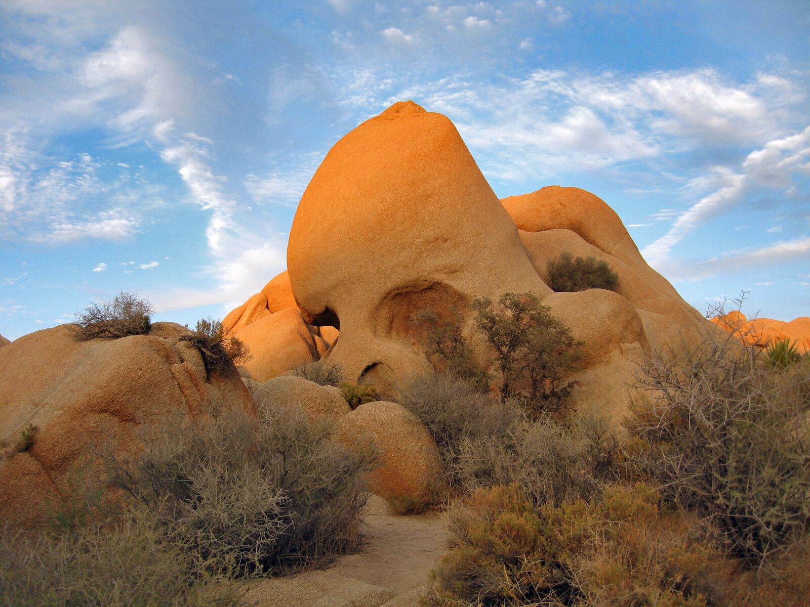
The Discovery Trail starts just across from famous Skull Rock. Photo: NPS/Robb Hannawacker/Public Domain
- Distance: .7 miles
- Elevation gain: +/- 70 feet
- Type: Loop
The Discovery Trail starts near another one of the park’s most famous rock formations: Skull Rock. The trailhead is across the road from Skull Rock, and if you head in a clockwise direction, you’ll hit a turn off for the Skull Rock Trail. Keep going, and you’ll hit another turnoff that connects to the Face Rock Trail just a few minutes before you return to the starting point.
Arch Rock
- Distance: 1.4 miles
- Elevation gain: +/-100 feet
- Type: Out-and-back with a loop
If you want to learn about the park’s unique geology (and potentially climb on some giant boulders), head to the Arch Rock Trail. When you get to the loop at the end, park rangers advise heading counterclockwise to get a clearer view of the impressive natural arch. ![]()
Traveling to Southern California? Check out Matador’s California accommodations guides:
- Get The Most Out of Palm Springs At These Guest-Favorite Airbnbs
- 8 Gorgeous Palm Springs Airbnbs With Private Pools
- The 9 Best Palm Springs Airbnbs for a Bachelorette Party to Remember
- 15 Rejuvenating Resorts Near Palm Springs for a Post-Coachella or Stagecoach Retreat
- The Most Iconic Palm Springs Hotels
- Guests Enter This Palm Desert Hotel Via a Gorgeous Gondola Ride