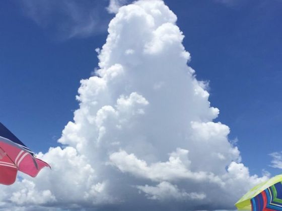
A crazy mushroom cloud resembling something that Super Mario might pluck from the sky made the rounds on social media this past weekend. On June 12th, Alabama meteorologist Jane Dunne tweeted this photo of a mushroom cloud of near-perfect symmetrics shooting down rain off the state’s southeastern coast, which promptly went viral:
Quite possibly the best example of a mushroom 🍄 cloud I have ever seen! Earlier today in Gulf Shores, #Alabama 📷 Rick Gross @StormHour @spann pic.twitter.com/OpAPS6MfIX
— Jake Dunne, MS (@Jake_WPMI) June 13, 2018
The photo was actually taken in July 2016 by Rick Geiss of Gulf Shores, Alabama, during an otherwise routine visit to a beach near his home. Why he waited nearly two years to send the photo to Dunne remains a mystery, but science can explain how this cloud, called a cumulus congestus, formed.