September is a month of denial. Many are loath to admit that summer is over and still cling desperately to those final sunny days. Others are more eager for fall, prematurely donning flannel shirts, scoping out apple orchards, and pre-ordering pumpkin spice lattes the second the calendar turns to September 1. Seasonal biases aside, September is actually the best of both worlds, and one of the best months of the year for a vacation. With the most intense summer heat behind us and the chilly autumn weather still ahead, this is the month to take that outdoor vacation you’ve been putting off. From mountain biking in Vermont’s rugged Northeast Kingdom to stargazing in the Texas Hill Country, these are the best regions to visit in September for an outdoor adventure.
Where to Travel in September for the Best Outdoor Adventures
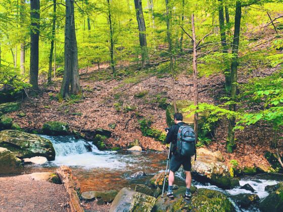
Northeast Kingdom, Vermont
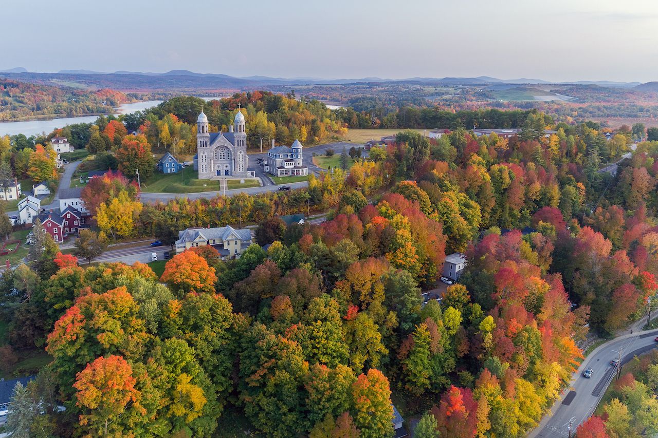
Photo: NEKVT/Shutterstock
The Northeast Kingdom might sound like a separate nation within Vermont, but its name actually represents the pride those who live there take in their remote homeland. The kingdom is composed of the rural, bucolic counties of Essex, Orleans, and Caledonia, and is defined by its small towns, wild landscape, and interesting characters you’ll meet when you visit. It’s also one of the best regions in New England for uncrowded biking trails. Everyone knows summer in New England can get pretty humid, making September the perfect time to visit.
How to get there: Anyone visiting the Northeast Kingdom from outside New England will want to fly into Burlington international Airport, and then drive about two hours east to the Northeast Kingdom. If you’re traveling from within New England, Boston has direct flights to Lebanon Municipal Airport in West Lebanon, New Hampshire, which puts you an hour’s drive from the Northeast Kingdom. You could also make the entire journey by car, as Boston is just a three hour drive from the region, and September is an ideal time of year to enjoy the changing foliage.
Where to go mountain biking: The Kingdom Trail network is one of the most beautiful biking trails in New England, and also one of the least visited. Located in East Burke, the network contains over 100 miles of trails for all ages and ability levels. There are skill parks, technical single tracks, more relaxed double tracks, excavated flow trails, and even pedestrian trails for those who’d prefer to walk. The entire network is interconnected, making it convenient to traverse multiple trails during a single visit as you pass through some of Vermont’s most rugged scenery.
Pocono Mountains, Pennsylvania
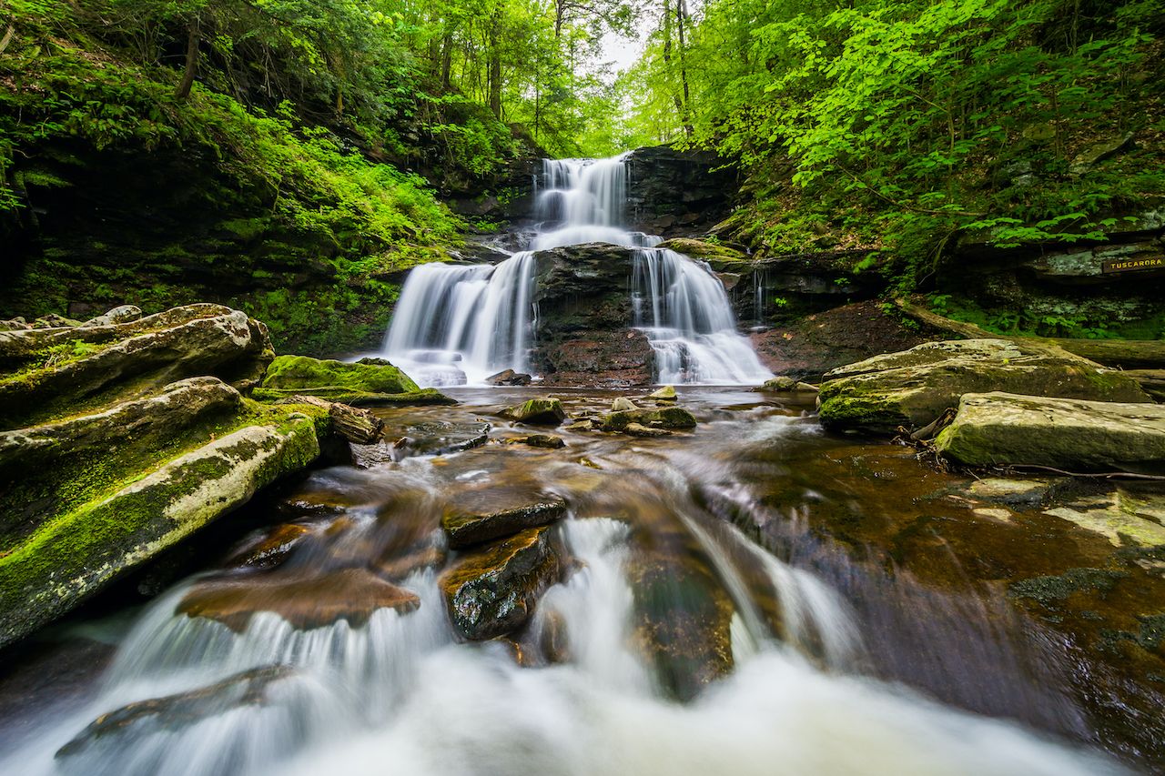
Photo: Jon Bilous/Shutterstock
The Poconos in northeastern Pennsylvania have the rare benefit of immersing visitors in nature while still being just a day trip away from a major urban area. Under two hours from Philadelphia and New York City, the Poconos Mountains are known for a diversity of outdoor adventure experiences, including whitewater rafting, waterparks, skiing, and beaches. The mountains are probably best known for hiking, however, especially in Ricketts Glen State Park.
How to get there: The Poconos are around a two hour drive from both Philadelphia and New York, and those are also the access points for travelers from elsewhere in the country. Flying into Philadelphia and then driving to the mountains is probably your best bet. There are also busses running between the airport and the mountains. Pocono Mountains Municipal Airport is another option, located under a half hour from your destination, though direct flights here are rarer and often more expensive.
Where to go hiking: Ricketts Glen State Park is the Pocconos’s premier hiking destination. The park is filled with hiking trails running alongside waterfalls, including the seven-mile Falls Trail loop that allows you to see 21 waterfalls along the way. There’s also a shorter Beach Trail that brings you around Lake Jean, the Grand View Trail that takes hikers to the highest point on Red Rock Mountain, and the difficult Mountain Springs Trail that winds past the old Lake Leigh Dam and down to Bowmans Creek.
East of Ricketts Glen, Bushkill Falls is another great option for hiking in the Poconos. This private hiking area is also home to several waterfalls, the tallest of which is 100 feet high.
Long Island, New York
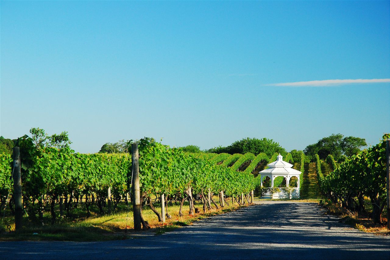
Photo: James Kirkikis/Shutterstock
A Long Island vacation might call to mind ritzy images of summer in the Hamptons, but fall is the best time of year to visit Long Island. And no, you don’t have to drop Hamptons levels of money. New England often hogs the fall scenery spotlight, but Long Island — particularly the North Fork — is filled with vineyards, pumpkin patches, and harvest festivals that rival anything you’d find in Massachusetts.
How to get there: MacArthur Airport is the largest regional airport on Long Island, though it’s probably easier and cheaper to fly into New York City via LaGuardia or JFK. You could also take the ferry from New London, CT, across the Long Island Sound to Orient Point.
Where to find fall festivities: Home to over 55 vineyards, the North Fork has no shortage of alluring options for visitors. Main Road, which stretches inland from Orient Point, is lined with farms, fruit vendors, pie stands, and vineyards.
Hallock’s Cider Mill is one of the most famous farms on Long Island, and is known for its key lime pie, jams, cookies, and eccentric gnome houses in the fantasy-themed yard. Garden of Eve Organic Farm and Market is perfect for those looking to do some picking, with sprawling strawberry, blueberry, blackberry, corn, and pumpkin fields. There’s also the Fun Fields for children, with farm animals, a bounce pad, tube slide, and pedal kart track. Those looking to ring in fall by imbibing should check out Bedell Cellars, a family-owned vineyard operating since 1980. Its picturesque grounds are defined by a mahogany pavilion with views of the lush vineyards and gardens, though there’s also a more intimate indoor loft with vaulted ceilings and a fireplace where you can sip in style. And if you happen to be visiting at the end of September, Harbes Family Farm is hosting a Pumpkin Harvest Festival on September 25 and 26, with live music, pumpkin picking, and musical hayrides.
Door County, Wisconsin
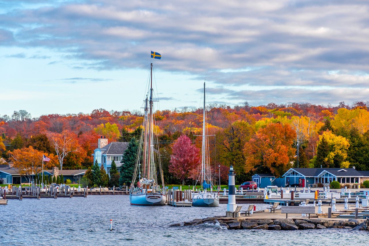
Photo: Nejdet Duzen/Shutterstock
Door County is situated on a peninsula jutting into Lake Michigan, and it has everything from picturesque fall hiking and biking trails to picnic areas, roadside farm markets, and apple cider. The best way to truly see it all is by renting a car (or driving your own) and road tripping through everything the county has to offer.
How to get there: The closest major airport to Door County is around two-and-a-half hours away Milwaukee. It’s probably best to rent a car at the airport, as driving is the most convenient way to explore the area. You can also get there by ferry (and take your car along for the ride). The Lake Michigan Car Ferry connects Ludington Michigan with Manitowic, Wisconsin.
Where to road trip: The Cave Point County Park at the south end of the peninsula is a great place to start your road trip. With views of the shoreline cliffs on Lake Michigan, the Cave Point Lakeside Trail is perfect for all skill levels and brings you through the park’s most lush scenery at a leisurely pace. The Black Trail is another option for hikers. Considered one of the best nature walks in the county, the trail loop starts at the Whitefish Dune State Park parking lot and winds around a section of coastline with views of Lake Michigan. Through the woods, you can glimpse the changing leaves. There are several picnic areas along the way where you can stop for the perfect fall picnic.
Along the way, make sure to sample the country’s best apple cider. Stop first at Lautenbach’s Orchard Country Winery & Market, a family-run market that has been producing fruit products since 1955, and known for its wide variety of hard cider flavors. Island Orchard Cider, at the northern end of the peninsula, is probably the perfect place to cap off your trip. The cider house has both indoor seating and an outdoor patio, flight tasting, and an extensive menu of specialty ciders.
Where to bike: There are also tons of prime biking routes for cyclists looking to hit multiple trails around the county. As you drive up the peninsula, the Country Road Q trail starts just north of Bailey’s Harbor, and winds north past the Mud Lake State Wildlife Area, Moonlight Bay, and North Bay. The forested route has great views of the lake and access to Cana Island. There’s also the option of taking the car ferry to Washington Island just off the northern tip of the peninsula, which is a great place to end your road trip. You can either rent a bike or use your own to explore historic churches, lavender fields, forests, and beaches on the island.
Great Smoky Mountains, North Carolina
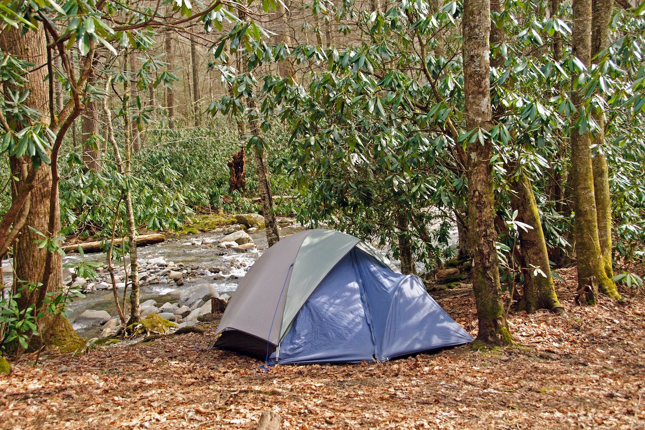
Photo: Wildnerdpix/Shutterstock
Seasoned campers might be comfortable camping all year round — even in the frigid winter months or in the burning summer heat. Those of us looking for a more comfortable, casual experience should camp in September, when the weather is cooling off but nature is still alive and colorful. The Great Smoky Mountains has a variety of backcountry and frontcountry campgrounds, which are a great complement to hiking the scenic trails and driving through the fall foliage.
How to get there: If you’re driving, the mountains are most commonly accessed via the Sugarlands entrance on the park’s north side, through Gatlinburg. There’s also a smaller, less-trafficked entrance south of Townsend, about 25 miles west of Gatlinburg. The closest major airport is Knoxville’s McGhee Tyson Airport, located an hour west of the mountains. Many travelers, however, use Asheville as a base, and might find the Asheville Regional Airport more convenient.
Where to go camping: The mountains have several campgrounds to take advantage of. Each campground has restrooms with toilets and running water, and each campsite comes with a fire grate and picnic table. Balsam Mountain Campground is one of the most popular, surrounded by streams and mountain views, and elk sightings are particularly common during the fall. Deep Creek, in the southeastern part of the park, is known for its vivid fall colors and access to several hiking trails. It’s also right next to a creek, making it perfect for a relaxing afternoon of fishing. Cades Cove is another popular campground, due to its hiking and biking trails, and the 11-mile Cades Cove Loop Road.The campground is in a valley surrounded by mountains, and wildlife like white-tailed deer, black bears, coyotes, groundhogs, turkeys, and other animals are oftens spotted here.There are also seven group campgrounds accommodating parties of eight or more, though trailers and campers are not permitted here — only tents.
Oregon Scenic Byways, Oregon
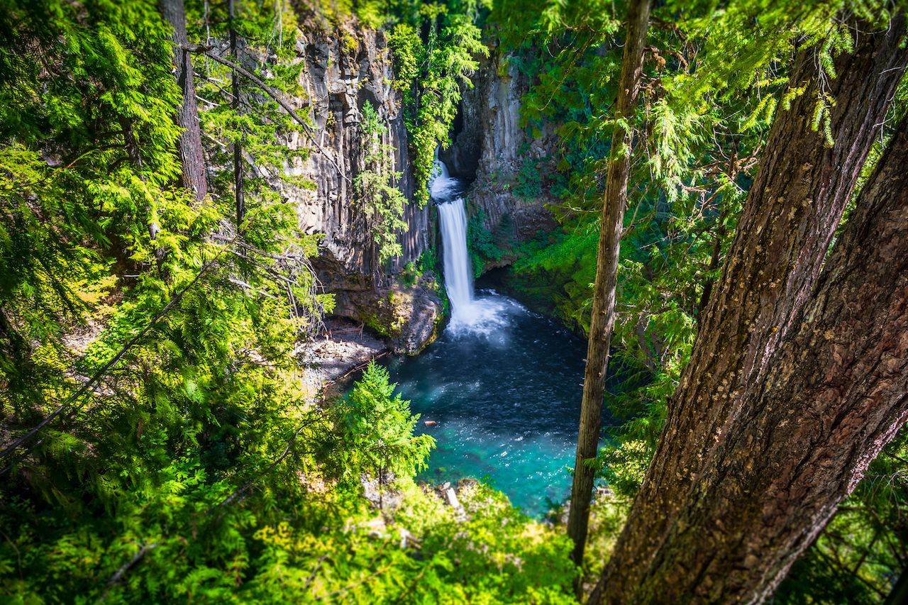
Photo: Stephen Moehle/Shutterstock
Fall is uniquely conducive to a trip based solely around sightseeing without having to burden yourself with the physical activity that usually comes with outdoor adventure. The season’s vibrant colors and trees full of eye-catching foliage make a sightseeing tour a great trip option — as long as you know where to go. The Pacific Northwest is known year-round for its natural beauty, though there’s nothing quite like Oregon’s Scenic Byways in the fall for sightseeing you simply can’t get anywhere else in the country.
How to get there: Since traveling the scenic byways requires a car, you’ll need to either rent one at an airport or drive your own. The state’s largest airport with the most rental options is in Portland, though regional airports in Bend and Eugene are also good options.
Where to do go sightseeing: Scenic byways are chosen for possessing unique natural, scenic, historic, cultural, recreational, or archeological qualities. It’s no surprise, then, that Oregon has 29 designated scenic byways throughout the state, each offering something slightly different. For autumn sightseers, the McKenzie Pass-Santiam Pass Scenic Byway should be first on your list. This byway starts in Sisters, and travels northwest on US-20 toward Santiam Pass. Along the way you’ll see Suttle Lake and Mt. Washington, as well as several ashen buttes from the pass itself. When you cross onto the McKenzie River Highway, you’ll have access to the McKenzie River National Recreation Trail if you want to stop for some hiking or biking along the river, or simply continue to see Sahalie Falls, which can be viewed from a parking lot. The Silver Falls State Park area also has several waterfalls, and red vine maples full of colorful leaves to really drive home that fall vibe.
To really plunge into the woodlands, drive the Rogue-Umpqua Scenic Byway starting in Roseburg. East of Roseburg you’ll drive through hills filled with oak trees, and farther on, hikers can take advantage of the North Umpqua Trail that winds through an old-growth forest. After you pass Toketee Lake on OR-138, you’ll be able to see Diamond Lake, Mt. Thielsen, and Mt. Bailey, followed by the Crater Rim Viewpoint with views of Crater Lake before plunging once again into the forest as you enter Rogue River-Siskiyou National Forest.
Texas Hill Country, Texas
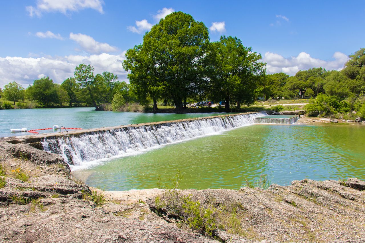
Photo: Philip Arno Photography/Shutterstock
Travelers might not typically associate Texas with fall, but it’s the best season to have an outdoor adventure in the Lone Star State without worrying about the oppressive heat. The Hill Country forms the southeastern part of the Edwards Plateau, a remote and rural region of Texas that’s perfect for hiking, camping, and picnicking — especially in the fall.
How to get there: The easiest way to reach the Hill Country is by flying into San Antonio International Airport or Austin-Bergstrom International Airport. If you don’t have your own car you’ll probably want to rent one, as convenient public transit is lacking.
Where to have a picnic: Pace Bend Park in Spicewood, northwest of Austin, might as well be called “Peace” Bend Park for how relaxing it is. This remote peninsula on Lake Travis has nine miles of shoreline, picturesque rocky cliffs, and beautiful views of the water pretty much anywhere you set up camp. After your picnic, go swimming in the lake or just spend the afternoon sunbathing on the cliffs. Krause Springs, also in Spicewood, is a great option for those who want to feel immersed in nature. Surrounded by oak and cypress trees, you can picnic under the boughs in a relaxing shade, with views of a small waterfall pouring into a swimming hole. Blanco State Park, southeast of Austin, is a picnic area well-equipped with picnic tables and barbecue pits. Located on a long stretch of riverbank, there are plenty of private areas where you can set up and enjoy the view of waterfalls cascading into the river.
For a slightly different experience, have a night picnic at Enchanted Rock State Natural Area. The park is one of the best dark-sky locations in Texas, making it perfect for stargazing and viewing the Milky Way. ![]()