In February, 2016, President Barack Obama extended a national monument designation to three Mojave Desert sites in eastern California: Mojave Trails south of Interstate 40 north of the Sheephole Valley Wilderness, Sand to Snow east of San Bernardino, and Castle Mountains in the Mojave National Preserve just west of the Nevada border. Collectively, these areas make up the California Desert Monuments, covering roughly 1.7 million acres of desert landscape originally inhabited thousands of years ago by the Chemehuevi, Kawaiisu, Mohave, Serrano, Cahuilla, Southern Paiute, and other Native American tribes. While they’re not national parks, the designation does give them federal protection.
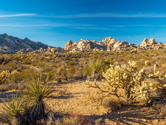
Photo: MightyPix/Shutterstock
The Best California National Monuments for a Weekend Road Trip From LA
The three California national monuments in the Mohave are some of the most vast and arid in the United States — and among the least-visited. That makes a road trip between the Sand to Snow, Mojave Trails, and Castle Mountains national monuments one of the best trips you can take outside of summer in the Golden State. (Or in summer, but it’s quite a bit hotter). All three have free admission as well as established trails and facilities. But all three are still in the desert, and in true desert fashion, the trails can be rugged and wayfinding can be tricky. Here’s how to plan a three-monument road trip through the stunning-but-rugged scenery of California’s new protected sites.
Roadtripping the new California national monuments
The best way to see all three sites on a road trip from Los Angeles is to head east out of the city on Interstate 10. Turn north in Redlands towards Highway 38. The drive will take about two and a half hours — but remember that driving in the parks can be slower, as the map uses the entry points of the monuments. You may also want to consider adding on additional outdoorsy destinations with more lodging options, like Joshua Tree National Park or in the mountains surrounding Big Bear Lake.
From there, the drive to Mojave Trails National Monument will take about three hours, or a little less from Big Bear. You’ll head to 29 Palms and then head north on Amboy Road toward the unincorporated community that goes by the same name. The monument is just outside of Amboy. Staging yourself in an Airbnb near Joshua Tree National Park might make sense the night before visiting the monument, or camping closer to the monument itself.
To get to Castle Mountains National Monument, head north largely via US-95 for about two and a half hours. You’ll cross into Nevada and then back into California to enter the monument. Camping is your best bet in the area unless you wish to head north to Las Vegas.
Sand to Snow National Monument
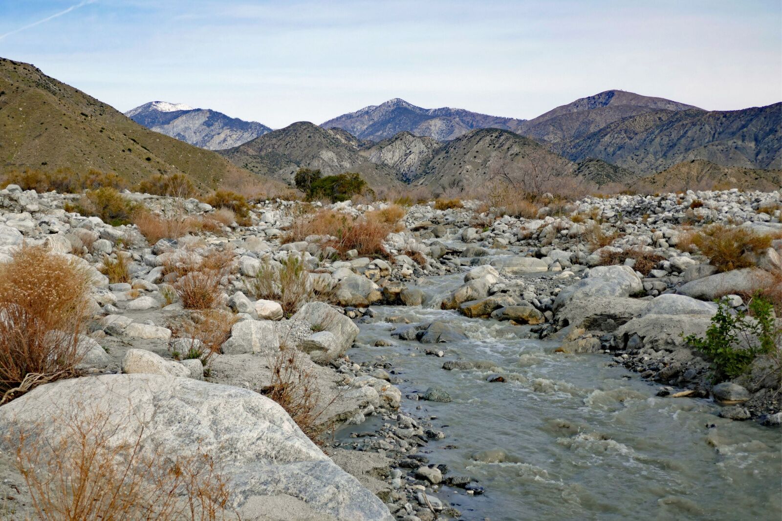
Photo: dlhca/Shutterstock
The furthest south of the new desert California national monuments is Sand to Snow National Monument, whose name alone gives you a great idea of what to expect across its 154,000 acres. The California national monument touches both the Sonoran Desert and San Bernardino National Forest.
Within the monument are 30 miles of the famed Pacific Crest Trail, which you can check out on a day hike or backpacking trip. For an extremely challenging but extremely beautiful hike, take the 16-mile San Bernardino Peak Trail, which gains more than 4,000 feet while offering views of San Gorgonio Mountain (the highest peak in Southern California). It’s usually only passable in the summer and early fall, but if there’s still snow when you go, you can cross country ski in the San Gorgonio Mountains within the monument. Good options for exploring on snowshoes or on foot include the .7-mile Marsh Trail and the 11-mile Morongo Canyon Trail. While hiking, keep your eyes peeled for the more than 240 types of birds that migrate throughout the monument.
- Location specifics: Sand to Snow isn’t very far distance-wise from Mojave Trails, but it’s an out-of-the-way drive. It takes about four hours to drive between the two California national monuments, going through Barstow and Victorville in the process. Of course, the drive could be drastically shorter (or longer) based on where you’re starting from in each reserve.
- Camping: You can camp almost anywhere within the monument and there are developed campsites available nearby in San Bernadino National Forest. Palm Springs is about 45 minutes south if you’d rather sleep in an actual bed.
Mojave Trails National Monument
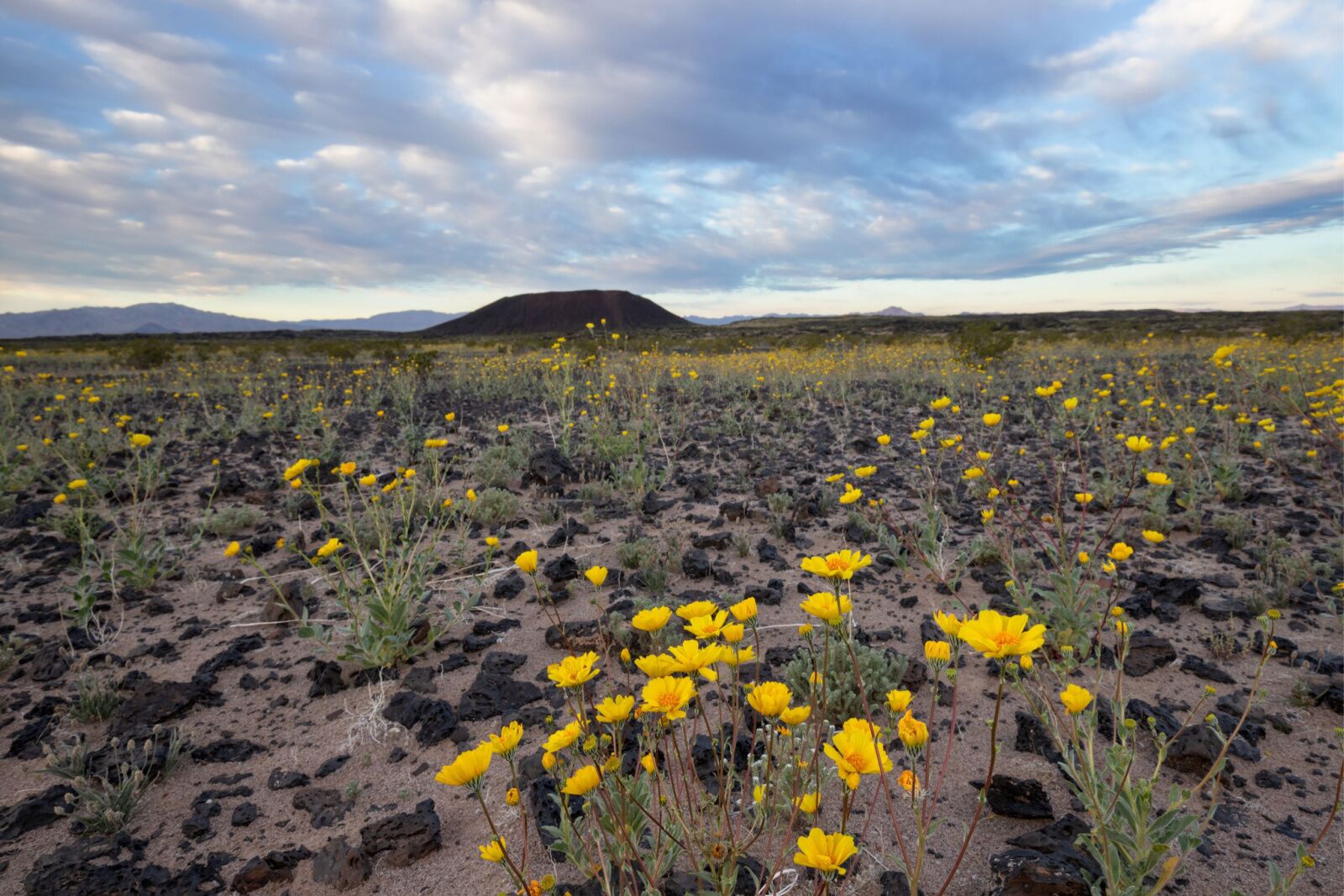
Photo: sumikophoto/Shutterstock
Mojave Trails National Monument spans 1.6 million acres, making it the largest national monument in the lower 48. Its designation spurred the town of 29 Palms, about 50 minutes to the south, to advocate to protect and promote the monument, and leaning into tourism as the monument’s gateway town.
“The town of 29 Palms recently voted to become an official gateway to Mojave Trails National Monument,” Jessica Dacey, director of communications at the Mojave Desert Land Trust, told Matador. “To the town’s citizens it’s a source of great pride that they are home to the biggest national monument in the contiguous 48 states. Over the last five years, tourism to the California desert region has steadily grown, and there has been a direct economic benefit for gateway communities like 29 Palms. There is a growing recognition of the importance of preserving these places.”
There is no shortage of options for foot-powered exploration once you arrive. Mojave Trails National Monument, managed by the Bureau of Land Management, epitomizes desert hiking in the western United States. It’s dry but beautiful, with year-round trail access and a diverse collection of wildlife including coyotes, jackrabbits, and even roadrunners (meep-meep).
A nice beginner hike is the three-mile round-trip hike to Amboy Crater, one of the country’s youngest volcanoes. Or go further out into the Bigelow Cholla Garden Wilderness to hike Afton Canyon for expansive desert sky views and rock formations. You’ll likely stumble across ancient fossils along the way, a popular collector’s item within the monument (watch this US Department of the Interior video for info on how and where to fossil hunt).
- Location specifics: California’s biggest national monument is about two hours south of Las Vegas. It borders the Mojave national Preserve to the north and Joshua Tree National Park to the south, so consider spending multiple days between the three sites. If you’re coming from Castle Mountains National Monument, it’s a 2-to-2.5-hour drive.
- Camping: Mojave Trails is managed by the Bureau of Land Management (BLM), so dispersed camping is allowed anywhere in the monument. There are also 22 campsiutes with facilities, reservations aren’t needed.
Castle Mountains National Monument
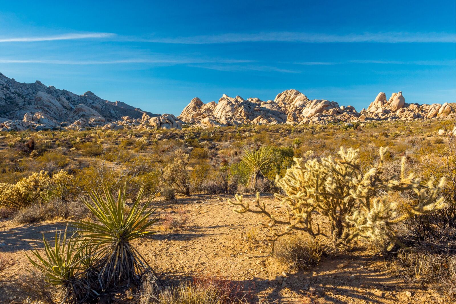
Photo: MightyPix/Shutterstock
Castle Mountains National Monument is very close to the Mojave National Preserve and has Joshua Tree forests, just like nearby Joshua Tree National Park. Part of the monument’s appeal is it’s nothingness, and there are no visitors centers, maps, or facilities (so bring everything you’ll need). The only infrastructure is a rough dirt road, which makes driving through the monument the primary activity of choice. Though there are no trails, you can explore on foot anywhere you’d like — just be careful of potential dangers like cacti, scorpions, rough brush, and more.
While driving (or hiking) keep an eye out for wildlife like bighorn sheep and golden eagles, plus burst of color from the early spring wildflower blooms. Remember that there is truly nothing in the reserve, including cell service, so have everything you need — and don’t count on finding any restrooms or water fill-up stations on the road’s halfway point. But what do you get in exchange? According to the 2017 proclamation, “The remoteness of the Castle Mountains area offers visitors the chance to experience the solitude of the desert and its increasingly rare natural soundscapes and dark night skies. The area’s native desert grassland is a hotspot of botanical diversity. The unique plant assemblage includes 28 species of native grasses, about half of which are rare, including burrograss and false buffalograss.”
- Location specifics: Though the monument is in California, it’s actually easiest to access from Nevada. Take Walking Box Rd. off Highway 164 for 13 miles, and you’ll see the sign for the reserve. It’s about a 1.25-hour drive from Las Vegas.
- Camping: Castle Mountains has two developed campgrounds: Mid-Hills Campground and Hole-in-the-Wall Campground. But often the best way to experience the area is to simply drive through and pull over when a particular view or path calls to you; you can dispersed camp anywhere in the monument.
Preparing for the California Desert Monuments
No matter which part of these California national monuments you visit, come prepared for solitude. Bring water, food, cold-weather clothing (yes, it gets quite cold in the desert at night), a good pair of hiking boots, and a GPS map such as AllTrails. You will definitely want to download your map in advance as most of the monuments do not have cell service.
All three of these new California national monuments are free to enter. So since you don’t have to spring for a parks pass, consider instead donating to one of the organizations that worked to get the national designation (and continues to work to protect the landscapes). That includes the Mojave Land Trust, which relies on donations to acquire and protect land and advocate for responsible recreating. The trust runs a clean-up day each year in the area in September. Consider also supporting the Wildlands Conservancy, which lobbied the Obama Administration to protect the three sites.
Of course, another way to support the California desert monuments is to pay them a visit (following Leave No Trace guidelines).