We’ve all heard of the Pacific Crest Trail, the grueling 2,650-mile path running over mountainous stretches of California, Oregon, and Washington that was immortalized in the film Wild. On the country’s opposite flank, the Appalachian Trail runs nearly 2,200 miles from Georgia to Maine. What these two trails have in common, beyond being long and challenging, is that they are US national scenic trails, pathways across some of the country’s most beautiful landscapes.
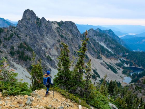
Photo: Tobin Akehurst/Shutterstock
The Appalachian Trail and PCT Are Just Two of the 11 Stunning National Scenic Trails
While the PCT and AT may be the best known of the national scenic trails — so much so that they’re often just referred to by their initials — there are in fact nine more of these paths worthy of your attention. With one notable, 65-mile exception, the national scenic trails span many hundreds or even a few thousand miles, showcasing everything from neotropical wetlands and prairies to deserts and rocky alpine environments. Their pathways are inspired both by geologic events and human history, and all are worth a gander.
Note: COVID-19 regulations may discourage thru-hiking in some areas, but each of these trails contains stretches where day hikes are possible.
What is a national scenic trail?

Photo: Nico Schueler/Shutterstock
Congress established national scenic trails in 1968 to preserve, protect, promote, and sometimes even extend paths of particular aesthetic beauty and cultural or historical significance. Some trails, like the Appalachian Trail, were already well-established by then while others have been conceived since the Trails Act was passed.
The trails are variously managed by the National Park Service together with other federal entities like the National Forest Service or Bureau of Land Management, depending on the land they cross, and more local entities like state and county park services. Local trail associations affiliated with each of these national scenic trails help maintain them and are great resources for trail information, including maps, suggested itineraries, and where to stay. If you only plan to explore sections of the trail — perhaps with a dog or via mountain bike or even on horseback — their resources will help you determine on which sections of the trail a canine or equine companion, or cycling, may be permitted.
1. Appalachian Trail

Photo: MarkVanDykePhotography/Shutterstock
Distance: 2,190 miles
Time: 6-7 months
The oldest trail on this list also passes the most states. Fourteen of them, in fact, from Georgia, North Carolina, Tennessee, Virginia, and West Virginia in the south to Maryland and Pennsylvania to the northeastern states of New Jersey, New York, Connecticut, Massachusetts, Vermont, New Hampshire, and Maine. The idea for a thru-trail was proposed 100 years ago, although it was finally completed in 1937. Even today, since the trail passes through private lands, some sections of it may change over time.
While millions hike sections of the trail each year, the number of annual thru-hikers is much smaller, with only 20,000 hikers having completed the whole trail since its inception. Those who do can apply to have their name added to the 2000-Milers list maintained by the Appalachian Trail Conservancy. The conservancy is also the best place to find interactive maps, state-by-state trail info, and other resources you’ll need to get the most out of this famed passageway.
2. The Arizona Trail

Photo: Maridav/Shutterstock
Distance: 800 miles
Time: 6-8 weeks
The Arizona National Scenic Trail winds on a north-south axis through some of the most beautiful landscapes in that desert state, from red rock canyons to high elevation forests of ponderosa pine. This trail is not for the faint of heart, traversing arid landscapes with multiple elevation changes, as it crosses several mountain peaks and many canyons, including the Grand Canyon itself.
While some sections are suitable for mountain biking, areas of the trail like those through the Superstition Wilderness are closed to cyclists. In the sections of trail that pass national forest land, you can easily find places to camp. You’ll need permits for areas like the Saguaro Wilderness and Grand Canyon. The only urban area the trail nears is Flagstaff, located at a pleasant elevation of nearly 7,000 feet, making this a fine place to rest and take a shower. The Arizona Trail Association is a must-visit resource before hiking the trail. It offers excellent section-by-section maps of the trail with information on distances, difficulty, where to camp, best water sources, and so on.
3. The Continental Divide Trail

Photo: Ryan DeBerardinis/Shutterstock
Distance: 3,100 miles
Time: 6 months
It makes sense that there should be a national scenic trail that traverses the spine of the continent. On either side of the Continental Divide, water flows down toward the western states or east towards the Great Plains, and the mountain states that the trail traverses comprise some of the most iconic and beautiful landscapes in the country — including those of Yellowstone and Glacier National Parks.
That said, this trail across the Rocky Mountains makes the Pacific Crest Trail and the Appalachian Trail — arduous mountain paths of their own — look like kids’ stuff. It slices 3,100 miles from national border to national border across the deserts of New Mexico before winding into Colorado, Wyoming, Idaho, and, finally, Montana. Look to the Continental Divide Trail Coalition for resources on thru-hiking or shorter sojourns on one of its many beautiful sections.
4. The Florida Trail

Photo: Fotoluminate LLC/Shutterstock
Distance: 1,500 miles
Time: 2-3 months
The Florida Trail runs from the south end of the state in the Big Cypress Preserve northward, and then due west towards the edge of the Florida panhandle, stopping short of the Louisiana border. It’s not as well delineated as other trails, with options in the middle of the state to pass by Orlando or to steer well clear of it. The trail is also incomplete in some sections that pass through private land, so roadways may be a part of it at times. But it’s the only trail in the country that takes you through neotropical wetlands, offering views of unique animal and plant life. The Florida Trail Association has maps and resources.
5. The Ice Age Trail

Photo: Maarten Daams/Shutterstock
Distance: 1,000 miles
Time: 2-3 months
The Ice Age Trail carves a meandering path across Wisconsin, heading south on the Door Peninsula along Lake Michigan before u-turning near the Illinois border and heading north again through the middle of the state, and then making a zigzaggy eastward path towards Minnesota. The trail is so named because its unique landscape was carved by receding glaciers from the last ice age — leaving behind odd hills called kames or drumlins, stratified areas called eskers, outwash plains where glaciers ended, and many, many lakes.
The trail is supported by the Ice Age Trail Alliance, which is working to see it completed all the way through. Given that Wisconsin gets average low temperatures in the single digits (Fahrenheit) in the winter months, you’d think no one would thru-hike this trail then. But at the time of writing, Minnesotan Emily Ford was on the final stretch of her journey, becoming the first woman to do so in winter.
6. The Natchez Trace
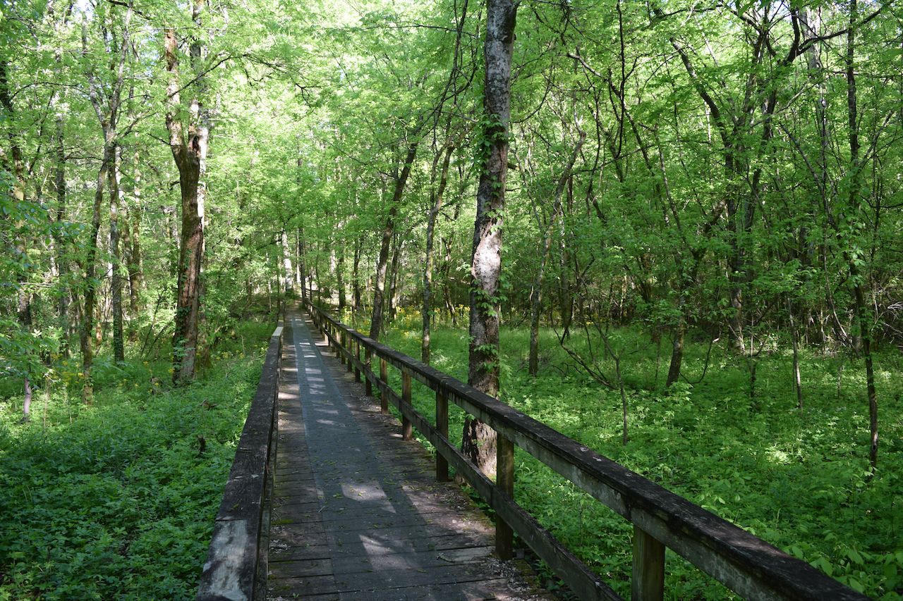
Photo: Fredlyfish4/Shutterstock
Distance: 60 miles, not contiguous
Time: Variable
The Natchez Trace is actually five separate trails in Tennessee and Mississippi, each section running anywhere from three to 26 miles for a total length of sixty miles. It’s inspired by the original Natchez Trace, a 440-mile long path that was created in the late 1700s through the Mississippi River Valley in an attempt to stop the French from extending their influence in this area. Today, much of this centuries-old throughway has become a paved, scenic roadway.
However, you can get off the pavement in certain areas and hike through these historic lands, alongside prairie land, forests, ravines, farmland, and old towns. The shortest branch, the three-mile Potkopinu Section, is where the wear and tear of so many footsteps over 10 generations have sunk the soft soil up to 20 feet below the normal groundline — so you’ll find yourself walking in what feels like a very wide trench with forest on either side. As the scenic trail is contained within the parkway, the Natchez Trace Parkway Association is where to look for more information.
7. The New England Trail

Photo: flashbacknyc/Shutterstock
Distance: 215 miles
Time: 2-4 weeks
This pleasant path starts in southern Connecticut on the Long Island Sound and cuts its way upward to the north end of Massachusetts — taking you through classic Northeast forests of maple, birch, beech, hemlock, and other deciduous trees that light up the autumn months with their blaze of colors. Evergreen white pines are also in the mix, as you pass unexpectedly beautiful landscapes of ancient mountains whose once-jagged peaks have been worn down to gentle slopes over the passage of time.
Glaciers worked their way through this area millennia ago, exposing rocks and river valleys. You’ll pass waterfalls and farmland here, so stay on the trail in the areas it crosses private land. Check out the New England Trail Association to find out where to get the best views on the trail.
8. The North Country Trail
Photo: BHamms/Shutterstock
Distance: 4,600 miles
Time: 7+ months
The North Country Trail is the longest of the national scenic trails, measuring a whopping 4,600 miles and running across eight states on the northern US border: North Dakota, Minnesota, Wisconsin, Michigan, Ohio, Pennsylvania, New York, and Vermont. Despite its length, it’s not necessarily the most taxing trail, as it doesn’t feature the elevation gains of treks like the Arizona Trail or Great Divide Trail, and you’ll find several campgrounds along the way — although you’ll still need to backcountry camp in places.
What you’ll see on this trail are wide-open landscapes of glacier-etched land, brimming with both deciduous and evergreen forests. You’ll hike along the rim of Lake Superior and pass between Lake Michigan and Lake Huron, all bodies of water so large they look like seas. In other places, like New York’s Finger Lakes region, you’ll take in the vista or more manageably sized natural pools. On a visit to the Midwest or Northeast, a day-hike on a section of the North Country Trail is the perfect outing. Check with the North Country Trail Association for information on how to do just that.
9. The Pacific Crest Trail

Photo: Elena Stepanova/Shutterstock
Distance: 2,650 miles
Time: 5 months
The Pacific Crest Trail is the most popular trail in the west, with nearly 1,200 thru-hikers completing the trail in 2018. The number has since dropped, due to both wildfires and the pandemic, but it is still a top bucket-list endeavor. The trail’s popularity may owe something to do with Cheryl Strayed’s book Wild: A Journey from Lost to Found and its cinematic representation with Reese Witherspoon. But the reality is, it already attracted hundreds of thru-hikers in the preceding years, and with good reason.
The trail takes you by the tallest mountains in the Lower 48 and incorporates a stretch of the John Muir Trail, named for the naturalist who encouraged the creation of Yosemite National Park and who co-founded the Sierra Club. The Pacific Crest Trail is so beautiful that even for those of us who can’t find the time to hike the whole thing, there are plenty of stunning sections that you could take on in a weekend or a week — whether alongside Washington Mount Rainier, Oregon’s Crater Lake, or California’s Yosemite, Sequoia, and Kings Canyon National Parks.
10. The Pacific Northwest Trail
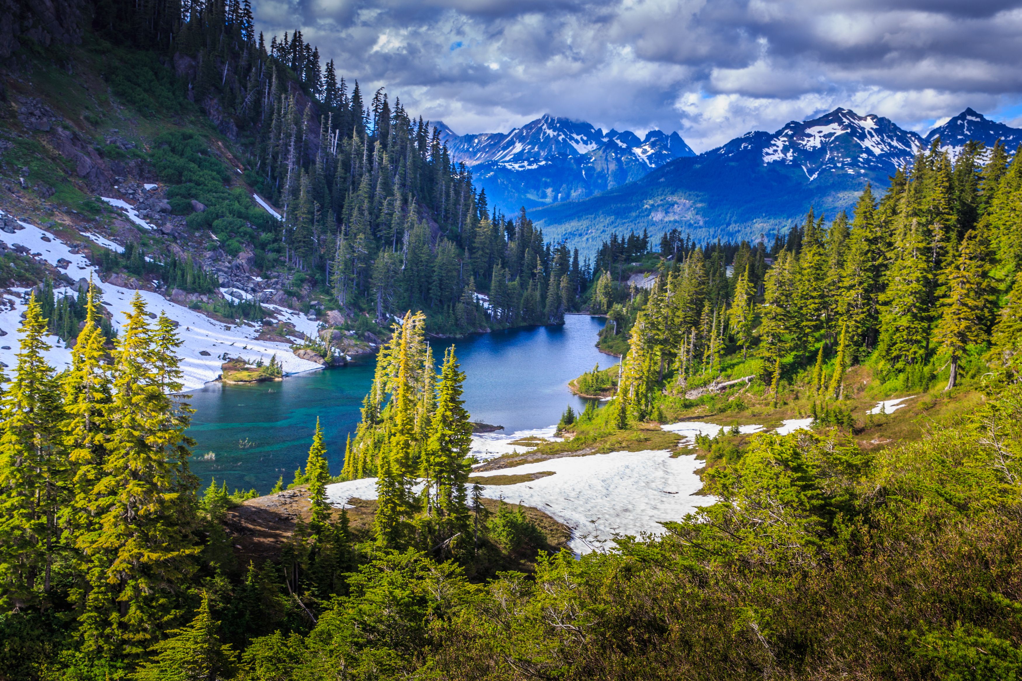
Photo: Vaclav Sebek/Shutterstock
Distance: 1,200 miles
Time: 60-75 days
The Pacific Northwest Trail picks up where other trails, namely the Continental Divide and the North Country trails, end. It traces a passage across the northern states due west of the Continental Divide on the side of the country that is still young, geologically speaking, with jagged mountain ranges that are hard to traverse. In fact, the trail crosses over seven mountain ranges and seven national forests, with one-quarter of it passing through federally designated wilderness areas.
Add to that the fact that the trail is still being developed in places, and that may explain why the Pacific Northwest Trail Association is hesitant to put an easily viewable map on its website. Perhaps the intention is to deter newbies who may suddenly find themselves at an apparent dead-end, needing to cut their way through overgrowth to find the trail again. In fact, the PNT Association stresses the need to have proper mountaineering skills.
You should also be prepared for scrambles up almost-vertical rocky paths, wilderness camping, and potential bear encounters. Hike outside the recommended July to September window and trudging over snow may also be a factor. Yet you’ll also pass some of the most dramatic and rugged scenery of the Lower 48 here, including portions of Olympic National Park and Glacier National Park.
11. The Potomac Heritage Trail

Photo: MarkVanDykePhotography/Shutterstock
Distance: 710, not contiguous
Time: Variable
Although it was established nearly 40 years ago, the Potomac Heritage Trail is still a work in progress. Eventually, it will run 710 miles through Virginia, Maryland, Pennsylvania, and Washington, DC — working its way from the Chesapeake Bay alongside the Potomac and into Pennsylvania’s Allegheny Plateau, carving a trail through the mid-Atlantic terrain that is steeped in history. Currently, the longest contiguous section is the 185-mile Chesapeake and Ohio Canal Towpath, which runs through a historic park of the same name. Unlike other trails on this list, a few sections are even paved, like the 19-mile-long Mt. Vernon Trail, which runs within the George Washington Memorial Parkway, making this one of the few trails you could tackle sections of while on a road bike. The Potomac Heritage Trail Association is working to preserve and expand the trail. ![]()