Going Old-School: Paper Maps From National Geographic

Travel
by Lola (Akinmade) Åkerström Jul 26, 2010
National Geographic Maps - Photo by Lola Akinmade

All photos by Lola Akinmade.

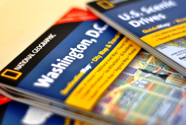
Nat Geo may very well have the lockdown on cartographic eye candy…

The email I got from National Geographic’s Maps Division began like this, “…so in recent conversations with Julie and Michelle at Matador, I understand you know a thing or two about maps! :)

They instantly scored two points for tapping right into my soft spot – beautifully crafted, superb quality cartographic maps. Before diving head first into the world of travel writing and photography, I built, designed, developed, and integrated maps for 14+ years, first as a Geographic Information Systems (GIS) programmer, and finally as a GIS System Architect before resigning last year.

National Geographic Maps - Photo by Lola Akinmade

Photo by author

I lived and breathed maps for years. Geography had always been my favorite subject and still is.

So when I received a complimentary stack of pretty National Geographic maps to review, I instantly morphed into a child at a candy store, wondering which pack of gummy bears or Smarties to dig into first.

I remember running little fingers over country boundaries, subconsciously outlining my future path and vowing to tread those lands in my lifetime, God willing.

Could I truly write an unbiased review of a company I’ve so admired since my childhood days in Nigeria?

The Booty

The following set of maps arrived:

  • U. S. Scenic Drives road map and travel guide, part of their GuideMap™ series
  • Washington, D.C. DestinationMap ™ city map and travel guide
  • Southeastern United States GuideMap ™ road map and travel guide
  • Shenandoah National Park , VA Trails Illustrated Map
  • TOPO! 4 Outdoor Recreation Mapping Software for the Mid-Atlantic states of Delaware, Maryland, Virginia, Washington, DC, and West Virginia

I immediately went straight for the DC city map, which included all the obvious details such as points of interest and their descriptions, a map of the transit system, a reference legend, and distance scale. An added bonus were a map of Alexandria, Virginia, illustrations of both airports – Dulles and Reagan National – as well as 3D renditions of the tourist attractions so you actually knew what the buildings looked like and if you were approaching them from the right direction.

National Geographic Maps - Photo by Lola Akinmade

Photo by author

With traditional paper maps, my pet peeves had been overlapping text as well as easy-rip material (they were made from paper after all) that seemed to tear at inopportune times.

The cartographic quality of these maps in terms of text rendering, resolving text overlap, symbology, feature layering, and labeling are on point. They’re also made from some durable glossy elastic paper material that seemed darn near impossible to rip…and believe me, I tried.

If anything, the maps kept stretching creepily as I tried pulling them apart; which seems to back up their waterproof claims too.

TOPO! Outdoor Recreation Mapping Software

The software was easy to install in 4 steps. I just clicked Next->Next->Install->Finish, and that was it. After entering the complimentary serial number, a screen requesting I enter my mapXchange account information popped up. This account allows you to download all types of maps – USGS Topo Quads and GDT Street maps – to use within the software. You can also choose to sign up for an account later as the software comes with 6 disks worth of map data to use.

National Geographic Maps - Photo by Lola Akinmade

Photo by author

Similar to the way an accountant knows his way around a spreadsheet, I felt quite at home within TOPO! The software comes with a slew of GIS tools – from finding locations and coordinates to importing GPS points and creating 3D flyovers of landscapes. You can use the software to plot out your own personal recreational hiking and camping maps, and (I suspect) a whole lot more.

The initial map activating sequences might be confusing for the casual map user, and some of the panning tools such as Centering Tool and Traveling Tool could be merged into one continuous “Move Around” hand tool which would be more natural to navigate.

While I definitely don’t see our regular Matador readers particularly using TOPO! (Unless you really dig drilling down into the nitty-gritty yourself), this software is more useful for those with a little bit of GIS experience and are well versed with navigating and deciphering outdoor maps.

National Geographic Maps - Photo by Lola Akinmade

Photo by author

The Practical Stuff

There’s a reason why book publishers keep churning out paperbacks and hardcovers by the hundreds every month. Physically flipping through pages of a book still feels more natural than scrolling down an e-book or Amazon Reader.

Plain and simple.

The same goes for paper maps. Sure, GPS units are extremely popular and location apps on smart phones are being downloaded by the second (statistics not verified), there’s nothing like unfurling a paper map in a new city and plotting out your next route; very much feeling like an explorer in your own way; tourist-in-the-street look aside.

A major plus if you’re also unfurling your map under the pouring rain.

While I may not sway you from your trusty iPhone apps, in-car Garmin unit, or Blackberry maps, if anything, buy these NG maps as collector’s items. Think vintage in a couple years. Plus, check out National Geographic’s World Atlas iPhone App which Michelle reviewed, and download some candy-sweet cartographic goodness to your iPhone.

Price: $7.95 – $11.95 | BUY online at National Geographic Maps

Discover Matador