The textile art of India and Pakistan is grabbing international attention after online brands from the two countries released ‘textile maps’ showing the historical significance of certain fabrics and embroidery techniques in different parts of the countries. The maps are not only beautiful but also provide a reminder of how important textile art has been in the cultural history of both countries. The countries have over 2,000 miles of shared border, and these maps serve as crash course in the areas’ stylistic fashions.
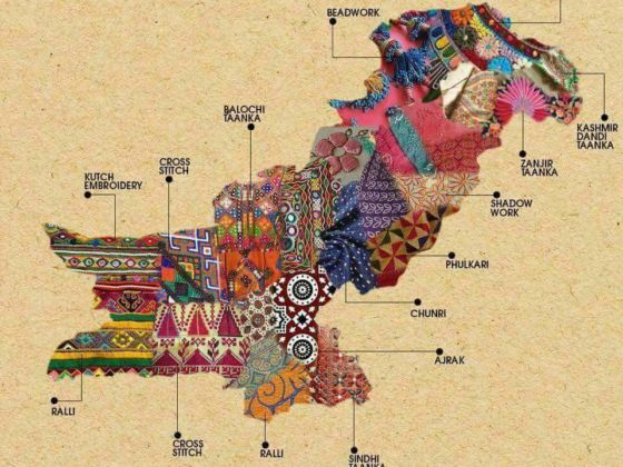
Photo: Generation
These Beautiful Maps Highlight the Embroidery Techniques of India and Pakistan by Region
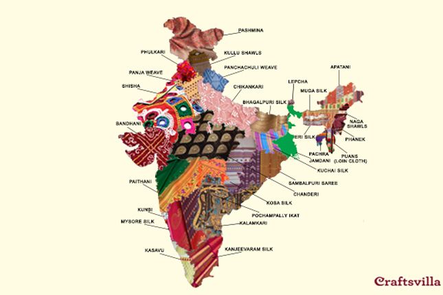
Photo: Crafts Villa
The India map, created by Craftsvilla, provides a state-by-state demonstration of which textiles are used in each state within the country. This provides a roadmap of what embroidery techniques are popular and hand-woven textiles — demonstrating that fabrics used to make clothing in each state are as unique as the patterns in the finished products, such as the following explanation on the floral Phulkari textile.
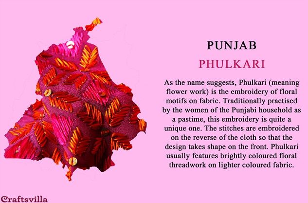
Photo: Crafts Villa
“From the array of delicacies to the interesting customs, traditions and festivals we celebrate, every state has its own cultural identity,” Craftsvilla said on its website as part of its Fabric Tour of India. “And an essential part of that is the attire of the people.” The website explains in detail the historical significance behind many of the fabrics and designs, and the handwoven styles behind them.
The Pakistani map, created by Pakistani clothing website Generation, is equally rich in culture, showing techniques and styles of each region in the country. The map displays everything from the techniques used in Cross Stitch and Kashmir Tandi Daanka to the stunning designs of Ajrak, Shadow Work, and Kutch Embroidery. ![]()
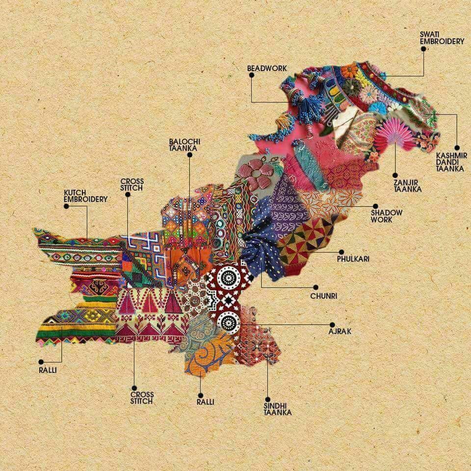
Photo: Generation