Now more than ever, many of us wish we could go back to a simpler time. Raimondas Kiveris, a software engineer at Google Research, decided to make this possible (at least virtually). He knew his neighborhood had changed dramatically over time, but lacked a way to actually visualize it. “There’s really no easy way to find that information in any organized way,” he told Fast Company, “so I was starting to think, can we somehow enable this kind of virtual time travel?”
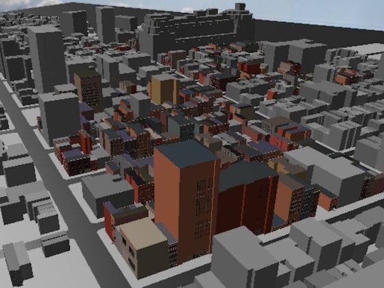
Photo: rǝ
A New Google Map Shows Your Neighborhood 200 Years Ago
That’s why Kiveris created an open-source map that shows both a bird’s-eye view and street-level view of neighborhoods around the country. A slider allows you to control the year, and you can see how the streetscapes evolved over time. You can use the map to view a historically accurately 3D representation of how US cities changed since 1800.
The “rǝ” map is still in its very early form, and it’s more filled out in New York City than some other locations, but it’s still sophisticated enough to show what someone’s cityscape might have seen 100 years ago. Kiveris created the map using historical fire insurance maps and wants to add the capability for librarians and map enthusiasts to add their own historical sources as well.
His ultimate goal is to create lifelike representations of full neighborhoods that are accurate and detailed enough that they could be used as the setting for a video game or movie. That will require a much higher level of detail, but if accomplished, would provide a fascinating insight into how our world looked hundreds of years ago. ![]()