New Orleans is preparing for an all too familiar phenomenon — an approaching hurricane. Currently only classified as a tropical storm, “Barry” has already brought thunderstorms and flash floods to the city, prompting a state of emergency and evacuations in select neighborhoods. Projected to turn into a full-fledged hurricane, Barry may exacerbate the flooding situation already taking place, causing the Mississippi River to rise as high as 20 feet above sea level.
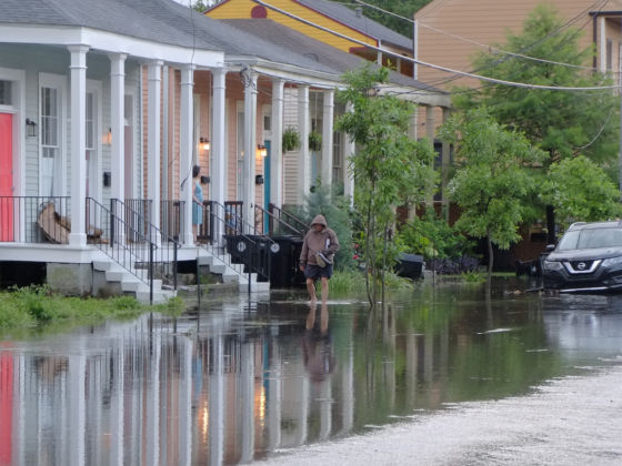
Photo: Chris Nicotera/Shutterstock
Tropical Storm Brings Dangerous Flooding to New Orleans
On Wednesday, the city was hit by eight inches of rain during a three-hour period, resulting in flooded vehicles and streets littered with stray trash cans overturned by the wind. Residents are hopeful the situation won’t get out of hand, but forecasts aren’t exactly encouraging.
Currently, the storm is about 95 miles southeast of the Mississippi River mouth, with winds of 40 miles per hour. The winds are predicted to reach 74 miles per hour by Friday, however, which would classify the storm as a hurricane. It is also expected to bring 10-15 inches of rain this weekend to the coasts of Louisiana and Texas.
Ricky Boyett, a spokesman for the US Army Corps of Engineers, which manages the levees, said, “We’re confident the levees themselves are in good shape. The big focus is height.” Indeed, as the storm surges, river and tides are expected to crest at higher than average levels. Even if the storm does not reach hurricane status, the heavy rain could still create dangerous flooding conditions.
“As we know all too well in Louisiana,” said Governor John Bel Edwards, “low intensity does not necessarily mean low impact. No one should take this storm lightly.” ![]()
H/T: BBC