Figuring out where you can and can’t travel these days is a bit like trying to solve a puzzle that grows new pieces every three seconds. Until the pandemic fully subsides, knowing where you can go and what the restrictions are is going to be difficult, but United Airlines is trying to make it easier — at least for domestic destinations — with a new interactive map.
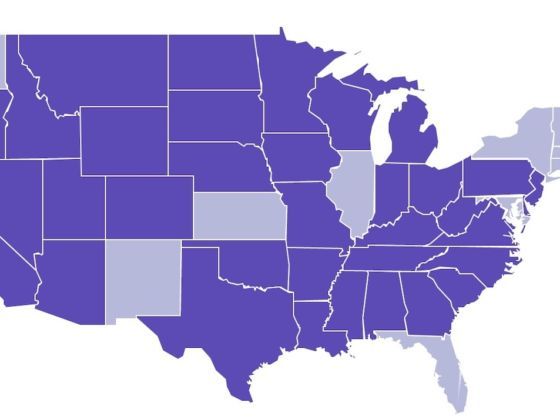
Photo: United
This Interactive Map Shows Where You Can Travel in the US and What’s Open
The map allows those planning a trip to search US destinations using a color-coded system and see whether it’s open, partially open, or closed. It also shows what testing or quarantine measures are required of incoming travelers.
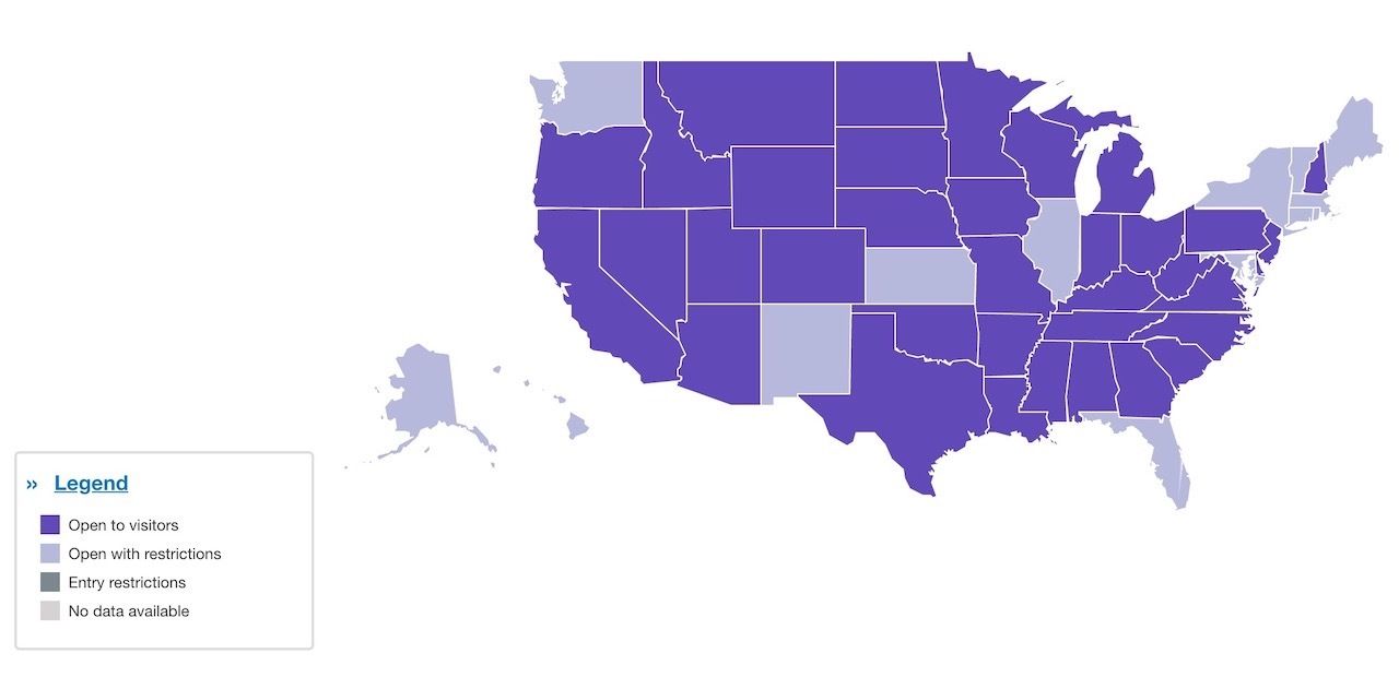
Photo: United
Linda Jojo, United’s executive vice president for technology and chief digital officer, said, “We know it’s a challenge to keep up with the ever-changing list of travel restrictions, policies and regulations so we are offering a simple, easy tool that helps customers decide where to travel next. By providing the most up-to-date information on the destinations we serve, customers can compare and shop for travel with greater confidence and help them find the destinations that best fit their preferences.”
To use the map, just click on each state to view the local regulations, restrictions, travel guidelines, and see which leisure activities are open (museums, bars and cafés, etc.) to the public and under which conditions.
Right now the map only includes US states, but it will soon be expanded to international destinations served by United flights. ![]()