Photo: Patrick Tr/Shutterstock

10 Cell Phone Dead Zones Worth a Trip

Hawaii Maine North Carolina Texas Washington National Parks Insider Guides
by Hal Amen Jul 8, 2011
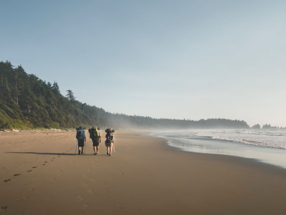
There are still a handful of places in the US where it’s possible to “unplug.”

THIS PAST WEEK, Matador Senior Editor David Miller went offline for a few days to camp with his family in Colorado. In a gchat about the trip, he said, “i’m shooting for 5 days internet free / will be the first time in at least 2 years.”

Yet, depending on where they went, what kind of phone he has, and who his provider is, there’s a good chance he could’ve been checking email from his tent.

That’s scary.

I’m just finished reading a book called The Last Empty Places, and there’s a passage where the author, who’s hiked with his family several miles into Gila National Forest (#7 below), is chilling in a natural hot springs and thinking,

Sometime in the not-too-distant future cell phones will link into satellite reception and it will be perfectly possible to sit in this hot springs pool in the midst of the wilderness and text with your friends back home.

In a mediocre book, it’s a line that stood out for me. I often think how sweet it’ll be when we can pick up a wifi signals everywhere — I make my living online, so universal coverage would mean true location independence.

But what’s the other side of that eventuality? What will we lose by never being able to “unplug” (unless your phone gets eaten by a bear or something)?

It’s a worn question, and I have nothing new to add here. Instead, I’ve compiled a list of places you go can now — before the world becomes one unified ball of information-infused 2.4 GHz radio waves — and not worry about getting pinged.

To do so, I compared coverage maps for the four big U.S. carriers: Verizon, AT&T, Sprint/Nextel, and T-Mobile. User comments (e.g., “You’re an idiot. I had 4 bars in the Hoh.”) welcome.

1. Baxter State Park, ME

Things get quiet fast once you exit I-95 and make it through Millinocket, the gateway town for Baxter. The park’s 200,000+ acres include Katahdin (the state’s highest peak at 5,268ft), 215 trail miles, eight car-access campgrounds, and two more in the backcountry.

Park facilities are described as “rustic.” All roads are unpaved, all water untreated. It costs $14/vehicle to enter (in-state plates get in free), and camping runs $30/site for roadside and $20 in the backcountry. These fees are a key source of revenue for Baxter, as the park receives no tax dollars like other state parks do.

Cell reception should be nil in most of the park, though you might pick up a Verizon signal at higher elevations. Leave the phone in the tent when you climb Knife’s Edge.

Get there: Exit 244 off I-95 and head west on 157, which is Main St. in Millinocket. On the other side of town, turn right on Golden Rd. and follow signs to the Togue Pond Gatehouse. There’s a second entrance up north (Matagamon Gatehouse) that’s harder to reach.

2. Na Pali Coast, HI

I think of the whole island chain as pretty remote, but you need to get to the remote of the remote before you lose the cell bars. That’d be Kauai — specifically, the Na Pali Coast.

There are no roads in this corner of Hawaii, only trail, cliff, and beach. For info on hiking and surfing options, check out #5 in 5 small-town adventure escapes in the US.

Get there: From Lihue, where the airport is, follow Highway 56 north for 30 miles as it curves along the coast. You’ll hit Hanalei, which is a good jumping-off point.

3. Olympic National Park, WA

You won’t find a comparably sized wilderness area with such proximity to a top-25 city anywhere in the country. Olympic NP is just a 2-hour car/ferry ride from downtown Seattle, covering 922,500 acres of the Olympic Peninsula, and yet the majority of the park is cell-service free.

There’s a place within the park’s Hoh Rainforest that’s actually “the only formally designated ‘quiet place’ in the world,” according to MatadorU alum Jed Purses, who discusses his search for the spot in Lessons From the One Square Inch of Silence.

Backpack camping is probably the most popular activity; the park is also one of the best for visiting old-growth forest; and Port Angeles, the gateway town, is “one of the few places in the world where you can snowboard and surf in the same day.”

Get there: The fastest routes make use of the Edmonds-Kingston or Seattle-Bainbridge ferry to hook up with 101 on the peninsula. Alternatively, drive south and cross via the Tacoma Narrows Bridge.

4. Great Smoky Mountains National Park, NC

I’ve been to the Great Smokies a couple times, and I feel like there are two very different possible perspectives/experiences: the Tennessee side vs. the North Carolina side.

The Tennessee side has the greater share of facilities, but that’s also where the majority of the park’s 8-10 million annual visitors (busiest in the US) spend their time. Then, right outside the boundaries you’ve got resorty Gatlinburg and the unholy marriage of zealous Christianity and showtunes that is Pigeon Forge.

The Carolina side, by comparison, is super chill, and its gateway towns of Cherokee and Bryson City have much more of a “let’s grab a beer and hit the river” vibe.

In the park, Sprint and possibly Verizon could find your receiver when you’re on high ground. Hang out in the river valleys and you’re golden.

Get there: Obviously, I prefer to approach from NC. Start in Chattanooga and take 74 east. It gets gorgeous fast — before the state line you’ll pass a series of TVA dams on the Ocoee, and then in NC the road follows the Nantahala to Bryson City. The drive takes 2.5 hours.

5. Big Bend National Park, TX

When I went on a family trip to Big Bend in ’97, I’m sure I would’ve enjoyed having my current myTouch 4G along to make calls, check email, and maybe watch some TV during the 14-mile South Rim loop hike my parents had us take. But that definitely wasn’t possible then, and fortunately it still isn’t.

You’re likely to get a signal near park headquarters, but you shouldn’t be hanging out there anyway. Go deeper, where the landscape is a mix of flat hot West Texas desert and deep canyons, including those cut by the Rio Grande.

Rafting and paddling are still popular here, despite security concerns (real and imagined) over the drug violence in northern Mexico. There are good hot springs nearby, and next year the old informal border crossing at Boquillas del Carmen is scheduled to reopen after 10 years of post-9/11 shutdown.

Get there: It’s a long way from anywhere. Take I-10 to Fort Stockton or Highway 90 to Marathon and head south on 385, which will take you directly into the park.

6. Del Norte Coast Redwoods State Park, CA

Much of the northern California coast is rugged and empty, but this park looks like the only section that can truly be called cell-free. What does it is probably the choppy, precipitous topography that dominates between Klamath and Crescent City — ideal terrain for old-growth redwood.

I’ve driven this section of 101 (Redwood Highway) on a foggy morning with the moonroof open. It’s something special.

You won’t find the largest or tallest redwoods in Del Norte, which (combined with the poor cell reception) may be why it’s currently nominated for closure as California slips further into financial meltdown.

Campgrounds are open May 1 – September 30, and there are some pretty solid trail routes described over at redwoodhikes.com.

Get there: Del Norte is right on Highway 101 just ten minutes south of Crescent City. Distance from San Francisco is 345 miles.

7. Gila National Forest, NM

At 3.3 million acres, this is one of the largest national forests in the nation — it’s also one of the least developed.

We’re talking about a big enough land area here that some pockets of reception may exist (Sprint and AT&T are most likely), but the vast majority of the forest is a no-bar zone.

The 700-year-old Gila Cliff Dwellings are the best-known attraction, but there are dozens and dozens of car and backcountry camping options, hundreds of miles of hiking trails, and easy access for fishing, cycling, and horseback riding.

Make sure to check the alerts and notices if you go this year, as the forest has been caught in the middle of the massive wildfires in Arizona and New Mexico.

Get there: Silver City is the gateway town. Exit 63 off I-25 and take 152 west for 75 miles. The national forest office is at 3005 E. Camino del Bosque.

8. Lake Ozonia area, Adirondack Park, NY

Adirondack Park is massive — its 6.1 million acres make it the largest protected area in the lower 48.

Not all land within its boundaries (roughly the entire Adirondack Range) is state-owned, and a cell blanket covers most. However, there’s a large section southeast of Potsdam, just below Lake Ozonia, that’s untouched.

I’ve never been, but Google Maps shows several roads that trace rivers/streams and access ponds — looks like a sweet place to fish trout.

Get there: To Lake Ozonia, follow 11B from Potsdam to Hopkinton and take a right on Lake Ozonia Rd. The area can also be reached from the west via Sylvan Falls Rd. out of Parishville.

9. Natural Bridges National Monument, UT

Just up the road from Monument Valley, Natural Bridges “preserves some of the finest examples of natural stone architecture in the southwest.”

It’s a total blank spot in terms of cell reception — as well as light pollution. In 2007, Bridges became the first-ever “International Dark Sky Park,” as designated by the International Dark-sky Association.

Acreage-wise, it’s not a huge reserve (7,600+), but unlike most of the other entries on this list, its dead zone extends significant distances beyond its borders. Inside the park, there are a few very short hikes and a 13-site first-come, first-served campground ($10/night).

You could probably keep the phone barless for most of the drive up to Canyonlands, but no guarantees once you arrive.

Get there: From the north, take 191 out of Moab and turn right on 95. From the south, turn off 163 (the Monument Valley drive) at 261, climb the Moki Dugway, then bang a left onto 95.

10. Kodiak National Wildlife Refuge, AK

I pulled up the Alaska coverage maps thinking it’d be easy to find some universal gaps — not so, unless you’re busting out on your own, Into the Wild style.

But on Kodiak Island, several miles southwest of the town of Kodiak and its cell networks, there’s the Kodiak National Wildlife Refuge. “Brown bears, salmon, sea otters, sea lions, other marine mammals, and migratory birds” being the wildlife. Hunting, fishing, paddling, and cabin camping are all possible within the refuge.

For other dead-zone ideas in the Frontier State, check out 5 national parks in Alaska.

Get there: Catch an Alaska Marine Highway ferry from Homer, or fly in. There are no roads on the island outside the towns/villages. A visitor center for the refuge is at 402 Center Street in Kodiak.

Discover Matador