Wildfires in the West are worse this year than any in recent memory. Northern California, Oregon, and parts of Washington have been dealing with intense fires, and their resulting smoke is turning the sky an eerie shade of orange and polluting the air. The smoke from the West Coast is so intense that it’s visible from space and drifting east across the country, and even reaching Europe. Now, many people are forced to consider the air quality before they venture outside.
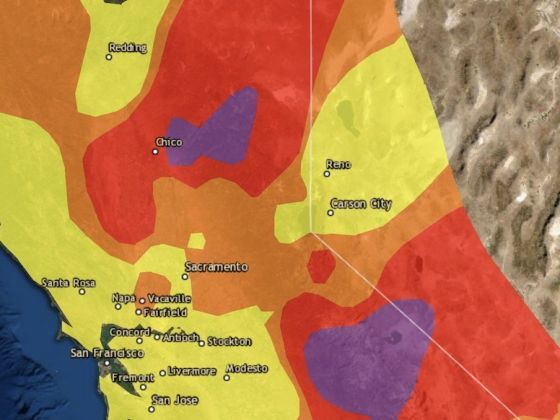
Photo: AirNow
These Real-Time Maps Show Where Air Quality Is Dangerous in the West
This can be confusing, especially if you’re unfamiliar with air quality indexes and have no idea what the numbers mean. Luckily, There are a few resources designed to make it easier for you. NOAA released an interactive map that allows you to look at factors like visibility, fire detections, near surface smoke, and more.
AirNow also has a tool for measuring air quality. The website highlights air quality information at the local, state, and national levels with an interactive map. It uses the official color-coded Air Quality Index to communicate whether air quality is healthy or unhealthy, as well as give data on current fire conditions and air quality forecasts so you can take the appropriate measures to keep yourself safe. ![]()